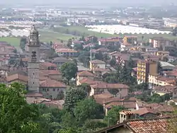
Chiuduno
Chiuduno (Bergamasque: Ciüdü) is a comune (municipality) in the Province of Bergamo, in Italian region of Lombardy; Chiuduno is located about 60 kilometres (37 mi) northeast of Milan and about 15 kilometres (9 mi) southeast of Bergamo, midway between the Bergamo plain and the Valcalepio.
Chiuduno | |
|---|---|
| Comune di Chiuduno | |
 Chiuduno | |
 Coat of arms | |
Location of Chiuduno 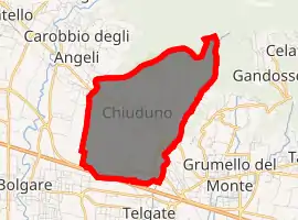
| |
 Chiuduno Location of Chiuduno in Italy 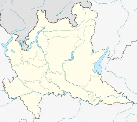 Chiuduno Chiuduno (Lombardy) | |
| Coordinates: 45°39′N 9°51′E | |
| Country | Italy |
| Region | Lombardy |
| Province | Bregamo (BG) |
| Government | |
| • Mayor | Stefano Locatelli (2011) |
| Area | |
| • Total | 6.6 km2 (2.5 sq mi) |
| Elevation | 218 m (715 ft) |
| Population (Dec. 2004)[2] | |
| • Total | 5,348 |
| • Density | 810/km2 (2,100/sq mi) |
| Demonym(s) | Chiudunesi |
| Time zone | UTC+1 (CET) |
| • Summer (DST) | UTC+2 (CEST) |
| Postal code | 24060 |
| Dialing code | 035 |
| Patron saint | Assumption of Mary |
| Saint day | August, 15th |
Chiuduno borders the following municipalities: Bolgare, Carobbio degli Angeli, Grumello del Monte, Telgate.
History
The settlement has Gaulish origins, and was later a Roman centre as Claudunum on the road between Bergamo and Brescia. It is however mentioned for the first time in a document from 795, and in the Middle Ages it developed and received a fortress.
Main sights
- Castle (9th century), of which only a tower and other parts remain.
- Another fortification on the border with the territory of Carobbio degli Angeli (now Suardi villa, 17th century).
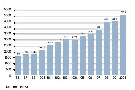
Demographic evolution
References
- "Superficie di Comuni Province e Regioni italiane al 9 ottobre 2011". Istat. Retrieved 16 March 2019.
- All demographics and other statistics: Italian statistical institute Istat.
This article is issued from Wikipedia. The text is licensed under Creative Commons - Attribution - Sharealike. Additional terms may apply for the media files.