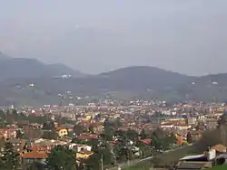
Ranica
Ranica (Bergamasque: Ranga or La Rànga or Laranga or Ràniga; Medieval Latin: Larianica) is a comune (municipality) in the Province of Bergamo in the Italian region of Lombardy, located about 50 kilometres (31 mi) northeast of Milan and about 5 kilometres (3 mi) northeast of Bergamo. As of 31 December 2004, it had a population of 5,984 and an area of 4.2 square kilometres (1.6 sq mi).[3]
Ranica | |
|---|---|
| Comune di Ranica | |
 Ranica | |
Location of Ranica 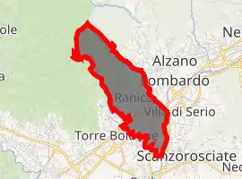
| |
 Ranica Location of Ranica in Italy  Ranica Ranica (Lombardy) | |
| Coordinates: 45°44′N 9°43′E | |
| Country | Italy |
| Region | Lombardy |
| Province | Province of Bergamo (BG) |
| Area | |
| • Total | 4.2 km2 (1.6 sq mi) |
| Elevation | 293 m (961 ft) |
| Population (Dec. 2004)[2] | |
| • Total | 5,984 |
| • Density | 1,400/km2 (3,700/sq mi) |
| Demonym(s) | Ranichesi |
| Time zone | UTC+1 (CET) |
| • Summer (DST) | UTC+2 (CEST) |
| Postal code | 24020 |
| Dialing code | 035 |
| Website | Official website |
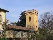
the tower of Viandasso
Ranica borders the following municipalities: Alzano Lombardo, Gorle, Ponteranica, Scanzorosciate, Torre Boldone, Villa di Serio. Part of Ranica's territory is part of Parco dei Colli di Bergamo.
The town contains the Church of the Santissimi Sette Fratelli Martiri.
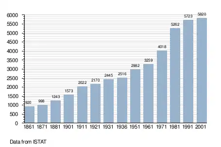
Demographic evolution
References
- "Superficie di Comuni Province e Regioni italiane al 9 ottobre 2011". Istat. Retrieved 16 March 2019.
- "Popolazione Residente al 1° Gennaio 2018". Istat. Retrieved 16 March 2019.
- All demographics and other statistics: Italian statistical institute Istat.
This article is issued from Wikipedia. The text is licensed under Creative Commons - Attribution - Sharealike. Additional terms may apply for the media files.