Clearfield Township, Griggs County, North Dakota
Clearfield Township[3] is a township in Griggs County, North Dakota, United States.
Clearfield Township, North Dakota | |
|---|---|
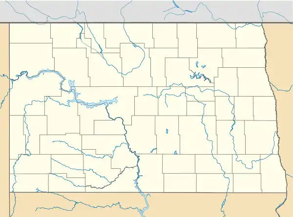 Clearfield Township, North Dakota Location within the state of North Dakota | |
| Coordinates: 47°27′25″N 98°18′28″W | |
| Country | United States |
| State | North Dakota |
| County | Griggs County |
| Township | Clearfield Township |
| Area | |
| • Total | 35.36 sq mi (91.6 km2) |
| Elevation | 1,450 ft (442 m) |
| Population (2010) | |
| • Total | 44 |
| • Density | 1.2/sq mi (0.5/km2) |
| Time zone | UTC-6 (Central (CST)) |
| • Summer (DST) | UTC-5 (CDT) |
| Postal Code(s)[1] | 58416 & 58425 |
| Area code(s) | 701 |
| GNIS feature ID | 1036644 |
| Census Code | 14340 |
| Census Class Code | T1 |
| Website | Griggs County |
| Historical population | |||
|---|---|---|---|
| Census | Pop. | %± | |
| 1900 | 137 | — | |
| 1910 | 128 | −6.6% | |
| 1920 | 172 | 34.4% | |
| 1930 | 195 | 13.4% | |
| 1940 | 127 | −34.9% | |
| 1950 | 152 | 19.7% | |
| 1960 | 137 | −9.9% | |
| 1970 | 94 | −31.4% | |
| 1980 | 94 | 0.0% | |
| 1990 | 65 | −30.9% | |
| 2000 | 49 | −24.6% | |
| 2010 | 44 | −10.2% | |
| 2018[2] (est.) | 40 | −9.1% | |
History
The exact date that Clearfield Township was incorporated is unknown. Pleasant View Township was designated by Congress on February 9, 1888. The township board met on February 23, 1893 and discussed the possibility of dividing Pleasant View into two Townships - Clearfield and Kingsley. There is no record of any action being taken. However, on July 9, 1894, it seemed to have been separated and Clearfield Township was in existence.[4]
Demographics
Its population during the 2010 census was 44.[5]
Location within Griggs County
Clearfield Township is located in Township 146 Range 60 west of the Fifth principal meridian.[6]
| Range 61 | Range 60 | Range 59 | Range 58 | |
|---|---|---|---|---|
| Township 148 | Rosendal | Willow | Pilot Mound | Lenora |
| Township 147 | Bryan | Addie | Tyrol | Romness |
| Township 146 | Kingsley | Clearfield | Cooperstown | Washburn |
| Township 145 | Mabel | Helena | Ball Hill | Sverdrup |
| Township 144 | Dover | Bartley | Greenfield | Broadview |
References
- Statistical Atlas for Clearfield Township
- City Population Data for Clearfield Township
- U.S. Geological Survey U.S. Board on Geographic Names information for Clearfield Township
- Clearfield Township from the Griggs County Centennial Book digitized on the Griggs County Museum website
- North Dakota 2010 Census
- Earth Point Tools for Google Earth
Municipalities and communities of Griggs County, North Dakota, United States | ||
|---|---|---|
| Cities | 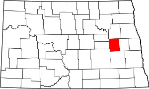 Map of North Dakota highlighting Griggs County | |
| Townships | ||
| CDPs | ||
| Unincorporated communities | ||
| ||
Category:Townships in Griggs County, North Dakota Category:Townships in North Dakota
This article is issued from Wikipedia. The text is licensed under Creative Commons - Attribution - Sharealike. Additional terms may apply for the media files.