Cooperstown Township, Griggs County, North Dakota
Cooperstown Township[2] is a township in Griggs County, North Dakota, United States.
Cooperstown Township, North Dakota | |
|---|---|
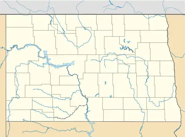 Cooperstown Township, North Dakota Location within the state of North Dakota | |
| Coordinates: 47°27′26″N 98°10′48″W | |
| Country | United States |
| State | North Dakota |
| County | Griggs County |
| Township | Cooperstown Township |
| Area | |
| • Total | 35.45 sq mi (91.8 km2) |
| Elevation | 1,470 ft (448 m) |
| Population (2010) | |
| • Total | 56 |
| • Density | 1.6/sq mi (0.6/km2) |
| Time zone | UTC-6 (Central (CST)) |
| • Summer (DST) | UTC-5 (CDT) |
| Area code(s) | 701 |
| GNIS feature ID | 1036643 |
| Census Code | 15940 |
| Census Class Code | T1 |
| Website | Griggs County |
| Historical population | |||
|---|---|---|---|
| Census | Pop. | %± | |
| 1890 | 120 | — | |
| 1900 | 226 | 88.3% | |
| 1910 | 283 | 25.2% | |
| 1920 | 297 | 4.9% | |
| 1930 | 231 | −22.2% | |
| 1940 | 239 | 3.5% | |
| 1950 | 208 | −13.0% | |
| 1960 | 188 | −9.6% | |
| 1970 | 109 | −42.0% | |
| 1980 | 104 | −4.6% | |
| 1990 | 86 | −17.3% | |
| 2000 | 82 | −4.7% | |
| 2010 | 56 | −31.7% | |
| 2018[1] (est.) | 51 | −8.9% | |
History
There was a meeting called by the county clerk of Griggs County on February 9, 1888 at 2 PM for organizing Township 146-59, also known as Cooperstown Township. The first township records were destroyed. [3]
Demographics
Its population during the 2010 census was 56.[4]
Location within Griggs County
Cooperstown Township is located in Township 146 Range 59 west of the Fifth principal meridian.[5]
| Range 61 | Range 60 | Range 59 | Range 58 | |
|---|---|---|---|---|
| Township 148 | Rosendal | Willow | Pilot Mound | Lenora |
| Township 147 | Bryan | Addie | Tyrol | Romness |
| Township 146 | Kingsley | Clearfield | Cooperstown | Washburn |
| Township 145 | Mabel | Helena | Ball Hill | Sverdrup |
| Township 144 | Dover | Bartley | Greenfield | Broadview |
References
- City Population Data for Cooperstown Township
- U.S. Geological Survey U.S. Board on Geographic Names information for Cooperstown Township
- Cooperstown Township from the Griggs County Centennial Book digitized on the Griggs County Museum website
- North Dakota 2010 Census
- Earth Point Tools for Google Earth
Municipalities and communities of Griggs County, North Dakota, United States | ||
|---|---|---|
| Cities | 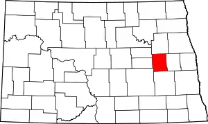 Map of North Dakota highlighting Griggs County | |
| Townships | ||
| CDPs | ||
| Unincorporated communities | ||
| ||
This article is issued from Wikipedia. The text is licensed under Creative Commons - Attribution - Sharealike. Additional terms may apply for the media files.