Rosendal Township, Griggs County, North Dakota
Rosendal Township[3] is a township in Griggs County, North Dakota, United States.
Rosendal Township, North Dakota | |
|---|---|
 Rosendal Township, North Dakota Location within the state of North Dakota | |
| Coordinates: 47°37′47″N 98°26′10″W | |
| Country | United States |
| State | North Dakota |
| County | Griggs County |
| Township | Rosendal Township |
| Area | |
| • Total | 34.78 sq mi (90.1 km2) |
| Elevation | 1,650 ft (503 m) |
| Population (2010) | |
| • Total | 35 |
| • Density | 1.0/sq mi (0.4/km2) |
| Time zone | UTC-6 (Central (CST)) |
| • Summer (DST) | UTC-5 (CDT) |
| Postal Code(s)[1] | 58416 & 58464 |
| Area code(s) | 701 |
| GNIS feature ID | 1036656 |
| Census Code | 68460 |
| Census Class Code | T1 |
| Website | Griggs County |
| Historical population | |||
|---|---|---|---|
| Census | Pop. | %± | |
| 1890 | 30 | — | |
| 1900 | 93 | 210.0% | |
| 1910 | 216 | 132.3% | |
| 1920 | 211 | −2.3% | |
| 1930 | 176 | −16.6% | |
| 1940 | 146 | −17.0% | |
| 1950 | 118 | −19.2% | |
| 1960 | 99 | −16.1% | |
| 1970 | 68 | −31.3% | |
| 1980 | 68 | 0.0% | |
| 1990 | 54 | −20.6% | |
| 2000 | 40 | −25.9% | |
| 2010 | 35 | −12.5% | |
| 2018[2] (est.) | 32 | −8.6% | |
Demographics
Its population during the 2010 census was 35.[4]
Location within Griggs County
Rosendal Township is located in Township 148 Range 61 west of the Fifth principal meridian.[5]
| Range 61 | Range 60 | Range 59 | Range 58 | |
|---|---|---|---|---|
| Township 148 | Rosendal | Willow | Pilot Mound | Lenora |
| Township 147 | Bryan | Addie | Tyrol | Romness |
| Township 146 | Kingsley | Clearfield | Cooperstown | Washburn |
| Township 145 | Mabel | Helena | Ball Hill | Sverdrup |
| Township 144 | Dover | Bartley | Greenfield | Broadview |
References
Municipalities and communities of Griggs County, North Dakota, United States | ||
|---|---|---|
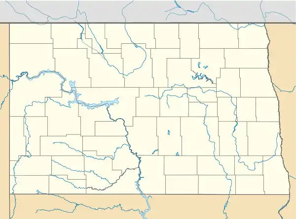
| Cities | 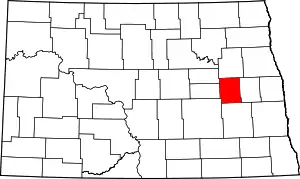 Map of North Dakota highlighting Griggs County | |
| Townships | ||
| CDPs | ||
| Unincorporated communities | ||
| ||
Category:Townships in Griggs County, North Dakota Category:Townships in North Dakota
Category:Townships in Griggs County, North Dakota
This article is issued from Wikipedia. The text is licensed under Creative Commons - Attribution - Sharealike. Additional terms may apply for the media files.