Jessie, North Dakota
Jessie is a census-designated place in northern Griggs County, North Dakota, United States. An unincorporated community, it was designated as part of the U.S. Census Bureau's Participant Statistical Areas Program on March 31, 2010.[4] It was not counted separately during the 2000 Census,[5] but was included in the 2010 Census,[6] where a population of 25 was reported.[2]
Jessie, North Dakota | |
|---|---|
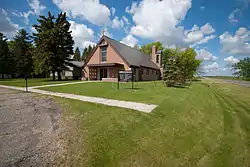 St. Lawrence Church in Jessie | |
 Jessie  Jessie | |
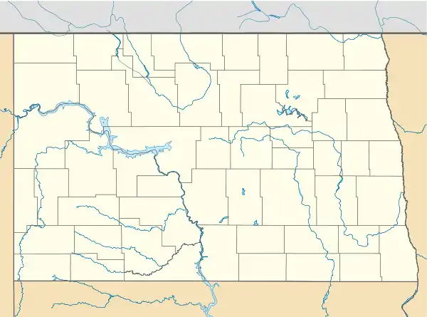
| Coordinates: 47°32′32″N 098°14′17″W | |
| Country | United States |
| State | North Dakota |
| County | Griggs |
| Area | |
| • Total | 0.475 sq mi (1.23 km2) |
| • Land | 0.475 sq mi (1.23 km2) |
| • Water | 0 sq mi (0 km2) |
| Elevation | 1,473 ft (449 m) |
| Population | |
| • Total | 25 |
| • Density | 53/sq mi (20/km2) |
| Time zone | UTC-6 (Central (CST)) |
| • Summer (DST) | UTC-5 (CDT) |
| ZIP codes | 58452 |
| Area code(s) | 701 |
| FIPS code[3] | 38-40740 |
| GNIS feature ID[3] | 2584348 |
It lies along North Dakota Highway 65 northwest of the city of Cooperstown, the county seat of Griggs County.[4] Although it is unincorporated, it has a post office with the ZIP code of 58452.[7]
References
- "US Gazetteer files: 2010, 2000, and 1990". United States Census Bureau. 2011-02-12. Retrieved 2011-04-23.
- "2010 Census Redistricting Data (Public Law 94-171) Summary File". American FactFinder. United States Census Bureau. Retrieved May 2, 2011.
- "US Board on Geographic Names". United States Geological Survey. 2007-10-25. Retrieved 2008-01-31.
- "Jessie Census Designated Place". Geographic Names Information System. United States Geological Survey. Retrieved 2010-07-13.
- U.S. Census Bureau (2003). "Population and Housing Unit Counts, North Dakota" (PDF). 2000 Census of Population and Housing. Government Printing Office. Retrieved 2008-07-20.
- U.S. Census Bureau (February 13, 2008). "Census Designated Place (CDP) Program for the 2010 Census—Final Criteria" (PDF). Federal Register. Archived from the original (PDF) on May 8, 2009. Retrieved 2010-07-13.
- Zip Code Lookup
Municipalities and communities of Griggs County, North Dakota, United States | ||
|---|---|---|
| Cities | 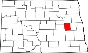 Map of North Dakota highlighting Griggs County | |
| Townships | ||
| CDPs | ||
| Unincorporated communities | ||
| ||
This article is issued from Wikipedia. The text is licensed under Creative Commons - Attribution - Sharealike. Additional terms may apply for the media files.