Conception Harbour
Conception Harbour is a town on the Avalon Peninsula in Newfoundland and Labrador, Canada. It is in Division 1 on Conception Bay.
Conception Harbour | |
|---|---|
Town | |
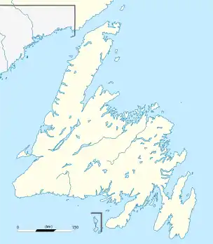 Conception Harbour Location of Conception Harbour in Newfoundland | |
| Coordinates: 47°26′30″N 53°13′00″W | |
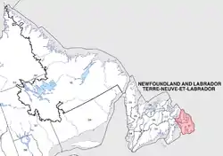
| Country | |
| Province | |
| Census division | 1 |
| Government | |
| • Mayor | Craig Williams |
| Area | |
| • Land | 21.61 km2 (8.34 sq mi) |
| Population (2016)[1] | |
| • Total | 685 |
| • Density | 31.7/km2 (82/sq mi) |
| • Demonym | Conception Harbour |
| Time zone | UTC-3:30 (Newfoundland Time) |
| • Summer (DST) | UTC-2:30 (Newfoundland Daylight) |
| Area code(s) | 709 |
| Highways | |
According to the 2016 Statistics Canada Census:[1]
- Population: 685
- % Change (2011-2016): -1.7%
- Dwellings: 392
- Area (km2.): 21.61
- Density (persons per km2.): 31.7
Conception Harbour includes the former communities of Bacon Cove, Cat's Cove, Kitchuses, and Silver Spring.
See also
- List of cities and towns in Newfoundland and Labrador
References
- "Census Profile, 2016 Census: Conception Harbour, Town [Census subdivision], Newfoundland and Labrador". Statistics Canada. Retrieved October 26, 2019.
Places adjacent to Conception Harbour | ||||||||||
|---|---|---|---|---|---|---|---|---|---|---|
| ||||||||||
This article is issued from Wikipedia. The text is licensed under Creative Commons - Attribution - Sharealike. Additional terms may apply for the media files.
