List of census divisions of Newfoundland and Labrador
The Canadian province of Newfoundland and Labrador is divided into 11 Census divisions which are numbered 1 through 11.[1] These areas exist solely for the purposes of statistical analysis and presentation; they have no government of their own as the province has no level of government between the provincial and municipal.

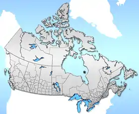
Map of the province showing the 10 Census Divisions
List of census divisions
The region and largest community are listed:
- Division No. 1, Newfoundland and Labrador (Avalon Peninsula-St. John's)
- Division No. 2, Newfoundland and Labrador (Burin Peninsula-Marystown)
- Division No. 3, Newfoundland and Labrador (South Coast-Channel-Port aux Basques)
- Division No. 4, Newfoundland and Labrador (St. George's-Stephenville)
- Division No. 5, Newfoundland and Labrador (Humber District-Corner Brook)
- Division No. 6, Newfoundland and Labrador (Central Newfoundland-Grand Falls-Windsor)
- Division No. 7, Newfoundland and Labrador (Bonavista/Trinity-Clarenville)
- Division No. 8, Newfoundland and Labrador (Notre Dame Bay-Lewisporte)
- Division No. 9, Newfoundland and Labrador (Northern Peninsula-St. Anthony)
- Division No. 10, Newfoundland and Labrador (Labrador-Happy Valley-Goose Bay)
- Division No. 11, Newfoundland and Labrador (Nunatsiavut-Nain)
Historical Districts
Newfoundland was once divided into historical districts:
- Bay de Verde
- Bonavista
- Burgeo and La Poile
- Burin
- Carbonear
- Ferryland
- Fogo
- Fortune Bay
- Harbour Grace
- Harbour Main
- Labrador
- Placentia and St. Mary's
- Port de Grave
- St. Barbe's
- St. George's-Port au Port
- St. John's East
- St. John's West
- Trinity
- Twillingate
See also
- Administrative divisions of Canada
- Subdivisions of Canada
References
- Statistics Canada (2006). "2006 Community Profiles - Newfoundland and Labrador - D". Retrieved 2007-11-16.
| Census divisions | |
|---|---|
| Cities | |
| Other communities |
|
| |
| Provinces |
|
|---|---|
| Territories |
|
| |
This article is issued from Wikipedia. The text is licensed under Creative Commons - Attribution - Sharealike. Additional terms may apply for the media files.