Victoria, Newfoundland and Labrador
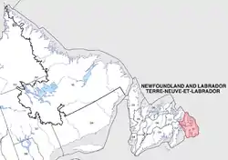
Victoria (47°46′03″N 53°14′28″W NST) is an incorporated town in Conception Bay located approximately midway on the Bay de Verde Peninsula of Newfoundland and Labrador, Canada.
Victoria
Victoria Village | |
|---|---|
Town | |
| Nickname(s): The Village, The Savage Hollar | |
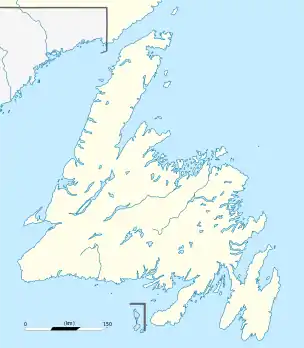 Victoria Location of Victoria in Newfoundland | |
| Coordinates: 47°46′03″N 53°14′28″W | |
| Country | |
| Province | |
| Government | |
| • Mayor | Barry Dooley |
| Area | |
| • Total | 17.64 km2 (6.81 sq mi) |
| Population (2016) | |
| • Total | 1,800 |
| • Density | 100/km2 (260/sq mi) |
| Time zone | UTC-3:30 (Newfoundland Time) |
| • Summer (DST) | UTC-2:30 (Newfoundland Daylight) |
| Area code(s) | 709 |
| Highways | |
Geography
Victoria, located on Route 70, is often referred to as the "crossroads to Trinity and Conception Bays." Victoria may have been named after the Queen.
Towns and communities nearby
Dotted around Victoria and surrounding areas are small fishing communities that were established due to the proximity of each community to the fishing grounds. Locally, Victoria goes by many nicknames, including "The Village" and "The Savage Hollar", although the use of these names has decreased in recent years. Among the communities within 15-minutes' driving distance from Victoria are:
History
The community of Victoria is believed to have originally begun as a "winterhouse" for people from Freshwater and Carbonear. People eventually built permanent dwellings around Beaver Pond, along the road between Carbonear and Heart's Content.
In the nineteenth century the settlement was named Victoria Village, in honour of Queen Victoria.
Although Victoria is an inland community, it is in walking distance of Carbonear, Freshwater and Salmon Cove. Most of the earliest settlers were fishing families (most of the men engaged in the Labrador Fishery). A small amount of farming and livestock raising was also conducted where the produce was sold in Carbonear.
There was a camp built at Victoria to house prisoners of war during World War II. The Americans felt this was a security risk for their bases in Newfoundland, so this structure was never used and it was taken down in 1943.
19th century
- 1817 – Victoria is being used as a source of lumber and firewood.
- 1800s – Many residents of Victoria sign on for the Labrador Fishery with merchants in Carbonear, Harbour Grace and Northern Bay.
20th century
- 1900s (early) – Other people find employment in lumbering, the railway and mining at Bell Island and Cape Breton.
- 1905 – An electric power station is running in the community.
- 1916 — Railway service on the Bay de Verde Branch Line is opened.
- 1921 – Sawmills are affected when a forest fire destroys much of the timber in the area. Nicholas Powell and Reuben, William and Nicholas Clarke are the merchants in Victoria.
- 1924 – An independent congregation (later joins the Pentecostal Assemblies of Newfoundland) is established by Victoria native Eugene Vaters.
- 1932 — Railway service is shut down.
- 1935 - The Pentecostal Assemblies of Newfoundland has more than 300 members in Victoria. Twenty-eight families from Victoria, take part in a land settlement program and move to Markland.
- 1985 – Victoria Electrical Museum is opened.
Economy
Industries / Economic Activity
- Agriculture - growing vegetables, hay, and raising cattle
- Forestry - sawmill
- Manufacturing/Retail - making barrels, tubs and wine barrels at the local cooperage located in the heritage park
- Construction - Home builders
Climate
The climate of the Atlantic Ocean and adjacent land areas is influenced by the temperatures of the surface waters and water currents as well as the winds blowing across the waters. Because of the oceans' great capacity for retaining heat, the climate of Victoria are moderate and free of extreme seasonal variations.
Precipitation falls on the area both as snow in the wintertime and moderate rainfall in summer.
The Gulf Stream and Labrador Current converge just off the coast of Newfoundland and provide for very dense fog that can linger in the area for days.
Culture
Demographics
| Population in 2001 | 1798 |
| Population change | -2.8% |
| Number of families | 580 |
| Number of married couples | 475 |
| Total number of dwellings | 645 |
| Catholic | 7.5% |
| Protestant | 92.5% |
| Land Area | 17.64 km2. |
Tourist attractions
- Victoria Hydro Electric Museum
- Victoria Lifestyles Museum
- Victoria Heritage Village
See also
- List of cities and towns in Newfoundland and Labrador
- Monarchy in Newfoundland and Labrador
External links
- Baccalieu Trail
- Historical Baccalieu Trail
- Statistics Canada
- Victoria - Encyclopedia of Newfoundland and Labrador, vol.5, p. 480.