Cornelius Pass Road
Cornelius Pass Road is an arterial road over Cornelius Pass in the Tualatin Mountains west of Portland, Oregon, United States, also extending several miles to the south. Running north–south, the road stretches between U.S. Route 30 (US 30) on the north and Blanton Street, just south of Oregon Route 8 (OR 8), on the south. The road passes through Washington and Multnomah counties, crossing the Tualatin Mountains at Cornelius Pass, 581 feet (177 m) above sea level.[2] TriMet's MAX Light Rail line (Blue Line or Westside MAX) travels over the road on a bridge.
| Length | 12.4 mi[1] (20.0 km) |
|---|---|
| South end | SE Blanton Street in Hillsboro |
| Major junctions | |
| North end |
Route description

Cornelius Pass Road begins at an intersection with Southeast Blanton Street in southern Hillsboro, about one block south of the Tualatin Valley Highway (OR 8). It travels north across a set of railroad tracks and intersects OR 8 before continuing into Hillsboro's suburban neighborhoods. The street passes under a viaduct carrying light rail trains on the Blue Line near Quatama station near the Orenco Woods Nature Park.[1]
From the undercrossing, the highway travels through several business parks on the east side of Intel's main factory, connected by the intersecting Cornell Road and Evergreen Parkway. Cornelius Pass Road then reaches an interchange with U.S. Route 26 (the Sunset Highway) and turns northeast as it leaves Hillsboro. The highway winds its way around farms and forestland as it ascends into the Tualatin Mountains, reaching its highest point at Cornelius Pass, elevation 581 feet (177 m).[3] The narrow road then descends from the mountains along McCarthy Creek and approaches the Multnomah Channel of the Columbia River, terminating at an intersection with U.S. Route 30 northwest of Portland.[1]
| Location | Volume | ||||
|---|---|---|---|---|---|
| 2010 | 2014 | 2018 | |||
| Near TV Highway | 16,294 | 15,347 | 17,000 | ||
| Near Baseline Road | 18,208 | 25,674 | 28,435 | ||
| Near Quatama Road | 24,338 | 25,674 | 31,910 | ||
| Near Cornell Road | 26,542 | 28,761 | 38,762 | ||
| Near Imbrie Drive | 38,860 | 43,346 | no data | ||
| Near West Union Road | 17,947 | 20,417 | 26,156 | ||
| Near Germantown Road | 8,103 | 9,777 | 16,431 | ||
Cornelius Pass is one of only two main north–south connecting roads in Hillsboro.[7] The former country road handles 11,000 drivers each day and is an arterial route from the Tualatin Valley between Hillsboro to the Columbia River north of Portland.[8] A mountainous road at points, 1,500 of the 11,000 vehicles each day are tractor-trailers on the road designed to handle up to 10,000 vehicles per day.[9] A portion of the road, from US 26 to Cornell, is part of the National Highway System.[10]
History
The road was built by Thomas R. Cornelius in the 19th century.[11] The interchange with the Sunset Highway (US 26) was rebuilt and widened in 1989, and the road widened to five lanes from the freeway to Cornell Road the following year.[12][13] In 1996, the road was extended southward when 216th and 219th avenues were renamed and became the southern section of the road,[14] terminating at Tualatin Valley Highway. At that time, the intersection with Baseline Road was re-aligned,[14] but most of the extension was simply a renaming of 216th Avenue. The intersection with US 26 was altered in 2005 with new on- and off-ramps extending from Cornelius Pass to the east, where a railroad overpass had previously been located.[15][16] In 2008, the entire Multnomah County section was changed to a no-passing zone on the winding road over the Tualatin Mountains.[8]
A one-mile section from Lois to Wilkins streets closed for eight months in 2010 in order to widen the road in that area to five lanes as well as add bike lanes and sidewalks.[17] The $12 million project included a new 182-foot (55 m) bridge over Beaverton Creek.[18] The county hoped to widen the remaining portion of the road to five lanes between Walbridge/Aloclek and Wilkins.[19] Announced in 2011, the expected cost was $10.1 million and would include a new bridge over Rock Creek.[19] Construction closed the section for six months, with the new bridge opening on December 31, 2012; at that time, the remaining widening was expected to continue until the middle of 2013.[20]
Hillsboro also began preliminary work in 2011 to extend Cornelius Pass south of Tualatin Valley Highway to prepare for the development of South Hillsboro.[21] The Oregon Legislature approved $9.5 million in 2012 to fund safety improvements such as guardrails.[22] Hillsboro also announced plans in 2012 to widen the road to seven lanes between Cornell and US 26.[23] The widening project was completed in March 2017 at a total cost of $18.3 million.[24]
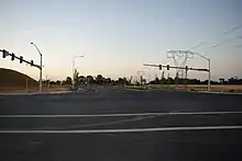
Construction began in 2016 on the extension of Cornelius Pass Road south of Tualatin Valley Highway. The extension, approximately one-third mile (540 m) long, was opened to traffic in July 2018.[25] The new section crosses Portland & Western Railroad tracks and takes Cornelius Pass Road into the under-construction South Hillsboro area.[25] The street currently ends at its intersection with an also-newly built section of SE Blanton Street.
In July 2019, a five-mile (8.0 km) stretch of Cornelius Pass Road between US 30 and NW Germantown Road began an 11-week closure. This stretch of road had experienced a high rate of crashes in preceding years, and Multnomah County closed the road so that safety improvements could be carried out, including curve realignment and widening of shoulders.[26][27][28]
The section of the road between US 26 and US 30 is scheduled to be transferred to the jurisdiction of the state department of transportation in early 2021.[29] Once transferred, it will be designated as Oregon Route 127 as part of the state highway system.[29]
Major intersections
| County | Location | mi[1] | km | Destinations | Notes |
|---|---|---|---|---|---|
| Washington | Hillsboro | 0.0 | 0.0 | Southeast Blanton Street | |
| 0.4 | 0.64 | ||||
| 3.3 | 5.3 | Cornell Road | |||
| 4.4 | 7.1 | Interchange | |||
| Multnomah | Portland | 12.4 | 20.0 | ||
| 1.000 mi = 1.609 km; 1.000 km = 0.621 mi | |||||
See also
References
- Google (August 8, 2018). "Cornelius Pass Road" (Map). Google Maps. Google. Retrieved August 8, 2018.
- United States Geological Survey. Linnton, OR (Map). Reston, VA: United States Geological Survey. Retrieved June 3, 2008 – via TopoQuest.
- "Cornelius Pass". Geographic Names Information System. United States Geological Survey. Retrieved August 8, 2018.
- "2010 Washington County Traffic Volume Table" (PDF). Washington County Department of Land Use and Transportation. April 2010. Retrieved January 3, 2021.
- "2010 Washington County Traffic Volume Table" (PDF). Washington County Department of Land Use and Transportation. 2014. Retrieved January 3, 2021.
- "2010 Washington County Traffic Volume Table" (PDF). Washington County Department of Land Use and Transportation. 2018. Retrieved January 3, 2021.
- Bermudez, Esmeralda (February 23, 2006). "Hillsboro seeks money for new north–south road". The Oregonian.
- Malkin, Whitney (April 12, 2008). "Family hopes to keep road from claiming another life". The Oregonian.
- Starke, Amy Martinez (January 26, 2008). "Family wants more than roadside marker". The Oregonian.
- Oregon Department of Transportation. Oregon Transportation Map: Washington County (PDF) (Map). Salem: Oregon Department of Transportation. Retrieved June 3, 2008.
- Baron, Connie; Trappen, Michelle (March 6, 2008). "Paths linking past and present". The Oregonian. Archived from the original on August 8, 2019. Retrieved August 8, 2019.
- "Sunset lanes to close". The Oregonian. July 11, 1989.
- "Road projects prompt county to ask state aid". The Oregonian. April 2, 1989.
- Hamilton, Don (June 6, 1996). "Road work ahead". The Oregonian.
- "US 26 Work Continues". The Oregonian. January 10, 2005.
- Anderson, David R. (February 20, 2003). "Help in sight for Sunset interchange". The Oregonian.
- Parks, Casey (January 19, 2010). "Hillsboro section of Cornelius Pass Road will close for eight months, $12 million in improvements". The Oregonian. Archived from the original on June 8, 2011. Retrieved August 8, 2019.
- Eckert, Kurt (December 7, 2010). "New Cornelius Pass Road set to ring in a New Year". The Hillsboro Argus. Archived from the original on August 8, 2019. Retrieved August 8, 2019.
- Eckert, Kurt (September 27, 2011). "County looks to finish Corn Pass with existing road funds". The Hillsboro Argus. Archived from the original on August 8, 2019. Retrieved March 9, 2012.
- Driessen, Katherine (December 31, 2012). "Cornelius Pass Road between Quatama Road and Cherry Drive in Hillsboro to reopen Monday evening". The Oregonian. Archived from the original on August 8, 2019. Retrieved August 8, 2019.
- Parks, Casey (July 26, 2011). "Hillsboro will begin work on Cornelius Pass Road expansion". The Oregonian. Archived from the original on October 26, 2013. Retrieved August 8, 2019.
- Theen, Andrew (May 18, 2012). "Scappoose family turns grief into political action, secures state money to improve dangerous road". The Oregonian. Retrieved May 23, 2012.
- Theen, Andrew (September 25, 2012). "Hillsboro planning commission seeks public comment on future road projects". The Oregonian. Retrieved January 3, 2013.
- Howard, John William (November 16, 2017). "Cornelius Pass Road project wins award". Hillsboro Tribune. Archived from the original on December 1, 2017. Retrieved November 18, 2017.
- Pursinger, Geoff (July 12, 2018). "Cornelius Pass Road extension offers glimpse of South Hillsboro". Hillsboro Tribune. Archived from the original on August 7, 2018. Retrieved August 7, 2018.
- Del Savio, Anna (July 26, 2019). "Commuters deal with Cornelius Pass Road closure". Portland Tribune. Retrieved August 9, 2019.
- Theen, Andrew (July 30, 2019). "Lengthy Cornelius Pass closure gets off to rocky start with at least two 'significant' crashes, detour changes". OregonLive. Retrieved August 9, 2019.
- "Cornelius Pass Road Safety Improvements". Multnomah County. Retrieved August 9, 2019.
- Savio, Anna Del (January 5, 2021). "ODOT to assume control of Cornelius Pass Road". Hillsboro NewsTimes. Retrieved January 8, 2021.