Multnomah County, Oregon
Multnomah County /mʌltˈnoʊmə/ is one of the 36 counties in the U.S. state of Oregon. As of the 2010 United States Census, the county's population was 735,334.[1] Its county seat, Portland, is the state's largest city.[2] Multnomah County is part of the Portland-Vancouver-Hillsboro, OR-WA Metropolitan Statistical Area, and though smallest in area, it is the state's most populous county.[3]
Multnomah County | |
|---|---|
 _(mulDA0006).jpg.webp)       From clockwise: Downtown Portland, Old Multnomah County Courthouse, First Presbyterian Church, Bonneville Dam, Vista House, St. Johns Bridge, Mount Hood, (middle) Arlene Schnitzer Concert Hall | |
 Seal Logo | |
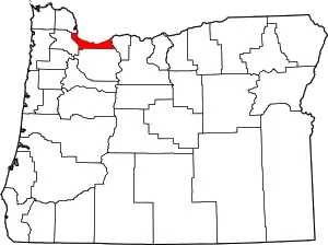 Location within the U.S. state of Oregon | |
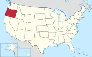 Oregon's location within the U.S. | |
| Coordinates: 45°32′N 122°25′W | |
| Country | |
| State | |
| Founded | December 22, 1854 |
| Seat | Portland |
| Largest city | Portland |
| Area | |
| • Total | 466 sq mi (1,210 km2) |
| • Land | 431 sq mi (1,120 km2) |
| • Water | 34 sq mi (90 km2) 7.4%% |
| Population (2010) | |
| • Total | 735,334 |
| • Estimate (2019) | 812,855 |
| • Density | 1,874/sq mi (724/km2) |
| Time zone | UTC−8 (Pacific) |
| • Summer (DST) | UTC−7 (PDT) |
| Congressional districts | 1st, 3rd, 5th |
| Website | www |
History
The area of the lower Willamette River has been inhabited for thousands of years, including by the Multnomah band of Chinookan peoples long before European contact, as evidenced by the nearby Cathlapotle village, just downstream.[4]
Multnomah County (the thirteenth in Oregon Territory) was created on December 22, 1854, formed out of two other Oregon counties – the eastern part of Washington County and the northern part of Clackamas County. Its creation was a result of a petition earlier that year by businessmen in Portland complaining of the inconvenient location of the Washington County seat in Hillsboro and of the share of Portland tax revenues leaving the city to support Washington County farmers. County commissioners met for the first time on January 17, 1855.[5] The county is named after the Chinookan word for the "lower river", Multnomah, Matlnomaq, máɬnumax̣ being interpretive English spellings of the same word. In Chinook Jargon, Ne-matlnomaq, means the "place of matlnomaq" or the (singular) Ne-matlnomag, "the lower river", from the Oregon City Falls toward the Columbia river. Alternatively, Chinookan máɬnumax̣ (also nímaɬnumax̣) ‘those toward water’ (or ‘toward the Columbia River’, known in Chinookan as ímaɬ or wímaɬ ‘the great water’). The explorer William Clark wrote in his Journal: "I entered this river...called Multnomah...from a nation who reside on Wappato Island, a little below the enterence" (quoted from Willamette Landings by H.M. Corning).(see:Portland Basin Chinookan Villages in the early 1800s, Boyd and Zenk,) Although Clark refers to the Willamette River as Multnomah, he may not have understood the meaning. Simply put, Multnomah("down river" or "toward the great water")is the shortened form of nematlnomaq/nímaɬnumax̣".
In 1924, the county's three commissioners were indicted and recalled by voters "in response to 'gross irregularities' in the award of contracts for construction of the Burnside and Ross Island bridges"; since all three had been supported by the Ku Klux Klan, their recall also helped reduce that organization's influence in the city.[6]
Vanport, built north of Portland in 1943 to house workers for Kaiser Shipyards, was destroyed by a flood five years later.
In 1968, the Oregon Legislative Assembly referred a bill, Ballot Measure 5, to voters that would amend the state constitution to allow for consolidated city-county governments when the population is over 300,000.[7] The 1968 voters' pamphlet noted that Multnomah County would be the only county in Oregon affected by the measure and voters approved the referendum in the 1968 general election.[7][8] Since the approval of Measure 5 in 1968, an initiative to merge the county with Portland has been considered and placed on the county ballot several times.[9][10][11]
Since 2000
In the 2000 presidential election, Multnomah played a decisive role in determining the winner of the state's electoral votes. Al Gore carried the county by more than 104,000 votes, enough to offset the nearly 100,000-vote advantage that George W. Bush had earned among Oregon's 35 other counties. The Democratic tilt was repeated in 2004, when John Kerry won by 181,000 votes, and in 2008 when Barack Obama won by 204,000 votes.
In February 2001, the Multnomah County Board of Commissioners unanimously accepted the recommendation of the Library Advisory Board and authorized the library to enter into a lawsuit to stop the Children's Internet Protection Act.[12] The US Supreme Court ultimately decided in 2003 that the law was constitutional in US v. ALA. However, the library chose to turn down $104,000 per year of federal funding under CIPA to be able to continue to offer unfiltered Internet access.[13][14]
Faced with decreasing government revenues due to a recession in the local economy, voters approved a three-year local income tax (Measure 26-48) [15] on May 20, 2003 to prevent further cuts in schools, police protection, and social services.[16] Multnomah County was one of the few local governments in Oregon to approve such a tax increase.
On March 2, 2004, Multnomah County Chair Diane Linn announced the county would begin granting licenses for same-sex marriages, pursuant to a legal opinion issued by its attorney deeming such marriages lawful under Oregon law. Her announcement was supported by three other commissioners (Serena Cruz, Lisa Naito, Maria Rojo de Steffey), but criticized by Lonnie Roberts, who represents the eastern part of Multnomah county and was left out of the decision.[17] Within a few days, several groups joined to file a lawsuit to halt the county's action.
But after that, Linn and the three commissioners developed a public feud, with the latter becoming known as the "mean girls".[18] The county government has also faced significant budget issues, including not being able to open the Wapato Corrections Facility since it was built in 2003.
Geography

According to the United States Census Bureau, the county has a total area of 466 square miles (1,210 km2), of which 431 square miles (1,120 km2) is land and 34 square miles (88 km2) (7.4%) is water.[19] It is the smallest county in Oregon by area. It is located along the south side of the Columbia River.
The county includes a number of extinct volcanoes in the Boring Lava Field. The Oregon side of the Columbia River Gorge forms the eastern portion of the county's northern border.
Major highways
Adjacent counties
- Columbia County - northwest
- Clark County, Washington - north
- Skamania County, Washington - northeast
- Hood River County - east
- Clackamas County - south
- Washington County - west
National protected area
- Mount Hood National Forest (part)
Demographics
| Historical population | |||
|---|---|---|---|
| Census | Pop. | %± | |
| 1860 | 4,150 | — | |
| 1870 | 11,510 | 177.3% | |
| 1880 | 25,203 | 119.0% | |
| 1890 | 74,884 | 197.1% | |
| 1900 | 103,167 | 37.8% | |
| 1910 | 226,261 | 119.3% | |
| 1920 | 275,898 | 21.9% | |
| 1930 | 338,241 | 22.6% | |
| 1940 | 355,099 | 5.0% | |
| 1950 | 471,537 | 32.8% | |
| 1960 | 522,813 | 10.9% | |
| 1970 | 556,667 | 6.5% | |
| 1980 | 562,640 | 1.1% | |
| 1990 | 583,887 | 3.8% | |
| 2000 | 660,486 | 13.1% | |
| 2010 | 735,334 | 11.3% | |
| 2019 (est.) | 812,855 | [20] | 10.5% |
| U.S. Decennial Census[21] 1790-1960[22] 1900-1990[23] 1990-2000[24] 2010-2019[1] | |||
2000 census
As of the 2000 census, there were 660,486 people in the county, organized into 272,098 households and 152,102 families. The population density was 1,518 people per square mile (586/km2). There were 288,561 housing units at an average density of 663 per square mile (256/km2). The racial makeup of the county was 79.16% White, 5.70% Asian, 5.67% Black or African American, 1.03% Native American, 0.35% Pacific Islander, 4.03% from other races, and 4.07% from two or more races. 7.51% of the population were Hispanic or Latino of any race. 16.0% were of German, 9.0% English, 8.8% Irish, and 5.1% American ancestry. 83.5% spoke English, 6.3% Spanish, 1.7% Vietnamese and 1.3% Russian as their first language.
There were 272,098 households, out of which 26.5% had children under the age of 18 living with them, 40.9% were married couples living together, 10.8% had a female householder with no husband present, and 44.1% were non-families. 32.5% of all households were made up of individuals, and 8.6% had someone living alone who was 65 years of age or older. The average household size was 2.37 and the average family size was 3.03.
In the county, the population was spread out, with 22.30% under the age of 18, 10.30% from 18 to 24, 33.80% from 25 to 44, 22.50% from 45 to 64, and 11.10% who were 65 years of age or older. The median age was 35 years. For every 100 females, there were 98.00 males. For every 100 females age 18 and over, there were 96.10 males.
The median income for a household in the county was $41,278, and the median income for a family was $51,118. Males had a median income of $36,036 versus $29,337 for females. The per capita income for the county was $22,606. 12.70% of the population and 8.20% of families were below the poverty line. Out of the total population, 15.40% of those under the age of 18 and 9.80% of those 65 and older were living below the poverty line.
2010 census
As of the 2010 United States Census, there were 735,334 people, 304,540 households, and 163,539 families residing in the county.[25] The population density was 1,704.9 inhabitants per square mile (658.3/km2). There were 324,832 housing units at an average density of 753.2 per square mile (290.8/km2).[26] The racial makeup of the county was 76.5% white, 6.5% Asian, 5.6% black or African American, 1.1% American Indian, 0.5% Pacific islander, 5.1% from other races, and 4.6% from two or more races. Those of Hispanic or Latino origin made up 10.9% of the population.[25] In terms of ancestry, 19.4% were German, 12.2% were Irish, 11.4% were English, and 4.2% were American.[27]
Of the 304,540 households, 27.0% had children under the age of 18 living with them, 38.6% were married couples living together, 10.7% had a female householder with no husband present, 46.3% were non-families, and 32.6% of all households were made up of individuals. The average household size was 2.35 and the average family size was 3.03. The median age was 35.7 years.[25]
The median income for a household in the county was $49,618 and the median income for a family was $62,956. Males had a median income of $45,152 versus $38,211 for females. The per capita income for the county was $28,883. About 11.3% of families and 16.0% of the population were below the poverty line, including 21.1% of those under age 18 and 12.1% of those age 65 or over.[28]
Law and government

Multnomah County was a bellwether county for much of the first half of the 20th century. However, since 1964, it has been the strongest Democratic bastion in Oregon. The Democrats have failed to win a majority in the county only two times since then, in 1972 and 1980.
As Multnomah County is by far the most populous county in Oregon, Democratic majorities in the county are often enough to swing the results in statewide elections. In 2008, Democratic challenger Jeff Merkley unseated incumbent two-term Senator Gordon Smith even though Smith carried 28 of Oregon's 36 counties. However, Merkley carried Multnomah County by over 142,000 votes, enough to allow him to defeat Smith by 59,100 votes.
The county courthouse is located in downtown Portland. The Multnomah County Central Courthouse opened in 2020, replacing a century-old building nearby that was in need of seismic retrofitting.[29]
Elected Officials
- County Commission
| District | Name[30] | Notes | |
|---|---|---|---|
| Chair | Deborah Kafoury | [31][32] | |
| Commissioner, District 1 | Sharon Meieran | [32][33] | |
| Commissioner, District 2 | Susheela Jayapal | [34][35] | |
| Commissioner, District 3 | Jessica Vega Pederson | [32][36] | |
| Commissioner, District 4 | Lori Stegmann | [32][37] | |
County Officials
| Office | Name | Party | |
|---|---|---|---|
| District Attorney | Mike Schmidt[38] | Nonpartisan | |
| Sheriff | Mike Reese[39] | Nonpartisan | |
| Auditor | Steve March[40] | Nonpartisan | |
- Appointed officials
- Elections: Tim Scott
- Finance: Mark Campbell
- Surveyor: James Clayton
Map of Multnomah County Senate-Representative District Maps
| Year | Republican | Democratic | Third parties |
|---|---|---|---|
| 2020 | 17.9% 82,995 | 79.2% 367,249 | 2.8% 13,415 |
| 2016 | 17.0% 67,954 | 73.3% 292,561 | 9.7% 38,588 |
| 2012 | 20.7% 75,302 | 75.4% 274,887 | 4.0% 14,533 |
| 2008 | 20.6% 75,171 | 76.7% 279,696 | 2.7% 9,843 |
| 2004 | 27.1% 98,439 | 71.6% 259,585 | 1.3% 4,670 |
| 2000 | 28.2% 83,677 | 63.5% 188,441 | 8.3% 24,567 |
| 1996 | 26.3% 71,094 | 59.2% 159,878 | 14.5% 38,989 |
| 1992 | 24.3% 72,326 | 55.3% 165,081 | 20.4% 60,884 |
| 1988 | 36.5% 95,561 | 61.6% 161,361 | 1.9% 4,921 |
| 1984 | 45.2% 119,932 | 54.3% 144,179 | 0.5% 1,428 |
| 1980 | 39.2% 101,606 | 46.5% 120,487 | 14.2% 36,875 |
| 1976 | 44.4% 112,400 | 51.0% 129,060 | 4.6% 11,699 |
| 1972 | 46.7% 118,219 | 49.6% 125,470 | 3.7% 9,269 |
| 1968 | 43.9% 106,831 | 51.2% 124,651 | 4.9% 12,036 |
| 1964 | 33.5% 81,683 | 66.1% 161,040 | 0.4% 1,016 |
| 1960 | 50.5% 127,271 | 49.3% 124,273 | 0.1% 338 |
| 1956 | 52.8% 129,658 | 47.2% 115,896 | 0.0% 0 |
| 1952 | 55.0% 132,602 | 44.4% 107,118 | 0.6% 1,339 |
| 1948 | 45.8% 86,519 | 49.6% 93,703 | 4.7% 8,806 |
| 1944 | 42.0% 78,279 | 56.7% 105,516 | 1.3% 2,423 |
| 1940 | 42.7% 73,612 | 56.6% 97,595 | 0.6% 1,106 |
| 1936 | 27.2% 41,405 | 70.0% 106,561 | 2.9% 4,353 |
| 1932 | 35.6% 47,201 | 59.4% 78,898 | 5.0% 6,644 |
| 1928 | 61.6% 75,731 | 36.8% 45,177 | 1.6% 1,951 |
| 1924 | 50.0% 48,866 | 22.2% 21,733 | 27.8% 27,165 |
| 1920 | 58.1% 44,806 | 35.8% 27,607 | 6.2% 4,761 |
| 1916 | 51.7% 41,458 | 44.6% 35,755 | 3.8% 3,022 |
| 1912 | 23.1% 9,212 | 34.8% 13,894 | 42.2% 16,862[42] |
| 1908 | 59.8% 17,819 | 33.1% 9,850 | 7.1% 2,118 |
| 1904 | 73.9% 13,692 | 12.5% 2,324 | 13.6% 2,518 |
| 1900 | 65.4% 9,948 | 29.1% 4,436 | 5.3% 814 |
| 1896 | 63.5% 11,824 | 34.6% 6,453 | 1.7% 334 |
| 1892 | 48.2% 8,041 | 12.2% 2,040 | 39.4% 6,572 |
| 1888 | 59.8% 6,250 | 38.2% 3,996 | 1.9% 201 |
| 1884 | 55.9% 5,058 | 42.9% 3,880 | 1.0% 95 |
| 1880 | 54.1% 3,211 | 45.8% 2,720 | 0.0% 0 |
Economy
The principal industries of Multnomah County are manufacturing, transportation, wholesale and retail trade, and tourism. Since Oregon does not have a sales tax, it attracts shoppers from southwest Washington.
The Port of Portland, established in 1891 and combined with the City of Portland's Commission of Public Docks in 1971, ranks third in total waterborne commerce on the West Coast, and 31st in the nation for total tonnage according to the 2009 American Association of Port Authorities' Port Industries Statistics.[43] Portland is one of the five largest auto import ports in the nation and is the West Coast's leading exporter of grain and lumber. The Port of Portland is also responsible for Portland International Airport (PDX) in the northeast section of Portland, the Troutdale Airport a few miles east of PDX in Multnomah County, the Hillsboro Airport to the west in Washington County, and Mulino State Airport to the south in Clackamas County.
Out of the 199 cities and counties located in the five West Coast states, Multnomah County ranked 198th in private sector job creation from 1997 to 2009.[44]
Tourism
The county is home to a number of Portland-area attractions and venues, including Oregon Museum of Science and Industry, Portland Art Museum, Memorial Coliseum, Oregon Convention Center, Moda Center, Providence Park, Washington Park, Oregon Zoo, International Rose Test Garden, Lan Su Chinese Garden, Portland Japanese Garden, and Pittock Mansion.
It is also home to the Historic Columbia River Highway, Multnomah Falls, and Oxbow Regional Park.
Communities
Cities
- Fairview
- Gresham
- Lake Oswego (small portion)[45]
- Maywood Park
- Milwaukie (small portion)
- Portland (county seat)
- Troutdale
- Wood Village
Unincorporated communities
Former communities
References
- "State & County QuickFacts". United States Census Bureau. Archived from the original on June 24, 2011. Retrieved November 15, 2013.
- "Find a County". National Association of Counties. Retrieved June 7, 2011.
- "Oregon Almanac: Abbreviation to Counties". Oregon Blue Book. State of Oregon. Retrieved July 4, 2007.
- Ames, Kenneth. "Cathlapotle". The Oregon Encyclopedia. The Oregon Historical Society. Retrieved November 3, 2017.
- "Oregon Historical County Records Guide:Multnomah County History". Oregon State Archives. Retrieved August 1, 2009.
- Genovese, Fran (February 19, 2009). "Politicians and scandal: a Portland-area tradition". The Oregonian. Retrieved December 10, 2011.
- Oregon Blue Book (2009). "Initiative, Referendum and Recall: 1958-1970". Oregon Secretary of State. Retrieved June 18, 2010.
- Oregon Secretary of State (1968). "State of Oregon Voters' Pamphlet General Election 1968" (PDF). Oregon State Library. Archived from the original (PDF) on August 20, 2011. Retrieved June 18, 2010.
- Briem, Chris. "Some Major City-County Consolidation Referenda in the 20th Century". University of Pittsburgh. Archived from the original on July 8, 2011. Retrieved March 28, 2010.
- Senator Lim (1997). "Relating to city-county consolidation; creating new provisions". Oregon Legislative Assembly. Archived from the original on June 11, 2011. Retrieved March 28, 2010.
- Bogstad, Deborah (1999). "Multnomah County March 30 & April 1, 1999 Board Meetings". Multnomah County, Oregon. Retrieved March 28, 2010.
- "Children's Internet Protection Act; Questions and Answers". Multnomah County Library. Retrieved June 29, 2007.
- Mitchell, Renee S. (May 5, 2004). "Once again, policy did not involve public". The Oregonian.
- "Children's Internet Protection Act; Questions and Answers". Multnomah County Library. December 23, 2009. Retrieved March 28, 2010.
- "May 2003 Special Election - Multnomah County - Measure No. 26-48". Multnomah County Elections.
- "May 20, 2003 - Election Results". Multnomah County Elections.
- "Oregon News homepage". The Oregonian. Retrieved November 22, 2010.
- Kelly House (November 4, 2013). "Former Multnomah County Chair Diane Linn returns to Portland with nonprofit job". The Oregonian.
- "2010 Census Gazetteer Files". United States Census Bureau. August 22, 2012. Retrieved February 26, 2015.
- "Population and Housing Unit Estimates". Retrieved March 26, 2020.
- "U.S. Decennial Census". United States Census Bureau. Retrieved February 26, 2015.
- "Historical Census Browser". University of Virginia Library. Retrieved February 26, 2015.
- Forstall, Richard L., ed. (March 27, 1995). "Population of Counties by Decennial Census: 1900 to 1990". United States Census Bureau. Retrieved February 26, 2015.
- "Census 2000 PHC-T-4. Ranking Tables for Counties: 1990 and 2000" (PDF). United States Census Bureau. April 2, 2001. Retrieved February 26, 2015.
- "DP-1 Profile of General Population and Housing Characteristics: 2010 Demographic Profile Data". United States Census Bureau. Archived from the original on February 13, 2020. Retrieved February 23, 2016.
- "Population, Housing Units, Area, and Density: 2010 - County". United States Census Bureau. Archived from the original on February 13, 2020. Retrieved February 23, 2016.
- "DP02 SELECTED SOCIAL CHARACTERISTICS IN THE UNITED STATES – 2006-2010 American Community Survey 5-Year Estimates". United States Census Bureau. Archived from the original on February 13, 2020. Retrieved February 23, 2016.
- "DP03 SELECTED ECONOMIC CHARACTERISTICS – 2006-2010 American Community Survey 5-Year Estimates". United States Census Bureau. Archived from the original on February 13, 2020. Retrieved February 23, 2016.
- Green, Aimee (October 4, 2020). "After decades of trying, Multnomah County opens a $324 million new, spacious, seismically safer courthouse". The Oregonian. Retrieved October 10, 2020.
- "Texas Redistricting". www.tlc.state.tx.us. Archived from the original on October 19, 2017. Retrieved November 3, 2017.
- "Deborah Kafoury takes office as Multnomah County Chair". multco.us. June 5, 2014. Retrieved July 22, 2014.
- Manning, Rob (January 3, 2017). "Multnomah County Swears In All-Female Commission". Oregon Public Broadcasting. Retrieved January 5, 2017.
- "Sharon Meieran, Commissioner, District 1". Multnomah County. Retrieved January 5, 2017.
- Oregonian/OregonLive, Beth Nakamura | The; Oregonian/OregonLive, Betsy Hammond | The Oregonian/OregonLive The; Oregonian/OregonLive, Betsy Hammond | The. "Jayapal sworn in as Oregon's first Indian American to hold elected county office". oregonlive.com. Retrieved January 5, 2019.
- "Susheela Jayapal". Multnomah County. December 19, 2018. Retrieved January 5, 2019.
- "Jessica Vega Pederson, Commissioner, District 3". Multnomah County. Retrieved January 5, 2017.
- "Lori Stegmann, Commissioner, District 4". Multnomah County. Retrieved January 5, 2017.
- Oregonian/OregonLive, Maxine Bernstein | The (August 11, 2020). "Hundreds of Portland protesters will see their criminal cases dropped as DA announces plan to 'recognize the right to speak'". oregonlive. Retrieved August 28, 2020.
- "District Attorney's Office homepage". Multnomah County. Retrieved November 22, 2010.
- "Auditor's Office". co.multnomah.or.us. Retrieved November 22, 2010.
- Leip, David. "Dave Leip's Atlas of U.S. Presidential Elections". uselectionatlas.org. Retrieved April 11, 2018.
- The leading "other" candidate, Progressive Theodore Roosevelt, received 12,523 votes, while Socialist Eugene Debs received 3,578 votes, Prohibition candidate Eugene Chafin received 761 votes.
- "Port Industry Statistics". American Association of Port Authorities. Retrieved August 1, 2011.
- "Portland's Economic Recovery and the Role of Trade". Friday Forums. City Club of Portland. December 2, 2011. Archived from the original on November 30, 2011. Retrieved December 10, 2011.
- Ci.oswego.or.us Archived February 4, 2012, at the Wayback Machine
External links
| Wikimedia Commons has media related to Multnomah County, Oregon. |
- Multnomah County
- Multnomah County History from the Oregon State Archives
- Historical Map of Multnomah County, Oregon Library of Congress - Map Date: January 1889 (hi-res)

Places adjacent to Multnomah County, Oregon | ||||||||||
|---|---|---|---|---|---|---|---|---|---|---|
| ||||||||||
Municipalities and communities of Multnomah County, Oregon, United States | ||
|---|---|---|
| Cities | Multnomah County map | |
| Unincorporated communities | ||
| Footnotes | ‡This populated place also has portions in an adjacent county or counties | |
| ||

| Authority control |
|---|