Cottonwood, Colorado
Cottonwood is a neighborhood in the Town of Parker, Colorado. A former census-designated place (CDP), the population was 931 at the 2000 census.
Cottonwood, Colorado | |
|---|---|
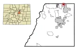 Location of Cottonwood in Douglas County, Colorado. | |
| Coordinates: 39°33′45″N 104°48′07″W[1] | |
| Country | |
| State | |
| County | Douglas County |
| County | Town of Parker |
| Elevation | 5,751 ft (1,753 m) |
| Population (2000) | |
| • Total | 931 |
| Time zone | UTC-7 (MST) |
| • Summer (DST) | UTC-6 (MDT) |
| Area codes | 303 & 720 |
| GNIS feature[1] | Cottonwood, Colorado |
Geography
Cottonwood is located at 39.562°N 104.802°W.[1]
Climate
This climate type is usually found in the outskirts of true deserts in low-latitude, semiarid regions. It has a cooler, wetter winter resulting from the higher latitude and mid-latitude frontal cyclone activity. Annual precipitation totals are greater than in tropical and subtropical desert climates. Yearly variations in amount are not as extreme as in the true deserts but are nevertheless large. The Köppen Climate Classification subtype for this climate is "BSk". (Tropical and Subtropical Steppe Climate).
| Climate data for Cottonwood, Colorado | |||||||||||||
|---|---|---|---|---|---|---|---|---|---|---|---|---|---|
| Month | Jan | Feb | Mar | Apr | May | Jun | Jul | Aug | Sep | Oct | Nov | Dec | Year |
| Average high °C (°F) | 6 (43) |
8 (46) |
11 (51) |
16 (60) |
21 (69) |
27 (80) |
30 (86) |
29 (84) |
25 (77) |
19 (66) |
11 (52) |
7 (45) |
17 (63) |
| Average low °C (°F) | −9 (15) |
−8 (18) |
−5 (23) |
−1 (31) |
4 (40) |
9 (49) |
13 (55) |
12 (54) |
8 (46) |
2 (35) |
−5 (23) |
−8 (17) |
1 (34) |
| Average precipitation mm (inches) | 7.6 (0.3) |
7.6 (0.3) |
23 (0.9) |
33 (1.3) |
64 (2.5) |
48 (1.9) |
56 (2.2) |
48 (1.9) |
28 (1.1) |
20 (0.8) |
18 (0.7) |
7.6 (0.3) |
360 (14.1) |
| Source: Weatherbase [2] | |||||||||||||
See also
- Outline of Colorado
- State of Colorado
- Colorado cities and towns
- Colorado counties
- Colorado metropolitan areas
References
- "U.S. Board on Geographic Names: Domestic Names". United States Geological Survey. Retrieved December 11, 2020.
- "Weatherbase.com :PARKER, COLORADO (closest city on record to Cottonwood, Colorado)". Weatherbase. 2013. Retrieved on May 5, 2013.
External links
Municipalities and communities of Douglas County, Colorado, United States | ||
|---|---|---|
| Cities |  Map of Colorado highlighting Douglas County | |
| Towns | ||
| CDPs | ||
| Unincorporated communities | ||
| Footnotes | ‡This populated place also has portions in an adjacent county or counties | |
| ||
This article is issued from Wikipedia. The text is licensed under Creative Commons - Attribution - Sharealike. Additional terms may apply for the media files.
