Douglas County, Colorado
Douglas County is a county located in the U.S. state of Colorado. As of the 2010 census, the population was 285,465.[1] The county seat is Castle Rock.[2]
Douglas County | |
|---|---|
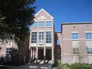 One of two county buildings for Douglas County in Castle Rock | |
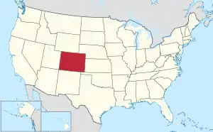
 Location within the U.S. state of Colorado | |
 Colorado's location within the U.S. | |
| Coordinates: 39°21′N 104°56′W | |
| Country | |
| State | |
| Founded | November 1, 1861 |
| Named for | Stephen A. Douglas |
| Seat | Castle Rock |
| Largest community | Highlands Ranch |
| Area | |
| • Total | 843 sq mi (2,180 km2) |
| • Land | 840 sq mi (2,200 km2) |
| • Water | 2.6 sq mi (7 km2) 0.3%% |
| Population | |
| • Estimate (2019) | 351,154 |
| • Density | 399/sq mi (154/km2) |
| Time zone | UTC−7 (Mountain) |
| • Summer (DST) | UTC−6 (MDT) |
| Congressional districts | 4th, 6th |
| Website | www |
Douglas County is part of the Denver-Aurora-Lakewood, Colorado, metropolitan statistical area. It is located midway between Colorado's two largest cities, Denver and Colorado Springs, and contains a portion of Aurora, the state's third-largest city. Douglas County has the highest median household income of any Colorado county or statistical equivalent. It is ranked seventh nationally in that category.
Overview
Douglas County is lightly wooded, mostly with ponderosa pine, with broken terrain characterized by mesas, foothills, and small streams. Cherry Creek and Plum Creek rise in Douglas County and flow north toward Denver and into the South Platte River. Both were subject to flash flooding in the past, Plum Creek being partially responsible for the Denver flood of 1965. Cherry Creek and Plum Creek are now dammed.
Most residents commute to workplaces elsewhere in the metropolitan area outside of the county. Suburban development is supplementing the traditional ranching economy of the county.
History
Douglas County was one of the original 17 counties created in the Colorado Territory by the Colorado Territorial Legislature on November 1, 1861. The county was named in honor of U.S. Senator Stephen A. Douglas[3] of Illinois, who died five months before the county was created. The county seat was originally Franktown, but was moved to California Ranch in 1863, and then to Castle Rock in 1874. Although the county's boundaries originally extended eastward to the Kansas state border, in 1874, most of the eastern portion of the county became part of Elbert County.
Geography
According to the U.S. Census Bureau, the county has a total area of 844 square miles (2,190 km2), of which 841 square miles (2,180 km2) are land and 2.6 square miles (6.7 km2) (0.3%) are covered by water.[4]
Adjacent counties
- Jefferson County, Colorado – west
- Arapahoe County, Colorado – north
- Elbert County, Colorado – east
- El Paso County, Colorado – south
- Teller County, Colorado – southwest
Major Highways
.svg.png.webp) Interstate 25
Interstate 25 I-25 BL
 U.S. Highway 85
 U.S. Highway 87
 State Highway 67
 State Highway 83
 State Highway 86
 State Highway 105
 State Highway 121
 State Highway 470
- E-470 (tollway)
Parks and recreational areas
Three state parks fall within Douglas County, Castlewood Canyon State Park, Chatfield State Park and Roxborough State Park. Parts of the county lie within the Pike National Forest and were crossed by the historic South Platte Trail.
Recreation trails in the county include:
- American Discovery Trail
- Colorado Trail
- Devils Head National Recreation Trail
- Highline Canal National Recreation Trail
- Platte River Greenway National Recreation Trail
- Ridgeline Open Space Trail
- Bluffs Regional Park Trail
The Rueter–Hess Reservoir, when filled, may provide significant recreation, including fishing, hiking, and nonmotorized boating. If filled to capacity, surface size would be 1,140 acres, making this a fairly significant reservoir in Colorado and Douglas County's largest body of water.
Demographics
| Historical population | |||
|---|---|---|---|
| Census | Pop. | %± | |
| 1870 | 1,388 | — | |
| 1880 | 2,486 | 79.1% | |
| 1890 | 3,006 | 20.9% | |
| 1900 | 3,120 | 3.8% | |
| 1910 | 3,192 | 2.3% | |
| 1920 | 3,517 | 10.2% | |
| 1930 | 3,498 | −0.5% | |
| 1940 | 3,496 | −0.1% | |
| 1950 | 3,507 | 0.3% | |
| 1960 | 4,816 | 37.3% | |
| 1970 | 8,407 | 74.6% | |
| 1980 | 25,153 | 199.2% | |
| 1990 | 60,391 | 140.1% | |
| 2000 | 175,766 | 191.0% | |
| 2010 | 285,465 | 62.4% | |
| 2019 (est.) | 351,154 | [5] | 23.0% |
| U.S. Decennial Census[6] 1790-1960[7] 1900-1990[8] 1990-2000[9] 2010-2015[1] | |||
As of the census[10] of 2000, 175,766 people, 60,924 households, and 49,835 families were residing in the county. The population density was 209 people per square mile (81/km2). The 63,333 housing units averaged 75 per square mile (29/km2). The racial makeup of the county was 92.77% White, 2.51% Asian, 0.95% African American, 0.41% Native American, 1.49% from other races, and 1.88% from two or more races. Hispanics or Latinos of any race made up 5.06% of the population.
Of the 60,924 households, 47.2% had children under the age of 18 living with them, 73.8% were married couples living together, 5.7% had a female householder with no husband present, and 18.2% were not families. About 13.3% of all households were made up of individuals, and 1.9% had someone living alone who was 65 years of age or older. The average household size was 2.88, and the average family size was 3.19.
In the county, the population distribution was 31.6% under the age of 18, 4.8% from 18 to 24, 37.9% from 25 to 44, 21.6% from 45 to 64, and 4.2% who were 65 years of age or older. The median age was 34 years. For every 100 females, there were 99.7 males. For every 100 females age 18 and over, there were 97.4 males.
The median income for a household in the county was $82,929, and for a family was $88,482 (these figures had risen to $93,819 and $102,767, respectively, as of a 2007 estimate[11]). Males had a median income of $60,729 versus $38,965 for females. The per capita income for the county was $34,848. About 1.6% of families and 2.1% of the population were below the poverty line, including 1.9% of those under age 18 and 3.7% of those age 65 or over.
Douglas County had the highest median household income of any Colorado county or statistical equivalent in 2000. In 2008, it ranked eighth in the United States in that category; it was one of two in the top 15 not in the vicinity of New York or Washington.
Politics
As a primarily exurban county, Douglas County has long been known as a Republican stronghold. In the 2012 election, Mitt Romney won 62% of the vote. Douglas County has become more competitive in recent years, with Donald Trump winning 55% of the county's vote in 2016, and only 52% of the vote in 2020.[12]
| Year | Republican | Democratic | Others |
|---|---|---|---|
| 2020 | 52.4% 121,270 | 45.2% 104,653 | 2.5% 5,682 |
| 2016 | 54.7% 102,573 | 36.6% 68,657 | 8.7% 16,270 |
| 2012 | 62.1% 104,397 | 36.4% 61,094 | 1.5% 2,593 |
| 2008 | 58.0% 88,108 | 40.8% 61,960 | 1.2% 1,751 |
| 2004 | 66.5% 80,651 | 32.7% 39,661 | 0.7% 889 |
| 2000 | 65.0% 56,007 | 31.4% 27,076 | 3.7% 3,142 |
| 1996 | 61.8% 32,120 | 31.2% 16,232 | 7.0% 3,623 |
| 1992 | 46.4% 18,592 | 24.9% 9,991 | 28.7% 11,477 |
| 1988 | 70.0% 17,035 | 28.5% 6,931 | 1.6% 384 |
| 1984 | 79.3% 12,249 | 19.5% 3,011 | 1.2% 181 |
| 1980 | 70.1% 8,126 | 18.2% 2,108 | 11.7% 1,362 |
| 1976 | 65.5% 5,078 | 31.7% 2,459 | 2.7% 211 |
| 1972 | 75.5% 3,625 | 21.8% 1,048 | 2.7% 127 |
| 1968 | 61.5% 1,910 | 27.6% 857 | 10.9% 337 |
| 1964 | 47.9% 1,336 | 51.7% 1,442 | 0.5% 13 |
| 1960 | 64.4% 1,490 | 35.6% 823 | 0.0% 0 |
| 1956 | 68.1% 1,508 | 31.5% 697 | 0.5% 10 |
| 1952 | 69.0% 1,427 | 30.8% 637 | 0.2% 4 |
| 1948 | 55.8% 979 | 43.7% 767 | 0.6% 10 |
| 1944 | 65.4% 1,214 | 34.4% 638 | 0.3% 5 |
| 1940 | 61.6% 1,298 | 38.0% 801 | 0.4% 9 |
| 1936 | 45.5% 895 | 53.1% 1,044 | 1.5% 29 |
| 1932 | 43.0% 836 | 54.5% 1,061 | 2.5% 49 |
| 1928 | 64.3% 1,107 | 35.0% 603 | 0.8% 13 |
| 1924 | 55.3% 870 | 24.4% 383 | 20.3% 319 |
| 1920 | 61.4% 948 | 36.3% 561 | 2.3% 35 |
| 1916 | 42.2% 612 | 56.5% 820 | 1.3% 19 |
| 1912 | 28.2% 373 | 46.8% 619 | 25.0% 330 |
| 1908 | 54.7% 779 | 44.2% 629 | 0.9% 14 |
| 1904 | 59.2% 792 | 39.2% 524 | 1.5% 20 |
| 1900 | 49.0% 642 | 49.6% 650 | 1.3% 18 |
| 1896 | 13.9% 172 | 85.2% 1,051 | 0.8% 10 |
| 1892 | 57.6% 360 | 42.4% 265 | |
| 1888 | 52.6% 385 | 42.0% 307 | 5.3% 39 |
| 1884 | 53.3% 288 | 45.5% 246 | 1.1% 6 |
| 1880 | 53.8% 331 | 45.8% 282 | 0.3% 2 |
Education
Douglas County is served by Douglas County School District RE-1, the third-largest school district in Colorado. In addition to traditional neighborhood schools, the district includes six charter schools, four option schools, and an online school . Schools are rated generally high in the area.
The University Center at Chaparral in Parker offers courses through Arapahoe Community College, University of Colorado Denver, University College of the University of Denver, and the Douglas County School District. The University of Phoenix has a campus in Lone Tree.
The University of Colorado offers courses from both its Boulder campus and its Denver campus at the CU-South Extension in Lone Tree.
Libraries
The Douglas County Libraries system has seven branches throughout the county. The library also houses the Douglas County History Research Center, which collects and preserves the history of Douglas County, the High Plains, the Divide area of the Front Range and the State of Colorado, to provide historical research resources to the public.[14]
Economy
Top employers

According to the county's 2015 Comprehensive Annual Financial Report,[15] the top employers in the county are:
| # | Employer | # of Employees |
|---|---|---|
| 1 | Douglas County School District RE-1 | 5,563 |
| 2 | Charles Schwab Corporation | 2,400 |
| 3 | EchoStar | 2,010 |
| 4 | CH2M Hill | 1,660 |
| 5 | HealthONE: Sky Ridge Medical Center | 1,220 |
| 6 | Western Union | 1,210 |
| 7 | Douglas County Government | 1,146 |
| 8 | Centura Health: Parker Adventist Hospital | 1,110 |
| 9 | Information Handling Services | 980 |
| 10 | Specialized Loan Servicing | 940 |
Recognition
Douglas County has been recognized by a number of national periodicals:
- Money magazine ranked Douglas County number five in the United States for “Job Growth over the Last Eight Years”, 18 August 2009 [16]
- American City Business Journals (ACBJ) ranked Douglas County fourth in the nation for “Quality of Life”, May 2004 [17]
- SchoolDigger.com ranked Douglas County School District at number one in the Denver metropolitan area and number 12 in Colorado based on 2009 test scores. (School district rankings were determined by averaging the rankings of individual schools within each of the 122 districts evaluated.)[18]
Communities
Cities
- Aurora (part)
- Castle Pines (Castle Pines North)
- Littleton (part)
- Lone Tree
- Castle Rock
- Parker
Census-designated places
See also
References
- "State & County QuickFacts". United States Census Bureau. Archived from the original on July 28, 2011. Retrieved June 7, 2014.
- "Find a County". National Association of Counties. Archived from the original on 2011-05-31. Retrieved 2011-06-07.
- Gannett, Henry (1905). The Origin of Certain Place Names in the United States. Govt. Print. Off. pp. 108.
- "US Gazetteer files: 2010, 2000, and 1990". United States Census Bureau. 2011-02-12. Retrieved 2011-04-23.
- "U.S. Census website". Retrieved April 21, 2019.
- "U.S. Decennial Census". United States Census Bureau. Retrieved June 7, 2014.
- "Historical Census Browser". University of Virginia Library. Retrieved June 7, 2014.
- "Population of Counties by Decennial Census: 1900 to 1990". United States Census Bureau. Retrieved June 7, 2014.
- "Census 2000 PHC-T-4. Ranking Tables for Counties: 1990 and 2000" (PDF). United States Census Bureau. Retrieved June 7, 2014.
- "U.S. Census website". United States Census Bureau. Retrieved 2011-05-14.
- "Douglas County, Colorado – Fact Sheet – American FactFinder". Factfinder.census.gov. Archived from the original on 2020-02-11. Retrieved 2010-07-22.
- "Douglas County, Colorado, 2016 Election Results: Elections: The Denver Post". Denver Post Election Data. Retrieved 16 March 2018.
- Leip, David. "Dave Leip's Atlas of U.S. Presidential Elections". uselectionatlas.org. Retrieved May 26, 2017.
- "Douglas County History Research Center". douglascountyhistory.org. Retrieved 16 March 2018.
- "2015 Comprehensive Annual Financial Report" (PDF). Douglas County Government. Retrieved February 4, 2017.
- "Best Places to Live 2009 – Top 25: Fastest job growth – from MONEY Magazine". Money.cnn.com. Archived from the original on 2014-03-28. Retrieved 2010-07-22.
- "Go west for top quality of life". bizjournals. 2004-05-24. Archived from the original on June 17, 2010. Retrieved 2010-07-22.
- "Colorado State Districts – CO School District Rankings". Schooldigger.com. Retrieved 2010-07-22.
External links
- Douglas County website Douglas County Website
- Douglas County School Information Douglas County Schools
- Douglas County Sheriff Department website
- YourHub.com/DouglasCounty
- Colorado Historical Society Colorado Historical Society
- Colorado County Evolution by Don Stanwyck
- Douglas County Libraries Douglas County Libraries
- DCL Archives & Local History DCL Archives & Local History
- Our Douglas County Colorado News and Events
Places adjacent to Douglas County, Colorado | ||||||||||
|---|---|---|---|---|---|---|---|---|---|---|
| ||||||||||
Municipalities and communities of Douglas County, Colorado, United States | ||
|---|---|---|
| Cities | Map of Colorado highlighting Douglas County | |
| Towns | ||
| CDPs | ||
| Unincorporated communities | ||
| Footnotes | ‡This populated place also has portions in an adjacent county or counties | |
| ||

| Authority control |
|---|