Goodridge, Minnesota
Goodridge is a small city in Pennington County, Minnesota, United States. The population was 132 at the 2010 census.[6] The city is located within Goodridge Township, but is politically independent.
Goodridge | |
|---|---|
 Downtown Goodridge | |
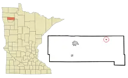 Location of Goodridge, Minnesota | |
| Coordinates: 48°8′38″N 95°48′21″W | |
| Country | United States |
| State | Minnesota |
| County | Pennington |
| Area | |
| • Total | 0.19 sq mi (0.49 km2) |
| • Land | 0.19 sq mi (0.49 km2) |
| • Water | 0.00 sq mi (0.00 km2) |
| Elevation | 1,171 ft (357 m) |
| Population | |
| • Total | 132 |
| • Estimate (2019)[3] | 129 |
| • Density | 686.17/sq mi (264.91/km2) |
| Time zone | UTC-6 (Central (CST)) |
| • Summer (DST) | UTC-5 (CDT) |
| ZIP code | 56725 |
| Area code(s) | 218 |
| FIPS code | 27-24470[4] |
| GNIS feature ID | 0644226[5] |
History
A post office called Goodridge has been in operation since 1915.[7] The city was named for a ridge near the town site.[8]
Geography
According to the United States Census Bureau, the city has a total area of 0.19 square miles (0.49 km2), all land.[9]
State Highway 1, State Highway 219, and County State-Aid Highway 24 are three of the main routes in the community.
Goodridge was the eastern terminus of the Minnesota Northwestern Electric Railway from 1914 until that company's demise in 1940.[10]
Demographics
| Historical population | |||
|---|---|---|---|
| Census | Pop. | %± | |
| 1920 | 231 | — | |
| 1930 | 171 | −26.0% | |
| 1940 | 174 | 1.8% | |
| 1950 | 144 | −17.2% | |
| 1960 | 134 | −6.9% | |
| 1970 | 144 | 7.5% | |
| 1980 | 191 | 32.6% | |
| 1990 | 115 | −39.8% | |
| 2000 | 98 | −14.8% | |
| 2010 | 132 | 34.7% | |
| 2019 (est.) | 129 | [3] | −2.3% |
| U.S. Decennial Census[11] | |||
2010 census
As of the census[2] of 2010, there were 132 people, 60 households, and 36 families residing in the city. The population density was 694.7 inhabitants per square mile (268.2/km2). There were 66 housing units at an average density of 347.4 per square mile (134.1/km2). The racial makeup of the city was 97.0% White, 0.8% African American, 0.8% Native American, and 1.5% from other races. Hispanic or Latino of any race were 4.5% of the population.
There were 60 households, of which 35.0% had children under the age of 18 living with them, 33.3% were married couples living together, 21.7% had a female householder with no husband present, 5.0% had a male householder with no wife present, and 40.0% were non-families. 40.0% of all households were made up of individuals, and 10% had someone living alone who was 65 years of age or older. The average household size was 2.20 and the average family size was 2.89.
The median age in the city was 41.7 years. 30.3% of residents were under the age of 18; 5.3% were between the ages of 18 and 24; 26.5% were from 25 to 44; 27.3% were from 45 to 64; and 10.6% were 65 years of age or older. The gender makeup of the city was 49.2% male and 50.8% female.
2000 census
As of the census[4] of 2000, there were 98 people, 47 households, and 26 families residing in the city. The population density was 523.1 people per square mile (199.1/km2). There were 53 housing units at an average density of 282.9 per square mile (107.7/km2). The racial makeup of the city was 100.00% White. Hispanic or Latino of any race were 2.04% of the population.
There were 47 households, out of which 36.2% had children under the age of 18 living with them, 31.9% were married couples living together, 23.4% had a female householder with no husband present, and 42.6% were non-families. 42.6% of all households were made up of individuals, and 8.5% had someone living alone who was 65 years of age or older. The average household size was 2.09 and the average family size was 2.85.
In the city, the population was spread out, with 31.6% under the age of 18, 5.1% from 18 to 24, 31.6% from 25 to 44, 23.5% from 45 to 64, and 8.2% who were 65 years of age or older. The median age was 34 years. For every 100 females, there were 104.2 males. For every 100 females age 18 and over, there were 97.1 males.
The median income for a household in the city was $17,292, and the median income for a family was $23,125. Males had a median income of $26,250 versus $14,688 for females. The per capita income for the city was $12,636. There were 19.0% of families and 23.8% of the population living below the poverty line, including 43.5% of under eighteen and none of those over 64.
References
- "2019 U.S. Gazetteer Files". United States Census Bureau. Retrieved July 26, 2020.
- "U.S. Census website". United States Census Bureau. Retrieved 2012-11-13.
- "Population and Housing Unit Estimates". United States Census Bureau. May 24, 2020. Retrieved May 27, 2020.
- "U.S. Census website". United States Census Bureau. Retrieved 2008-01-31.
- "US Board on Geographic Names". United States Geological Survey. 2007-10-25. Retrieved 2008-01-31.
- "2010 Census Redistricting Data (Public Law 94-171) Summary File". American FactFinder. U.S. Census Bureau, 2010 Census. Retrieved 23 April 2011.
- "Pennington County". Jim Forte Postal History. Retrieved 29 July 2015.
- Upham, Warren (1920). Minnesota Geographic Names: Their Origin and Historic Significance. Minnesota Historical Society. p. 406.
- "US Gazetteer files 2010". United States Census Bureau. Archived from the original on 2012-01-25. Retrieved 2012-11-13.
- Prosser, Richard S. (1966). Rails to the North Star. University of Minnesota Press. ISBN 978-0-8166-5267-9.
- "Census of Population and Housing". Census.gov. Retrieved June 4, 2015.
Municipalities and communities of Pennington County, Minnesota, United States | ||
|---|---|---|
| Cities | 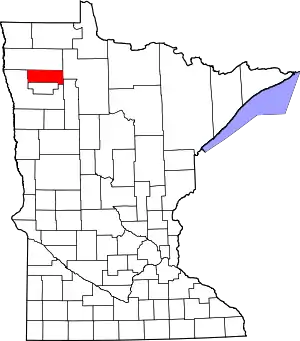 Map of Minnesota highlighting Pennington County | |
| Townships | ||
| Unincorporated communities | ||
| Indian reservation | ||
| Footnotes | ‡This populated place also has portions in an adjacent county or counties | |
| ||
| Authority control |
|
|---|