Croker Group
The Croker Group is a group of islands in the Arafura Sea. The group lies offshore from Cobourg Peninsula, and is part of the Northern Territory of Australia. The group is Aboriginal freehold land, held by the Arnhem Land Aboriginal Land Trust.[1]
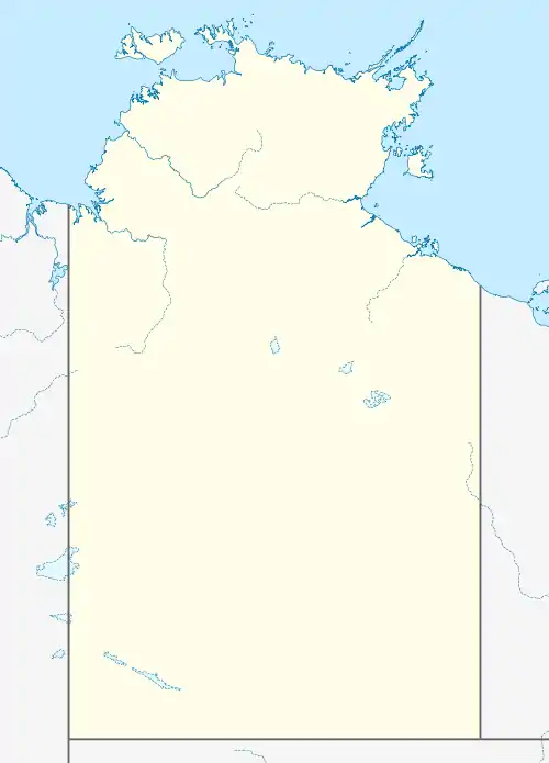
 Croker Group New Year Island (Northern Territory, Australia) | |
| Geography | |
|---|---|
| Location | Arafura Sea |
| Coordinates | 11.1°S 132.7°E |
| Administration | |
Australia | |
| State | Northern Territory |
| Region | Top End |
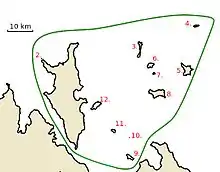
The group consists of at least 12 named islands, and a number of small unnamed islands and rocks. By far the largest island of the group is Croker Island, which has an area of 331 km². Croker Island is also the only permanently inhabited island in the group. None of the other islands in the group is larger than 15 km².
List of Islands

Location Map of Croker Island Group, Northern Territory, Australia
- Croker Island
- Peacock Island
- Oxley Island
- New Year Island
- McCluer Island
- Lawson Island
- Delphinia Island
- Grant Island
- Valencia Island
- Cowlard Island
- Templer Island
- Darch Island
| Name | Area | Location |
|---|---|---|
| Croker Island | 331 km² | 11.1333331°S 132.55°E |
| Peacock Island | 0.09 km²[2] | 11.025°S 132.458°E |
| Oxley Island | 2 km² | 11.00°S 132.826°E |
| New Year Island | 1 km² | 10.908°S 133.031°E |
| McCluer Island | 9 km² [3] | 11.07°S 133.0°E |
| Lawson Island | 3 km² | 11.05°S 132.86°E |
| Delphinia Island | 0.6 km² | 11.0823°S 132.8775°E |
| Grant Island | 12 km² | 11.156°S 132.89°E |
| Valencia Island | 3 km² | 11.383°S 132.785°E |
| Cowlard Island | 0.02 km² | 11.31669°S 132.78366°E |
| Templer Island | 1 km² | 11.28927°S 132.727976°E |
| Darch Island | 6 km² | 11.19519°S 132.662578°E |
References
- "Northern Territory Government: Sites of Conservation Significance" (PDF). Retrieved 23 May 2016.
- "Bonzle: Peacock Island".
- "Bonzle: McCluer Island".
This article is issued from Wikipedia. The text is licensed under Creative Commons - Attribution - Sharealike. Additional terms may apply for the media files.