Howard Island
Howard Island[1] is an island in the Arafura Sea, Northern Territory, Australia. It belongs to East Arnhem Region, and is evenly divided between Gumurr Gatjirrk Ward in the west and Gumurr Marthakal Ward in the east. The only settlements are two family outstations. Nikawu is located on the eastern end, and Langarra, the main settlement, on the north coast in the western part of the island.
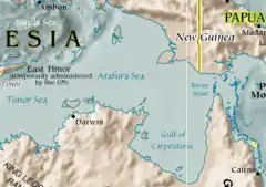
Map of the Arafura Sea, location of the Howard Island
Howard Island is 39 km long and maximally 10 km wide. The area is 280.3 km².[2] It is separated from the mainland by a long and narrow marine channel, which is only 70 m wide in places. 1600 m northeast of Howard Island is Elcho Island, and 1400 m to the southwest is Banyan Island.
References
- BushTel - Remote Communities of the Northern Territory
- "UN Islands Map". UN System-Wide Islandwatch. 18 July 1988. Archived from the original on 7 March 2018. Retrieved 24 November 2018.
External links
Islands of the Northern Territory | |
|---|---|
|
This article is issued from Wikipedia. The text is licensed under Creative Commons - Attribution - Sharealike. Additional terms may apply for the media files.