Crossdale, Queensland
Crossdale is a rural locality in the Somerset Region, Queensland, Australia.[2] In the 2016 census Crossdale had a population of 75 people.[1]
| Crossdale Queensland | |||||||||||||||
|---|---|---|---|---|---|---|---|---|---|---|---|---|---|---|---|
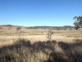 Paddocks along Wivenhoe Somerset Dam Road, 2015 | |||||||||||||||
 Crossdale | |||||||||||||||
| Coordinates | 27.1819°S 152.5511°E | ||||||||||||||
| Population | 75 (2016 census)[1] | ||||||||||||||
| • Density | 0.658/km2 (1.704/sq mi) | ||||||||||||||
| Postcode(s) | 4312 | ||||||||||||||
| Area | 114.0 km2 (44.0 sq mi) | ||||||||||||||
| Time zone | AEST (UTC+10:00) | ||||||||||||||
| Location |
| ||||||||||||||
| LGA(s) | Somerset Region | ||||||||||||||
| State electorate(s) | Nanango | ||||||||||||||
| Federal Division(s) | Blair | ||||||||||||||
| |||||||||||||||
Geography
Part of the western boundary of Crossdale follows the Stanley River. Some of the waters of Somerset Dam are within the locality. Crossdale is relatively large and has a diverse topography. In the north east the elevations rises along the north of the D'Aguilar Range. Little Mount Brisbane is located close to the Somerset Dam wall. In the south another hilly area reaches heights greater than 300 m around McKey Hill. A majority of the locality is devoid of vegetation although the slopes remain covered by bushland.[3]
History
In the 2011 census, Crossdale had a population of 190 people.[4]
In the 2016 census Crossdale had a population of 75 people.[1]
Education
There are no schools in Crossdale. The nearest primary schools are Toogoolawah State School in Toogoolawah to the west and Fernvale State School in Fernvale to the south-west. The nearest secondary schools are Toogoolawah State High School in Toogoolawah to the west and Kilcoy State High School in Kilcoy to the north.[3]
Facilities

Bryden-Fairview Cemetery is at 2959 Wivenhoe Somerset Road down a 300-metre (980 ft) access road (27.2048°S 152.5541°E).[5]
References
| Wikimedia Commons has media related to Crossdale, Queensland. |
- Australian Bureau of Statistics (27 June 2017). "Crossdale (SSC)". 2016 Census QuickStats. Retrieved 20 October 2018.

- "Crossdale – locality in Somerset Region (entry 44861)". Queensland Place Names. Queensland Government. Retrieved 29 December 2020.
- "Queensland Globe". State of Queensland. Retrieved 5 February 2021.
- Australian Bureau of Statistics (31 October 2012). "Crossdale". 2011 Census QuickStats. Retrieved 11 April 2014.
- "Cemetery Areas - Queensland". Queensland Open Data. Queensland Government. 12 November 2020. Archived from the original on 15 November 2020. Retrieved 12 November 2020.