England Creek, Queensland
England Creek is a rural locality split between Somerset Region and City of Brisbane, Queensland, Australia.[2][3] In the 2016 census England Creek had a population of 33 people.[1]
| England Creek Queensland | |||||||||||||||
|---|---|---|---|---|---|---|---|---|---|---|---|---|---|---|---|
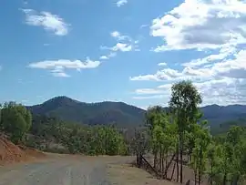 View north east from England Creek Road, 2014 | |||||||||||||||
 England Creek | |||||||||||||||
| Coordinates | 27.3561°S 152.7214°E | ||||||||||||||
| Population | 33 (2016 census)[1] | ||||||||||||||
| • Density | 0.568/km2 (1.471/sq mi) | ||||||||||||||
| Postcode(s) | 4306 | ||||||||||||||
| Area | 58.1 km2 (22.4 sq mi) | ||||||||||||||
| Time zone | AEST (UTC+10:00) | ||||||||||||||
| LGA(s) | |||||||||||||||
| State electorate(s) | |||||||||||||||
| Federal Division(s) | |||||||||||||||
| |||||||||||||||
Geography
The locality lies a short distance south-east of Lake Wivenhoe.
England Creek (the watercourse) flows through the locality down to the Brisbane River.
The main route through the locality is England Creek Road.
History
The locality presumably takes its name from the creek.
In the 2016 census England Creek had a population of 33 people.[1]
References
- Australian Bureau of Statistics (27 June 2017). "England Creek (SSC)". 2016 Census QuickStats. Retrieved 20 October 2018.

- "England Creek (Brisbane City) (entry 41383)". Queensland Place Names. Queensland Government. Retrieved 7 June 2014.
- "England Creek (Somerset Regional) (entry 50057)". Queensland Place Names. Queensland Government. Retrieved 7 June 2014.
This article is issued from Wikipedia. The text is licensed under Creative Commons - Attribution - Sharealike. Additional terms may apply for the media files.