Crystal Bay, Nevada
Crystal Bay is a census-designated place (CDP) on the north shore of Lake Tahoe in Washoe County, Nevada, United States. The population was 305 at the 2010 census.[1] It is part of the Reno−Sparks Metropolitan Statistical Area. Prior to 2010, it was listed by the U.S. Census Bureau within the Incline Village–Crystal Bay CDP.
Crystal Bay, Nevada | |
|---|---|
 | |
 Location of Crystal Bay, Nevada | |
| Coordinates: 39°13′40″N 120°0′16″W | |
| Country | United States |
| State | Nevada |
| Area | |
| • Total | 0.8 sq mi (2.0 km2) |
| • Land | 0.5 sq mi (1.2 km2) |
| • Water | 0.3 sq mi (0.8 km2) |
| Elevation | 6,400 ft (2,000 m) |
| Population (2010) | |
| • Total | 305 |
| • Density | 390/sq mi (150/km2) |
| Time zone | UTC-8 (Pacific (PST)) |
| • Summer (DST) | UTC-7 (PDT) |
| FIPS code | 32-16700 |
Geography
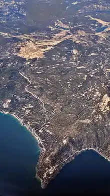
Elevation ranges from 6,229 feet (1,899 m) on the shore of Lake Tahoe to over 6,800 feet (2,100 m) above sea level.[2] The CDP is located on the north shore of Lake Tahoe, adjacent to the California state line.
According to the United States Census Bureau, the CDP has a total area of 0.77 square miles (2.0 km2), of which 0.46 square miles (1.2 km2) is land and 0.31 square miles (0.8 km2), or 42.12%, is water.[1]
Climate
Crystal Bay has a humid continental climate (Dfb) with warm to hot summers with cool nights and moderately cold winters with frigid nights.
| Climate data for Incline Village–Crystal Bay, Nevada | |||||||||||||
|---|---|---|---|---|---|---|---|---|---|---|---|---|---|
| Month | Jan | Feb | Mar | Apr | May | Jun | Jul | Aug | Sep | Oct | Nov | Dec | Year |
| Average high °F (°C) | 39.4 (4.1) |
40.6 (4.8) |
44.2 (6.8) |
49.3 (9.6) |
58.1 (14.5) |
65.7 (18.7) |
73.2 (22.9) |
73.4 (23.0) |
68.4 (20.2) |
59.7 (15.4) |
49.5 (9.7) |
42.1 (5.6) |
55.3 (12.9) |
| Average low °F (°C) | 20.5 (−6.4) |
23.7 (−4.6) |
28.9 (−1.7) |
36.3 (2.4) |
41.0 (5.0) |
47.7 (8.7) |
54.1 (12.3) |
54.0 (12.2) |
47.3 (8.5) |
42.6 (5.9) |
30.6 (−0.8) |
22.3 (−5.4) |
37.4 (3.0) |
| Average precipitation inches (mm) | 2.95 (74.93) |
3.19 (81.12) |
2.48 (62.88) |
1.38 (35.00) |
1.80 (45.67) |
1.03 (26.28) |
0.37 (9.49) |
0.60 (15.33) |
0.97 (24.52) |
2.14 (54.37) |
3.22 (81.78) |
2.96 (75.25) |
23.09 (586.62) |
| Source: National Weather Service | |||||||||||||
Education
The region is served by the Washoe County School District.
References
- "Geographic Identifiers: 2010 Demographic Profile Data (G001): Crystal Bay CDP, Nevada". U.S. Census Bureau, American Factfinder. Archived from the original on February 12, 2020. Retrieved January 16, 2013.
- U.S. Geological Survey, Kings Beach 7.5-minute quadrangle, 2012
External links
![]() Media related to Crystal Bay, Nevada at Wikimedia Commons
Media related to Crystal Bay, Nevada at Wikimedia Commons
Municipalities and communities of Washoe County, Nevada, United States | ||
|---|---|---|
| Cities | 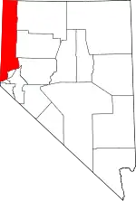 Washoe County map | |
| CDPs | ||
| Unincorporated communities | ||
| Indian reservation | ||
| Indian colony | ||
| Ghost towns | ||
| ||