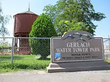
Gerlach, Nevada
Gerlach, Nevada is a census-designated place (CDP) in Washoe County, Nevada, United States. The population was 107 at the 2018 American Community Survey.[2] It is part of the Reno–Sparks Metropolitan Statistical Area. Prior to 2010, Gerlach was part of the Gerlach–Empire census-designated place. The town of Empire is now a separate CDP. The next nearest town, Nixon, is 60 miles (100 km) to the south on a reservation owned by the Pyramid Lake Paiute Tribe. The Fly Geyser is located near Gerlach.
Gerlach, Nevada | |
|---|---|
 | |
 Location of Gerlach, Nevada | |
| Coordinates: 40°39′6″N 119°21′19″W[1] | |
| Country | United States |
| State | Nevada |
| Area | |
| • Total | 3.1 sq mi (8.0 km2) |
| • Land | 3.1 sq mi (8.0 km2) |
| • Water | 0.0 sq mi (0.0 km2) |
| Elevation | 3,944 ft (1,202 m) |
| Population | |
| • Total | 107 |
| Time zone | UTC−8 (Pacific (PST)) |
| • Summer (DST) | UTC−7 (PDT) |
| ZIP code | 89412 |
| Area code(s) | 775 |
| FIPS code | 32-27300 |
| GNIS feature ID | 845471 |
| Website | |
| Reference no. | 152 |
Geography
According to the United States Census Bureau, the Gerlach CDP has a total area of 3.1 square miles (8.0 km2), all land.[2] Its elevation is 3,944 ft (1,202 m).[1] Gerlach is approximately 100 miles north of Reno, Nevada.[3]
Economy
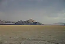
The economy of Gerlach focuses on tourism in the nearby Black Rock Desert, and hunting. Gypsum mining was the historic staple of the local economy. Nearby Empire was a company town of the United States Gypsum Corporation (USG) until the plant closed on January 31, 2011, eliminating 95 jobs.[4][5] In 2016, the town of Empire was purchased by the Empire Mining Company, who have re-opened gypsum mining operations, and have begun to rehabilitate the houses in town.[6]
The other major industries are a Union Pacific switching station in Gerlach and public services of Washoe County, which includes its roads department and a K–12 public school owned by the Washoe County School District; the future of the Gerlach K–12 School is uncertain, as it is estimated after the gypsum plant closed in 2011, only around a dozen children remained in Gerlach.[4] Many of the inhabitants of Gerlach are elderly retirees. Many people in Gerlach also have small private businesses. Many businesses are Internet-based, due to the town's remote Nevada location. Hunters from all over the west travel to Gerlach to hunt a wide variety of game such as chukar, geese, deer, antelope, etc.
Since 1990, Burning Man, a week-long countercultural festival with a population of 68,000[7] (as of 2013), has been held nearby. The event is responsible for around 25% of the yearly sales at the few commercial establishments in the area, which include the closest permanent fuel and grocery stops to the Burning Man event site. The Black Rock Desert is also the site of many other recreational activities throughout the year.[8]
History
Gerlach was founded in 1906[9] during the construction[10] of the Western Pacific Railroad Feather River Route.
In 2009, the Space Chair was lofted to near space north of Gerlach.
Transportation
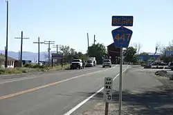
Primary highway access to Gerlach is provided by State Route 447. It can also be accessed via three former state highways: State Route 34, State Route 48, and State Route 49 (also known as Jungo Road).
Gerlach has an airfield, simply a graded dirt strip, which is no longer usable. It should not be used unless under emergency.
The California Zephyr inter-city rail service was routed through Gerlach from its inception in 1949 until the end of its pre-Amtrak incarnation in 1970, providing direct service from Oakland, California to Chicago.
In Popular Culture
Gerlach was one of the film locations for the film Far From Home (1989). Gerlach was also the site for Gary Cooper's first (credited) film, The Winning of Barbara Worth (1926).[11]
Media
Gerlach has two non-profit community-based radio stations. KFBR 91.5 [12] is run by Friends of Black Rock/High Rock,[12] and has a studio at Jalisco's on Main Street. KLAP[13] 89.5 is run by Open Sky Radio Corp and broadcast from a studio located at 395 Main Street in the old Gerlach Gas Station and Garage Building Office.[14]
Education
Gerlach has a public library, a branch of the Washoe County Library.[15]
References
- U.S. Geological Survey Geographic Names Information System: Gerlach
- "Census - Geography Profile". Retrieved April 12, 2020.
- Oliver Roeder (8 February 2017). "The Darkest Town In America". FiveThirtyEight.com. Retrieved 9 February 2017.
- Huffington Post: "Empire, Nevada Completely Wiped Out By Recession", June 22, 2011.
- Bruder, Jessica (June 11, 2011). "Slump in construction industry creates a Sheetrock ghost town". The Christian Science Monitor. Yahoo! News. Retrieved June 12, 2011.
- "SOLD: $11.38M quasi-ghost town in Burning Man's backyard". Reno Gazette Journal. Retrieved 2018-06-09.
- "Burning Man event in the Nevada desert at the Black Rock dry lake bed tops 61,000 attendees". Associated Press. 2013-08-31. Retrieved 2014-01-01.
- Fulbright, Leslie (August 28, 2005), "A warmer welcome, Residents of small Nevada town profit from annual countercultural festival", San Francisco Chronicle
- Carlson, Helen S. (1974-01-01). Nevada Place Names: A Geographical Dictionary. University of Nevada Press. p. 119. ISBN 9780874170948. Retrieved 2014-01-01.
- "Belleville". Nevada State Historic Preservation Office. Retrieved April 12, 2020. State Historical Marker No. 152.
- https://www.imdb.com/title/tt0017567/locations?ref_=tt_dt_dt
- "Home". Friends of Black Rock High Rock. Retrieved 2019-10-01.
- www.klap.fm http://www.klap.fm/. Retrieved 2019-10-01. Missing or empty
|title=(help) - Glionna, John M. (2019-09-24). "He was 'goofy and innocent and often annoying,' but he inspired a tough town to celebrate eccentricities". Los Angeles Times. Retrieved 2019-10-01.
- "Nevada Public Libraries". PublicLibraries.com. Retrieved 14 June 2019.
External links
![]() Media related to Gerlach, Nevada at Wikimedia Commons
Media related to Gerlach, Nevada at Wikimedia Commons
Municipalities and communities of Washoe County, Nevada, United States | ||
|---|---|---|
| Cities | 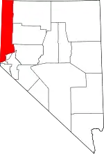 Washoe County map | |
| CDPs | ||
| Unincorporated communities | ||
| Indian reservation | ||
| Indian colony | ||
| Ghost towns | ||
| ||
| Authority control |
|---|