Lemmon Valley, Nevada
Lemmon Valley is a census-designated place (CDP) in Washoe County, Nevada, United States. The population was 5,040 at the 2010 census.[1] It is a northern suburb of the city of Reno and is part of the Reno–Sparks Metropolitan Statistical Area. Prior to 2010 it was listed by the U.S. Census Bureau as part of the Lemmon Valley–Golden Valley CDP.
Lemmon Valley, Nevada | |
|---|---|
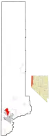 Location of Lemmon Valley, Nevada | |
| Coordinates: 39°39′50″N 119°49′37″W | |
| Country | United States |
| State | Nevada |
| Area | |
| • Total | 18.4 sq mi (47.6 km2) |
| • Land | 17.2 sq mi (44.5 km2) |
| • Water | 1.2 sq mi (3.1 km2) |
| Population (2010) | |
| • Total | 5,040 |
| • Density | 270/sq mi (110/km2) |
| Time zone | UTC-8 (Pacific (PST)) |
| • Summer (DST) | UTC-7 (PDT) |
| ZIP code | 89506 |
| FIPS code | 32-41800 |
Geography
Lemmon Valley is located at 39°39′50″N 119°49′37″W (39.6638, -119.8270),[2] some 10 miles (16 km) north of downtown Reno. Golden Valley is adjacent to the south.
According to the United States Census Bureau, the CDP has a total area of 18.4 square miles (47.6 km2), of which 17.2 square miles (44.5 km2) is land and 1.2 square miles (3.1 km2), or 6.57%, is water,[1] consisting mainly of the Swan Lake Nature Study Area, a small wetland conservation area home to many bird species.
References
| Wikimedia Commons has media related to Lemmon Valley, Nevada. |
- "Geographic Identifiers: 2010 Demographic Profile Data (G001): Lemmon Valley CDP, Nevada". U.S. Census Bureau, American Factfinder. Archived from the original on February 12, 2020. Retrieved January 16, 2013.
- "US Gazetteer files: 2010, 2000, and 1990". United States Census Bureau. 2011-02-12. Retrieved 2011-04-23.
Municipalities and communities of Washoe County, Nevada, United States | ||
|---|---|---|
| Cities | 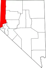 Washoe County map | |
| CDPs | ||
| Unincorporated communities | ||
| Indian reservation | ||
| Indian colony | ||
| Ghost towns | ||
| ||