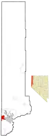
Mogul, Nevada
Mogul is a census-designated place (CDP) in Washoe County, Nevada, United States. It lies on the western side of the Reno–Sparks Metropolitan Statistical Area, just off Interstate 80. The population was 1,290 at the 2010 census.[1] Prior to 2010, the community was part of the Verdi-Mogul CDP.
Mogul, Nevada | |
|---|---|
 Location of Mogul, Nevada | |
| Coordinates: 39°30′49″N 119°55′33″W | |
| Country | United States |
| State | Nevada |
| Area | |
| • Total | 1.5 sq mi (3.8 km2) |
| • Land | 1.5 sq mi (3.8 km2) |
| • Water | 0 sq mi (0 km2) |
| Elevation | 4,701 ft (1,433 m) |
| Population (2010) | |
| • Total | 1,290 |
| • Density | 880/sq mi (340/km2) |
| Time zone | UTC-8 (Pacific (PST)) |
| • Summer (DST) | UTC-7 (PDT) |
| ZIP code | 89523 |
| FIPS code | 32-48000 |
Geography
Mogul is located at 39°30′49″N 119°55′33″W (39.5138, -119.9260). It lies along Interstate 80, 6 miles (10 km) west of downtown Reno, near the western border of Nevada.
According to the United States Census Bureau, the CDP has a total area of 1.5 square miles (3.8 km2), all land.[1]
The area is served by the Washoe County School District.
2008 earthquake swarm
In February 2008, an earthquake swarm began and activity was high until June 2008. The total number of earthquakes in the area reached over 5,000 and ranged from negative magnitudes to a moment magnitude 5.0 mainshock on April 26, 2008.
References
- "Geographic Identifiers: 2010 Demographic Profile Data (G001): Mogul CDP, Nevada". U.S. Census Bureau, American Factfinder. Archived from the original on February 12, 2020. Retrieved January 17, 2013.
External links
![]() Media related to Mogul, Nevada at Wikimedia Commons
Media related to Mogul, Nevada at Wikimedia Commons
Municipalities and communities of Washoe County, Nevada, United States | ||
|---|---|---|
| Cities | 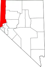 Washoe County map | |
| CDPs | ||
| Unincorporated communities | ||
| Indian reservation | ||
| Indian colony | ||
| Ghost towns | ||
| ||