D Line (RTD)
The D Line is a light rail line which is part of the rail system operated by the Regional Transportation District in the Denver–Aurora Metropolitan Area in Colorado. The D line was the first line in the system when it opened in 1994, traveling from downtown Denver to I-25 and Broadway as the Central Corridor. It was extended along the Southwest Corridor in July 2000. Because it was the first and only line in the system it had no letter or color designation until the Central Platte Valley Spur opened on April 5, 2002, although on maps it was designated as Route 101.
| D Line | ||||||||||||||||||||||||||||||||||||||||||||||||||||||||||||||||||||||||||||||||||||||||||||||||||||||||||||||||||||||||||||||||||||||||||||||||||||||||||||||||||||||||||||||
|---|---|---|---|---|---|---|---|---|---|---|---|---|---|---|---|---|---|---|---|---|---|---|---|---|---|---|---|---|---|---|---|---|---|---|---|---|---|---|---|---|---|---|---|---|---|---|---|---|---|---|---|---|---|---|---|---|---|---|---|---|---|---|---|---|---|---|---|---|---|---|---|---|---|---|---|---|---|---|---|---|---|---|---|---|---|---|---|---|---|---|---|---|---|---|---|---|---|---|---|---|---|---|---|---|---|---|---|---|---|---|---|---|---|---|---|---|---|---|---|---|---|---|---|---|---|---|---|---|---|---|---|---|---|---|---|---|---|---|---|---|---|---|---|---|---|---|---|---|---|---|---|---|---|---|---|---|---|---|---|---|---|---|---|---|---|---|---|---|---|---|---|---|---|---|
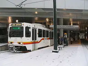 D Line at the Convention Center | ||||||||||||||||||||||||||||||||||||||||||||||||||||||||||||||||||||||||||||||||||||||||||||||||||||||||||||||||||||||||||||||||||||||||||||||||||||||||||||||||||||||||||||||
| Overview | ||||||||||||||||||||||||||||||||||||||||||||||||||||||||||||||||||||||||||||||||||||||||||||||||||||||||||||||||||||||||||||||||||||||||||||||||||||||||||||||||||||||||||||||
| Status | Operational | |||||||||||||||||||||||||||||||||||||||||||||||||||||||||||||||||||||||||||||||||||||||||||||||||||||||||||||||||||||||||||||||||||||||||||||||||||||||||||||||||||||||||||||
| Owner | Regional Transportation District | |||||||||||||||||||||||||||||||||||||||||||||||||||||||||||||||||||||||||||||||||||||||||||||||||||||||||||||||||||||||||||||||||||||||||||||||||||||||||||||||||||||||||||||
| Locale | Denver–Aurora Metropolitan Area | |||||||||||||||||||||||||||||||||||||||||||||||||||||||||||||||||||||||||||||||||||||||||||||||||||||||||||||||||||||||||||||||||||||||||||||||||||||||||||||||||||||||||||||
| Termini | 18th & California/18th & Stout Littleton–Mineral | |||||||||||||||||||||||||||||||||||||||||||||||||||||||||||||||||||||||||||||||||||||||||||||||||||||||||||||||||||||||||||||||||||||||||||||||||||||||||||||||||||||||||||||
| Stations | 12 | |||||||||||||||||||||||||||||||||||||||||||||||||||||||||||||||||||||||||||||||||||||||||||||||||||||||||||||||||||||||||||||||||||||||||||||||||||||||||||||||||||||||||||||
| Service | ||||||||||||||||||||||||||||||||||||||||||||||||||||||||||||||||||||||||||||||||||||||||||||||||||||||||||||||||||||||||||||||||||||||||||||||||||||||||||||||||||||||||||||||
| Type | Light rail | |||||||||||||||||||||||||||||||||||||||||||||||||||||||||||||||||||||||||||||||||||||||||||||||||||||||||||||||||||||||||||||||||||||||||||||||||||||||||||||||||||||||||||||
| System | Regional Transportation District | |||||||||||||||||||||||||||||||||||||||||||||||||||||||||||||||||||||||||||||||||||||||||||||||||||||||||||||||||||||||||||||||||||||||||||||||||||||||||||||||||||||||||||||
| Operator(s) | Regional Transportation District | |||||||||||||||||||||||||||||||||||||||||||||||||||||||||||||||||||||||||||||||||||||||||||||||||||||||||||||||||||||||||||||||||||||||||||||||||||||||||||||||||||||||||||||
| History | ||||||||||||||||||||||||||||||||||||||||||||||||||||||||||||||||||||||||||||||||||||||||||||||||||||||||||||||||||||||||||||||||||||||||||||||||||||||||||||||||||||||||||||||
| Opened | October 7, 1994 | |||||||||||||||||||||||||||||||||||||||||||||||||||||||||||||||||||||||||||||||||||||||||||||||||||||||||||||||||||||||||||||||||||||||||||||||||||||||||||||||||||||||||||||
| Technical | ||||||||||||||||||||||||||||||||||||||||||||||||||||||||||||||||||||||||||||||||||||||||||||||||||||||||||||||||||||||||||||||||||||||||||||||||||||||||||||||||||||||||||||||
| Track gauge | 4 ft 8 1⁄2 in (1,435 mm) | |||||||||||||||||||||||||||||||||||||||||||||||||||||||||||||||||||||||||||||||||||||||||||||||||||||||||||||||||||||||||||||||||||||||||||||||||||||||||||||||||||||||||||||
| Electrification | Overhead lines, 750 V DC | |||||||||||||||||||||||||||||||||||||||||||||||||||||||||||||||||||||||||||||||||||||||||||||||||||||||||||||||||||||||||||||||||||||||||||||||||||||||||||||||||||||||||||||
| ||||||||||||||||||||||||||||||||||||||||||||||||||||||||||||||||||||||||||||||||||||||||||||||||||||||||||||||||||||||||||||||||||||||||||||||||||||||||||||||||||||||||||||||
Route
The D Line's northern terminus is in downtown Denver, at 19th Street. On trips from Littleton, the line runs along 14th Street and California Street before reaching the northern terminus; on trips leaving downtown, the line goes along Stout Street. Then the line follows Stout Street and Colfax Avenue, and follows a railroad right-of-way, where it joins with the C Line at 10th & Osage station. They run in tandem until they reach their southern terminus at Mineral Avenue in Littleton.[1]
The line previously went as far north as Five Points, but was truncated to downtown with the commencement of L Line service in January 2018.
Stations
The Convention Center/Performing Arts Station, which opened in 2004, replaces the 14th & Stout and 14th & California stations, which opened in 1994.
| Name | Opening Year | Interchange | Municipality | park-n-Ride? |
|---|---|---|---|---|
| D Line (30th & Downing – Littleton/Mineral) | ||||
| 18th & California (northbound) and 18th & Stout (southbound) |
1994 | F , H & L Lines | Denver | No |
| 16th & California (northbound) and 16th & Stout (southbound) |
1994 | F , H & L Lines FREE MallRide (16th St) |
Denver | No |
| 14th & California (northbound) and 14th & Stout (southbound) |
1994 (closed 2004) | F & H | Denver | No |
| Theatre District–Convention Center | 2004 | F & H Lines | Denver | No |
| Colfax at Auraria | 1994 | F & H Lines | Denver | No |
| 10th & Osage | 1994 | C , E , F & H Lines | Denver | No |
| Alameda | 1994 | C , E , F & H Lines | Denver | No |
| I-25 & Broadway | 1994 | C , E , F & H Lines | Denver | Yes |
| Fare Zone Boundary | ||||
| Evans | 2000 | C Line | Denver | Yes |
| Englewood | 2000 | C Line | Englewood | Yes |
| Oxford–City of Sheridan | 2000 | C Line | Sheridan | No |
| Fare Zone Boundary | ||||
| Littleton–Downtown | 2000 | C Line | Littleton | Yes |
| Littleton–Mineral | 2000 | C Line | Littleton | Yes |
FasTracks
The 2004 voter approved FasTracks plan will add 2.5 mi (4.02 km) to the Southwest Corridor (C Line and D Line). It will also add a station with 1,000 parking spots at C-470 and Lucent Boulevard in Highlands Ranch.[2]
References
- "RTD - Light Rail System Map". Regional Transportation District. Retrieved June 2, 2014.
- "RTD - FasTracks System Map". Regional Transportation District. Archived from the original on December 23, 2013. Retrieved May 12, 2015.
External links
| Operators |
| ||||||||||
|---|---|---|---|---|---|---|---|---|---|---|---|
| Rail service |
| ||||||||||
| Bus service | |||||||||||
| Other topics | |||||||||||
