Dawson, Maryland
Dawson is an unincorporated community and census-designated place (CDP) in Allegany County, Maryland, United States.[1] As of the 2010 census it had a population of 103.[2]
Dawson, Maryland | |
|---|---|
 Dawson Location within the State of Maryland  Dawson Dawson (the United States) | |
| Coordinates: 39°28′39″N 78°56′37″W | |
| Country | |
| State | |
| County | |
| Area | |
| • Total | 0.5 sq mi (1.3 km2) |
| • Land | 0.5 sq mi (1.3 km2) |
| • Water | 0 sq mi (0 km2) |
| Elevation | 765 ft (233 m) |
| Population (2010) | |
| • Total | 103 |
| • Density | 198/sq mi (76.6/km2) |
| Time zone | UTC-5 (Eastern (EST)) |
| • Summer (DST) | UTC-4 (EDT) |
| FIPS code | 24-21925 |
| GNIS feature ID | 2583606 |
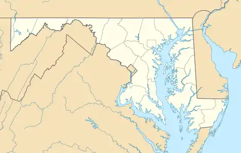
Dawson is on U.S. Route 220, 3 miles (5 km) northeast of Keyser, West Virginia, and 17 miles (27 km) southwest of Cumberland. It is situated along the northwest bank of the North Branch Potomac River, which forms the Maryland–West Virginia border.
References
- "Geographic Names Information System". Dawson (Populated Place). U.S. Geological Survey. 2009-01-29.
- "Geographic Identifiers: 2010 Demographic Profile Data (G001): Dawson CDP, Maryland". U.S. Census Bureau, American Factfinder. Archived from the original on February 12, 2020. Retrieved May 24, 2013.
Municipalities and communities of Allegany County, Maryland, United States | ||
|---|---|---|
| Cities | 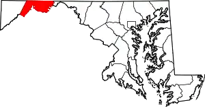 | |
| Towns | ||
| CDPs |
| |
| Other communities | ||
| ||
This article is issued from Wikipedia. The text is licensed under Creative Commons - Attribution - Sharealike. Additional terms may apply for the media files.