De Wolden
De Wolden (![]() pronunciation ) is a municipality in the northeastern Netherlands in the province of Drenthe.
pronunciation ) is a municipality in the northeastern Netherlands in the province of Drenthe.
De Wolden | |
|---|---|
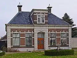 Monumental farmhouse in De Wijk | |
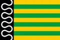 Flag Coat of arms | |
.svg.png.webp) Location in Drenthe | |
| Coordinates: 52°40′N 6°26′E | |
| Country | Netherlands |
| Province | Drenthe |
| Established | 1 January 1998[1] |
| Government | |
| • Body | Municipal council |
| • Mayor | Roger de Groot (PVDD) |
| Area | |
| • Total | 226.35 km2 (87.39 sq mi) |
| • Land | 224.55 km2 (86.70 sq mi) |
| • Water | 1.80 km2 (0.69 sq mi) |
| Elevation | 12 m (39 ft) |
| Population (January 2019)[5] | |
| • Total | 24,110 |
| • Density | 107/km2 (280/sq mi) |
| Time zone | UTC+1 (CET) |
| • Summer (DST) | UTC+2 (CEST) |
| Postcode | Parts of 7900 range |
| Area code | 0522, 0523, 0528 |
| Website | www |
Population centres
- Alteveer
- Anholt
- Ansen
- Armweide
- Bazuin
- Benderse
- Berghuizen
- Blijdenstein
- Bloemberg
- Braamberg
- Buitenhuizen
- Bultinge
- De Oude Tol
- De Stapel
- De Stuw
- De Tippe
- De Wijk
- Dijkhuizen
- Dickninge
- Drogt
- Drogteropslagen
- Dunnigen
- Echten
- Eemten
- Engeland
- Eursinge
- Fort
- Gijsselte
- Haakswold
- Haalweide
- Hees
- Hoge Linthorst
- Kerkenveld
- Koekange
- Koekangerveld
- Kraloo
- Leeuwte
- Linde
- Lubbinge
- Lunssloten
- Middelveen
- Nolde
- Oldenhave
- Oosteinde
- Oosterwijk
- Oshaar
- Oud Veeningen
- Paardelanden
- Pieperij
- Rheebruggen
- Ruinen
- Ruinerweide
- Ruinerwold
- Schottershuizen
- Schrapveen
- Steenbergen
- Struikberg
- Ten Arlo
- Veeningen
- Vuile Riete
- Weerwille
- Wemmenhove
- Witteveen
- Zuidwolde
Topography
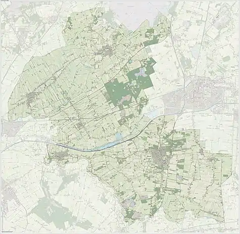
Dutch topographic map of the municipality of De Wolden, June 2015
Notable people

Jan Vayne, 2005
- Jan Evertsen Cloppenburgh (1571 in Ruinen – 1648) a Dutch publisher during the Dutch Golden Age
- Steven van Voorhees (1600 in Hees – 1684) an early Dutch settler in America
- Henrik Ruse, Baron of Rysensteen (1624 in Ruinen - 1679) a Dutch officer and fortification engineer
- Hendrikje Doelen (1784 in Oosterwijk – 1847) a Dutch serial killer
- Jan Arend Godert de Vos van Steenwijk II (1818 in De Wijk – 1905) a Dutch politician and president of the senate 1874/1880
- Jan Hendrik de Boer (1899 in Ruinen – 1971) a Dutch physicist and chemist
- Jan Vayne (1966 in Zuidwolde) a Dutch pianist
- Korie Homan (born 1986 in de Wijk) a Dutch former wheelchair tennis player and gold medallist at the 2008 Paralympics
Gallery
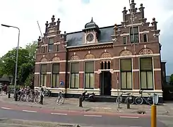 Oude gemeentehuis van Ruinerwold
.jpg.webp) De Wildenberg at sunset, Zuidwolde
De Wildenberg at sunset, Zuidwolde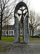 De Wieker Poort Onno de Ruijter
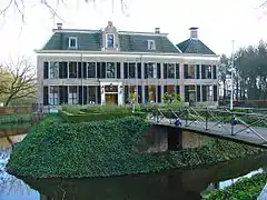 Huis te Echten
References
- "Gemeentelijke indeling op 1 januari 1998" [Municipal divisions on 1 January 1998]. cbs.nl (in Dutch). CBS. Retrieved 6 October 2013.
- "Ronnie Dunning" [Ronnie Dunning] (in Dutch). Gemeente De Wolden. Archived from the original on 14 July 2014. Retrieved 6 October 2013.
- "Kerncijfers wijken en buurten 2020" [Key figures for neighbourhoods 2020]. StatLine (in Dutch). CBS. 24 July 2020. Retrieved 19 September 2020.
- "Postcodetool for 7921GD". Actueel Hoogtebestand Nederland (in Dutch). Het Waterschapshuis. Retrieved 6 October 2013.
- "Bevolkingsontwikkeling; regio per maand" [Population growth; regions per month]. CBS Statline (in Dutch). CBS. 1 January 2019. Retrieved 1 January 2019.
External links
Places adjacent to De Wolden | ||||||||||
|---|---|---|---|---|---|---|---|---|---|---|
| ||||||||||
Municipalities of Drenthe | ||
|---|---|---|
 | ||
| ||
This article is issued from Wikipedia. The text is licensed under Creative Commons - Attribution - Sharealike. Additional terms may apply for the media files.
