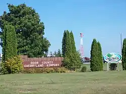
Door County Cherryland Airport
Door County Cherryland Airport (IATA: SUE, ICAO: KSUE, FAA LID: SUE) is a county-owned public-use airport in Door County, Wisconsin, United States. It is located two nautical miles (4 km) west of the central business district of Sturgeon Bay, Wisconsin.[1] It is included in the Federal Aviation Administration (FAA) National Plan of Integrated Airport Systems for 2019–2023, in which it is categorized as a local general aviation facility.[2]
Door County Cherryland Airport | |||||||||||||||
|---|---|---|---|---|---|---|---|---|---|---|---|---|---|---|---|
 | |||||||||||||||
| Summary | |||||||||||||||
| Airport type | Public | ||||||||||||||
| Owner | Door County | ||||||||||||||
| Serves | Sturgeon Bay, Wisconsin | ||||||||||||||
| Elevation AMSL | 724 ft / 221 m | ||||||||||||||
| Coordinates | 44°50′37″N 087°25′18″W | ||||||||||||||
| Website | map.co.door.wi.us/airport/ | ||||||||||||||
| Map | |||||||||||||||
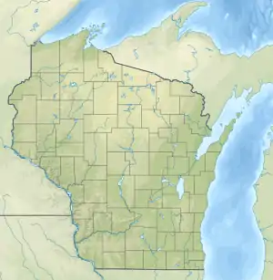 SUE Location of airport in Wisconsin, United States  SUE SUE (the United States) | |||||||||||||||
| Runways | |||||||||||||||
| |||||||||||||||
| Statistics | |||||||||||||||
| |||||||||||||||
Door County Cherryland Airport is home to the Door County Civil Air Patrol Composite Squadron (WI-197). The Experimental Aircraft Association (EAA) Chapter 630, Peninsula Flyers, are also based at the airfield.
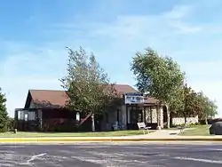
Facilities and aircraft
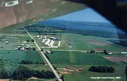
Door County Cherryland Airport covers an area of 436 acres (176 ha) at an elevation of 724 feet (221 m) above mean sea level. It has two asphalt paved runways: 2/20 is 4,599 by 75 feet (1,402 x 23 m) and 10/28 is 3,199 by 75 feet (975 x 23 m), all having approved GPS approaches.[1]
For the 12-month period ending June 21, 2018, the airport had 23,150 aircraft operations, an average of 63 per day: 97% general aviation, 2% air taxi and 1% military. In December 2020, there were 28 aircraft based at this airport: 23 single-engine, 4 multi-engine and 1 jet.[1]
Incidents
On April 2, 2012, an 81-year-old pilot was flying with his wife when he lost consciousness and ultimately died in mid-air. His 80-year-old wife took over the controls of the plane and successfully landed it at Door County Cherryland Airport. Her husband was pronounced dead on scene.[3]
Climate
| ||||||||||||||||||||||||||||||||||||||||||||||||||||||||||||||||||||||||||||||||||||||||||||||||||||||||||||||||||||||||||||
References
- FAA Airport Form 5010 for SUE PDF. Federal Aviation Administration. effective December 31, 2020.
- "NPIAS Report 2019-2023 Appendix A" (PDF). Federal Aviation Administration. October 3, 2018. Retrieved October 12, 2018.
- "Wisconsin woman, 80, lands plane after pilot husband dies at controls". TwinCities.com Pioneer Press. Associated Press. April 2, 2012.
- "NASA Earth Observations Data Set Index". NASA. Retrieved 30 January 2016.
External links
| Wikimedia Commons has media related to Door County Cherryland Airport. |
- Door County Cherryland Airport
- Airport page at Door County website
- "Aerial photo / diagram" (PDF). Archived from the original (PDF) on 2006-09-29. from Wisconsin DOT
- Tailwind Flight Center - Sturgeon Bay, the fixed-base operator (FBO)
- FAA Terminal Procedures for SUE, effective January 28, 2021
- Resources for this airport:
- FAA airport information for SUE
- AirNav airport information for KSUE
- ASN accident history for SUE
- FlightAware airport information and live flight tracker
- NOAA/NWS weather observations: current, past three days
- SkyVector aeronautical chart, Terminal Procedures
Civil aviation in Wisconsin | ||
|---|---|---|
| Primary airports | ||
| Airlines | ||
| Museums | ||
| Aviation related | ||
| People | ||