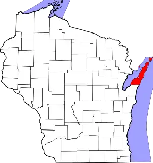
Door County, Wisconsin
Door County is the easternmost county in the U.S. state of Wisconsin. As of the 2010 census, the population was 27,785.[4] Its county seat is Sturgeon Bay, making it one of three Wisconsin counties on Lake Michigan not to have a county seat with the same name.[5] The county was created in 1851 and organized in 1861.[6] It is named after the strait between the Door Peninsula and Washington Island. The dangerous passage, known as Death's Door, contains shipwrecks and was known to Native Americans and early French explorers. Door County is a popular Upper Midwest vacation destination.[7]
Door County | |
|---|---|
 | |
 Location within the U.S. state of Wisconsin | |
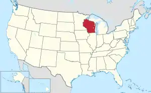 Wisconsin's location within the U.S. | |
| Coordinates: 45.02°N 87.01°W | |
| Country | |
| State | |
| Founded | 1851 |
| Named for | Porte des Morts |
| Seat | Sturgeon Bay |
| Largest city | Sturgeon Bay |
| Area | |
| • Total | 2,370 sq mi (6,100 km2) |
| • Land | 482 sq mi (1,250 km2) |
| • Water | 1,888 sq mi (4,890 km2) 80% |
| Population (2010) | |
| • Total | 27,785 |
| • Estimate (2019) | 27,668 |
| • Density | 12/sq mi (4.5/km2) |
| Time zone | UTC−6 (Central) |
| • Summer (DST) | UTC−5 (CDT) |
| Area code | 920 |
| Congressional district | 8th |
| Website | Official website |
| Wisconsin county code 15 FIPS county code 55029 | |
History
Native Americans and French
Porte des Morts legend
Door County's name came from Porte des Morts ("Death's Door"), the passage between the tip of Door Peninsula and Washington Island.[8] The name "Death's Door" came from Native American tales, heard by early French explorers and published in greatly embellished form by Hjalmar Holand, described a failed raid by the Ho-Chunk (Winnebago) tribe to capture Washington Island from the rival Pottawatomi tribe in the early 1600s. It has become associated with shipwrecks within the passage.[9]
19th–20th century settlement

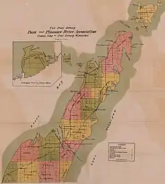
The 19th and 20th centuries saw the immigration and settlement of pioneers, mariners, fishermen, loggers, and farmers. The first white settler was Increase Claflin.[10] In 1851, Door County was separated from what had been Brown County.[11] In 1854 on Washington Island, the first post office opened in the county.[12] In 1855, four Irishmen were accidentally left behind by their steamboat, leading to the settlement of what is now Forestville.[13] In 1853, Moravians founded Ephraim as a religious community after Nils Otto Tank resisted attempts at land ownership reform at the old religious colony near Green Bay.[14] In the 19th century, a fairly large-scale immigration of Belgian Walloons populated a small region in southern portion of the county,[15] including the area designated as the Namur Historic District. They built small roadside votive chapels, some still in use today,[16] and brought other traditions over from Europe such as the Kermiss harvest festival.[17]
With the passage of the Homestead Act of 1862, people could purchase 80 acres of land for $18, provided they resided on the land, improved it, and farmed for five years. This made settlement in Door County more affordable.
When the 1871 Peshtigo fire burned the town of Williamsonville, sixty people were killed. The area of this disaster is now Tornado Memorial County Park, named for a fire whirl which occurred there.[18][19][20] Altogether, 128 people in the county perished in the Peshtigo fire.[11] Following the fire, some residents decided to use brick instead of wood.[21]
In 1885 or 1886, what is now the Coast Guard Station was established at Sturgeon Bay.[22][23] The small seasonally open station on Washington Island was established in 1902.[24]
As the period of settlement continued, Native Americans lived in Door County as a minority. The 1890 census reported 22 Indians living in Door County. They were self-supporting, subject to taxation, and did not receive rations.[25] By the 1910 census their numbers had declined to nine.[26]
In 1894 the Ahnapee and Western Railway was extended to Sturgeon Bay. In 1969, a train ran north of Algoma into the county for the last time,[27] although further south trains continued to operate until 1986.[28]

.jpg.webp)

Early tourism
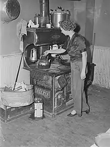
From 1865 through 1870, three resort hotels were constructed in and near Sturgeon Bay along with another one in Fish Creek. One resort established in 1870 charged $7.50 per week (a little over $150 in 2020 dollars). Although the price included three daily meals, extra was charged for renting horses, which were also available with buggies and buggy-drivers.[29] Besides staying in hotels, tourists also boarded in private homes. Tourists could visit the northern part of the county by Great Lakes passenger steamer, sometimes as part of a lake cruise featuring music and entertainment.[30] Reaching the peninsula from Chicago took three days. The air surrounding the agricultural communities was relatively free of ragweed pollen because grain crops matured slowly in the cool climate and were harvested late in the year. This prevented late-season ragweed infestations in the stubble. This made it especially attractive to those suffering from hay fever in the city.[31]
Improved highways of crushed stone facilitated motor tourism in the early 1900s.[11] By 1909 at least 1,000 tourists visited per year.[32] In 1938 Jens Jensen cautioned about negative cultural impacts of tourism. He wrote, "Door County is slowly being ruined by the stupid money crazed fools. This tourist business is destroying the little bit of culture that was."[33]
Orchard boosterism
In 1865, the first commercial fruit operation was established when grapes were cultivated on one of the Strawberry Islands. By 1895, a large fruit tree nursery was established and fruit horticulture was aggressively promoted. Not only farmers but even "city-bred" men were urged to consider fruit husbandry as a career. The first of multiple fruit marketing cooperatives began in 1897. In addition to corporate-run orchards, in 1910 the first corporation was established to plant and sell pre-established orchards. Although apple orchards predated cherry orchards, by 1913 it was reported that cherries had outpaced apples.[34]
Cherry crop labor sources
Women and children were typically employed to pick fruit crops, but the available work outstripped the labor supply. By 1918, it was difficult to find enough help to pick fruit crops, so workers were brought in by the YMCA and Boy Scouts of America. Cherry picking was marketed as a good summer camp activity for teenage boys in return for room, board, and recreation activities. One orchard hired players from the Green Bay Packers as camp counselors. Additionally, members of the Oneida Nation of Wisconsin and other native tribes were employed to pick fruit crops.[35][36] In addition to their pay, Native American families were given fruit that was too ripe for marketing, which they preserved and stored for long term use.[37] A Civilian Conservation Corps camp was established at Peninsula State Park during the Great Depression. In the summer of 1945, Fish Creek was the site of a POW camp under an affiliation with a base camp at Fort Sheridan, Illinois.[38][39][40] The German prisoners engaged in construction projects, cut wood, and picked cherries in Peninsula State Park and the surrounding area.[41] During a brief strike, the POWs refused to work. In response the guards established a "no work, no eat" policy and they returned to work, picking 11 pails per day and eventually totaling 508,020 pails.[42]
The Wisconsin State Employment Service established an office in Door County in 1949 to recruit Tejanos to pick cherries. Work was unpredictable, as cherry harvests were poor during certain years and workers were paid by the amount they picked. In 1951, the Wisconsin Department of Public Welfare conducted a study documenting conflict between migrant workers and tourists, who resented the presence of migrant families in public vacation areas.[43] A list of recommendations was prepared to improve race relations.[44] The employment of migrants continues to the present day. In 2013, there were three migrant labor camps in the county, housing a total of 57 orchard laborers and food processors along with five non-workers.[45]
20th–21st-century events
In 1905, the Lilly Amiot was in Ellison Bay with a load of freight, dynamite, and gasoline when it caught fire. After being cut loose, it drifted until exploding; the explosion was heard up to 15 miles away.[46]
In 1912, the barnstormer Lincoln Beachey demonstrated his biplane during the county fair; this is believed to be the first takeoff and landing in the county.[47]
In 1913, The Old Rugged Cross was first sung at the Friends Church in Sturgeon Bay as a duet by two traveling preachers.[48]
In 1919, the first Army-Navy hydrogen balloon race was won by an Army team whose balloon splashed down in the Death's Door passage. Two soldiers endured 10-foot waves for an hour before their rescue by a fisherman.[49]
In 1925, a cow in Horseshoe Bay named Aurora Homestead Badger produced 30,000 pounds of milk, at the time a world record for dairy cattle.[50]
In June 1938, aerial photos were taken of the entire county; in 2011 the photos were made available online.[51]
In 1941, the Sturgeon Bay Vocation School opened. It is now the Sturgeon Bay campus of Northeast Wisconsin Technical College.
In December 1959, the Bridgebuilder X disappeared after leaving a shipyard in Sturgeon Bay where it had been repaired. Its intended destinations were Northport and South Fox Island. Possible factors included lack of ballast and a sudden development of 11-foot waves. The body of one of the two crew members was found the following summer.[52]
In 2004, the county began a sister cities relationship with Jingdezhen in southeastern China.[53]
Geography
According to the U.S. Census Bureau, the county has a total area of 2,370 square miles (6,100 km2), of which 482 square miles (1,250 km2) is land and 1,888 square miles (4,890 km2) (80%) is water.[54] It is the largest county in Wisconsin by total area.
The county has 298 miles (480,000 m) of shoreline, which in general is characterized by the escarpment on the west side. On the east side peat is followed by dunes and beaches of sand or gravel along the lakeshore.[55] During years with receding lake levels, flora along the shore demonstrates plant succession. The middle of the peninsula is mostly flat or rolling cultivated land. There are three distinct aquifers and two types of springs present in the county.[56][57]
The county covers the majority of the Door Peninsula. With the completion of the Sturgeon Bay Shipping Canal in 1881,[58] the northern half of the peninsula became an artificial island.[59] This canal is believed to have somehow caused a reduction in the sturgeon population in the bay due to changes in the aquatic habitat.[60] The 45th parallel north bisects the "island," and this is commemorated by Meridian County Park.[61][62]
| Niagara Escarpment | |||
   | |||
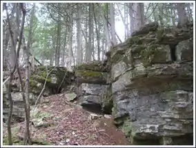
Escarpment
Dolomite outcroppings of the Niagara Escarpment are visible on both shores of the peninsula, but the karst formations of the cuesta ridge are especially prominent on the Green Bay side as seen at the Bayshore Blufflands. South of Sturgeon Bay the escarpment separates into multiple lower ridges without as many larger exposed rock faces.[63] Many caves are found in the escarpment.[64][65] Beyond the peninsula's northern tip, the partially submerged ridge forms the Potawatomi Islands, which stretch to the Garden Peninsula in the Upper Peninsula of Michigan. The largest of these is Washington Island. Most of them form the Town of Washington.[66]
The escarpment is an attractive location for quarrying, homes, and communications towers.[67] A former stone quarry on the escarpment five miles northeast of Sturgeon Bay is now a county park.[68]

High points
Eskers are only found in the far southwest corner of the county, but drumlins and small moraines also occur further up the peninsula.[69]
The 102 ft high Brussels Hill[70] (44.75166°N 87.59093°W, elevation 851 feet) is the highest point in the county.[71] The nearby Red Hill Woods is the largest remaining maple–beech forest in the area.[72]
Old Baldy (44.920344°N 87.20192°W) is the state's tallest sand dune[73] at 93 feet above the lake level.[74]
Soils and crops
The most common USDA soil association in the northern two-thirds of the county is the Summerville[lower-alpha 1]-Longrie[lower-alpha 2]-Omena.[lower-alpha 3][75] These associated soils typically are less than three feet deep. Altogether, thirty-nine percent of the county is mapped as having less than three feet (about a meter) to the dolomite bedrock. Because there is relatively little soil over much of the peninsula and the bedrock is fractured, snowmelt quickly enters the aquifer. This causes seasonal basement flooding in some areas.[76]
Both sale prices and rental values of agricultural land are lower than most Wisconsin counties.[77] The most important field crops by acres harvested in 2017 were hay and haylage at 25,197 acres, soybeans at 16,790 acres, corn (grain) at 15,371 acres, corn (silage) at 9,314 acres, wheat at 8,790 acres, oats at 2,610 acres, and barley at 513 acres.[78] Despite lower productivity for other forms of agriculture, in the early 1900s the combination of thin soils and fractured bedrock was described by area promoters as beneficial to fruit horticulture, as the land would quickly drain during wet conditions and provide ideal soil conditions for orchard trees.[34] For apples, the influence of the calcium-rich dolomite on the soil was expected to promote good color.[79]
Soils in the county are classified as "frigid" because they usually have an average annual temperature of less than 8 °C (46.4 °F). The implication of this classification is that county soils are expected to be wetter and have less microbial activity than soils in warmer areas classified as "mesic." County soils are colder than inland areas of Wisconsin due to the climate-moderating effects of nearby bodies of water.[80]

Gravel pits, minerals, and oil
The prevalence of shallow soils and exposed bedrock hinders agriculture but is beneficial for mining. As of 2016, there are 16 active gravel pits and quarries in the county. They produce sand, gravel, and crushed rock for roadwork and construction use.[81] Six of them are county-owned and produce 75,000 cubic yards annually.[82]
Minerals found in Door County include fluorite,[83] gypsum,[84] calcite,[85] dolomite,[86] quartz,[87] marcasite,[88] and pyrite.[89] Crystals may be found in vugs.[90]
On three occasions in the early 1900s oil was found within a layer of shale in the middle and southern part of the county.[91] Additionally, solid bitumen has been observed in dolomite exposed along the Lake Michigan shore.[92]
Pollution
The combination of shallow soils and fractured bedrock makes well water contamination more likely. At any given time, at least one-third of private wells may contain bacteria.[93]
Mines, prior landfills, and former orchard sites are considered impaired lands and marked on an electronic county map.[94] A different electronic map shows the locations of private wells polluted with lead, arsenic, and other contaminants down to the section level.[95]
Most air pollution in Door County comes from outside the county.[96] The stability of air over the Lake Michigan shore along with the lake breezes[lower-alpha 4] may increase the concentration of ozone along the shoreline.[97]
Fewer late spring freezes
The moderating effects of nearby bodies of water reduce the likelihood of damaging late spring freezes. Late spring freezes are less likely to occur than in nearby areas, and when they do occur, they tend not to be as severe.[98]
Climate data
- For climate charts and tables, see Sturgeon Bay, Wisconsin § Climate and Washington Island (Wisconsin) § Climate
The county has a humid continental climate (classified as Dfb in Köppen) with warm summers and cold snowy winters. Data from the Peninsular Agricultural Research Station north of the city of Sturgeon Bay gives average monthly temperatures ranging from 68.7 °F (20.4 °C) in the summer down to 18.0 °F (−7.8 °C) in the winter.
Climate records
On January 7, 1967 Washington Island received 17 inches of snow, setting the county record for the greatest one-day snowfall.[99]
Ice accumulation during the winter of 2014 was the highest ever recorded on Lake Michigan.[100]
Tornadoes
Four tornadoes touched down between 1844 and 1880, and six from 1950 to 1989, but there were no fatalities in any of them. Two crossed the Door-Kewaunee county line.[101] From 1989 to 2019, there were 2 additional tornadoes, including the F3 "Door County tornado" which hit Egg Harbor in 1998.[102] Additionally there were 10 waterspouts between 1950 and 2018.[103]
| Date of Tornado | Time | F-Scale | Length | Width (yards)[104] |
|---|---|---|---|---|
| 7/1/1956 | 12:05 PM CST | F2 | 10.6 miles | 50 yards |
| 7/25/1966 | 6:20 PM CST | F0 | 2 miles | 17 yards |
| 4/22/1970 | 9:10 PM CST | F2 | 2.3 miles | 500 yards |
| 4/22/1970 | 9:30 PM CST | F2 | 4.3 miles | 500 yards |
| 7/12/1973 | 7:30 AM CST | F1 | 0 miles | 100 yards |
| 6/8/1985 | 8:00 PM CST | F2 | 5 miles | 150 yards |
| 8/23/1998 | 5:30 PM CST | F3 | 5.1 miles | 1,300 yards |
| 7/13/2000 | 2:55 PM CST | F0 | 0.1 miles | 50 yards |
Weather monitoring
Weather in the county is reported by WXN69 (FM 162.425), the NOAA weather radio station in Sister Bay.[105] Green Bay and Lake Michigan ice thickness reports and forecasts are produced by NOAA.[106]
Weather monitors in the county report terrestrial and marine weather conditions:
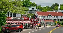
Attractions
.jpg.webp)
In 1905, Theodore Roosevelt recommended that the Shivering Sands area be protected.[108] Today this area includes Whitefish Dunes, Kellner's Fen, Shivering Sands wetland complex,[109] and Cave Point County Park.[110] Hjalmar Holand, an Ephraim resident,[111] promoted Door County as a tourist destination in the first half of the 20th century. He served on a committee begun in 1927 to protect and promote historical sites,[112] and as a result of this effort the county historical society purchased lands that are now county parks, including Tornado Park, Robert LaSalle Park, Murphy Park, Increase Claflin Park, and the Ridges Sanctuary.[113]
Today, most tourists and summer residents come from the metropolitan areas of Milwaukee, Chicago, Madison, Green Bay, and the Twin Cities,[114] although Illinois residents are the dominant group both in Door County and further south along the eastern edge of Wisconsin.[115]
In 2003, researchers found that compared to other Wisconsin counties, Door County had a middling amount of inland water acreage, forestland, county-owned acreage, and rail trail mileage and a high number of golf courses, amusement businesses,[lower-alpha 5] and downhill ski hills and campgrounds.[116] Despite the high number of campgrounds the Wisconsin DNR in 2006 reported that "demand for camping far exceeds current supply."[117]
Recreational lands


Lands open to public use
Door County is home to six state parks. Four are on the peninsula: Newport State Park, northeast of Ellison Bay; Peninsula State Park, east of Fish Creek; Potawatomi State Park, along Sturgeon Bay; and Whitefish Dunes State Park along Lake Michigan. Two are located on islands: Rock Island State Park and Grand Traverse Island State Park.[lower-alpha 6] In addition to the nature centers located inside the state parks, there are three others outside the parks. There are four State Wildlife and Fishery Areas[lower-alpha 7] and also State Natural Areas that allow free public access.[121][lower-alpha 8]
Besides county,[122] town, and community parks,[123][124] there is a boy scout camp, a Christian camp,[125] and a public site operated by The Archaeological Conservancy.[126][127] A local land trust operates 14 privately owned parks open to the public,[128] and 3,277.3 acres (1326.3 ha) of privately owned lands are open to the public for hunting, fishing, hiking, sight-seeing and cross-country skiing under the Managed Forest Program.[129]
Beaches
- For further information, see Pollution in Door County, Wisconsin § Beach contamination and Door Peninsula § Lake breeze
Including both the Lake Michigan and Green Bay shores, there are 54 public beaches or boat launches[130] and 39 kayak launch sites,[131] leading to the area's promotion as "the Cape Cod of the Midwest."[132] 35 beaches are routinely monitored for water quality advisories.[133]
Although Door County has fewer sunny days than most counties in Wisconsin and Illinois, it also has less rainfall and lower summer temperatures,[134] making for an optimal beach-going climate.
Waters
Boating

In 2012, 8,341 registered boats were kept in the county. Most of the county boating accidents reported in 2012 occurred in Green Bay.[135] A 1989–90 study of recreational boating in Wisconsin found that the county's Green Bay and Lake Michigan waters had a higher frequency of Great Lakes boating than any other county bordering Lake Michigan or Lake Superior. The typical motor used in the county's Green Bay and Lake Michigan waters had a horsepower over 90, while the typical motor used for inland county waters had a horsepower under 50. Overall, boaters perceived county waters as uncrowded and boater satisfaction was average.[136]
An annual race is held for which participants build small plywood boats.[137]
The county's longest river canoe route is on the Ahnapee River from County H south to the county line.[138]
Some itineraries connecting the Great Loop around the eastern U.S. and through the Mississippi include stops in Door County.[139]
A charity holds sailing classes each summer.[140] 1972–1973 surveys of high school juniors and seniors in northeast Wisconsin found that students from Door County were more likely to use sailboats than students from other counties.[141]
Lakes and ponds
Besides Lake Michigan and Green Bay, there are 25 lakes, ponds, or marshes and 37 rivers, creeks, streams, and springs in the county.[142]
Wetlands
4,631 ha (11,400 acres) of Door Peninsula Coastal Wetlands are listed under the Ramsar Convention as wetlands of international importance.[143] The listing includes three areas previously recognized as "Wetland Gems."[144]
| Wetland | Access[145] |
|---|---|
| Baileys Harbor Swamp | privately owned, although some parcels at the edge of the swamp on the east of Highway 57 are owned by the DNR as part of Mud Lake State Natural Area[146] |
| Big Marsh (Gunnerson Marsh) | 31.1 acres of water; partly within a DNR State Natural Area[147] |
| Button Marsh | privately owned, 81.6 acres of Managed Forest Land[148] to the west of it |
| Coffee Swamp | 2.2 acres of water; mostly within a DNR State Natural Area[149] |
| Ephraim Swamp | privately owned, although Ephraim Creek which runs through the swamp is a Class II[lower-alpha 9] trout stream and is open to the public up to the ordinary high water mark.[150] |
| Gardner Swamp | Gardner Swamp Wildlife Area[151] has three access sites[152] and 160 acres of adjacent Managed Forest Land[153] |
| Greenwood Swamp | privately owned |
| Larson Swamp | privately owned |
| Little Marsh (Wickman Marsh) | 14 acres of water; DNR State Natural Area[147] |
| Kellner's Fen | 60 to 80 acres of water; largely owned by an entity allowing public access[154] |
| Maplewood Swamp | privately owned, but the Ahnapee Trail runs through part of it[155] |
| May Swamp | privately owned |
| Stony Creek Swamp | privately owned, but the Ahnapee Trail runs past the far south end[156] |
| Voecks Marsh | 19.1 acres of water; within the Ridges Sanctuary which charges admission[157] |
Recognized natural areas
There are 29 state-defined natural areas in the county.[121]
| SNA # | SNA Name | Reference |
|---|---|---|
| 12 | Peninsula Park Beech Forest | [158] |
| 13 | Peninsula Park White Cedar Forest | [159] |
| 17 | The Ridges Sanctuary | [157] |
| 47 | Sister Islands | [160] |
| 57 | Toft Point | [161] |
| 90 | Newport Conifer-Hardwoods | [162] |
| 110 | Jackson Harbor Ridges | [163] |
| 125 | Mud Lake | [146] |
| 175 | Whitefish Dunes | [164] |
| 204 | Marshall's Point | [165] |
| 218 | Mink River Estuary | [166] |
| 233 | Moonlight Bay Bedrock Beach | [167] |
| 276 | Coffey Swamp | [149] |
| 284 | Baileys Harbor Boreal Forest and Wetlands | [168] |
| 335 | Kangaroo Lake | [169] |
| 377 | Bayshore Blufflands | [170] |
| 378 | Ellison Bluff | [171] |
| 379 | Europe Bay Woods | [172] |
| 381 | North Bay | [173] |
| 382 | Rock Island Woods | [174] |
| 383 | White Cliff Fen and Forest | [175] |
| 391 | Big and Little Marsh | [147] |
| 403 | Thorp Pond | [176] |
| 413 | Detroit Harbor | [177] |
| 543 | Logan Creek | [178] |
| 544 | Meridian Park | [179] |
| 554 | Little Lake | [180] |
| 559 | Cave Point-Clay Banks | [181] |
| 688 | Peninsula Niagara Escarpment | [182] |
| Select State Natural Areas | |||
             | |||
Living plant collections
- This section is about cultivated plants. For wild plants and fungi, see Flora of Door County, Wisconsin
Living plant collections include the orchid project at The Ridges Sanctuary[183] in Baileys Harbor and the U.S. Potato Genebank and a public garden in Sevastopol.[184][185]
Vertebrate species lists
From 1971 through 1976, 11 species of small mammals were found at Toft Point,[186] the Newport State Park Mammals Checklist has 34 species,[187] and in 1972 44 mammals were listed for the entire county.[188] From 1981 through 1995, 7 species of frogs and toads were recorded in the county.[189] In 1992 six amphibians and eight reptiles were found in and around Potawatomi State Park.[190]

Unique vertebrates
Tamias striatus doorsiensis, a subspecies of eastern chipmunk, is only found in Door, Kewaunee, Northeastern Brown, and possibly Manitowoc counties.[192] In 1999, the Wisconsin Natural Heritage Inventory listed 24 aquatic and 21 terrestrial animals in Door County as "rare."[193]
Birds
As of 2018, 166 species of birds have been confirmed to live in Door County, excluding birds seen which lack the habitat to nest and must only be passing through.[194]
Reverse migration is occasionally observed in the county. When birds traveling north reach the tip of the peninsula and the islands beyond, the long stretches of water sometimes unnerves them. Instead of crossing over to the Garden Peninsula, they turn around and fly back down the peninsula.[195]
During the 20th century, thousands of herring gulls were banded on Hat Island[196] to determine their migratory patterns.[197] Banded birds were found as far north as Hudson Bay and as far south as Central America.[118]
Brood parasitism by red-breasted mergansers has been observed on Gravel and Spider islands and on another island known informally as "The Reef." They laid eggs into the nests of mallards, gadwalls, and lesser scaups.[198]
Rare bees
The sweat bee Lasioglossum sagax was collected on Ridges Road in 2006. Aside from a single collection from Manitowoc County in 2005, it had previously been found only in Colorado.[199]
The kleptoparasitic bee Stelis labiata is considered very rare.[200] It was collected at Toft point in 2006. This was only the second time the species had been found in Wisconsin; the earlier collection's county of origin is unknown.[201]
Horseshoe Bay Cave invertebrates
In 2014 an invertebrate survey of Horseshoe Bay Cave found an apparently groundwater-dwelling amphipod of the genus Crangonyx. Groundwater-dwelling Crangonyx species had never been documented in Wisconsin before.[202] A springtail of the genus Pygmarrhopalites (a genus name synonymous with Arrhopalites) was "found on the surface of drip pools." It appeared to be adapted to cave life and the study concluded that it "could represent an undescribed cave species."[203]
Toft Point invertebrates
In 2004, an invertebrate species list for Toft Point was published listing five isopods, four millipedes, six daddy longlegs, and 113 spiders. Of these, two of the millipedes and 14 of the spiders had never been documented in Wisconsin before.[204]
Spiders
The local climate may allow for the better survival of the northern black widow spider.[205]
Additionally, the county is home to the fishing spider Dolomedes tenebrosus, which can grow to about three inches, half the size of a tarantula.[206]
Other invertebrates
Kangaroo Lake State Natural Area has the largest breeding population of the endangered Hine's Emerald Dragonfly in the world.[207]
The Lake Huron locust lives on dunes in the county and is not found anywhere else in the state.[208]
From 1996 to 2001, researchers identified 69 species of snails in the county, including rare species.[209][138]
Research on apple maggots infesting cherries in Door County contributed to the study of sympatric speciation in the 1970s.[210]
In the 20th century, seven fish parasites were found in Hibbards Creek and 13 in Sturgeon Bay.[211]
During an experiment an estimated several thousand Mayflies hatched in Sawyer Harbor in 2016. They had previously been extirpated.[212]
By season
Although Door County has a year-round population of about 27,610, it experiences an influx of tourists each summer between Memorial Day and Labor Day, with over 2.1 million visitors per year.[213] Most businesses are targeted to tourism and operate seasonally. Based on room tax collections from 2017 to 2018, July is the busiest month of the year, although sales tax revenue is higher in August. The fewest room taxes are collected for January, and the fewest sales taxes are collected for April.[214]
Room occupancy for motels, resorts, and inns in Door County, July 2018 – August 2020[215]


.jpg.webp)

Springtime
Maple syrup production[216] was 983 gallons in 2017 from seven operations. This was similar to figures from 2012, but down from 2007 when 15 operations produced 2,365 gallons.[217]
The sucker run, which was a popular fishing event in the 19th century,[218] occurs in March and April.[219] Suckers may be taken by frame dip nets,[220] and the sucker run is also sought out as viewing opportunity.[221] Another permitted method of fishing for suckers is by speargun. In April 2018, the state speargun record for longnose sucker was taken by out of Door County waters on the Lake Michigan side. It weighed 3 pounds, 9.9 ounces and was 21.25 inches long.[222]
Another attraction is mushroom hunting on public land.[223][224] Additionally, as of 2017 there are two commercial mushroom operations.[225]
Summer
In 2017, there were ten operations growing 14 acres of strawberries.[226]
In 2017, there were eight operations harvesting five acres of fresh cut herbs, up from four acres in 2012.[227] Two of these operations grow lavender on Washington Island.[228][229]
In Baileys Harbor, religious tourism includes the Blessing of the Fleet.[230]
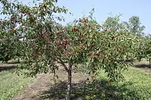
Door County has a history of strawberry,[231] apple, cherry, and plum growing that dates back to the 19th century.[232][34] Farmers were encouraged to grow fruit on the basis of the relatively mild climate on the peninsula. This is due to the moderating effects of the lake and bay on nearby land temperatures. U-pick orchards and fruit stands can be found along country roads when in season, and there are two cherry processors.[233]
However, the cherry and apple businesses have declined[234] since peaking in 1941[235] and 1964[34][236] respectively due to concerns about pesticides,[237] lack of migrant labor and a difficulty in finding local help, the closure of all processing plants save one, unpredictable harvests, the introduction of Drosophila suzukii, land-use competition with tourism and residential development, better growing conditions to the east in the fruit belt, such as the nearby Traverse City area,[238][34] and intentional destruction of a portion of the crop ordered by the processor in order to drive up prices.[239] In 2017, there were only 1,945 acres of tart cherry orchards, down from 2012 when there were 2,429 acres.[240]
Lightening bugs become common by the end of June.[241]

Fall
Additionally, there were 400 acres of apple orchards in 2017, down from 468 acres in 2012.[242] In 2017, there were 12 acres of pear orchards, spread among 11 operations.[243] In 2017, there was only one acre of plum orchards, spread among four operations.[244] In 2007, there were two acres of apricot orchards, spread among six operations.[245] Research on the development of cold-hardy peaches has continued since the 1980s.[246] In 2012, there were two acres of peach orchards, spread among seven operations.[247]
In 2017, there were 40 acres of vineyards, down from 78 acres in 2012.[248] The county was recognized as part of a larger federally designated wine grape-growing region in 2012.
In 2018, a county total of 4,791 deer were killed as a total of all deer hunting seasons, down from the total harvest of 5,264 deer in 2017.[249] Chronic wasting disease as of 2018 has never been detected within the county.[250]
Another autumn activity is leaf peeping.[251]
| Skiing and skating at Sturgeon Bay High School | |||
    | |||
Winter
Winter attractions include ice fishing, sledding,[lower-alpha 10] cross-country skiing,[256] camping,[257] broomball,[258] pond hockey,[259] snowmobiling,[260] watching lake freighters in Sturgeon Bay,[261] and Christmas tree farms.[262][263] In 2017, 860 Christmas trees were cut, down from 1,929 in 2012.[264] Nearly 60% of the time, Door County has a white Christmas.[265]
Lighthouses
Including both lake and Green Bay shorelines, there are twelve lighthouses and sets of range lights. Most were built during the 19th century and are listed in the National Register of Historic Places: Baileys Harbor Range Lights, Cana Island Lighthouse,[266] Chambers Island Lighthouse, Eagle Bluff Lighthouse, Pilot Island Lighthouse, Plum Island Range Lights,[267] Pottawatomie Lighthouse, and Sturgeon Bay Canal Lighthouse. The other lighthouses in the county are: Boyer Bluff Lighthouse,[268] Baileys Harbor Light, Sherwood Point Lighthouse, and the Sturgeon Bay Canal North Pierhead Light.[269]
Historical sites
Thirteen historical sites are marked[270] in the state maritime trail for the area[271] in addition to eight roadside historical markers.[272] In Sturgeon Bay, the tugboat John Purves is operated as a museum ship. Including lighthouses, the county has 72 properties and districts listed on the National Register of Historic Places. There are 214 known confirmed and unconfirmed shipwrecks listed for the county,[273] including the SS Australasia, Christina Nilsson, Fleetwing, SS Frank O'Connor, Grape Shot, Green Bay, Hanover, Iris, SS Joys, SS Lakeland, Meridian, Ocean Wave, and Success. The SS Louisiana sank during the Great Lakes Storm of 1913.[274] Some shipwrecks are used for wreck diving.[275]
Buildings made from cordwood construction survive in the county, especially in the Bailey's Harbor area. Some, such as the Blacksmith Inn, are covered with clapboards on the outside.[276][277] It has been speculated that the use of stovewood in the county was associated with German immigrants and was also due to the lack of manpower needed to haul heavy logs.[278]
Food
| Some foods of Door County | |||
    |
Agritourism and culinary tourism supports local food production.[279] Cooking classes are offered to tourists.[280]
Distinctive local foods include:
- cherry pie[281]
- Belgian pie[282]
- rhubarb pie[283]
- cherry kuchen[283]
- apple kuchen[283]
- rødgrød[283]
- rhubarb salad[283]
- rhubarb cake[283]
- rhubarb torte[283]
- cherry torte[283]
- raspberry marmalade Linzer torte[284]
- chicken caps–broiled mushroom caps coated in chicken spread and nuts[283]
- chocolate kraut cookies[283]
- cooked rhubarb juice diluted with water and sweetened with sugar[285]
- apricot pockets[286]
- cherry tarts[286]
- chopped cherry jam[287]
- cherry soup[288]
- Norwegian frugt suppe[289]
- cherry bread pudding[290]
- dried cherries[291]
- Limpa bread[290]
- skorpa[lower-alpha 11][290]
- æbleskiver–Icelandic pancakes[292][293]
- Norwegian and Swedish pancakes[294]
- green tomato jam[295]
- plum pudding with flaming brandy sauce[296]
- baked pears with cheese[297]
- cheese curds[298]
- fried perch[299]
- smoked chubs[300]
- fish boil–fuel oil flare up originated locally to entertain tourists[301][lower-alpha 12]
- booyah[302]–did not originate in Europe[303]
- Belgian trippe–sausage made with stomach lining[304]
- lapskaus–Norwegian potato stew[305]
- hash brown sandwich[304]
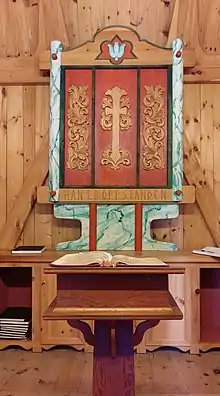
Scandinavian heritage
Scandinavian heritage-related attractions include The Clearing Folk School, two stave churches,[306] structures in Rock Island State Park furnished with rune-inscribed furniture,[307] and Al Johnson's Swedish Restaurant, which features goats on its grassy roof. In Ephraim, the Village Hall, the Moravian and Lutheran churches, and the Peter Peterson House are listed in the National Register of Historic Places, as is the L. A. Larson & Co. Store building in Sturgeon Bay. Although fish boils have been attributed to Scandinavian tradition,[308] several ethnicities present on the peninsula have traditions of boiling fish. The method common in the county is similar to that of Native Americans.[309][lower-alpha 13]
Industry
In Sturgeon Bay, industrial tourism includes tours of the Bay Shipbuilding Company,[310] CenterPointe Yacht Services[311][312] and other manufacturers.[313] In particular, Bay Ship owns a blue gantry crane that dominates the skyline.[314] A cheese factory in Clay Banks conducts public tours.[315]
Arts
Tourism supports an arts community, including weavers,[316] painters,[317] decorative artists,[318] blacksmiths,[319] actors,[lower-alpha 14] songwriters,[320] musicians,[321] and hymn-singers.[322]
A quilt trail along roadside barns was organized in 2010.[323]
The interesting landscape makes it an attractive target for photography. Several photographs have been used for commemorative stamps. A Town of Sturgeon Bay farm was featured on a stamp commemorating the Wisconsin Sesquicentennial in 2004,[324] and a cherry orchard near Brussels was featured on 2012 Earthscapes series stamp.
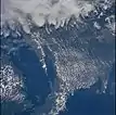
Astronauts on missions using every space shuttle and living in three different space stations have photographed the county. In 2014, one picture was featured as the NASA Earth Observatory Image of the Day.[100]
| Select astronaut photography of Door County | |||
           | |||
Radio stations
Sports
| Door County Fairgrounds | |||
 | |||
Sports tourism includes an underwater hockey team,[325] a motor racetrack in Sturgeon Bay,[326] and a semi-pro football team in Baileys Harbor.[327]
A county-wide men's baseball league has eight teams.[328]
High school sports teams play in the Packerland Conference, except for girls' swimming and golf, which compete in the Bay Conference.
In 2014, Door County ranked 264th out of all 3,141 U.S. counties by number of golf courses and country clubs. The county has nine courses, tying with 42 other counties. Door County had the 87th highest number of courses per resident of all U.S. counties.[329]
Motorcycling
In 2018, 3,476 motorcycles were registered in the county, up from 1,806 in 2018.[330] A local motorcycle club hosts a regional burning man event[331] involving a large wooden cow and maintains the adjacent Wisconsin Motorcycle Memorial.[332]
Flying
In 2019, 46 aircraft were registered in the county, most owned by individuals.[333] During the EAA AirVenture Oshkosh, a fish boil is held as a $100 hamburger event at the Washington Island Airport to entice AirVenture conventiongoers to land on the island.[334]
Ephraim no longer dry
In 2014–15, there were 257 liquor licenses in the county,[335] including one issued for a tavern on Washington Island which sells more Angostura bitters than any other tavern worldwide.[336] The county also has businesses that produce alcoholic beverages.[337] To encourage tourism, Ephraim residents passed referenda in 2016 to allow beer and/or wine sales within the village. Until then, Ephraim had been the state's last dry municipality.[338]
Economics of tourism
Door County's economy is similar to that of Bayfield, Iron, Oneida, Sawyer, and Vilas counties. These six northern Wisconsin counties have been categorized as having "forestry-related tourism"-based economies.[339]
An analysis comparing 1999 data for select Wisconsin counties found that Door County was especially strong in the retail of building and materials, groceries, apparel and accessories, miscellaneous retail, and restaurants. For services, it ranked strong in amusement, movie, and recreation and lodging. Door County ran a fiscal surplus in all categories to all other counties, with the exception of furniture & home furnishing, in which Door County had a leakage of sales to other counties.[340]
House pricing, real estate, and development
Between 2000 and 2017, prices for houses in Door County rose only 1.3% annually, less than the U.S. average of 2.5%.[341] In a 2008 survey of county residents, the most frequent local concern was the need to control rampant overdevelopment, including condos.[342] In 2006, nonresidents paid about 60% of the property taxes in the northern half of the county.[343]
Shoreline development
As of 2011, 7,889 residential buildings were located in within a quarter mile (402 meters) of the shore. Shoreline developments are vulnerable to erosion[344] and destruction from ice shoves.[345] Seiches on Green Bay cycle about every 11 hours but are highly variable and are capable of reversing the flow of water from rivers.[346]
Shoreline parcels, which tend to be the most highly valued real estate, are typically owned by non-Wisconsin residents unless they are public property.[347]
Effects of high property values
In 2017 the county had the second highest property values per capita in the state.[348] The high property values combined with low enrollment serve to punish local school districts in the state funding formula.[349] Since 1959, the Wisconsin Department of Public Instruction has wanted more school consolidation in Door County in order to achieve their statewide goal of having every district supported by a large tax base and offering a sufficiently comprehensive high school program. However, only the Southern Door School District complied with the DPI's expectations by consolidating into a single site in 1962.[350] As a result, the county's school districts often have referenda for additional property tax funding.[349]
For forested lands, high property values drive up property tax levies, which in turn encourages landowners to enroll their land in the Managed Forest Program to reduce their taxes.[351]
Effects of protected areas on nearby development
A 2012 report found that Door County's preserved open spaces reduced the likelihood that nearby land would be subdivided, but if it was subdivided, areas near the open space were divided into more parcels than those further away. It did not appear to affect agriculture-related development.[352]

Arts spending
In 2015, Door County arts and cultural organizations spent $9.7 million, of which 70.9% was spent locally, in addition to $15.0 million spent by attendees. An estimated 1,582 volunteers for arts and cultural organizations averaged 35.7 hours each. In 2015, 194,424 people attended arts and cultural events in the county, 78.0% of them non-residents. In 2016, the average arts event attendee from the county spent $28.96, while the average nonresident spent $90.53. In 2016, 50.6% of non-residents said the arts event was the primary reason they made the trip to the county. 66.0% of county resident attendees in 2016 were 65 or older, while 48.6% of non-resident attendees were 65 or older.[353]
Revenues
County spending in Door County is supported by property taxes, sales taxes, and state aid. In 2017, the county had the highest per capita property tax burden in the state,[348] although when compared by amount levied per $1,000 of property the tax was comparatively low with the county having the fifteenth lowest per capita property tax rate per $1,000 out of all 72 Wisconsin counties.[348] The county also collected $140 in per capita sales taxes in 2017, the second highest in the state,[348] and received the ninth highest level of per capita state financial assistance to the county government in 2015 figures.[348]
Expenses
Operating expenses of the Door County Tourism Zone Commission, 2008–2019[354]
In 2015, Door County had the third-highest level of per capita county spending in Wisconsin.[348] It was Wisconsin's only county with high per capita government spending in 2005 that did not also have a large low-income population. High per capita county government spending in Wisconsin is typically due to poverty.[357] Door County's spending can be explained by both the need to provide services to people present only during the tourism season[358] and by development patterns. A 2004 study showed that residential and commercial land tends to require more in government services than property taxes generate. These in turn are subsidized by taxes on industrial, agricultural, and open lands, which generally require few government services.[359]
The dispersal of residential developments is a compounding factor. A 2002 study found that Wisconsin town residents are typically subsidized by city and village residents.[360] The effect of seasonal residents on persons-per-housing unit figures was once masked by larger family sizes among year-round inhabitants. Beginning in the 1980 census the number of persons per housing unit fell below typical figures for Wisconsin as the number of children in the county dropped.[31]
Seasonality in both employment and housing
Door County unemployment rates during the summer and fall are considerably lower than in winter.[361][362] Annual earnings in Door County are typically less than similar jobs in other areas of Wisconsin. This has been attributed to the seasonal nature of much of the employment. For example, in 2009, it was found that people were 4.85 times more likely to be employed by hotels and motels in Door County as opposed to the rest of the nation.[363]
22.0% of the county's 13,728 employed workers[lower-alpha 15] in 2018 served in the leisure and hospitality sector, more than any other sector. However, because leisure and hospitality jobs tend not to pay very well, they only earned 12.9% of all wages earned in the county. In contrast, manufacturing employees received 24.5% of the wages paid in 2018, even though they only made up 17.0% of the workforce. This is despite the average annual wage for leisure and hospitality workers being 109.3% of the state average wage for leisure and hospitality in 2018. In contrast, workers employed in manufacturing received 86.7% of the state average wage for manufacturing. Wages in Door County trailed state averages for every sector except leisure and hospitality.[364] The effects of the low earnings are compounded by average housing prices; other areas in Wisconsin with low wages tend to have low housing prices.[365] The unaffordability of housing has been linked to the labor shortage problem, as new employees may be unable to afford housing and decide to leave.[366] A 2019 study found the county to have the eighth highest cost of living out of all Wisconsin counties.[367]
Homes, cabins, and cottages permitted for short term rentals, 2008 – May 2020[368]
Reliance on immigrant and foreign student labor
As high school enrollment in the county has dwindled,[lower-alpha 16] employers have turned to J-1 visas to fill seasonal positions instead.[371]
J-1 visas issued for work in Door County, 2016–2019

Because foreign workers brought in under the Summer Work Travel Program are sometimes housed in a different community from where they are employed, some have ended up bicycling 10–15 miles a day since they lack cars and the county has limited public transportation.[372] Additionally, illegal or undocumented immigrants who work in the tourism industry often lack drivers' licenses.[373] In 2012, Door County District Attorney Ray Pelrine said the "illegal immigrant workforce is now built into the structure of a lot of businesses here."[374]
For reported labor, people in the county tend to work in the county, and jobs in the county tend to be performed by county residents. According to 2011–2015 ACS data, out of 17 counties in northeastern Wisconsin, Door County had the second lowest percentage of residents commuting out-of-county to work. Only Brown County residents were less likely to commute out of their county to work. 89.08% of reported jobs Door County are performed by workers residing in the county, the highest percentage in the 17-county area. The low ranking has been attributed to the peninsula, which limits the directions people can practically commute.[375]
Geographic distribution of tourist spending
The economic impact of tourism is not the same throughout the county. A 2018 survey of tourists reported that Forestville and Brussels were the county's least visited communities.[376] Due to tourism's impact on restaurant prices, some residents of the more rural southern part of the county cannot afford to eat at restaurants in the northern part.[377]
Income inequality
Measures of income inequality show mixed results in Door County. Using the ACS five-year estimates from 2012 to 2016, the household income ratio between the 80th to 20th percentiles was only 3.76, the 352nd lowest such ratio out of 3,140 U.S. counties. On the other hand, 23.1% of all household income in the county was earned by the top 5th percentile, the 452nd greatest percentage out of 3,135 U.S. counties reporting data.[378]
Housing inequality
Most of the homeless in Door County are couch surfers, although in the summer many will camp or live out of their vehicles.[379]
The largest single-family house in the state is in Liberty Grove.[380] It was built in 1996 and is about 35,000 square feet. Although in 2005 it sold for about $20 million, in 2016 it sold for only $2.7 million,[381] and in 2019 was assessed at $2.625 million.[382] Additionally, an earth house in Sevastopol has been considered the "strangest home in Wisconsin."[383]
Elderly and housing
A 2019 report by the Wisconsin Bureau of Aging and Disability Resources based on data from 2013 to 2017 found that while only 12.7% of Door County residents aged 65 and older rented (compared to 23.5% statewide), 59.8% of those who did rent spent 30% or more of their income on rental costs (compared to 55.4% statewide).[384]
Transportation
Land
According to the Wisconsin Department of Transportation, in 2018 Door County had 1,270 miles of roadways.[385] In county figures for 2007 there were 1,455 named roads in the county.[386] In 2013 there were 588 lane miles[lower-alpha 17] of county trunk highways, 1743 lane miles of local roads, and 268 lane miles of state highways.[388] In Wisconsin DOT figures for 2018, there were 102 miles of state highways, 296 miles of county highways, and 872 miles of local roads.[385]
State highways
Average daily traffic by year; WIS–57 in Baileys Harbor[389]
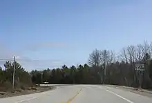

The highest volumes of traffic in the county occur on Wisconsin Highway 42–57 from the junction of the separated highways in Nasewaupee to the Sturgeon Bay Ship Canal. The combined WIS 42–57 separates again at a junction in Sevastapol. Following this separation, WIS 42 continues along the western side of the peninsula and sees more traffic than WIS 57, which continues along the eastern side.[390] The two highways combine again at a junction in Liberty Grove.
 Wisconsin Highway 42 (WIS 42)
 Wisconsin Highway 57 (WIS 57)
- Door County Coastal Byway (WIS 42 and WIS 57) north of Sturgeon Bay to Northport is classified as a Coastal Byway.[391]
Rustic roads
- There are five rustic roads in the county.[392] In addition to state-recognized rustic roads, Liberty Grove manages a heritage roads program. As of 2019 there were 12 heritage roads in the town.[393]
Snowmobile
Non-motorized
- The Ahnapee State Trail connects Sturgeon Bay to Kewaunee, winter snowmobile access is dependent on weather and trail grooming.[396] Although the Ice Age Trail coincides with most of the Ahnapee State Trail, the Ice Age Trail forks away in the City of Sturgeon Bay and reaches its northern terminus at Potawatomi State Park.[397]
- WIS 42 and 57 are part of the Lake Michigan Circle Tour.[398]
- Egg Harbor operates a free public bicycle-sharing system, limited to daylight hours within the village during the tourist season.[399]
Bridges across Sturgeon Bay
- Sturgeon Bay Bridge, (also called Michigan Street Bridge) (11.5 feet clearance, overhead-truss, Scherzer-type, double-leaf, rolling-lift bascule)[400]
- Oregon Street Bridge (reinforced concrete slab, rolling lift bascule girder with mechanical driven center locks)[401]
- Bayview Bridge (monolithic concrete placed on structural deck with steel girder superstructure, open grating on deck, bascule)[402]
Air
A daily private shuttle service operates between Green Bay–Austin Straubel International Airport and Sturgeon Bay.[403] The nearest intercity bus station with regular service is in Green Bay.[404] There are eleven airports in the county, including private or semi-public airports.
- Door County Cherryland Airport (KSUE), public use, three miles west of Sturgeon Bay, Wisconsin
- Ephraim–Gibraltar Airport (3D2), public use, one mile southwest of Ephraim, Wisconsin
- Washington Island Airport (2P2), public use
- Crispy Cedars Airport, Brussels (7WI8), private, but open to visitors with advance notice[405]
- Door County Memorial Hospital Heliport, allows for air ambulance service to the hospital from remote areas of the county[406] and for flying patients to Green Bay.
- Chambers Island Airport, private[407]
- Five other small airports[lower-alpha 18]
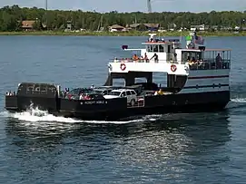
Ferries
- Washington Island is served by two ferry routes. The first route is to take a 30-minute ferry ride from the Door Peninsula to Detroit Harbor on the island from a freight, automobile, and passenger ferry that departs daily from the Northport Pier at the northern terminus of Highway 42. This ferry makes approximately 225,000 trips per year.[403] The second route is a passenger-only ferry that departs from the unincorporated community of Gills Rock on a 20-minute route.[413]
- Rock Island State Park is reachable by the passenger ferry Karfi from Washington Island.[414] (During winter Rock Island is potentially accessible via snowmobile and foot traffic.)
- Although Chambers Island has no regularly scheduled ferry, there are boat operators which transport people to the island on call from Fish Creek.
Boat ramps and marinas
- There are 30 public boat access sites in the county.[415] The Lake Michigan State Water Trail follows most county shorelines.[416]
Population and its health

2000 Census
As of the 2000 census,[417] there were 27,961 people, 11,828 households, and 7,995 families residing in the county. The population density was 58 people per square mile (22/km2). There were 19,587 housing units at an average density of 41 per square mile (16/km2). The racial makeup of the county was 97.84% White, 0.19% Black or African American, 0.65% Native American, 0.29% Asian, 0.01% Pacific Islander, 0.33% from other races, and 0.69% from two or more races. 0.95% of the population were Hispanic or Latino of any race. 39.4% were of German and 10.3% Belgian ancestry. A small pocket of Walloon speakers forms the only Walloon-language region outside of Wallonia and its immediate neighbors.[418][419]
Out of a total of 11,828 households, 58.10% were married couples living together, 6.50% had a female householder with no husband present, and 32.40% were non-families. 28.10% of all households were made up of individuals, and 12.70% had someone living alone who was 65 years of age or older. The average household size was 2.33 and the average family size was 2.84.
| Historical population | |||
|---|---|---|---|
| Census | Pop. | %± | |
| 1860 | 2,948 | — | |
| 1870 | 4,919 | 66.9% | |
| 1880 | 11,645 | 136.7% | |
| 1890 | 15,082 | 29.5% | |
| 1900 | 17,583 | 16.6% | |
| 1910 | 18,711 | 6.4% | |
| 1920 | 19,073 | 1.9% | |
| 1930 | 18,182 | −4.7% | |
| 1940 | 19,095 | 5.0% | |
| 1950 | 20,870 | 9.3% | |
| 1960 | 20,685 | −0.9% | |
| 1970 | 20,106 | −2.8% | |
| 1980 | 25,029 | 24.5% | |
| 1990 | 25,690 | 2.6% | |
| 2000 | 27,961 | 8.8% | |
| 2010 | 27,785 | −0.6% | |
| 2019 (est.) | 27,668 | [420] | −0.4% |
| U.S. Decennial Census[421] 1790–1960[422] 1900–1990[423] 1990–2000[424] 2010–2019[4] | |||
For every 100 females there were 97.10 males. For every 100 females age 18 and over, there were 94.50 males. In the county, the population was spread out, with 22.10% under the age of 18 (a decrease from 25.9% being under the age of 18 in the 1990 census[425]), 6.10% from 18 to 24, 25.40% from 25 to 44, and 27.70% from 45 to 64.
Births, abortions, deaths, migration
In 2017, there were 217 births, giving a general fertility rate of 59 births per 1000 women aged 15–44, the 49th highest rate out of 72 Wisconsin counties.[426] Additionally, there were eleven reported induced abortions performed on women of Door County residence in 2017.[427]
Between April 2010 and January 2019, there were an estimated 1,869 births and 2,904 deaths in the county. Although the greater number of deaths served to decrease the population by an estimated 1,035 people, this was more than offset by a net gain of 1,900 people who moved in from outside the county. Altogether, the population increased by an estimated 865 persons during this period.[428]
Most elderly and youthful communities
From ACS data from 2014 to 2018, the most elderly community in the county was the village of Ephraim with a median age of 65.4, the seventh most elderly out of all 1965 cities, towns, and villages having available data. Following Ephraim was Egg Harbor with a median age of 64.0, the 14th most elderly in the state, Sister Bay with a median age of 63.4, tied with Sherman in Iron County as the 18th most elderly, Washington Island with a median age of 62.9, tied with Union in Burnett County as the 22nd most elderly, Liberty Grove with a median age of 62.4, tied with Lakewood in Oconto County as the 26th most elderly, Egg Harbor with a median age of 59.8, tied with three other towns as the 55th most elderly, Gibraltar with a median age of 59.4, tied with the town of Raddison in Sawyer county as the 64th most elderly, and Bailey's Harbor with a median age of 58.5, tied with Big Bend in Rusk County as the 83rd most elderly.
The youngest community in Door County was the village of Forestville with a median age of 39.0. It tied with 12 other communities as the 429th youngest community in the state. Following the village of Forestville was the city of Sturgeon Bay with a median age of 42.8, tied with 9 other communities as the 742nd youngest in the state, Brussels with a median age of 46.9, tied with 8 other communities as the 1163rd youngest in the state, the town of Forestville with a median age of 47.4, tied with 9 other communities as the 1222nd youngest in the state, and Gardner with a median age of 49.4, tied with 15 other communities as the 1434th youngest in the state.[429]
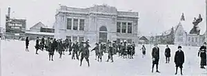
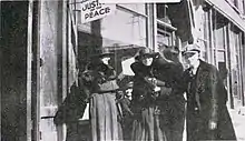
| Children, Sturgeon Bay, 1917 | |||
   | |||
Based on ACS data from 2013 to 2017, the county had a median age of 52.4 years old, tied with Florence as the fifth most elderly of all Wisconsin counties.[384] This was an increase from the 2000 census, which reported a county median age of 43 years. In the 2000 census, 18.70% of the county population was 65 years of age or older. By 2015, the percentage of elderly climbed, with 25.8% of the population being 65 or older, the third highest in the state.[348]
Declining youth and overall population
According to ACS estimates, the number of people under 18 in the county dropped from 5,119 in 2010 to 4,479 in 2017.[430] In 2013, a researcher predicted that by 2040, the county's population would decline 4.2%, the 10th-largest percentage decline among all Wisconsin counties.[431]
From 2013 to 2017, 36.8% of the 9,358 households in the county included children, based on the ACS 5-year estimate, compared to 44.2% for Wisconsin in 2017, based on the ACS one-year estimate.[432]
Declining public school enrollment
With the exception of the preschool program in Sevastopol, all county districts saw enrollment declines from 2000 to 2019 at the elementary, middle, and high school levels.[433] The Door County Charter School in Sturgeon Bay is not listed as it was only in operation from 2002 to 2005.[434]
| District | School | 2000 enrollment | 2019 enrollment | % Change |
|---|---|---|---|---|
| Gibraltar School District | Gibraltar High School | 233 | 192 | -17.6% |
| Gibraltar School District | Gibraltar Middle School | 167 | 84 | |
| Gibraltar School District | Gibraltar Elementary School | 293 | 278 | |
| Gibraltar School District | Gibraltar, combined statistics for the elementary and middle schools | 460 | 362 | -21.3% |
| Sevastopol School District | Sevastopol High School | 270 | 194 | -25.6% |
| Sevastopol School District | Sevastopol Elementary School (2000, K-5; 2018, K-6) | 284 | 258 | |
| Sevastopol School District | Sevastopol Junior High (7–8) in 2000; Sevastopol Middle School (6–8) in 2018 | 102 | 122 | |
| Sevastopol School District | Sevastopol, combined statistics for elementary and jr. high/middle school (K-8) | 386 | 380 | -1.6% |
| Sevastopol School District | Sevastopol Special Education, 2000, in 2018 the name is Sevastopol Pre-School | 13 | 28 | 115.4% |
| Southern Door School District | Southern Door High School | 453 | 331 | -26.9% |
| Southern Door School District | Southern Door Middle School | 298 | 279 | -6.4% |
| Southern Door School District | Southern Door Elementary School | 576 | 463 | -19.6% |
| Sturgeon Bay School District | Sturgeon Bay High School | 515 | 389 | -21.0% |
| Sturgeon Bay School District | T. J. Walker Middle School | 350 | 253 | -27.1% |
| Sturgeon Bay School District | Sunset Elementary School (in 2018, PreK–K) | 197 | 157 | |
| Sturgeon Bay School District | Sawyer Elementary School (in 2018, 1–2) | 164 | 131 | |
| Sturgeon Bay School District | Sunrise Elementary School (in 2018, 3–5) | 214 | 208 | |
| Sturgeon Bay School District | Sturgeon Bay, combined statistics for Sunset, Sawyer, and Sunrise Elementary Schools | 575 | 496 | -13.7% |
| Washington School District | Washington Island Elementary | 87 | 53 | -39.1% |
| Washington School District | Washington Island High School | 37 | 27 | -27.0% |
| All county districts | 4,253 | 3,453 | -18.8% |
Declining high school enrollment[433][lower-alpha 21] has been blamed for the shortage of seasonal workers, and credited with prompting the expansion of the J-1 visa program.[435][lower-alpha 22]
Total 9–12 enrollment at all five Door County high schools, 2000–2019
Marriages
Five-year ACS data from 2012 to 2016 show that an estimated 24.6% of women aged 45–54 in the county had never been married, the 69th highest percentage of never-married women in this age bracket out of 3,130 U.S. counties reporting data. The ACS estimate also found that 75.9% of women aged 35–44 were married, the 389th highest number of married women in this age bracket out of 3,136 counties reporting data, and that the county was tied with three other counties in having the 180th lowest percentage of births to unmarried women out of 3,021 counties reporting data. 13.4% of births were to unmarried women.[378]
In 2015, the county had the 20th-most marriages and 43rd-most divorces out of all Wisconsin counties. August and September tied as the months with the most weddings, with 75 each.[436] In 2016 the county was the 45th-most populous in the state.[437]

Religious statistics
In 2010 statistics, the largest religious group in Door County was the Catholics, with 9,325 adherents worshipping at six parishes, followed by 2,982 ELCA Lutherans with seven congregations, 2,646 WELS Lutherans with seven congregations, 872 Moravians with three congregations, 834 United Methodists with four congregations, 533 non-denominational Christians with six congregations, 503 LCMS Lutherans with two congregations, 283 LCMC Lutherans with one congregation, 270 Converge Baptists with three congregations, 213 Episcopalians with one congregation, 207 UCC Christians with one congregation, and 593 other adherents. Altogether, 69.3% of the population was counted as adherents of a religious congregation.[439]
In 2014, Door County had the 719th-most religious organizations per resident out of all 3,141 U.S. counties, with 34 religious organizations in the county.[329]
Median incomes
According to 2014–2018 ACS data, four communities had median incomes lower than the county median income of $58,287. Of these, Sister Bay had the lowest median household income at $40,944, ranking the 135th lowest in the state out of 1,951 cities, villages, and towns which had available data. Following Sister Bay was the village of Forestville at $49,500 and ranking 444th lowest in a tie with New London in Waupaca County, the city of Sturgeon Bay at $52,917 and ranking 610th lowest, and Washington Island at $55,341 and ranking 737th lowest.
Gibraltar had the highest median income in the county at $80,602, the 232nd highest in the state, followed by Ephraim at $77,500 and ranking 305th highest, Egg Harbor at $75,833 and ranking 343rd highest, and Jacksonport at $70,625 at 483rd highest.[429]
In 2016, the county had the third highest per capita personal income in the state[348] and in 2015 it had the seventh lowest poverty level in the state.[348] In 2015, 39.0% of the population had an associate degree or more, making Door County the 12th most educated out of all 72 Wisconsin counties.[348]

Cattle and deer
In 2018, there were an estimated 23,500 head of cattle in the county.[440] In 2017, Door and Kewaunee counties were reported to have equal deer-to-human ratios, although Kewaunee County had a considerably greater cow-to-human ratio.[441]
Public health
2019 drug charges by type of drug[442]
Minors receiving county-managed
psychiatric medication, 2014–2019[443]
In most measures of public health for 2015, the county has figures as healthy as or healthier than those of the entire state.[444] According to calculations based on 2010–2014 data, children born in Door County have a life expectancy of 80.9 years, the ninth highest of Wisconsin's 72 counties.[445] From 2000 to 2010, the county's premature death rate for people under 75 fell 35.0%, the second-greatest reduction in Wisconsin.[446]
In December 2018, Door County residents aged 18–64 were less likely to be receiving government payments for disability than the averages for Wisconsin and the United States as a whole.[447] Five-year ACS estimates for 2012–2016 found that Door County tied with 24 other counties in having the 573rd lowest percentage of disabled residents under 65 out of all 3,145 U.S. counties. 9.3% were disabled.[378]
From 2009 to 2013 the county had the highest skin cancer rate in the state.[448]
In 2017, three people died from drug abuse, up from two in 2016.[449]
A CDC survey of people reporting frequent mental distress (14–30 mentally unhealthy days in the last 30 days, data aggregated over 2003–2009) found that people in Door County were more likely to be distressed than those in most Wisconsin counties, but less likely to be distressed than those in the heavily urbanized southeast portion of the state.[450]
With a rate of 9.53 county-medicated children per 1000 children, Door County had the fourth highest rate in the state out of all 27 counties and multi-county social services agencies reporting statistics on the psychiatric medication of minors in 2019. Out of the 43 medicated minors in 2019, 26 were female and 17 were male, 36 were white, 5 were of an unknown race, and 2 belonged to other races.[451]
In 2019, the county Behavioral Health Unit had 185 clients, up from 142 in 2018.[2]
Tick-borne illnesses
A study of the risk of getting Lyme disease in Door County between 1991 and 1994 found it to be relatively low, possibly due to its having less vegetation than most Wisconsin counties.[452] From 2015 through 2017 reported cases of Lyme disease increased from 4 cases in 2015 to 30 cases in 2017.[453] As of 2017, no cases of babesiosis have been reported in the county, but the range of this disease now includes Brown County after considerable expansion into Northeastern Wisconsin from 2001 to 2015.[454][449]
COVID-19
The COVID-19 pandemic was reported to have reached the county on March 30, 2020. As of February 3, 2021, the Door County Public Health Office reported 2,362 cases, 80 hospitalizations, and 18 deaths of county residents, with 2,389 recoveries.[455]
Vehicle accidents

Most fatal or incapacitating vehicle accidents in the county between 2010 and 2014 involved visitors. 6% of those involved in these accidents were from Illinois, 3% from Florida, and 7% from other states.[459] In a study of car accident data from 1992 to 2001, the risk of incurring a severe traffic injury during a stretch of driving was found to be lower in Door County than in Kewaunee County, but Door County had more fatalities per 100 people severely injured than Kewaunee, Brown, Manitowoc, and Sheboygan counties. This was thought to be due to the relatively long distance it takes to get people injured in Door County to treatment, as the nearest hospital with a high level of trauma certification was St. Vincent Hospital in Green Bay.[460] Currently, St. Vincent's and Aurora BayCare are certified as level II trauma centers.[461]
From 2014 through 2017, fatalities and serious injuries especially occurred on the western side of the peninsula between the bay of Sturgeon Bay and Egg Harbor.[390]
From January 2001 through December 2020, there were 67 collisions reported in the county involving fatalities. Out of 66 of the fatal collisions, 29 occurred south of the canal, 36 occurred on the peninsula north of the canal, and one occurred on Washington Island. One additional fatal crash was not mapped by the state Department of Transportation. Out of 66 of the fatal collisions, 29 occurred along or at the intersection of the main route of a state highway, not including business routes. Three fatal crashes involving motorcycles occurred, with one each in the towns of Jacksonport, Baileys Harbor, and Liberty Grove.[456]
From January 2010 through December 2020 there were 329 reported collisions involving alcohol within the county, which resulted in 9 fatalities and 198 injuries.[456]
From January 2010 through December 2020 there were 47 reported collisions involving drugs. Out of 45 collisions involving drugs, 10 occurred south of the canal (with one involving fatalities), 34 occurred on the peninsula north of the canal, (with three involving fatalities) and one crash with no fatalities occurred on Washington Island. Two additional crashes involving drugs were not mapped.[456]
From January 2010 through December 2020 there were 48 reported collisions involving bicycles. Out of 46 of the collisions involving bicycles, 5 occurred south of the canal, 37 occurred on the peninsula north of the canal, and four occurred on Washington Island. Two additional crashes involving bicycles were not mapped.[456]
From January 2010 through December 2020 there were 29 reported collisions involving work zones, resulting in 12 injuries and no fatalities.[456]
From January 2010 through January 2020 there were 44 reported collisions involving pedestrians. Out of 34 of the crashes involving pedestrians, 6 occurred south of the canal and 28 occurred on the peninsula north of the canal. 10 additional crashes involving pedestrians were not mapped.[456]
Crime

In 2019 there were 176 felony cases prosecuted by the county, up from 171 in 2018. Of these, 3 went to trial, down from 6 in 2018.[2]
The county has been a focus of sex-trafficking enforcement efforts.[462] From 2015 to 2019 there were no reports of sex-trafficking in the county.[463]
Adult Protective Services referrals, 2007–2019 and annual WATTS reviews[lower-alpha 23] conducted for persons under court-ordered supervision, 2008–2018[464]
referrals to APS WATTS reviewsAdult Protective Services
In 2012, 58% of referrals alleging the abuse and neglect of the elderly or elders at risk involved self-neglect. 15.1% were for financial exploitation, 11.9% were for neglect, 7.9% were for emotional abuse, 5.6% were for physical abuse, and 0.8% were for sexual abuse.[465]
Child maltreatment
In 2019, there were 433 complaints of child neglect, abuse, or emotional damage/abuse in the county. At 9.6 reports per 100 children, Door County had the ninth highest rate of allegations out of all 72 Wisconsin counties. Among the 433 allegations, 105 passed the screening and were considered credible enough to investigate. At 2.3 screened-in complaints per 100 children, Door County ranked the 23rd highest in the state.[466]
113 reports were placed by "not documented" sources, 98 were placed by educational personnel, 47 were placed by mental health professionals, 45 were placed by legal/law enforcement, 26 were placed by others, 23 were placed by social services workers, 22 were placed by medical professionals, 17 were placed by relatives, and 16 were placed by parents of the child victims.[467]
Child welfare cases resulting in ongoing social services supervision of the family, 2007–2012 and total child welfare cases investigated, 2007–2014[468]
Decisions were made about whether to investigate the complaints 87 times within 24–48 hours and 309 times within five business days. The number of complaints peaked in February, April, July, and October, with the month of October having the greatest number of allegations at 57.[467]
321 reports (93 deemed worth investigating) concerned a white child victim, while 20 reports (6 deemed worth investigating) concerned African American children. Most reports concerning African American children were generated by educational personnel. 103 reports (12 considered worth investigating) concerned children of a race besides white or African American, or whose race was unknown or was not provided. Due to multiracial children, the total number exceeds 433.[467]
198 of the reports alleged neglect, with 56 of the reports coming from "not documented" sources, 36 reports from educational personnel, and 23 reports from legal/law enforcement. 137 of the reports alleged physical abuse, with 46 reports from educational personnel, 27 reports from "not documented" sources, and 21 reports from mental health professionals. 94 of the reports alleged sexual abuse, with 28 from "not documented" sources, 17 from mental health professionals, 15 from legal/law enforcement, and 10 from educational personnel. Out of the 43 reports alleged emotional damage/abuse, 15 came from educational personnel.[467]
In 2012, 34 children were held for 72 hours, up from 32 children in 2011.[469]
Communities
City
- Sturgeon Bay (county seat)
Villages
Towns
- Baileys Harbor (Cana Island is in the Town of Baileys Harbor)
- Brussels
- Clay Banks
- Egg Harbor
- Forestville
- Gardner
- Gibraltar (the Strawberry Islands, Hat, Horseshoe, and Chambers Island are in the Town of Gibraltar)
- Jacksonport
- Liberty Grove (Gravel Island, Spider Island, and the Sister Islands are in the Town of Liberty Grove)
- Nasewaupee
- Sevastopol
- Sturgeon Bay
- Union
- Washington Island
Unincorporated communities
Absorbed into Sturgeon Bay
- Sawyer
- Stevens Hill
Abandoned
Census-designated places
Adjacent counties
By land
- Kewaunee County - south
In Green Bay
- Brown County - southwest[470]
- Oconto County - west
- Marinette County - northwest
- Menominee County, Michigan - northwest
Along the Rock Island Passage
- Delta County, Michigan - north
In Lake Michigan
- Leelanau County, Michigan - northeast and east
- Benzie County, Michigan - southeast
Notable people
- Robert C. Bassett (1911–2000), U.S. presidential advisor[471]
- Jule Berndt (1924–1997), pastor
- Norbert Blei (1935–2013), writer
- Gene Brabender (1941–1996), baseball player[472]
- Hans Christian (born 1960), musician
- Jessie Kalmbach Chase (1879–1970), painter
- Eddie Cochems (1877–1953), "Father of the Forward Pass"
- Erik Cordier (born 1986), baseball player
- Katherine Whitney Curtis (1897–1980), originator of synchronized swimming
- Mary Maples Dunn (1931–2017), historian
- Jim Flanigan (born 1971), football player[473]
- Lou Goss (born 1987), racecar driver
- Chris Greisen (born 1976), Milwaukee Iron quarterback (AFL)
- Nick Greisen (born 1979), Denver Broncos linebacker (NFL)
- Stuart Hagmann (born 1942), film and television director
- Bernard Hahn (1860–1931), Wisconsin State Representative, hotel and opera house owner, arsonist
- Arthur G. Hansen (1925–2010), engineer, university president and chancellor.
- Hjalmar Holand (1872–1963), historian
- Jens Jensen (1860–1951), landscape architect
- M. J. Jischke (born 1885), butcher, postmaster
- Al Johnson, (born 1979), football player
- Ben Johnson (born 1980), football player
- Bill Jorgenson (1930 – 2007), bluegrass musician
- Al C. Kalmbach (1910–1981), publisher
- Henry Killilea (1863–1929), helped found American League[474]
- Curly Lambeau (1898–1965), football player and coach[475]
- Doug Larson (1926–2017), newspaper writer
- James Larsin (b. 1855), saved seven people from drowning
- Lester Leitl (1899–1980), football player and coach
- Pat MacDonald (born 1952), once part of Timbuk 3, runs Steel Bridge Songfest
- Eli Mattson (born 1981), musician
- Amy McKenzie (born 1959), producer/director
- Edward S. Minor (1840–1924), U.S. Representative
- Conrad P. Olson (1882–1952), Oregon Supreme Court justice
- Sigurd F. Olson (1899–1982), wilderness guide
- Alexander Noble (1829–1905), town official in Fish Creek
- Charles L. Peterson, (born 1927), painter
- Casey Rabach (born 1977), Washington Redskins center (NFL)
- David M. Raup (1933–2015), paleontologist
- Hugh M. Raup (1901–1995), ecologist
- Dennis A. Reed (born 1822), Wisconsin State Representative, Civil War lieutenant
- Charles Reynolds (1839–1914), Wisconsin State Representative, Civil War captain
- Thomas Reynolds (1840–1919), Wisconsin State Representative, patriarch of Wisconsin political dynasty
- Jack Ritchie (1922–1983), writer of detective fiction
- Paul J. Schlise, U.S. Navy admiral
- John Shinners (born 1947), football player
- Paul Sills (1927–2008), director, improvisation teacher
- Allen Thiele (1940–2017), Coast Guard officer
- Chester Thordarson (1867–1945), inventor, erected buildings on Rock Island
- Madeline Tourtelot (1915–2002), artist, founder of the Peninsula School of Art
- James Valcq (born 1963), writer of musicals
- Richard Warch (1939–2013), president of Lawrence University
- Lloyd Wasserbach (1921–1949), football player
- Charles Mitchell Whiteside (1854–1924), helped merge Sawyer and Sturgeon Bay
- Randy Wright (born 1961), Green Bay Packers quarterback (NFL)
- Albert Zahn (1894–1953), folk artist known as the birdman
Politics
Door County has voted for the winning candidate in every presidential election since 1980, except for 1992.
| Year | Republican | Democratic | Third parties |
|---|---|---|---|
| 2020 | 48.5% 9,752 | 49.9% 10,044 | 1.6% 321 |
| 2016 | 48.8% 8,580 | 45.6% 8,014 | 5.7% 998 |
| 2012 | 46.0% 8,121 | 53.0% 9,357 | 1.1% 193 |
| 2008 | 40.7% 7,112 | 58.0% 10,142 | 1.3% 227 |
| 2004 | 50.9% 8,910 | 47.8% 8,367 | 1.2% 214 |
| 2000 | 51.3% 7,810 | 43.1% 6,560 | 5.6% 850 |
| 1996 | 40.4% 4,948 | 45.6% 5,590 | 14.0% 1,713 |
| 1992 | 39.7% 5,468 | 34.4% 4,735 | 25.9% 3,574 |
| 1988 | 55.6% 6,907 | 43.7% 5,425 | 0.7% 90 |
| 1984 | 67.4% 8,264 | 31.9% 3,916 | 0.7% 91 |
| 1980 | 55.2% 7,170 | 38.2% 4,961 | 6.6% 851 |
| 1976 | 57.4% 6,557 | 39.9% 4,553 | 2.7% 307 |
| 1972 | 64.3% 6,503 | 33.9% 3,430 | 1.9% 188 |
| 1968 | 63.3% 5,647 | 30.6% 2,728 | 6.1% 541 |
| 1964 | 49.2% 4,289 | 50.7% 4,416 | 0.1% 9 |
| 1960 | 61.5% 5,790 | 38.4% 3,610 | 0.2% 14 |
| 1956 | 78.0% 6,722 | 21.6% 1,859 | 0.5% 41 |
| 1952 | 80.8% 7,621 | 19.0% 1,790 | 0.2% 19 |
| 1948 | 65.8% 4,911 | 32.7% 2,440 | 1.5% 108 |
| 1944 | 68.3% 5,668 | 31.3% 2,599 | 0.5% 38 |
| 1940 | 66.1% 5,461 | 33.3% 2,750 | 0.6% 49 |
| 1936 | 41.1% 3,146 | 51.6% 3,952 | 7.4% 566 |
| 1932 | 37.0% 2,488 | 61.6% 4,149 | 1.4% 97 |
| 1928 | 59.3% 3,636 | 40.0% 2,456 | 0.7% 42 |
| 1924 | 38.6% 1,891 | 4.8% 235 | 56.6% 2,778 |
| 1920 | 88.3% 3,817 | 8.9% 385 | 2.8% 119 |
| 1916 | 56.3% 1,656 | 40.9% 1,204 | 2.9% 84 |
| 1912 | 41.2% 1,167 | 27.1% 769 | 31.7% 900 |
| 1908 | 73.9% 2,463 | 23.3% 778 | 2.8% 93 |
| 1904 | 80.5% 2,689 | 15.4% 515 | 4.1% 136 |
| 1900 | 76.3% 2,362 | 21.8% 674 | 1.9% 60 |
| 1896 | 71.3% 2,402 | 26.6% 895 | 2.1% 72 |
| 1892 | 58.2% 1,596 | 36.7% 1,007 | 5.1% 140 |
Gallery
 Sunset, Sister Bay
 Wigwam display at Whitefish Dunes State Park
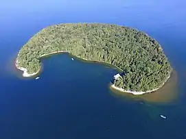
 Cave Point County Park
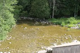 The Ahnapee River below the dam at Forestville
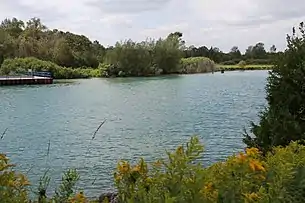 Sturgeon Bay Shipping Canal
Notes
- Summerville soil series information, also see inceptisol as Summerville soils are inceptisols.
- Longrie soil series information, also see spodosol, as Longrie soils are spodosols.
- Omena soil series information, also see alfisol, as Omena soils are alfisols.
- See § Lake breezes
- such as go-kart tracks, water parks, and mini-golf
- Grand Traverse Island State Park was founded in 1970 and protects sightly more than 5 acres (2.0 ha) of land on Detroit Island.[119] As it consists of five discontiguous parcels[120] and there is no ferry access this park is ordinarily unadvertised.
- Gardner Swamp Wildlife Area, Mud Lake Wildlife Area, Reibolts Creek Public Access, and Schuyler Creek State Fishery Area
- Access to SNAs depends on ownership, but most are free and open to the public. Complex ownership complicates a straightforward listing of the parks, as besides the local land trust, the Nature Conservancy manages five preserves in the county.
- See Trout stream classifications, Wisconsin DNR
- There are two public sledding hills in Sturgeon Bay,[252] one in Sister Bay,[253] one in Peninsula State Park,[254] and a small sledding hill in Potawatomi State Park.[255]
- See Skorpa for fika by Bonnie Sparrman in Pietisten 12(2), Fall/Winter 2017
- As a food preparation ritual, fish boils in the county have been compared to the Lūʻau parties of Hawaii, the barbecues of the South, and the clambakes of the Northeast.[31]
- For a description of Belgian acculturation towards Native Americans, see The Walloon Immigrants Of Northeast Wisconsin An Examination Of Ethnic Retention by Jacqueline Tinkler, MA Thesis, UT-Arlington, May 2013, pp. 26–27 (pp. 33–34 of the pdf)
- See Peninsula Players and Northern Sky Theater
- Excluding unreported workers
- See § Declining public school enrollment
- Lane miles are the number of miles of road multiplied by the number of lanes; in Wisconsin lane mile figures each lane is a 12-foot width of road.[387]
- The other five private airports:
- This ferry is named after Robert Noble, who was a shipwreck survivor and 19th century ferry operator across Sturgeon Bay.[412]
- For an updated pyramid, see 2010-2040CoPyramids.xlsx
- Due to incomplete reporting or reporting of statistics identical to the previous year by one or more county schools in 2002, 2003, these years are omitted from the graph; also the Washington Island data for 2018 is reflected in the total for 2019 as the most recent data was not reported.
- See § Reliance on immigrant and foreign student labor
- For an explanation of WATTS reviews, see New Annual Review (Watts) Requirement per Wis. Stats. § 55.18(4), Wisconsin DHS
References
- Door County: County Courthouse – Sturgeon Bay, courthouses.co
- County of Door 2019 Annual Reports, felonies: page 17, road salt: page 26, behavioral health: page 40, snowmobile trails and Government Center: page 46, invasive species: page 70
- Door County: County Courthouse – Sturgeon Bay, courthouses.co
- "State & County QuickFacts". United States Census Bureau. Archived from the original on June 6, 2011. Retrieved January 18, 2014.
- "Find a County". National Association of Counties. Archived from the original on May 31, 2011. Retrieved June 7, 2011.
- "Wisconsin: Individual County Chronologies". Wisconsin Atlas of Historical County Boundaries. The Newberry Library. 2007. Retrieved August 13, 2015.
- Top Things to Do in Door County
- Gannett, Henry (1905). The Origin of Certain Place Names in the United States. Washington, D.C.: U.S. Government Printing Office. p. 108. Retrieved May 7, 2018 – via Internet Archive.
- Kohl, Cris & Joan Forsberg, Shipwrecks at Death's Door, p. 10.
- History of Door County Wisconsin, The County Beautiful by Hjalmar Holand, Chicago: S. J. Clarke, 1917, p. 77.
- Door County Comprehensive Plan 2030. Chapter 3 – Historical and Cultural Resources. Volume II, Resource Report., Table 3.1: Timeline of Historic Events in Door County, pp. 19–20 (pp. 4–5 of the pdf)
- Going For The Mail: A History Of Door County Post Offices by James B. Hale, Brown County Historical Society: Green Bay, WI. 1996. Full text on Internet Archive
- Village of Forestville Comprehensive Plan, September 11th, 2009, pages 14–16 of the document
- Inventory of the Church Archives of Wisconsin: Moravian Church, by the Historical Records Survey, Division of Women's and Professional Projects, Works Progress Administration, 1938, p. 21 and "History of Ephraim, Door County, Wisconsin". by Hjalmar R. Holand, 1917
- Soucek, G. (2011). Door County Tales: Shipwrecks, Cherries and Goats on the Roof. American Chronicles. Arcadia Publishing Incorporated. ISBN 978-1-61423-383-1. Retrieved April 23, 2017.
- Lott, Katie (May 1, 2009). "Southern Door County's Belgian Wayside Chapels". Door County Living. Retrieved January 22, 2019.doorcounty.com. "Where to Find Belgian Chapels in Door County". Door County Visitor Bureau. Retrieved January 22, 2019., also Wisconsin Belgian Roadside Chapels in Google Maps
- Holand, Hjalmar Rued, Wisconsin's Belgian community: an account of the early events in the Belgian settlement in northeastern Wisconsin with particular reference to the Belgians in Door County, Chapter VII Belgian Characteristics and Customs, p. 82 ff, 1933. See also the Table of Contents for the entire book.
- Tornadoes of Fire at Williamsonville, Wisconsin, October 8, 1871 by Joseph M. Moran and E. Lee Somerville, 1990, Wisconsin Academy of Sciences, Arts, and Letters, 31 pp.
- Skiba, Justin (September 2, 2016). "The Fire That Took Williamsonville". Door County Living. Retrieved January 22, 2019.
- Tornado Memorial Park kiosk historical notes, also see p. 19 of the County C Park and Ride lot panel draft pdf
- Brick by Brick: A Comparative pXRF Analysis of Brickworks and Structures in the Belgian-American Community of the Door Peninsula by Lisa Marie Zimmerman, unpublished M.S. thesis, University of Wisconsin Milwaukee, 2013 and Old World Wisconsin: around Europe in the Badger State by Fred L. Holmes. E. M. Hale and Company, 1944, p. 163 (169 of the pdf)
- II. Transportation Profile Draft, by the Door County Comprehensive Plan 2030 Transportation Advisory Workgroup, p. 5 of the pdf
- "Station Sturgeon Bay Canal, Wisconsin" (PDF). U.S. Coast Guard History Program. United States Coast Guard. Archived from the original (PDF) on 25 September 2008. Retrieved November 23, 2011.
- "USCG Station Washington Island" (PDF). United States Coast Guard. January 2012. Retrieved November 23, 2012.
- Total Indian Population as of June 1, 1890 Bureau of the Census, page 1 of the pdf.
- Table 7. Indians, Chinese, and Japanese, For Counties and For Cities of 25,000 or More: 1920, 1920, and 1900. Fourteenth Census of the United States: State Compendium: Wisconsin Bureau of the Census, 1925, page 33 (page 35 of the pdf)
- The Rise and Fall of the Ahnapee & Western Railway by Myles Dannhausen Jr. and Patty Williamson, Door County Living November 15th, 2011
- Mailer, Stan (1989). Green Bay & Western The First 111 Years. Hundman Publishing.
- Door County Wisconsin's Peninsular Jewel by Bruce Thomas, 1993, pages 33–34, and 41, also see the inflation calculator from measuringworth.com
- Ships and Shipwrecks in Door County, Wisconsin, Volume 2 by Arthur C. and Lucy F. Frederickson, Frankfort, Michigan, 1963, page 3 (page 5 of the pdf)
- Hart, John Fraser. Resort Areas in Wisconsin. Geographical Review 74(2) 1984, pages 206, 207, and 198–200 and A Bee-keeper's Vacation Spent in Wisconsin by C. F. Dadant, September 19, 1901 in American Bee Journal 41(38): Chicago, page 957
- State parks for Wisconsin. Report of John Nolen, Landscape Architect, With Letter of Transmittal by State Park Board, by John Nolen, 1909, p. 31 (p. 47 of the pdf)
- quotation taken from the Green Bay Press Gazette, June 15, 1938 on p. 194 of Door County's Emerald Treasure: A History of Peninsula State Park by William H. Tishler, Madison, Wisconsin: The University of Wisconsin Press, 2006
- Cain, Cortney (May 2006). "Chapter 4, Door County Apple Horticulture". The Development of Apple Horticulture in Wisconsin, 1850s-1950s: Case Studies of Bayfield, Crawford, and Door Counties (M.A. thesis). UW-Madison. Retrieved September 15, 2019.
- Geography of Apple Orchards in Wisconsin: Examining the Core of Cultivation by Kody Bankston, Morgan Jarocki, and Adrienne Miller, unpublished student paper, UW-Madison, 2012
- Migrant Labor and Door County Cherries by Emily Irwin, July 1, 2017
- Good Seeds: A Menominee Indian Food Memoir by Thomas Pecore Weso, Wisconsin Historical Society Press, 2016, page 29
- Mariah Goode. "The Harvest of 1945: German POW Camps Filled Door County's Labor Shortage". Door County Pulse, July 1, 2005.
- cheyenne Lentz. "Story Of Wisconsin's German POWs Is A Piece Of Hidden History, Author Says". Wisconsin Public Radio, June 23, 2015.
- Damien Jaques. "Cherry picking with German POWs in Door County". On Milwaukee, July 9, 2012.
- Tishler, W.H. (2006). Door County's Emerald Treasure: A History of Peninsula State Park. Wisconsin Land and Life. University of Wisconsin Press. ISBN 978-0-299-22073-0. Retrieved 2017-04-23.
- Stalag Wisconsin: Inside WW II Prisoner-of-war Camps, by Betty Cowley, Oregon, Wisconsin: Badger Books, 2002, Section on Camp Sturgeon Bay 1945, pp. 240 and 243
- Mexicans in Wisconsin by Sergio González, Wisconsin Historical Society Press, 2017
- The list is found on pp. 51 ff of Migrant agricultural workers in Door County by the Division for Children and Youth, State Department of Public Welfare, Wisconsin, 1951
- Developing Strategies to Improve Farm Labor Camp Housing Policy in Massachusetts, by Daniel MacVeigh-Fierro Samantha Ricci Damani Walder, Worcester Polytechnic Institute Boston Project Center B.S. Interactive Qualifying Project, p. 65 (p. 79 of the pdf)
- Shipwrecks of Lake Michigan by Benjamin J. Shelak, Black Earth, Wisconsin: Trails Books, 2003, p. 41
- They Wanted Wings: A History of Door County Aviation by John Enigl and Wallace "Bud" Felhofer, 2001, p. 5 (p. 11 of the pdf)
- Hidden History of Sturgeon Bayby Heidi Hodges and Kathy Steebs, Charleston, North Carolina: The History Press, 2018, p. 113
- They Wanted Wings: A History of Door County Aviation by John Enigl and Wallace "Bud" Felhofer, 2001, p. 13 (p. 19 of the pdf) and U.S. Air Services, Volumes 2–4, p. 33
- Horseshoe Bay Farms Still Stands Tall by Myles Dannhausen Jr., Door County Living May 1, 2013
- They are available from the WHAIFinder application, for reference see Wisconsin historic aerial photographs now available online by Howard Veregin, Wisconsin Geospatial News, February 23, 2011
- More Mysteries in the Great Lakes (Archived February 7, 2020) by Meghan Morelli, UpNorthLive, December 14, 2012, also see 1959 Bridgebuilder X (Archived November 23, 2019) by Ross Richardson, Michigan Mysteries
- Door County and Jingdezhen, China: Sister Cities by Door County Pulse, Door County Living, July 1, 2004, accessed December 12, 2019
- "2010 Census Gazetteer Files". United States Census Bureau. August 22, 2012. Archived from the original on September 4, 2015. Retrieved August 4, 2015.
- Soil Survey of Door County, Wisconsin by W. J. Geib, Carl Thompson, and H.V. Geib, USDA Bureau of Soils, 1918, page 6, (page 8 of the pdf)
- Geology and ground water in Door County, Wisconsin, with emphasis on contamination potential in the Silurian dolomite by M.G. Sherrill Section: "Hydrologic Characteristics of Rock Units," 1978, U.S. Geological Survey Water-Supply Paper 2047, pp. 11–12
- Wisconsin Springs: Data, see the four points located in the county on the electronic map, Susan Swanson, Wisconsin Geological and Natural History Survey
- Wardius, K.; Wardius, B. (2013). Wisconsin Lighthouses: A Photographic and Historical Guide, Revised Edition. Wisconsin Historical Society Press. pp. 100–25. ISBN 978-0-87020-610-8. Retrieved April 23, 2017.
- Great Lakes Island Escapes by Maureen Dunphy, chapter on Washington Island, Wisconsin, page 64 (page 3 of the pdf), Wayne State University Press, 2016
- City of Sturgeon Bay Comprehensive Plan Update, 2010, chapter 2 p. 2 (p. 14 of the pdf)
- "Meridian County Park". Door County Parks. Retrieved May 18, 2020.
- Meridian County Park and Harter-Matter Sanctuary Map and trail guide
- Chapter 8: Central Lake Michigan Coastal Ecological Landscape, subsection on Bedrock Geology from The ecological landscapes of Wisconsin: An assessment of ecological resources and a guide to planning sustainable management. Madison: Wisconsin Department of Natural Resources, 2015. PUB-SS-1131Q 2015, page J-5 (page 15 of the pdf)
- Geology and Ground Water in Door County, Wisconsin, with Emphasis on Contamination Potential in the Silurian Dolomite By M. G. Sherrill, United States Geological Survey Water-Supply Paper 2047. 1978, locations of caves are shown on Plate 1
- Man Goes Deep To Explore, Preserve The Hidden Treasures Of Door County's Caves, by Joel Waldinger, October 14, 2014, Wisconsin Life PBS
- "Soil Survey of Door County, Wisconsin" (PDF). USDA SCS. December 1978. Retrieved January 22, 2019.
- The Niagara Escarpment: Inventory Findings 1999–2001 and Considerations for Management. Final Report, Craig Anderson, Eric Epstein, William Smith, Nicole Merryfield, May 2002, Natural Heritage Inventory Program Bureau of Endangered Resources Wisconsin Department of Natural Resources, p. 32 (p. 40 of the pdf)
- George Pinney County Park kiosk information
- Wisconsin Geology electronic map, in the Layer List, "Landforms features (lines)" was selected to show the glacial landforms
- Town of Gardner 20 Year Comprehensive Plan, January 2010, Chapter 5, p. 15 (p. 78 of the pdf)
- Town of Brussels 2020 Comprehensive Plan, Chapter 2, p. 30 (p. 56 of the pdf)
- Wisconsin Land Legacy Report, Central Lake Michigan Coastal ecological landscape, subsection "Red Hill Woods – Brussels Grassland", page 134 (page 7 of the pdf), 2006, Wisconsin DNR
- Get A Bird's Eye View of Wisconsin's Fall Color by Travel Wisconsin, Sept. 21, 2017
- Note that lake level changes from year to year. Whitefish Dunes State Park Trail descriptions, Wisconsin DNR, March 20th 2016, accessed September 7th, 2019
- Map 6.1: General Soil Association, Door County Comprehensive and Farmland Preservation Plan 2035
- Village of Ephraim Comprehensive Plan 2009 Chapter 6, p. 5 (p. 66 of the pdf)
- See the map of soils by suitability for agriculture for context. In 2016, the average rental value was $81.00 per acre, less than the Wisconsin average of $131.00 per acre and $144.00 per acre for Kewaunee County. The average sale price of agricultural land in 2016 was $3,861 per acre, less than the Wisconsin average of $5,306 per acre and $6,568 per acre for Kewaunee County. Statistics from the 2017 Wisconsin Agricultural Statistics pp. 5 and 10 and (9 and 14 of the pdf), by the USDA National Agricultural Statistics Service, September 2017
- Quick Stats data from the USDA National Agricultural Statistics Service.
- The Encyclopedia of Practical Horticulture: A Reference System of Commercial Horticulture, Volume 1 by Granville Lowther and William Worthington, Seattle: Lowman and Hanford, 1914, p. 90
- Modeling Soil Temperatures and the Mesic-Frigid Boundary in the Central Great Lakes Region, 1951–2000 by Schaetzl, Randall J.; Knapp, Bruce D.; Isard, Scott A., Soil Science Society of America Journal 69(6), 2005, pp. 2033–2040, DOI: 10.2136/sssaj2004.0349
- Pit locations spreadsheet, Wisconsin Department of Transportation, 1/21/2016
- 2019 Annual Report Door County Highway and Airport Department, pages 35 and 37
- Fluorite in Minerals of Wisconsin by William S. Cordua, Wisconsin Geological and Natural History Survey, 1998
- Gypsum in Minerals of Wisconsin by William S. Cordua, Wisconsin Geological and Natural History Survey, 1998
- Calcite in Minerals of Wisconsin by William S. Cordua, Wisconsin Geological and Natural History Survey, 1998
- Dolomite in Minerals of Wisconsin by William S. Cordua, Wisconsin Geological and Natural History Survey, 1998
- Quartz in Minerals of Wisconsin by William S. Cordua, Wisconsin Geological and Natural History Survey, 1998
- Marcasite in Minerals of Wisconsin by William S. Cordua, Wisconsin Geological and Natural History Survey, 1998
- Pyrite in Minerals of Wisconsin by William S. Cordua, Wisconsin Geological and Natural History Survey, 1998
- Tales of the wild: a year with nature by Roy Lukes, (entry on worldcat.org) Egg Harbor, Wisconsin: Nature-Wise, 2000, p. 47
- At an exploratory hole drilled by the Tornado Oil & Gas Co. near Brussels, oil showings were reported at 760, 820, and 947–950 feet in depth. A water well dug for the City of Sturgeon Bay found oil at 650 to 800 feet in depth, but mostly at about 800 feet. The report states: "it was of dark color and very offensive smell. So much was obtained that he said that they feared they would get oil rather than water." This problem was solved when they drilled deeper, past the layer of shale into sandstone. The inflow of water from the deepest aquifer washed away the oil. Similar findings were reported at the well dug for Sawyer on the northern side of the Sturgeon Bay. Structure and oil possibilities in Door County, Wisconsin by F. T. Thwaites and R. C. Lentz, Oil Indications, pp. 14–15 (pp. 16–17 of the pdf)
- Hydrocarbons in Minerals of Wisconsin by William S. Cordua, Wisconsin Geological and Natural History Survey, 1998
- Protect the Water You Drink pamphlet, by Debbie Beyer, UW-Extension Basin Education Initiative; Shelby Giguere, and the Door County Soil and Water Conservation Department. See also Groundwater Quality Changes in a Karst Aquifer of Northeastern Wisconsin, USA: Reduction of Brown Water Incidence and Bacterial Contamination Resulting from Implementation of Regional Task Force Recommendations by Kevin Erb, Eric Ronk, Vikram Koundinya, and John Luczaj, published in Resources 2015, 4, 655–672; doi:10.3390/resources4030655
- Web-Map of Door County, Wisconsin ... For All Seasons!, Door County Land Information Office, Accessed September 7th, 2019
- Groundwater Quality Viewer, UW-Stevens Point, College of Natural Resources, Groundwater Center
- Photo of the monitoring station on p. 128 of WI DNR. "Air Monitoring Network Plan 2016 June 2015" (PDF). EPA. Retrieved 6 February 2019.
- Relations between Meteorology and Ozone in the Lake Michigan Breeze by Steven R. Hanna and Joseph C. Chang, Journal of Applied Meteorology 34, March 1995, p. 678 (p. 9 of the pdf)
- A Climatology of Late-spring Freezes in the Northeastern United States by Brian E. Potter and Thomas W. Cate, USDA Forest Service, General Technical Report NC - 204, 1999, p. 2 (p. 4 of the pdf). Also see maps on pp. 15 and 29 (pp. 17 and 31 of the pdf)
- Wisconsin 1-Day Snowfall Extremes, NOAA National Centers for Environmental Information, October 22, 2018
- Ice stringers, Lake Michigan, Earth Observatory, Image of the Day for March 10, 2014
- A Tornado Climatology for Wisconsin by Pamela Naber Knox and Douglas Norgord, Wisconsin Geological and Natural History Survey Bulletin 100, 2000, p. 9 (p. 17 of the pdf) and p. 13 (p. 21 of the pdf)
- Development of the Door County Supercell on 23 August 1998 by James R. Jelinek, Department of Atmospheric and Ocean Sciences, University of Wisconsin-Madison, Madison, Wisconsin, May 2006
- Door County Tornado Guide, weather.gov
- Door County Hazard Mitigation Plan – Chapter 2: Risk Assessment by the Door County Planning Department, June 28, 2016, p. 16 and NOAA Storm Events Database results for tornadoes in Door County
- Stations in Northeast and North-Central Wisconsin, NOAA Weather Radio-All Hazards by the Green Bay, WI Weather Forecast Office.
- Latest Nowcast & Forecast GLCFS Winds, Waves, Surface Currents, Water Temps, Ice, and GLSEA SST & NIC Ice via Google Maps, glerl.noaa.gov
- Green Bay Buoy, Great Lakes Observing System, UW-Milwaukee
- Town of Sevastopol Comprehensive Plan 2028, November 2008, Chapter 6, p. 7, p. 104 of the pdf
- Landings, Journal of the Door County Land Trust, Spring 2012, pp. 6–7
- A Data Compilation and Assessment of Coastal Wetlands of Wisconsin's Great Lakes, 2002 (See M-16. Shivering Sands Area on p. 37 of the document and p. 43 of the pdf)
- My first eighty years by Holand, Hjalmar Rued, 1957, Twayne Publishers, New York, p. 10 (p. 16 of the pdf)
- Old peninsula days; the making of an American community, Chapter 26, "The Peninsula's County Parks" by Holand, Hjalmar Rued, 8th revised edition, 1959, p. 242 and following (p. 254 and following of the pdf)
- Door County's Original Historian: Hjalmar R. Holand by Steve Grutzmacher, Door County Living, September 4, 2015
- Lyttle, Bethany (September 11, 2008). "The Cape Cod of the Midwest". The New York Times. Archived from the original on October 22, 2017. Retrieved September 25, 2008.
- Rebecca L. Schewe; Donald R. Field; Deborah J. Frosch; Gregory Clendenning; Dana Jensen (May 15, 2012). Condos in the Woods: The Growth of Seasonal and Retirement Homes in Northern Wisconsin. University of Wisconsin Press. pp. 22–. ISBN 978-0-299-28533-3.
- Standardizing county-level recreation supply components: A precursor to the Wisconsin SCORP, 2005 Working Paper 03-2 November 2003 by Peter Herreid, Dave Marcouiller, and Jeff Prey
- Wisconsin Land Legacy Report, Northern Lake Michigan Coastal ecological landscape, subsection "Recreation Uses and Opportunities", page 119 (page 2 of the pdf), 2006, Wisconsin DNR
- Door County's Islands by Sally Slattery, Door County Living, July 1, 2014
- "Payment of State Aid to Municipalities for the payment year of 2005" (PDF). Wisconsin Department of Natural Resources. Retrieved 2016-02-26.
- Hunting & Trapping Map Grand Traverse Island State Park, Wisconsin DNR PUB PR-2090, Rev. 9/11/2014
- Wisconsin DNR. "Door". State natural areas by county. Retrieved January 22, 2019.
- Interactive map of State and County Parks
- Parks (list)
- Far From the Madding Crowd: Liberty Grove Town Parks
- Camp Zion listing in the CCCA campgrounds directory, accessed December 10th, 2019
- Ice Age Trail Guidebook 2014, Points of interest: Cardy Paleo-Indian Camp Archaeological Site, p. 353 (p. 6 of the pdf)
- Life During The End Of The Ice Age: The Cardy site could inform archaeologists about how humans dealt with a challenging environment., American Archaeology Vol. 14, No. 3, Fall 2010
- "Explore Our Preserves". Archived from the original on 2018-04-10. Retrieved 2019-01-22.
- Lands enrolled in the tax program are shown on the DNR Private Forest Lands Open for Public Recreation interactive map and Managed Forest Law 2019 Acreage Summary Report by Municipality by the Wisconsin Department of Natural Resources, February 25, 2019, p. 17
- Map of Door County Beaches on Lake Michigan and Wisconsin's Great Lake Public Access Guide, electronic map
- Bicycle and other silent sports map 2016, Door County Visitor Bureau
- Lyttle, Bethany (September 11, 2008). "The Cape Cod of the Midwest". New York Times. Retrieved 23 April 2017.
- Wisconsin Beach Advisories on the Wisconsin Beach Health website; counties are located in the dropdown menu
- See map at bottom of "Door County, Wisconsin, - Sperling's BestPlaces". Bestplaces.net. Retrieved December 12, 2019.
- 2012 Wisconsin Boating Program Report, Wisconsin Department of Natural Resources Bureau of Law Enforcement Pub-LE-314-2012
- Boating Pressure on Wisconsin's Lakes and Rivers: Results of the 1989–1990 Wisconsin Recreational Boating Study, Phase 1, 1991, Technical Bulletin No. 174 Department of Natural Resources: Madison, Wisconsin
- Jon Gast: It's safe to say Sturgeon Bay's Sikaflex 'boat' race is like no other by Jon Gast, Green Bay Press Gazette, August 7, 2018
- A Guide to Significant Wildlife Habitat and Natural Areas Of Door County, Wisconsin, March, 2003, by the Wisconsin Department of Natural Resources Sturgeon Bay Service Center, p. 128, p. 52, p. 23, p. 127 and pp. 52, 83, 85, and 99 (note: pagination in the pdf is one page past the numerical pagination)
- Kim Russo (July 6, 2017). "Both Sides of Lake Michigan". blogtalkradio.com (Podcast). Great Loop Radio., at 10:36 there is a discussion of Sister Bay, at 13:04 there is a discussion of anchorages off of Door County, at 14:00 there is a discussion of Fish Creek, and at 16:50 there is a discussion of fish boils. Also see the map of the Great Loop Segment: Drummond Island to Chicago, America's Great Loop Cruisers' Association website, Accessed February 10, 2020
- Sturgeon Bay (#405), YouTube, Around the Corner with John McGivern, February 4, 2015, Milwaukee PBS and Sailing Classes - Info and Schedules, Sail Training Foundation website, Accessed December 31, 2019
- Marine Recreational Uses of Green Bay: A Survey of Human Behavior and Attitude Patterns of High School Juniors and Seniors. by RB Ditton and PK Johnsen, UW-Wisconsin Sea Grant Program, February 1974, p. 29 (p. 36 of the pdf)
- Wisconsin DNR (November 27, 2009). "P. 20 of the pdf, Tables 4.15 and 4.16" (PDF). Door County Comprehensive Plan 2030: Chapter 4, Agricultural and Natural Resources. Archived from the original (PDF) on January 13, 2020. Retrieved January 22, 2019.
- United States designates its 37th Ramsar Site, April 27, 2015 United States of America; for a map of the wetlands see Figure 2-28. Door Peninsula Coastal Wetlands Ramsar Site map by the Door County Planning Department, May 2014 in the July 9, 2020 Land Conservation Committee Agenda, page 83
- Document RIS 2218: Door Peninsula Coastal Wetlands, Ramsar Information Service, March 25, 2015, also see Door Peninsula Coastal Wetlands in the Ramsar Sites Information Service
- Door County Soil and Water Conservation Department (June 27, 1999). "Figure 9: Door County Lakes and Ponds, pages 32–39 (pages 36–43 of the pdf); Rodgers lake is covered on page 23 (page 27 of the pdf)" (PDF). Surface Water Inventory of Door County. Archived from the original (PDF) on 2020-01-13. Retrieved January 22, 2019. and Find A Lake database, Wisconsin DNR; areas of public ownership or DNR Managed Forest Land are shown on the Door County Web Map
- Mud Lake (No. 125), Wisconsin DNR, January 31, 2020
- Big and Little Marsh (No. 391), Wisconsin DNR, January 31, 2020
- Managed Forest Land Map 14-005-2006, Wisconsin DNR
- Coffey Swamp (No. 276), Wisconsin DNR, January 31, 2020
- Door County Trout Map, Wisconsin DNR, January 6, 2017 and Waterway and wetland permits: Ordinary High Water Mark, Wisconsin DNR
- Gardner Swamp Wildlife Area, Wisconsin DNR
- Gardner 2014 Public Access inventory in the Town of Gardner Open Space and Recreation Plan, October 17th 2014, page 8 and pages 21–23
- Managed Forest Land Map 15-224-1998, Wisconsin DNR
- Recent Purchase Protects Centerpiece Parcel at DCLT's Kellner Fen Nature Preserve, October 26, 2010 and Kellner Fen Natural Area Hunting Map, Door County Land Trust, 2018; description of the Fen is included at Wisconsin State Natural Areas Program Cave Point-Clay Banks (No. 559) overview section, Wisconsin DNR
- Maplewood Swamp and the Ahnapee Trail, Ice Age Trail Interactive Hiker Resource Map
- Stony Creek Swamp and the Ahnapee Trail, Ice Age Trail Interactive Hiker Resource Map
- The Ridges Sanctuary (No. 17), Wisconsin DNR, January 31, 2020
- Peninsula Park Beech Forest (No. 12), Wisconsin DNR, January 31, 2020
- Peninsula Park White Cedar Forest (No. 13), Wisconsin DNR, January 31, 2020
- Sister Islands (No. 47), Wisconsin DNR, January 31, 2020
- Toft Point (No. 57), Wisconsin DNR, January 31, 2020
- Newport Conifer-Hardwoods (No. 90), Wisconsin DNR, January 31, 2020
- Jackson Harbor Ridges (No. 110), Wisconsin DNR, January 31, 2020
- Whitefish Dunes (No. 175), Wisconsin DNR, January 31, 2020
- Marshall's Point (No. 204), Wisconsin DNR, January 31, 2020
- Mink River Estuary (No. 218), Wisconsin DNR, January 31, 2020
- Moonlight Bay Bedrock Beach (No. 233), Wisconsin DNR, January 31, 2020
- Baileys Harbor Boreal Forest And Wetlands (No. 284), Wisconsin DNR, January 31, 2020
- Kangaroo Lake (No. 335), Wisconsin DNR, January 31, 2020
- Bayshore Blufflands (No. 377), Wisconsin DNR, January 31, 2020
- Ellison Bluff (No. 378), Wisconsin DNR, January 31, 2020
- Europe Bay Woods (No. 379), Wisconsin DNR, January 31, 2020
- North Bay (No. 381), Wisconsin DNR, January 31, 2020, also see the Three Springs Nature Preserve Door County Land Trust map
- Rock Island Woods (No. 382), Wisconsin DNR, January 31, 2020
- White Cliff Fen And Forest (No. 383), Wisconsin DNR, January 31, 2020
- The pond itself and its shore are not part of the State Natural Area Thorp Pond (No. 403), Wisconsin DNR, January 31, 2020
- Detroit Harbor (No. 413), Wisconsin DNR, January 31, 2020
- Logan Creek (No. 543), Wisconsin DNR, January 31, 2020
- Meridian Park (No. 544), Wisconsin DNR, January 31, 2020 and Lyle-Harter-Matter Sanctuary, Door County Parks website
- Little Lake (No. 554), Wisconsin DNR, January 31, 2020
- Cave Point-Clay Banks (No. 559), Wisconsin DNR, January 31, 2020
- Peninsula Niagara Escarpment (No. 688), Wisconsin DNR, January 31, 2020
- Orchid Restoration Work at The Ridges By Door County Pulse, Peninsula Pulse, January 20, 2017
- Jones, Gary (September 16, 2009). "Door County's Potato Genebank". Door County Pulse. Retrieved January 22, 2019.
- The Garden Door Fact Sheet by the Door County Master Gardeners Association, Accessed December 18, 2019
- Johnson, Wendel J. (1978). "Small mammals of the Toft Point scientific area, Door County, Wisconsin: a preliminary survey". The State of Wisconsin Collection. Retrieved February 6, 2019.
- Melinda Kleinedler (March 2017). "Newport State Park Mammals Checklist" (PDF). Newport Wilderness Society. Retrieved 22 January 2019.
- Col. James M. Miller (October 1974). "Draft Environmental Statement for the Sturgeon Bay and Lake Michigan Canal, Wisconsin". U.S. Army Corps of Engineers. Retrieved 6 February 2019.
- Monitoring long-term trends in Wisconsin frog and toad populations, chapter 21 in Status and Conservation of Midwestern Amphibians ed. Mossman, M. J. chapter by M. J. Mossman, L. M. Hartman, R. Hay, J. R. Sauer, and B. J. Dhuey, University of Iowa Press, 1998, pages 169–198, county level species distribution maps are found on pp. 185–186, (pp. 16–18 of the pdf)
- Dreux J. Watermolen (December 1992). "page 6 of the pdf, Amphibians and Reptiles of the Potawatomi State Park Area with Notes on Other Door County Localities" (PDF). Chicago Herpetological Society. Archived from the original (PDF) on 2019-01-23. Retrieved 22 January 2019.
- Feeding Flights of Breeding Double-Crested Cormorant at Two Wisconsin Colonies by Thomas W. Custer and Christine Bunck, J. Field Ornithology 63(2), pages 203–211
- Tales of the wild: a year with nature by Roy Lukes, (entry on worldcat.org) Egg Harbor, Wisconsin: Nature-Wise, 2000, p. 73
- Door County Soil and Water Conservation Department (27 June 1999). "Figure 11 General Distribution of Rare Species and Habitats in Door County, p. 62 of the pdf" (PDF). Surface Water Inventory of Door County. Archived from the original (PDF) on 2020-01-13. Retrieved 22 January 2019.
- Nick Anich (October 2, 2018). "Season 4 Preliminary Results and Stats". UWGB Cofrin Center for Biodiversity. Retrieved January 22, 2019. and ebird.org. "Wisconsin Breeding Bird Atlas". Cornell Lab of Ornithology. Retrieved January 22, 2019. Species distribution maps showing locations within counties are found on the individual species entries accessible from the Richter Museum of Natural History's Online Guide to Wisconsin Bird Eggs.
- Reverse migration of Juvenile Broad-winged hawks by Robert Demars, The Passenger Pigeon 63(4), 2001, pp. 301–304, (pp. 3–6 of the pdf)
- The Herring Gulls of Hat Island, Wisconsin by Murl Deusing, The Wilson Bulletin, September, 1939 Vol. 51, No. 3
- Door to Nature column by Roy and Charlotte Lukes, June 12, 2008
- Nest Parasitism by Red-Breasted Mergansers in Wisconsin by Henry W. Pelzl, The Auk 88(1), January 1, 1971, pp. 184–185
- See Lasioglossum sagax (article in Swedish), Bees of Wisconsin (Hymenoptera: Apoidea: Anthophila) by A. T. Wolf, J. S. Ascher, Great Lakes Entomologist, 2009, p. 153
- Stelis labiata, F, Side, NC, Moore County, usgs.gov, picture taken December 17, 2019
- Bees of Wisconsin (Hymenoptera: Apoidea: Anthophila) by A. T. Wolf, J. S. Ascher, Great Lakes Entomologist, 2009, page 156
- Horseshoe Bay Cave Update (cont'd) Echolocator, January 2015, p. 12
- Rapid Inventory & Assessment of Horseshoe Bay Cave by Redell, Jennifer and Schuster, William, sections "Conclusions from the invertebrate inventory" and "Invertebrate fauna of Horseshoe Bay Cave, Door County, Wisconsin, with notes on habitats and management recommendations" by Taylor, Steven J. and Soto-Adames, Felipe, pp. 71, 197, 220, and 264, also see the Horseshoe Bay Cave presentation, 2014
- Preliminary Survey of the Terrestrial Isopods (Isopoda), Millipedes (Diplopoda), Harvestmen (Opiliones), and Spiders (Araneae) of Toft Point Natural Area, Door County, Wisconsin by Bruce A. Snyder, Michael L. Draney, John L. Kaspar, and Joel Whitehouse, October 2004, The Great Lakes Entomologist 37(3–4), pp. 105ff.
- Wisconsin's Top 10 Trends Of 2017 For Insects (And Other Pests) Reports Of Familiar And Invasive Species Points To 2018 Possibilities by PJ Liesch, UW-Extension April 26, 2018
- Eeek! Spiders so big you will 'freak' by Scott Cooper Williams, Green Bay Press-Gazette, Aug. 22, 2014
- "Hines Dragonfly". Hinesdragonfly.org. Archived from the original on September 28, 2007. Retrieved August 3, 2007.
- Factors affecting the distribution of the threatened Lake Huron locust, (Orthoptera: Acrididae) by Scholtens, Brian G., Reznik, Joseph, and Holland, Janet, Journal of Orthoptera Research 14(1), p. 47 (p. 4 of the pdf), DOI: 10.1665/1082-6467(2005)14[45:FATDOT]2.0.CO;2
- Terrestrial gastropod fauna of Northeastern Wisconsin and the Southern Upper Peninsula of Michigan, Jeffrey C. Nekola, 2003, American Malacological Bulletin 18(1-2)
- The Evolution of Key Tree-Fruit Pests: Classical Cases by Stewart H. Berlocher and Jeffrey L. Feder, p. 32 and following (p. 49 of the pdf), published by CAB international in Biorational tree fruit pest management, 2009
- Parasites of Fish from the Great Lakes: A Synopsis and Review of the Literature, 1871-2010 by Patrick M. Muzzall and Gary Whelan, February 2011, Great Lakes Fishery Commission Miscellaneous Publication 2011-01
- Evaluation of lower Green Bay benthic fauna with emphasis on re-ecesis of Hexagenia mayfly nymphs by Jerry L. Kaster, Christopher M. Groff, J. Val Klump, Danielle L. Rupp, Suneil Iyer, Ashely Hansen, Samantha Barbour, and Louisa Hall, doi.org/10.1016/j.jglr.2018.06.006, Journal of Great Lakes Research (2018), p. 14
- Town of Sevastopol Comprehensive Plan 2028, November 2008, Chapter 4, p. 11, (page 64 of the pdf)
- Monthly Report, December 2019, Door County Visitor Bureau, pp. 1 and 5
- Administrator's Monthly Reports by Kim Roberts, Door County Tourism Zone website, Accessed October 30, 2020
- Door County Syrup: It Depends by Jackie Nelson, Door County Visitor's Bureau, accessed September 7th, 2019 and The sweet taste of Door County maple syrup by Alyssa Bloechl, Green Bay Press-Gazette, April 1, 2016
- NASS Quick Stats, 1997–2017
- History of Little Lake, Sturgeon Bay, Wisconsin by John L. Herlache, 2018, Rotary Club of Sturgeon Bay, p. 5
- Atlas of the Spawning and Nursery Areas of Great Lakes Fishes, Volume IV Goodyear C. D., T. Edsall D. M. Ormsby Dempsey G 0 Moss and P. E. Polanski 1982 Fish and wildlife Service FNS/0BS-82/52, p. 155, 164 of the pdf
- Spearing, Netting, and Bait Harvest Regulations 2019–2020, Wisconsin DNR, p. 12
- Door County Spring Information by the Door County Visitor's Bureau, 2017, p. 1, Archived July 13, 2017
- Wisconsin Record Fish List, September 2018, Wisconsin DNR (The records are current as of September 2018.)
- Shortcut to Door County's Mushrooms by Jackson Parr, Door County Living, May 2, 2016
- Morel mushroom hunt in Door County by Eric Peterson, Thursday, May 19th 2016, FOX 11 news
- USDA NASS Quick Stats data for mushrooms, 2017
- USDA NASS Quick Stats data for strawberries, 2007–2017
- USDA NASS Quick Stats data for fresh cut herbs, 1997–2017
- Scandinavian heritage, quirky charm await on winsome Washington Island, by Kurt Chandler, Chicago Tribune, June 30, 2017
- The Largest Lavender Farm In The Midwest Calls Washington Island Home by Joel Waldinger, October 13, 2016, Wisconsin Life, PBS
- Baileys Harbor's Blessing of the Fleet June 1 by Door County Pulse, Peninsula Pulse – May 29, 2019, accessed December 11, 2019.
- The Marketing of Door County Cherries (Google books) by Walter Ernest Paulson, Ph.D. thesis, University of Wisconsin, June 26, 1923, p. 13
- Apple & Cherry Orchards: Door County Wisconsin Archived October 6, 2008, at the Wayback Machine
- "Archived copy". Archived from the original on 2014-12-07. Retrieved 2014-12-04.CS1 maint: archived copy as title (link)
- Mariah Goode (1 September 2008). "Agriculture in Door County". Door County Living. Retrieved 22 January 2018.
- The Flavor of Wisconsin: An Informal History of Food and Eating in the Badger State by Harva Hachten and Terese Allen, Madison, Wisconsin: Wisconsin Historical Society Press, Second edition, 2009, p. 111.
- 1964 U.S Census of Agriculture, Volume 1, Part 14: Wisconsin, County Tables, Table 13: Acreage, Quantity, and Sales of Crops Harvested: 1964 and 1959
- Bearing Fruit: The Fight For The FDA's Food Safety Reforms by Shelley A. Hearne, Health Affairs, November 2015
- Jay Jones (April 1, 2015). "Cherries are always in season for Door County". Chicago Tribune. Retrieved 22 January 2018. See also Varietal and Developmental Susceptibility of Tart Cherry (Rosales: Rosaceae) to Drosophila suzukii (Diptera: Drosophilidae) by Matthew T Kamiyama, Christelle Guédot, Journal of Economic Entomology, Volume 112, Issue 4, August 2019, pp. 1789–1797
- Cherry industry at odds over restricted crop rules by Jennifer Kiel, farmprogress.com/, July 22, 2019
- USDA NASS Quick Stats database results for tart and sweet cherries
- Door County Outdoors: A Guide to the Best Hiking, Biking, Paddling, Beaches, and Natural Places by Magill Weber, Madison, Wisconsin: University of Wisconsin Press, 2011, page 22 and Blinking beetles: Fireflies get glowing reviews from their fans but remain mysterious by Amanda Laurenzi, DNR Magazine, August 2013
- USDA NASS Quick Stats database results for apples
- USDA NASS Quick Stats database results for pears, 2002–2017
- USDA NASS Quick Stats database results for plums, 2017
- USDA NASS Quick Stats database results for apricots, 2007–2017
- Current state of cold hardiness research on fruit crops by Pauliina Palonen and Deborah Buszard, Canadian Journal of Plant Science 77(3) December 1996
- USDA NASS Quick Stats database results for peaches, 2002–2012
- USDA NASS Quick Stats database results for grapes, 2017–2002 data
- WI DNR Harvest Trends database, accessed September 5th, 2019
- Door County avoids CWD in 2018, DoorCountyDailyNews.com, Jonathan Bregman, January 2018
- Fall Aerial Tour video, July 15, 2011, Explore The Door, Door County Visitor Bureau
- Explore Like a Local: Sledding in Big Hill Park by the Sturgeon Bay Visitor Center, Accessed December 30, 2019
- Play: Sledding Hill, Village of Sister Bay, Archived July 10, 2019
- Winter Use Map: Peninsula State Park, Wisconsin DNR, January 2015 and Door County is a winter wonderland for families by Amy Carr, Time Out Chicago, November 21, 2011
- Potawatomi State Park: Activities and recreation, Wisconsin DNR, April 2, 2018
- 3 summer resort towns in Wisconsin worth visiting in winter by Chelsey Lewis, Milwaukee Journal Sentinel, Feb. 21, 2019
- "at least seven plowed sites"–Great Wisconsin Winter Weekends by Candice Gaukel Andrews, Madison, Wisconsin: Trails Books, 2006, p. 64
- Door County Ice Rinks, Door County Tourism bureau website, accessed September 10th, 2019
- Door County Pond Hockey Tournament, doorcountypondhockey.com, Accessed February 6, 2020
- Snowmobile Trail Conditions by the Door County Parks System, Accessed September 7th, 2019
- Winter Fleet early arrivals in Sturgeon Bay by Eric Peterson, FOX 11, December 17th 2018
- Growing Trees For Seasonal Holiday Is A Year-Round Job by Zac Schultz, December 15, 2017, Wisconsin Life, PBS
- 7 Fun Places to Cut Your Own Christmas Tree in Northeast Wisconsin by November 26, 2013 BY Ashley Steinbrinck, whoonew.com
- USDA NASS Quick Stats database results for Christmas trees, 1997–2017
- This is defined as one inch of snow or more on the ground at 6 am Christmas morning, from 1984–2014. El Niño: White Christmas Unlikely
- Keeper Of The Light: A Modern Lighthouse Keeper by Patty Murray, September 25, 2017 Wisconsin Originals, PBS
- Women Learn Life Skills While Preserving Maritime Landmarks by Joel Waldinger, October 15, 2015, Wisconsin Life, PBS
- Boyer Bluff (Wisconsin), United States Lighthouse Society
- More Door County Lighthouses Archived May 7, 2018, at the Wayback Machine. Door County Maritime Museum and Wisconsin Coastal Lighthouses Tour electronic map, Wisconsin Coastal Management Program
- Maritime Trail video, July 15, 2011, Explore the Door, Door County Visitor Bureau and also see the Maritime trail markers for Door County listed by the Maritime Preservation Program of the Wisconsin Historical Society
- On the Wisconsin DNR website, see Door County/Green Bay Trail (Marinette, Oconto, Brown, Door and Kewaunee counties)
- Official List of Wisconsin's State Historic Markers by the Wisconsin Historical Society, June 21, 2018 and Wisconsin Historical Marker, electronic map, Wisconsin Historical Society
- Wisconsin Shipwrecks: Door County
- Photos: The Deadly Great Lakes 'Hurricane' of 1913 by Stephanie Lecci & Mitch Teich, November 7, 2013, WUWM 89.7 Milwaukee's NPR
- Guide to Door County Shore Dives by Chuck Larsen and Wisconsin's Door County Full of Treasures for Scuba Divers by Brian E. Clark, July 7, 2012, updated November 9, 2015, Twin Cities Pioneer Press
- Around the Shores of Lake Michigan: A Guide to Historic Sites by Margaret Beattie Bogue, University of Wisconsin Press, 1985, page 220
- Stovewood: Pioneer Construction by Mariah Goode, Door County Living, November 15, 2005
- Richard W. E. Perrin. (1963). Wisconsin "Stovewood" Walls: Ingenious Forms of Early Log Construction. The Wisconsin Magazine of History, 46(3), pages 217–219.
- Localizing Linkages for Food and Tourism: Culinary Tourism as a Community Development Strategy Gary Paul Green and Michael L. Dougherty COMMUNITY DEVELOPMENT: Journal of the Community Development Society, Vol. 39, No. 3 and Local Food Tourism Networks and Word of Mouth by Michael L. Dougherty and Gary Paul Green, April 2011 Volume 49 Number 2 Article Number 2FEA5, Journal of Extension and 2017 Door County Local Producers Guide, UW-Extension, January 2017 and Apple & Cherry Orchards and Farm Markets of Door County 2020, Door County Visitor Bureau
- Savory Spoon Cooking School video, YouTube, Explore the Door, July 15, 2011, Door County Visitor Bureau, also see Cooking classes: The Flour Pot, Travel Wisconsin Website, Accessed December 31, 2019, The Flavor of Wisconsin: An Informal History of Food and Eating in the Badger State by Harva Hachten and Terese Allen, Madison, Wisconsin: Wisconsin Historical Society Press, Second edition, 2009, p. 138, and Private Hands On Cooking Classes at Eagle Harbor Inn with Chef Terri Milligan, April 23, 2013, Door County Chefs website
- The Ephraim Cook Book, compiled by the Ladies' Aid Society of the Moravian Church at Ephraim, Wisconsin, 1921, p. 126 (p. 134 of the pdf)
- Southern Door's Dessert: The Belgian Pie by Gina Guth, Door County Living August 1, 2018 and Belgian pie entry in the Dictionary of American Regional English, Quarterly Update 4, Spring 2016, UW-Madison
- Immanuel Cookbook: from members and friends of Immanuel Lutheran Church, Baileys Harbor, Wisconsin. Compiled by Immanuel Luther League, Printed by On Time Publishing, Sister Bay, Wisconsin, 1996, pp. 174, 193, 199, 41, 161, 187, 183, 7, and 125
- Coming Home to Door by the Door County Literary Guild, Wisconsin Rapids: Home Brew Press, 1998, page 129
- The Gift to Be Simple bread book : --a Door County journey with recipes (worldcat entry) by Carol Hoehn and Bill Hoehn, Fish Creek, Wisconsin: Dancing Bears' Press, 1995, p. 53, recipe is titled "Door County Mai Tai alias Rhubarb Juice Cocktail," variations given are plain, with ice, with lemon-lime soda, and with alcohol
- The Gift to Be Simple bread book : --a Door County journey with recipes (worldcat entry) by Carol Hoehn and Bill Hoehn, Fish Creek, Wisconsin: Dancing Bears' Press, 1995, pp. 33 and 35
- Northern Door County (#213), YouTube, Around the Corner with John McGivern, April 11, 2013, Milwaukee PBS
- Mango, W.P. (1994). Grandma's Home Kitchen: Where Lessons and Life Were Mixed with Love : Family Recipes & Traditions of Grandma's Swedish Bakery, Door County. Wan'a Press. p. 40. ISBN 978-0-942495-38-6.
- The Flavor of Wisconsin: An Informal History of Food and Eating in the Badger State by Harva Hachten and Terese Allen, Madison, Wisconsin: Wisconsin Historical Society Press, Second edition, 2009, p. 205
- Door County's Quiet Side (#811), YouTube, Around the Corner with John McGivern, March 21, 2019, Milwaukee PBS
- The Flavor of Wisconsin: An Informal History of Food and Eating in the Badger State by Harva Hachten and Terese Allen, Madison, Wisconsin: Wisconsin Historical Society Press, Second edition, 2009, p. 111
- Abelskiver and Community on Washington Island by Heidi Hodges, February 18, 2015, Wisconsin Life, PBS
- Recipe for Icelandic pancakes in The Flavor of Wisconsin: An Informal History of Food and Eating in the Badger State by Harva Hachten and Terese Allen, Madison, Wisconsin: Wisconsin Historical Society Press, Second edition, 2009, p. 192
- The Flavor of Wisconsin: An Informal History of Food and Eating in the Badger State by Harva Hachten and Terese Allen, Madison, Wisconsin: Wisconsin Historical Society Press, Second edition, 2009, p. 191
- Underwater & Underground, Henriksen Fisheries & Door County Underground, Wisconsin Foodie, February 7, 2019
- The Flavor of Wisconsin: An Informal History of Food and Eating in the Badger State by Harva Hachten and Terese Allen, Madison, Wisconsin: Wisconsin Historical Society Press, Second edition, 2009, p. 330
- Baked pears with cheese, YouTube, April 29, 2013, Renard's Cheese
- Cheese Curds: A Wisconsin Delicacy by Brittany Jordt, Door County Living, November 15, 2012 and Take a Cheese Tour of Door County, Wisconsin by the Wisconsin Milk Marketing Board, Cheese Talk, July 13, 2017
- The Lake Michigan Cottage Cookbook, by Amelia Levin, North Adams, Massachusetts: Storey Publishing, 2018, pp. 16–17
- The Flavor of Wisconsin: An Informal History of Food and Eating in the Badger State by Harva Hachten and Terese Allen, Madison, Wisconsin: Wisconsin Historical Society Press, Second edition, 2009, p. 196
- The Flavor of Wisconsin: An Informal History of Food and Eating in the Badger State by Harva Hachten and Terese Allen, Madison, Wisconsin: Wisconsin Historical Society Press, Second edition, 2009, pp. 85–86
- Booyah, a hearty Belgian soup-stew, is revered tradition in Green Bay by Molly Bergin, September 25, 2018, Milwaukee Journal Sentinel
- The Flavor of Wisconsin: An Informal History of Food and Eating in the Badger State by Harva Hachten and Terese Allen, Madison, Wisconsin: Wisconsin Historical Society Press, Second edition, 2009, p. 206
- Brussels Countryside Diner entry, travelwisconsin.com, accessed December 10, 2019
- Cruising Green Bay in "Explore the Door," October 15, 2014 Lakeland boating: Voice of the Great Lakes
- The Björklunden stave church is called Boynton Chapel and it is just south of Baileys Harbor. The Washington Island Stavkirke is part of and adjacent to Trinity Lutheran Church on Washington Island.
- Whisked Away to Rock Island by Benson Gardner, Portal Wisconsin, 2010; the page links to a panoramic tour of the boathouse
- In The Upper Midwest, Summertime Means Fish Boils by Amanda Vinicky, The Salt, section on npr.org, August 18, 2015; also see Joy Marquardt. "Fish boils serve up food, fun". Wausau Daily Herald, August 31, 2016.
- Sagamité and Booya: French Influence in Defining Great Lakes Culinary Heritage by Janet C. Gilmore in Material History Review 60 (Fall 2004) and "Pretty Hungry For Fish": Fish Foodways Among Commercial Fishing People of the Western Shore of Lake Michigan's Green Bay by Janet C. Gilmore, in Midwestern folklore. v.28–29 2002–2003, p. 46 (page 158 of the pdf)
- Wisconsin Life # 701: Headfirst, October 3, 2019, hosted by Angela Fitzgerald, PBS
- Duct Tape Guys Tour Palmer Johnson Yacht Company, Ultimate Originals television show pilot, accessed December 11, 2019
- Public offered rare opportunity to tour Sturgeon Bay shipyards, Staff Report, April 25, 2019, Door County Advocate
- Industrial Park Opens for Manufacturing Days by Jim Lundstrom, Peninsula Pulse, October 13, 2017
- Sturgeon Bay's Gantry Crane, accessed December 11, 2019
- Renard's Cheese, YouTube, Explore the Door, January 28, 2015, Door County Visitor Bureau
- Textile Artists’ Work And Lives Intertwined by Joe Astrouski, February 4, 2014, Wisconsin Life, PBS
- Venezuelan Artist Now Lives in Door County, Paints Scenes by Zac Schultz, April 16, 2018, Wisconsin Life, PBS
- Door County Woman Is Known As "Egg Lady Of Egg Harbor" by Zac Schultz, February 25, 2014, Wisconsin Life, PBS
- Small Towns: The art of blacksmithing in Door County, NBC 26, Small Towns series, August 29, 2017
- Holiday Music Motel by Todd Witter, June 11, 2010, Wisconsin Life, PBS
- Cellist Turns Classics Into Bluegrass Music by Zac Schultz, November 17, 2016, Wisconsin Life, PBS
- Ephraim by the Ephraim Historical Foundation, Charleston, South Carolina: Arcadia Publishing, 2008, p. 8
- Barn Quilts of Door County Location Guide, by the UW-Extension and 4-H program, 2014
- Town of Sturgeon Bay Comprehensive Plan 2030, 2012
- Sturgeon Bay Team Plays Hockey Under Water by Joe Astrouski February 25, 2014, Wisconsin Life, PBS
- The Hill Raceway scales back to reinvent its local short-track success Mike Shaw, May 18, 2018, Green Bay Press-Gazette
- About the Door County Destroyers
- Door County Baseball League as popular as ever by Jonathan Bregman, Door County Daily News, June 2019, accessed December 13, 2019.
- Social Capital Variables Spreadsheet for 2014, PennState College of Agricultural Sciences, Northeast Regional Center for Rural Development
- Facts & Figures 2018 by the Wisconsin Division of Motor Vehicles, p. 110 (p. 129 of the pdf) and Facts & Figures 2008 by the Wisconsin Division of Motor Vehicles, p. 110 (p. 129 of the pdf)
- Celebrating the Cow…and Music by Door County Pulse, Peninsula Pulse, July 15, 2015
- Wisconsin Motorcycle Memorial supporters, Accessed, September 21, 2019
- FAA Registry State Entered: WISCONSIN County Entered: DOOR, database accessed September 23, 2019.
- Door County's Aviation History: Coming! Coming! A Flying Circus! by Jackson Parr and Sean Zak, Door County Living, July 30, 2018
- Wisconsin Epidemiological Profile on Alcohol and Other Drug Use, 2016, P-4578-16, November 2016, Wisconsin Department of Health Services
- Kunkel, Leigh (5 March 2018). "How a Tiny Wisconsin Island Became the World's Biggest Consumer of Bitters". Atlas Obscura. Retrieved 6 March 2018.
- "Door County Wine Trail". Door County Visitor Bureau. Retrieved May 7, 2018. and "Archived copy". Archived from the original on December 9, 2014. Retrieved December 4, 2014.CS1 maint: archived copy as title (link) and "About Us - Island Orchard Cider". islandorchardcider.com. Archived from the original on October 22, 2017. Retrieved May 7, 2018.
- Roberts, Rhonda (April 6, 2016). "After 163 years, Door County's Ephraim no longer dry". WBAY-TV, Green Bay. Archived from the original on April 18, 2016. Retrieved April 6, 2016.
- Clustering Wisconsin Counties for Analytical Comparisons by Martin Shields and Steven C. Deller, CCED Staff Paper # 96.7, October 1996, pp. 11 and 16 (pp. 13 and 19 of the pdf)
- Trade Area Analysis of Select Wisconsin Counties by Steven C. Deller, August 2001, Staff Paper No. 428, University of Wisconsin-Madison, Staff Paper Series. Archived January 17, 2020
- Door County Housing Analysis from the Door County Economic Development Corporation, January 25, 2019
- 2008 Door County Citizen's Survey
- The Future of Farming and Rural Life in Wisconsin: Findings, Recommendations, Steps to a Healthy Future by the Wisconsin Academy of Sciences, Arts and Letters, p. 100
- Door County Hazard Mitigation Plan by the Door County Planning Department, June 28, 2016, Chapter 2: Risk Assessment, p. 22 (erosion) and p. 43 (spills)
- Ice Shove Plows into Home in Southern Door County by Jim Lundstrom, April 6, 2018, Door County Pulse and Guide to Hazard Mitigation Planning for Wisconsin Coastal Communities by the Bay–Lake Regional Planning Commission, June 2007, Section on Coastal Shove Ice and Jams, pp. 36–37 (pp. 43–44 of the pdf)
- State of the Bay Report 2013 by Theresa Qualls, H.J. (Bud) Harris, and Victoria Harris; The State of the Bay: The Condition of the Bay of Green Bay/Lake Michigan 2013, page 63
- Who owns the coast? Applications of an integrated digital parcel map for the Lake Michigan coast of Wisconsin, by David Hart and Alberto Vargas, Proceedings of the 2nd Biennial Coastal GeoTools Conference Charleston, SC, January 8–11, 2001, pp. 12–13
- The Green Book: A book of county facts, Forward Analytics, Wisconsin Counties Association, 2019, property values: p. 47 (p. 53 of the pdf); tax burden: p. 29 (p. 35 of the pdf); property tax rate: p. 31 (p. 37 of the pdf); sales tax: p. 33 (p. 39 of the pdf); state financial assistance: p. 27 (p. 33 of the pdf); county spending: p. 21 (p. 27 of the pdf); 65 or older: p. 13, (p. 19 of the pdf); personal income: p. 39 (p. 45 of the pdf); poverty level: p. 45 (p. 51 of the pdf); educated: p. 15, (p. 19 of the pdf)
- School Referendum Round-Up, by Door County Pulse, March 28th, 2013
- Chapter on "The Fight for Funding" in The Fight for Local Control: Schools, Suburbs, and American Democracy by Campbell F. Scribner, Cornell University Press, 2016, pages 109–112 (pages 17–20 of the pdf)
- Small-Diameter Timber Utilization in Wisconsin: A Case Study of Four Counties by Scott A. Bowe and Matthew S. Bumgardner, NJAF 23(4) 2006, p. 253
- The effects of open-space conservation on ecosystems: An application of a joint ecological-economic model by Katherine Y. Zipp, presentation at the Agricultural & Applied Economics Association's 2012 AAEA Annual Meeting, Seattle, Washington, August 12–14, 2012 Archived, January 14, 2020
- Arts and Economic Prosperity 5, National Statistical Report by Americans for the Arts, pp. B–25, B–73, B–189, B–205, B–333, B–365, B–381, B–413, B–445 (pp. 57, 105, 221, 237, 365, 397, 413, 445, and 477 of the pdf)
- Annual Audit Reports Door County Tourism Zone website, accessed February 14, 2020
- Rural Wisconsin Today 2016, UW-Extension, p. 27
- Checking in, a look at Wisconsin Room Tax Trends by Jason Stein, Matt Tompach, and Rob Henken, Wisconsin Policy Forum, May 2019. Individual spending by each municipality is described on the Wisconsin State Department of Revenue Room Tax Reports
- A Snapshot of County Finances: 2005, The Wisconsin Taxpayer, October 2007
- Estimating the Seasonal Population of Door County by Greg Lamb, Door County University Extension
- The Cost of Community Services in the Towns of Gibraltar and Nasewaupee Door County, Wisconsin by Mary Edwards, November, 2004
- County Spending and the Implicit Subsidy to "Urban Sprawl" by M. Kevin McGee, Revised March 2002
- Monthly Unemployment Rate for Door County, WI, 1991-2019, graph by FRED Economic Research, Federal Reserve Bank of St. Louis, accessed December 12, 2019.
- Year 2025 Comprehensive Plan Town of Nasewaupee Door County, Wisconsin, September 2003, p. 117 of the pdf, Figure 6-1
- The Economic Impacts of Agriculture in Wisconsin Counties by Steven C. Deller and David Williams.
- 2019 Workforce profile: Door County by Ryan Long, Bay Area Regional Economist for the State of Wisconsin Department of Workforce Development, 2019, p. 7, section "Industry Employment and Wages, 2018 Employment and Wage Distribution by Industry, Door County"
- Village of Sister Bay 2020 Comprehensive Plan Chapter 1, p. 16 (p. 31 of the pdf), 2003
- Town of Liberty Grove Comprehensive Plan 2003 Chapter 1, p. 12 (p. 32 of the pdf)
- This was for a two-parent family with one school-age child and one preschooler, the annual self-sufficiency standard was $63,001. The Self-Sufficiency Standard for Wisconsin 2019 by Diana M. Pearce and the Wisconsin Department of Workforce Development, May 2019, Center for Women's Welfare, University of Washington School of Social Work, p. 11 (p. 13 of the pdf)
- 2018 Annual Meeting Report by the Door County Tourism Zone, table: 2008–2019: A Historical Look at Permit Totals By Year June 20, 2019, p. 24 and Permit Statistics: By Permit Type & Percent of the Total on page 14 in the 2019 Annual Meeting Report, Door County Tourism Zone, June 18, 2020
- Proliferation of Airbnb-type rentals hits Door Co. housing market, traditional lodging by Liz Welter, Green Bay Press-Gazette, January 24, 2019
- A Place of Our Own: The Challenge of ‘Home’ in Door County, Peninsula Pulse – April 19th, 2019
- J-1 Visa Program Growing in Door County by Jackson Parr, Peninsula Pulse May 4, 2018 and Door County's seasonal, J-1 Visa workers need housing. This Illinois couple hopes to help by Sammy Gibbons, Green Bay Press-Gazette, August 15, 2019
- Administrative Relationships, Agency Theory, and the Summer Work Travel Program: 2012–2013 by Mark Reardon, Ph.D. thesis, Clemson University, p. 134 (143 of the pdf)
- Building Bridges Between Cultures by Gary Jones, Peninsula Pulse, February 4, 2011
- The Immigration Debate – and Why it Matters to Door County More than You Think by Myles Dannhausen Jr., Peninsula Pulse, July 5, 2012
- 2019 Workforce profile: Door County by Ryan Long, Bay Area Regional Economist for the State of Wisconsin Department of Workforce Development, 2019, p. 5, section "Door County Worker Commute"
- 2018 Satisfaction Survey, p. 330 of the document, p. 103 of the pdf
- Drawing Lines: Door County's Geographic Rivalries, Myles Dannhausen Jr., Door County Living – July 1st, 2011
- Social Capital Project: Social Capital Index Data accompanying the U.S. Congress, Joint Economic Committee, Social Capital Project. “The Geography of Social Capital in America.” Report prepared by the Vice Chairman's staff, 115th Cong., 2nd Sess. (April 2018)
- Donations to United Way, Salvation Army Red Kettles help homeless Door County families Liz Welter, Green Bay Press Gazette Dec. 15, 2017
- Video tour of Sur la Baie, Door County mansion, Nov 1, 2012, Door County Advocate
- Ellison Bay mansion, largest in Wisconsin, is sold, Samantha Hernandez, Journal Sentinel Online, April 21, 2016
- 2019 Parcel Tax Bill Detail, Door County Treasurer's Office and State of Wisconsin Property Tax Bill for 2019, Town of Liberty Grove
- 'Mushroom House' Is Wisconsin's Strangest Property For Sale by Scott Anderson, patch.com, January 20, 2019
- Profiles of Persons Ages 65 and Older, Wisconsin Bureau of Aging and Disability Resources, Eric Grosso
- Wisconsin DOT Door County Map
- 2007 Annual Reports, Door County Board of Supervisors, page 28 (page 29 of the pdf)
- Winter facts, Wisconsin DOT
- 2013 Annual Reports, Door County Board of Supervisors, page 30
- Traffic Count Map, continuous traffic monitor located on Wisconsin Highway 57 in Baileys Harbor, Wisconsin DOT
- Anatomy of Door County: A Traffic Safety Summary, Wisconsin Traffic Operations and Safety Laboratory, Figure 1: Traffic Volume on the State Trunk Network Door County, WI, page 3 and Figure 13: Door County Fatalities and Serious Injuries (2014-2017) with Map of Hospitals, page 15
- Door County Coastal Byway Map, Door County Visitor Bureau
- Rustic Roads Guide, 2018, Wisconsin DOT
- Heritage Rd. Information, Town of Liberty Grove, accessed 12/10/2019
- Map of Snowmobile Trails in Door County, also see the Snowmobile Trails Tour, YouTube, July 15, 2011, Explore the Door, Door County Visitor Bureau
- Door County Winter Snow Report
- Wisconsin Snow Report
- Ice Age National Scenic Trail Hiker Resource Map
- Lake Michigan Circle Tour, Great Lakes Circle Tour website.
- Green Tier Legacy Community 2018 Annual Report, Village of Egg Harbor, Wisconsin DNR, p. 4
- Michigan Street Bridge entry on http://bridgehunter.com
- Oregon Street Bridge entry on bridgereports.com
- Bayview Bridge entry on bridgereports.com
- Table 7.6: Transportation Service Providers, Door County, p. 176 (p. 16 of the pdf), found in Chapter 7: Transportation, October 27, 2009, Door County Comprehensive Plan, 2030 Volume II, Resource Report
- Bus to Wisconsin, jeffersonlines.com, accessed January 12, 2020
- Crispy Cedars Private Airfield website, 2014 and Crispy Cedars Airport entry on airport-data.com
- Changes and Constants in Health Care Delivery by Karen Grota Nordahl, Door County Living May 1, 2010
- Chambers Island Airport entry on airport-data.com
- Town of Egg Harbor 20-Year Comprehensive Plan, 2009, Chapter 8, p. 8 (p. 157 of the pdf)
- Mick Schier Field Airport entry on airplanemanager.com
- Mave's Lakeview Road Airport entry on airport-data.com
- Sunny Slope Runway Airport entry on airport-data.com
- Sturgeon Bay by Ann Jinkins and Maggie Weir, Charleston, South Carolina: Arcadia Publishing, 2006, p. 23
- "The Island Clipper & The Viking Train". www.islandclipper.com. Retrieved June 26, 2018.
- "Rock Island Ferry". www.wisferry.com. Retrieved July 3, 2018.
- Fishing Guide of Door County: Door County Boat Access Sites Map, Archived August 4, 2016 for detailed mapping, see the Wisconsin DNR interactive boating map: Door County
- Wisconsin's Lake Michigan Water Trail Project: Inventory and Analysis of Access Sites in Support of a Lake Michigan Water Trail, December 2011, Wisconsin DNR, pp. 13–23, also see Map 3, Map 4, Map 5, and the electronic Lake Michigan State Water Trail map
- "U.S. Census website". United States Census Bureau. Retrieved May 14, 2011.
- A Forgotten Language Sparks A Love To Remember by Zac Schultz, December 24, 2015, Wisconsin Life, PBS.
- "Belgian-American Research Collection" Archived January 6, 2011, at the Wayback Machine, University of Wisconsin and Quantity-to-Quality Contrast Shift and Phonemic Merger in Wisconsin Walloon High Front Vowels by Kelly Biers and Ellen Osterhaus, Selected Proceedings of the 9th Workshop on Immigrant Languages in the Americas (WILA 9), ed. Kelly Biers and Joshua R. Brown, 11-19. Somerville, Massachusetts: Cascadilla Proceedings Project.
- "Population and Housing Unit Estimates". Retrieved March 26, 2020.
- "U.S. Decennial Census". United States Census Bureau. Retrieved August 4, 2015.
- "Historical Census Browser". University of Virginia Library. Archived from the original on August 11, 2012. Retrieved August 4, 2015.
- Forstall, Richard L., ed. (March 27, 1995). "Population of Counties by Decennial Census: 1900 to 1990". United States Census Bureau. Archived from the original on July 18, 2015. Retrieved August 4, 2015.
- "Census 2000 PHC-T-4. Ranking Tables for Counties: 1990 and 2000" (PDF). United States Census Bureau. April 2, 2001. Archived (PDF) from the original on December 18, 2014. Retrieved August 4, 2015.
- Table 1. Summary of General Characteristics of Persons: 1990, p. 20 of the pdf
- Annual Wisconsin Birth and Infant Mortality Report, 2017 P-01161-19 (June 2019): Detailed Tables
- Reported Induced Abortions in Wisconsin, Office of Health Informatics, Division of Public Health, Wisconsin Department of Health Services. Section: Trend Information, 2013–2017, Table 18, pp. 17–18
- Final Estimated Components of Population Change for Wisconsin Counties: April 2010 - January 2019, Wisconsin Demographic Services Center, October 2019
- p01213b spreadsheet by Eric Grosso, Office on Aging, Bureau of Aging and Disability Resources, Wisconsin Department of Health Services
- ACS 5-year estimate, Accessed December 12, 2019
- Wisconsin's Future Population Projections for the State, Its Counties and Municipalities, 2010–2040, by David Egan-Robertson, UW-Madison Applied Population Laboratory, Prepared for the Wisconsin Department of Administration Demographic Services Center, December 2013, p. 20 (p. 24 of the pdf)
- Door County Families: Structure and Composition, Livestories Statistics, compared to Wisconsin Families: Structure and Composition, Livestories Statistics, accessed September 6, 2019
- 2000-2019 enrollment figures come from the Wisconsin DPI Program Statistics Archives, Wisconsin School Free/Reduced Eligibility Data and the Wisconsin DPI School Nutrition Program Statistics reports for school level enrollment and participation data, except for Washington Island, which was missing for 2019. Instead, 2018 WISEdash elementary and high school statistics for Washington Island are used.
- Closed charters by state, The Center for Education Reform, February 2009, p. 61
- J-1 Visa Program Growing in Door County by Jackson Parr, Peninsula Pulse May 4, 2018
- 2015 Wisconsin Marriages and Divorces by the State Vital Records Office, May 2016, p. 7 and following (p. 11 and following of the pdf)
- Wisconsin Blue Book 2017–2018 Basic data on Wisconsin counties, Basic data on Wisconsin counties, p. 590 (p. 3 of the pdf)
- Stella Maris Parish website, About Us: Locations, accessed December 14, 2019
- County Membership Report: Door County (Wisconsin), The Association of Religion Data Archives
- All cattle and calves in Wisconsin as of January 1, 2017–2018, by the USDA National Agricultural Statistics Service
- Where Cows and Deer Outnumber People In Wisconsin A Badger State Approach to Rural Identity, Malia Jones, UW Applied Population Lab, November 17, 2017, Accessed December 12, 2019
- Table: 2019 Drug Incidents in Agenda: Public Safety Committee, June 8, 2020, page 42
- Mental Health: County Services Dashboard, Wisconsin DHS
- Wisconsin: Overall Rankings, countyhealthrankings.org and Wisconsin Public Health Profile for Door County, 2017 compared to Wisconsin Public Health Profile for Wisconsin, 2017, Office of health informatics, Division of Public Health, Wisconsin Department of Health Services.
- Life Expectancy in Wisconsin by Karl Pearson and Reka Sundaram-Stukel, August 2016, Wisconsin Department of Health Services, Office of Health Informatics, pp. 13–4 (pp. 15–16 of the pdf)
- Progress in Reducing Premature Deaths in Wisconsin Counties, 2000–2010 by Thomas Nonnweiler, Elizabeth A. Pollock, Barbara Rudolph, and Patrick L. Remington, Wisconsin Medical Journal, Vol. 112, October 2013, p. 212
- SSI Recipients by State and County, 2018, Number of recipients in state (by eligibility category, age, and receipt of OASDI benefits) and amount of payments, by county, December 2018, Table 3.p. 101
- Door County skin cancer rate highest in state by Liz Welter, USA Today Network-Wisconsin, June 27, 2017
- For 2016 statistics, see Wisconsin Public Health Profile for Door County, 2016, Office of health informatics, Division of Public Health, Wisconsin Department of Health Services For 2017 statistics, see Wisconsin Public Health Profile for Door County, 2017, Office of health informatics, Division of Public Health, Wisconsin Department of Health Services
- A look at the prevalence of mental illness in California and the U.S. by Kurt Snibbe, Orange County Register, November 11, 2017, accessed December 11, 2019.
- Mental Health: County Services Dashboard, Wisconsin DHS and US Census Bureau Quick Facts. "Quick Facts". Census.gov. U.S. Census Bureau. Retrieved June 19, 2020.
- Spatial Analysis of the Distribution of Lyme Disease in Wisconsin, American Journal of Epidemiology, Vol. 145, No. 6, 1997, by Uriel Kitron and James J. Kazmierczak
- EPHTracker, Wisconsin Department of Public Health, Accessed December 19, 2019
- Babesiosis Surveillance — Wisconsin, 2001–2015 by Elizabeth Stein, Lina I. Elbadawi, James Kazmierczak, AND Jeffrey P. Davis, Morbidity and Mortality Weekly Report, Volume 66, Issue Number XX, pp. 687–691.
- Powers, Susan (February 3, 2020). "Situation Update".
- Community Maps - Wisconsin County TSC Crash Mapping, Wisconsin DOT
- Communications Month Report February 2020 by Daniel Kane, on page 16 of the Public Safety Committee Agenda Packet, March 9th, 2020
- Door County Budget Survey – Results Summary, Committee on Finance, page 3
- More Than Half of County Vehicle Accidents Involve Visitors by Door County Pulse, Peninsula Pulse, November 10, 2016
- Geographic analysis of traffic injury in Wisconsin: impact on case fatality of distance to level I/II trauma care. by Maureen Durkin, Jane A. Mcelroy, Hui Guan, Wayne Bigelow, Tom Brazelton, Wisconsin Medical Journal 2005 Feb; 104(2):26–31.
- Wisconsin Trauma Facilities electronic map, Wisconsin Department of Health Services
- Door County Part of Targeted Sex Trafficking Stings, September 15, 2017 by Roger Levendusky, WDOR radio
- UCR Offense Data, Wisconsin Department of Justice
- Annual Reports, Door County Board of Supervisors, 2007, page 71 (page 72 of the pdf); 2008, page 73 (page 74 of the pdf); 2009, page 175; 2010, page 71 (page 73 of the pdf), 2011, page 70 (page 72 of the pdf); 2012, page 81; 2013, page 36; 2014, page 37; 2015, page 40; 2016, page 43; 2017, page 45; 2018, page 43; 2019, page 40
- 2012 Annual Reports, Door county Board of Supervisors, page 81
- US Census Bureau Quick Facts. "Quick Facts". Census.gov. U.S. Census Bureau. Retrieved June 19, 2020. and Division of Safety and Permanence Bureau of Compliance, Research, and Analytics. "Child Protective Services (CPS) Reports Dashboard". dcf.wisconsin.gov. Wisconsin Department of Children and Families. Retrieved June 19, 2020.CS1 maint: multiple names: authors list (link)
- Division of Safety and Permanence Bureau of Compliance, Research, and Analytics. "Child Protective Services (CPS) Reports Dashboard". dcf.wisconsin.gov. Wisconsin Department of Children and Families. Retrieved June 19, 2020.CS1 maint: multiple names: authors list (link)
- Annual Reports, Door County Board of Supervisors, 2007, page 72 (page 73 of the pdf); 2008, page 75 (page 76 of the pdf); 2009, page 174; 2010, page 69 (page 71 of the pdf), 2011, page 71 (page 73 of the pdf); 2012, page 82; 2013, page 37; 2014, page 38
- Annual Reports, Door County Board of Supervisors, 2011, page 71 (page 73 of the pdf) and 2012, page 82
- Maps of borders along county waters are available on the Selection Map at data.census.gov
- Arlington National Cemetery. Robert C. Bassett. "Bassett, who was born in Sturgeon Bay on March 2, 1911"
- Gene Brabender by Rory Costello, Society for American Baseball Research
- Traveling Back: In 2003, Door County was 'football capital of the world' by Robert Johnson, USA TODAY NETWORK-Wisconsin, November 16, 2018
- Henry Killilea by Dennis Pajot, Society for American Baseball Research
- Five worst fires in Packers history by Cliff Christl, Green Bay Packers, May 6, 2015
- Leip, David. "Dave Leip's Atlas of U.S. Presidential Elections". uselectionatlas.org. Archived from the original on March 23, 2018. Retrieved November 9, 2020.
Further reading
- Holand, Hjalmar R. History of Door County, Wisconsin, The County Beautiful. Chicago: S. J. Clarke, 1917.
- Martin, Chas. I. History of Door County, Wisconsin. Sturgeon Bay, Wisconsin: Expositor Job Print, 1881.
External links
| Wikimedia Commons has media related to Door County, Wisconsin. |
| Wikivoyage has a travel guide for Door County. |
- Door County map from the Wisconsin Department of Transportation
- Door County Historical Society
- Maps of Door County articles on Wikipedia and photos from Wikimedia Commons
Places adjacent to Door County, Wisconsin | ||||||||||
|---|---|---|---|---|---|---|---|---|---|---|
| ||||||||||
Municipalities and communities of Door County, Wisconsin, United States | ||
|---|---|---|
| City |
| Towns in 1915; the borders remain the same today except for annexations by the City of Sturgeon Bay and the four villages. |
| Villages | ||
| Towns | ||
| CDPs | ||
| Unincorporated communities | ||
| Footnote | ‡Partially located in Kewaunee County | |
| ||
| Authority control |
|---|