Sturgeon Bay, Wisconsin
Sturgeon Bay is a city in and the county seat of Door County, Wisconsin, United States.[4] The population was 9,144 at the 2010 census. The city is well-known regionally for being the center of the Door Peninsula, the namesake of the county.
Sturgeon Bay, Wisconsin | |
|---|---|
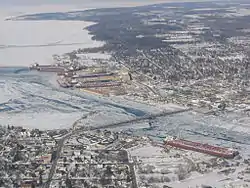 Aerial view of Sturgeon Bay. | |
| Nickname(s): Shipbuilding Capital of the Midwest | |
 Location of Sturgeon Bay in Door County, Wisconsin. | |
| Coordinates: 44°50′01″N 87°22′40″W | |
| Country | |
| State | |
| County | Door |
| Government | |
| • Mayor | David Ward |
| Area | |
| • Total | 11.49 sq mi (29.77 km2) |
| • Land | 9.83 sq mi (25.46 km2) |
| • Water | 1.66 sq mi (4.31 km2) |
| Population | |
| • Total | 9,144 |
| • Estimate (2019)[3] | 8,934 |
| • Density | 908.85/sq mi (350.92/km2) |
| Time zone | UTC−6 (Central (CST)) |
| • Summer (DST) | UTC−5 (CDT) |
| Zip Code | 54235 |
| Area code(s) | 920 |
| FIPS code | 55-77875 |
| Website | www.sturgeonbaywi.org |
History
The area was originally inhabited by the Ho-Chunk and Menominee. The town is known in the Menominee language as Namāēw-Wīhkit, or "bay of the sturgeon".[5] The Menominee ceded this territory to the United States in the 1836 Treaty of the Cedars following years of negotiations with the Ho-Chunk and the U.S. government over how to accommodate the incoming populations of Oneida, Stockbridge-Munsee, and Brothertown peoples who had been removed from New York.[6] After that, the area was available for white settlement. In 1874, Sturgeon Bay was incorporated as a village. It became a city in 1883. In 1891, Charles Mitchell Whiteside (1854–1924), member of the Wisconsin Assembly, sponsored a bill that merged the community of Sawyer with Sturgeon Bay.[7] The city is locally known for its Bridge, which at the time of its 1931 opening was both the second across the bay and to carry WIS 17 (now WIS 42 and WIS 57/78. Sturgeon Bay is one of several cities in the Midwest to assist during World War II.
Geography
At 584 feet (178 meters) above sea level, Sturgeon Bay is located at 44°49′56″N 87°22′19″W (44.813376, -87.372076).[8] According to the United States Census Bureau, the city has a total area of 11.66 square miles (30.20 km2), of which, 9.82 square miles (25.43 km2) is land and 1.84 square miles (4.77 km2) is water.[9]
Sturgeon Bay is at the natural end of Sturgeon Bay;[10] the Sturgeon Bay Ship Canal was built across the remainder of the Door Peninsula. It is one of several cities along the bay of Green Bay, including Green Bay, Marinette, and Escanaba, Michigan, and along Lake Michigan north of Manitowoc and south of Manistique, Michigan.
Distance
Sturgeon Bay is 38.4 miles north of Green Bay, 127 miles north of Milwaukee, 169 miles south of Houghton, Michigan, and 289 miles east of Minneapolis. Although Marinette is 21.9 miles away, people must physically travel towards the bottom of the bay by Green Bay and travel along or nearby the western shore of Green Bay.
Climate
Sturgeon Bay has a humid continental climate (Köppen: Dfb). The city experiences warm summers and cold snowy winters, with an average temperature ranging from 68.7 °F (20.4 °C) in the summer down to 18.0 °F (−7.8 °C) in the winter.
| Peninsular Agricultural Research Station north of Sturgeon Bay | ||||||||||||||||||||||||||||||||||||||||||||||||||||||||||||
|---|---|---|---|---|---|---|---|---|---|---|---|---|---|---|---|---|---|---|---|---|---|---|---|---|---|---|---|---|---|---|---|---|---|---|---|---|---|---|---|---|---|---|---|---|---|---|---|---|---|---|---|---|---|---|---|---|---|---|---|---|
| Climate chart (explanation) | ||||||||||||||||||||||||||||||||||||||||||||||||||||||||||||
| ||||||||||||||||||||||||||||||||||||||||||||||||||||||||||||
| ||||||||||||||||||||||||||||||||||||||||||||||||||||||||||||
| Climate data for Peninsular Agricultural Research Station north of Sturgeon Bay, 1981-2010 normals, extremes 1905-present | |||||||||||||
|---|---|---|---|---|---|---|---|---|---|---|---|---|---|
| Month | Jan | Feb | Mar | Apr | May | Jun | Jul | Aug | Sep | Oct | Nov | Dec | Year |
| Record high °F (°C) | 55 (13) |
58 (14) |
76 (24) |
85 (29) |
91 (33) |
100 (38) |
105 (41) |
102 (39) |
96 (36) |
86 (30) |
74 (23) |
60 (16) |
105 (41) |
| Mean maximum °F (°C) | 41.7 (5.4) |
44.8 (7.1) |
59.1 (15.1) |
72.6 (22.6) |
81.1 (27.3) |
87.5 (30.8) |
89.7 (32.1) |
89.0 (31.7) |
83.7 (28.7) |
73.3 (22.9) |
58.6 (14.8) |
44.9 (7.2) |
91.7 (33.2) |
| Average high °F (°C) | 25.7 (−3.5) |
29.0 (−1.7) |
38.6 (3.7) |
51.7 (10.9) |
63.6 (17.6) |
73.5 (23.1) |
78.7 (25.9) |
77.4 (25.2) |
69.5 (20.8) |
56.1 (13.4) |
42.7 (5.9) |
30.3 (−0.9) |
53.1 (11.7) |
| Daily mean °F (°C) | 18.0 (−7.8) |
20.7 (−6.3) |
30.3 (−0.9) |
42.4 (5.8) |
53.1 (11.7) |
63.2 (17.3) |
68.7 (20.4) |
67.8 (19.9) |
60.0 (15.6) |
47.7 (8.7) |
35.9 (2.2) |
23.6 (−4.7) |
44.3 (6.8) |
| Average low °F (°C) | 10.2 (−12.1) |
12.4 (−10.9) |
22.0 (−5.6) |
33.1 (0.6) |
42.6 (5.9) |
52.8 (11.6) |
58.6 (14.8) |
58.3 (14.6) |
50.6 (10.3) |
39.4 (4.1) |
29.0 (−1.7) |
17.0 (−8.3) |
35.5 (1.9) |
| Mean minimum °F (°C) | −8.9 (−22.7) |
−6.5 (−21.4) |
2.9 (−16.2) |
20.2 (−6.6) |
30.5 (−0.8) |
39.9 (4.4) |
46.4 (8.0) |
46.0 (7.8) |
35.9 (2.2) |
27.5 (−2.5) |
15.3 (−9.3) |
−1.3 (−18.5) |
−13.0 (−25.0) |
| Record low °F (°C) | −29 (−34) |
−29 (−34) |
−23 (−31) |
2 (−17) |
20 (−7) |
29 (−2) |
36 (2) |
32 (0) |
26 (−3) |
12 (−11) |
−6 (−21) |
−22 (−30) |
−29 (−34) |
| Average precipitation inches (mm) | 1.65 (42) |
1.25 (32) |
1.94 (49) |
2.75 (70) |
3.14 (80) |
3.64 (92) |
3.38 (86) |
3.47 (88) |
3.36 (85) |
3.05 (77) |
2.49 (63) |
1.82 (46) |
31.94 (811) |
| Average snowfall inches (cm) | 14.6 (37) |
10.6 (27) |
7.3 (19) |
2.4 (6.1) |
0.0 (0.0) |
0.0 (0.0) |
0.0 (0.0) |
0.0 (0.0) |
0.0 (0.0) |
0.1 (0.25) |
2.6 (6.6) |
13.1 (33) |
50.7 (129) |
| Average precipitation days (≥ 0.01 in) | 10.9 | 8.2 | 8.8 | 10.1 | 11.4 | 10.6 | 11.0 | 10.2 | 10.7 | 11.4 | 10.0 | 10.5 | 123.8 |
| Average snowy days (≥ 0.1 in) | 7.2 | 5.3 | 3.7 | 1.3 | 0.0 | 0.0 | 0.0 | 0.0 | 0.0 | 0.1 | 1.8 | 6.0 | 25.4 |
| Source: NOAA[11][12] | |||||||||||||
Demographics
| Historical population | |||
|---|---|---|---|
| Census | Pop. | %± | |
| 1880 | 1,199 | — | |
| 1890 | 2,195 | 83.1% | |
| 1900 | 3,372 | 53.6% | |
| 1910 | 4,262 | 26.4% | |
| 1920 | 4,553 | 6.8% | |
| 1930 | 4,983 | 9.4% | |
| 1940 | 5,439 | 9.2% | |
| 1950 | 7,054 | 29.7% | |
| 1960 | 7,353 | 4.2% | |
| 1970 | 6,776 | −7.8% | |
| 1980 | 8,847 | 30.6% | |
| 1990 | 9,176 | 3.7% | |
| 2000 | 9,437 | 2.8% | |
| 2010 | 9,144 | −3.1% | |
| 2019 (est.) | 8,934 | [3] | −2.3% |
| U.S. Decennial Census[13] | |||
2010 census
As of the census[2] of 2010, there were 9,144 people, 4,288 households and 2,385 families. The population density was 931.2 inhabitants per square mile (359.5/km2). There were 4,903 housing units at an average density of 499.3 per square mile (192.8/km2). The racial makeup of the city was 95.1% White, 1.0% African American, 0.9% Native American, 0.6% Asian, 1.0% from other races, and 1.4% from two or more races. Hispanic or Latino of any race were 2.7% of the population.
There were 4,288 households, of which 24.3% had children under the age of 18 living with them, 42.5% were married couples living together, 9.7% had a female householder with no husband present, 3.5% had a male householder with no wife present, and 44.4% were non-families. 38.9% of all households were made up of individuals, and 17.5% had someone living alone who was 65 years of age or older. The average household size was 2.07 and the average family size was 2.74.
The median age in the city was 45.2 years. 19.8% of residents were under the age of 18; 7.4% were between the ages of 18 and 24; 22.5% were from 25 to 44; 31% were from 45 to 64; and 19.2% were 65 years of age or older. The gender makeup of the city was 48.1% male and 51.9% female.
2000 census
As of the census[14] of 2000, there were 9,437 people, 4,048 households, and 2,432 families residing in the city. The population density was 981.4 people per square mile (378.8/km2). There were 4,447 housing units at an average density of 462.5 per square mile (178.5/km2). The racial makeup of the city was 97.22% White, 0.33% Black or African American, 0.78% Native American, 0.37% Asian, 0.02% Pacific Islander, 0.46% from other races, and 0.82% from two or more races. 1.28% of the population were Hispanic or Latino of any race.
There were 4,048 households, of which 28.7% had children under the age of 18 living with them, 42.81% were married couples living together, 9.0% had a female householder with no husband present, and 39.9% were non-families. 35.0% of all households were made up of individuals, and 15.8% had someone living alone who was 65 years of age or older. The average household size was 2.26 and the average family size was 2.92.

In the city, the population was spread out, with 23.5% under the age of 18, 7.6% from 18 to 24, 26.6% from 25 to 44, 23.7% from 45 to 64, and 18.7% who were 65 years of age or older. The median age was 40 years. For every 100 females, there were 92.4 males. For every 100 females age 18 and over, there were 88.0 males.
The median income for a household in the city was $31,935, and the median income for a family was $45,084. Males had a median income of $31,879 versus $21,414 for females. The per capita income for the city was $18,899. About 5.5% of families and 7.7% of the population were below the poverty line, including 11.2% of those under age 18 and 8.3% of those age 65 or over.
Municipal services
- Police — 12 patrol officers, 4 sergeants, and nine cars with a supporting staff of five.
- Fire — 14 full-time, 15 part-time firefighters and 11 vehicles operating out of two stations.
Transportation
Major highways
 WIS 42 Northbound travels to Egg Harbor, Fish Creek, Sister Bay, Ellison Bay and Gills Rock. South it travels to Algoma, Kewaunee, Two Rivers, and Manitowoc, where it connects to I-43.
 WIS 57 southbound connects to Green Bay and connects with Baileys Harbor and Jacksonport northbound.
- CTH-S
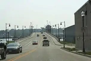
Bridges Across the bay
- Ahnapee & Western Railroad Bridge (built 1887, rebuilt in 1894 to accommodate railroad traffic, demolished entirely by 1970)
- Michigan Street Bridge (built 1929-31)
- Oregon Street Bridge (built 2006-08)
- Bay View Bridge (built 1976-78)
Airport
Sturgeon Bay is served by Door County Cherryland Airport (IATA: SUE, ICAO: KSUE), which is off of Wisconsin Highway 42 and 57 on County Highway PD.
Education
The community is served by Sturgeon Bay High School and has a satellite campus of Northeast Wisconsin Technical College.
Sturgeon Bay also has three elementary schools, Sawyer, Sunrise, and Sunset. The middle school, T.J. Walker Middle School, is connected to the high school. St. Peter's Lutheran School is a Pre-K to 8th grade school of the Wisconsin Evangelical Lutheran Synod.[15] Three former schools, Saint Peter and Paul, Corpus Christi, and Saint Joseph, have combined to form Saint John Bosco. The Door County Charter School was in operation from 2002 to 2005.[16]
In 2000–2019 public school statistics, high school enrollment declined 21.0%, middle school enrollment 27.1%, and elementary school enrollment 13.7%.[17]
Media
Sturgeon Bay was home to the Door County Advocate (now a subsidiary of Green Bay Press-Gazette) and numerous radio stations in the Door County Radio Market. No television stations originate from Sturgeon Bay, and WFRV's and WLUK's remote-operated weather cameras are the only full-time presence of Green Bay stations in the city.
Entertainment
The community has one movie theater, Sturgeon Bay Cinema 6, and a professional regional theatre, the Third Avenue Playhouse. Every year the town hosts Steel Bridge Songfest, where nationally known musicians perform. Past performers include Jackson Browne, Jane Wiedlin of the Go-Gos and Pat MacDonald of Timbuk3.
Notable people
- Gideon Winans Allen, Wisconsin State Representative
- Robert C. Bassett, U.S. presidential advisor[18]
- Eddie Cochems (1877-1953), "Father of the Forward Pass" [19]
- Frank N. Graass, Wisconsin State Representative
- Chris Greisen, Milwaukee Iron quarterback (AFL)
- Nick Greisen, Denver Broncos linebacker (NFL)
- Stuart Hagmann, film and television director
- Bernard Hahn, Wisconsin State Representative
- Arthur G. Hansen (1925-2010), engineer, former president of Georgia Institute of Technology (1969–71) and Purdue University (1971-82), and chancellor of the Texas A&M University System (1982–85).
- Joseph Harris, Wisconsin State Senator
- Lawrence Johnson, Wisconsin State Representative
- Al C. Kalmbach, founder of Kalmbach Publishing
- Doug Larson, newspaper columnist and writer
- Pat MacDonald, solo troubadour of stomp musician & former member of Timbuk 3
- Edward S. Minor, U.S. Representative
- Conrad P. Olson, Oregon Supreme Court justice
- Henry J. Overbeck, Wisconsin State Representative[20][21]
- Casey Rabach, Washington Redskins center (NFL)
- Dennis A. Reed, Wisconsin State Representative
- Hallie H. Rowe, Wisconsin State Representative
- Paul J. Schlise, U.S. Navy admiral
- Alexander B. Whitman, Wisconsin State Senator
- Jarvis T. Wright, Wisconsin State Representative
- Randy Wright, Green Bay Packers quarterback (NFL)
Images
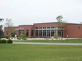 Sturgeon Bay NWTC campus
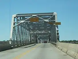
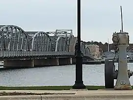
 Oregon Street Bridge
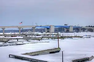 Bayview bridge, as seen from the marina
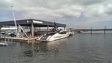 CenterPointe Yacht Services; Maple-Oregon Street Bridge in the background
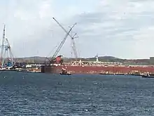
.jpg.webp) Blue gantry crane
Blue gantry crane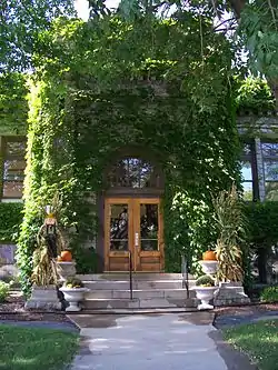 Former Carnegie Free Library
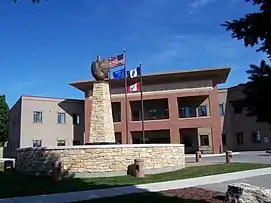 City hall
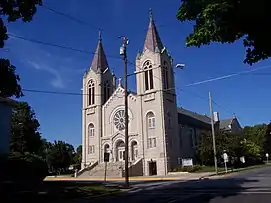 St. Joseph's Catholic Church, part of the Louisiana Street/Seventh Avenue Historic District
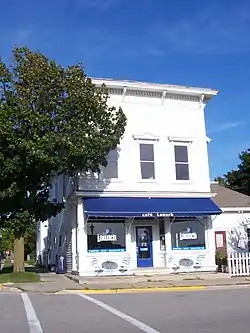 The former L. A. Larson & Co. Store
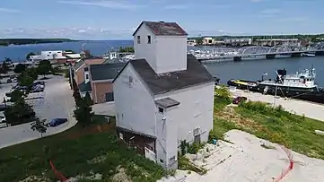
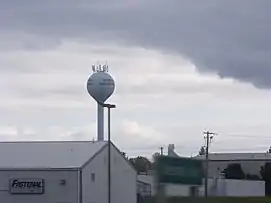 Sturgeon Bay Industrial Park and Water Tower #4
.jpg.webp) Interior of the Hotel Carmen, printed between c.1930–c.1945
Interior of the Hotel Carmen, printed between c.1930–c.1945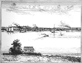 Sturgeon Bay, 1881
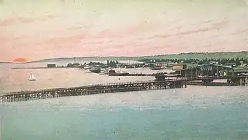 Aerial view of Sturgeon Bay, from a postcard published 1908 or earlier
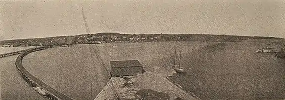 Sturgeon Bay, from a postcard published 1907 or earlier
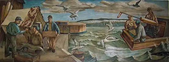 Mural in the Post Office
References
- "2019 U.S. Gazetteer Files". United States Census Bureau. Retrieved August 7, 2020.
- "U.S. Census website". United States Census Bureau. Retrieved 2012-11-18.
- "Population and Housing Unit Estimates". United States Census Bureau. May 24, 2020. Retrieved May 27, 2020.
- "Find a County". National Association of Counties. Retrieved 2011-06-07.
- Hoffman, Mike. "Menominee Place Names in Wisconsin". The Menominee Clans Story. Retrieved 2018-10-05.
- "Menominee Treaties and Treaty Rights". Indian Country Wisconsin. Retrieved 2018-10-05.
- Man Who Wed Sawyer and Sturgeon Bay Dies, Door County Advocate, August 1, 1924, pg. 1
- "US Gazetteer files: 2010, 2000, and 1990". United States Census Bureau. 2011-02-12. Retrieved 2011-04-23.
- "US Gazetteer files 2010". United States Census Bureau. Archived from the original on 2012-01-25. Retrieved 2012-11-18.
- Map of the City of Sturgeon Bay, Door County Land Use Services Dept, August 28, 2019
- "National Weather Service Climate". National Oceanic and Atmospheric Administration. Retrieved 2013-05-04.
- "WMO Climate Normals for Sturgeon Bay Exp Farm". National Oceanic and Atmospheric Administration. Retrieved November 18, 2017.
- "Census of Population and Housing". Census.gov. Retrieved June 4, 2015.
- "U.S. Census website". United States Census Bureau. Retrieved 2008-01-31.
- "St. Peters Lutheran School".
- Closed charters by state, The Center for Education Reform, February 2009, page 61
- 2000-2019 enrollment figures come from the Wisconsin DPI Program Statistics Archives, Wisconsin School Free/Reduced Eligibility Data and the Wisconsin DPI School Nutrition Program Statistics reports for school level enrollment and participation data.
- Arlington National Cemetery. Robert C. Bassett. "Bassett, who was born in Sturgeon Bay on March 2, 1911"
- https://doorcountypulse.com/footballs-father-of-the-forward-pass-born-in-sturgeon-bay/
- Wm. H. Froehlich (comp.). The Blue Book of the State of Wisconsin. 1901, p. 746. "Henry Overbeck, Jr. (Rep.). of Sturgeon Bay"
- "Henry Overbeck of Sturgeon Bay Dead, Milwaukee". The Manitowoc Herald-News, March 5, 1921, p. 1.
External links
- City of Sturgeon Bay
- Sturgeon Bay Visitor Center
- Live webcam of Michigan Street Bridge
- Sanborn fire insurance maps: 1885 1891 1898 1904 1911 1919
| Wikimedia Commons has media related to Sturgeon Bay, Wisconsin. |
Control Cities adjacent to Sturgeon Bay | ||||||||||
|---|---|---|---|---|---|---|---|---|---|---|
| ||||||||||
Municipalities and communities of Door County, Wisconsin, United States | ||
|---|---|---|
| City |
|  Towns in 1915; the borders remain the same today except for annexations by the City of Sturgeon Bay and the four villages. |
| Villages | ||
| Towns | ||
| CDPs | ||
| Unincorporated communities | ||
| Footnote | ‡Partially located in Kewaunee County | |
| ||
| Authority control |
|---|