Dunmore, Falkirk
Dunmore is a small village in the Falkirk council area of Scotland. It lies 6.5 miles (10.5 km) south east of Stirling and 5.5 miles (8.9 km) north of Falkirk. The village lies along the A905 road between Throsk and Airth on the banks of the River Forth.
Dunmore
| |
|---|---|
 The village green at Dunmore | |
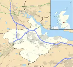 Dunmore Location within the Falkirk council area | |
| Population | 70 (2001 census) |
| OS grid reference | NS891893 |
| • Edinburgh | 24.8 mi (39.9 km) SE |
| • London | 350 mi (560 km) SSE |
| Civil parish | |
| Council area | |
| Lieutenancy area | |
| Country | Scotland |
| Sovereign state | United Kingdom |
| Post town | FALKIRK |
| Postcode district | FK2 |
| Dialling code | 01324 |
| Police | Scotland |
| Fire | Scottish |
| Ambulance | Scottish |
| UK Parliament | |
| Scottish Parliament | |
| Website | falkirk.gov.uk dunmorevillage.co.uk |
The population of Dunmore was recorded as 70 in the United Kingdom Census 2001, and as 79 in the census of 1991.[1]
Formerly known as Elphinstone Pans, the settlement was entirely remodelled as a planned village in the 1840s by the local landowner, the Countess of Dunmore.[2] Dunmore is a conservation area.
Landmarks
The Dunmore Pineapple, an 18th-century folly owned by the National Trust for Scotland, lies south of Dunmore, on the estate of the now-derelict Dunmore House.
Notable people
- Dr L. W. Hinxman FRSE (1855-1936) a geologist and son of the local minister, Rev Charles Hinxman, was born and raised in Dunmore.[3]
References
- "Insight 2001 Census, No. 3 - 2001 Census population of wards and settlements" (PDF). Falkirk Council. 2003. Archived from the original (PDF) on 3 June 2011. Retrieved 9 December 2009.
- Scott, Ian. "Dunmore near Airth". Falkirk Herald.
- Biographical Index of Former Fellows of the Royal Society of Edinburgh 1783–2002 (PDF). The Royal Society of Edinburgh. July 2006. ISBN 0 902 198 84 X.
This article is issued from Wikipedia. The text is licensed under Creative Commons - Attribution - Sharealike. Additional terms may apply for the media files.