Ouargla
Ouargla (ورقلة) is the capital city of Ouargla Province in the Sahara Desert in southern Algeria. It has a flourishing petroleum industry and hosts one of Algeria's universities, the University of Ouargla.[2] The commune of Ouargla had a population of 133,024 in the 2008 census,[1] up from 112,339 in 1998,[3] and an annual population growth rate of 1.7%.[1] However, including the commune of Rouissat, found in Ouargla's urban area, gives a total population of 191,136.[1]
Ouargla
ورقلة (Arabic) | |
|---|---|
 The Ouargla tramway | |
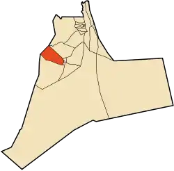 Location of Ouargla commune within Ouargla Province | |
 Ouargla Location of Ouargla within Algeria | |
| Coordinates: 31°57′N 5°19′E | |
| Country | |
| Province | Ouargla Province |
| District | Ouargla District |
| Elevation | 219 m (719 ft) |
| Population (2008)[1] | |
| • City | 133,024 |
| • Urban | 191,136 |
| Time zone | UTC+1 (CET) |
| Postal code | 30000 |
Historical Ouargla
According to Ibn Khaldun the town was founded by Banu Wargla who, accompanied by sections of the Maghrawa and Banu Ifran, left the Tlemcen region and founded Ouargla. These Berbers of Ouarghla then embraced Ibadi doctrines, which later made the town an attractive refuge for the citizens of Tahert.
In the 11th century, Banu Hilal, an Arab tribe living between Nile and Red Sea, settled in Tunisia, Tripolitania (western Libya) and Constantinois (eastern Algeria) which was Ouargla party.
In the 19th century, the town was known for being on a caravan route to the south, and a starting point for exploring the southern Sahara.[4]
Modern Ouargla
The city was a significant tourist attraction until the civil unrest of the 1990s. Many tourists shopped for sand roses at the souk l'ehjar, the old rock market. The souq, or market, had many traditional shops filled with antiquities, traditional crafts, and local items - from dresses to stuffed lizards. The area across from these shops was used to display sand roses, mineral specimens, of all sizes and shapes. The market has gone through a renovation process.
Not far from the souk l'ehjar is the old groceries market, or the Sunday market as it is called by the locals. It too is located in the centre of the old city, La Kasbah. At its centre the original old market is shaped as a circle split into small arcs. The central circular structure is now a meat market, surrounded by rows of grocers' and farmers' stalls displaying all sorts of fruit and vegetables.
Next to the old groceries market lie the two oldest mosques of the city, "al-Masjid al-Atiq" which literally means "the old mosque," and the old Ibadhi mosque, home to one of the most renowned Islamic scholars of the city, Taleb et-Tayeb.
Some of Ouargla's population speak the Wargli language, which is part of the Zenati languages subgrouping of the Northern Berber languages.[5] There are Wargli speakers in N'Goussa as well.
Climate
Ouargla has a desert climate ( Koppën Classification BWh ) typical of the Sahara Desert in which it is located. The city has very long and extremely hot summers and short and pleasant winters. The average temperatures of the city are the highest of the big cities of Algeria of which Ouargla is part of it. The temperature of July, which is the hottest month, is around 110 °F (43 °C). The heat becomes persistent and unpleasant in summer with temperatures sometimes exceeding 120 °F (49 °C). On average, the city of Ouargla has a temperature equal to or greater than 95 °F (35 °C) for more than 135 days and 100 °F (40 °C) for more than 83 days. The year with the most days with a temperature equal to or greater than 100 °F (40 °C) was in 2014 with 99 days, while the lowest total was 39 days in 1981. By comparison, the city of Carpentras in France had a total of 16 days since 1963 when the temperature was equivalent or above 100 °F (40 °C). The highest minimum temperature recorded at Ouargla was 36.6 °C on July 31, 2005. The highest temperature was recorded on August 13, 1984 at 53.5 °C.

The climate is particularly arid and not very rainy with clear skies most of the time. The rainfall recorded in the city of Ouargla is limited to only 55 mm per year in average. The most rainy year lived in Ouargla was that of 1903 with 135 mm. The most arid year was that of 1929 with 0 mm. Precipitation is quite scarce most of the year in Ouargla and occurs at every opportunity in a small quantity quickly evaporated by the heat of the sun which quickly regains the upper hand. The year of 1903, which was the rainiest in Ouargla, still had 9 constant months with a rainfall of 0 mm, from February to October. January is the rainiest month with 12.4 mm. August is the driest with 0.3 mm.
The hot, dry and sunny climate can make this beautiful city very interesting during the winter, compared to the icy winters that the north of the country can experience.
On average, Ouargla rarely sees days with a minimum temperature below zero. However, if one moves away from the urban area of Ouargla, the gel is much more frequent in the periphery of the city. The record for the number of days below zero was in 1983 with 7 days during the month of January and 7 days during the month of December for a total of 14 days. The city sees an average of 5 days below zero per year. The winter with the most frost in Ouargla was from 1999 to 2000 with a total of 55 days. Snow is very rare in Ouargla, and only occurs in exceptional cases and in a small quantity. The lowest temperature recorded at Ouargla is -3.7 °C on January 16, 2001, while the lowest maximum temperature is 8 °C on January 27, 2005.
| Climate data for Ouargla (1981-2010, extremes 1963–present) | |||||||||||||
|---|---|---|---|---|---|---|---|---|---|---|---|---|---|
| Month | Jan | Feb | Mar | Apr | May | Jun | Jul | Aug | Sep | Oct | Nov | Dec | Year |
| Record high °C (°F) | 28.3 (82.9) |
37.2 (99.0) |
40.0 (104.0) |
41.3 (106.3) |
46.2 (115.2) |
49.0 (120.2) |
51.3 (124.3) |
53.5 (128.3) |
47.7 (117.9) |
42.3 (108.1) |
38.9 (102.0) |
31.4 (88.5) |
53.5 (128.3) |
| Average high °C (°F) | 18.1 (64.6) |
20.9 (69.6) |
26.0 (78.8) |
30.0 (86.0) |
34.9 (94.8) |
40.3 (104.5) |
43.3 (109.9) |
42.5 (108.5) |
37.3 (99.1) |
31.4 (88.5) |
23.7 (74.7) |
19.2 (66.6) |
30.8 (87.4) |
| Daily mean °C (°F) | 11.3 (52.3) |
13.6 (56.5) |
18.0 (64.4) |
22.3 (72.1) |
27.4 (81.3) |
32.5 (90.5) |
35.5 (95.9) |
34.9 (94.8) |
30.1 (86.2) |
24.3 (75.7) |
16.8 (62.2) |
12.4 (54.3) |
23.5 (74.3) |
| Average low °C (°F) | 4.7 (40.5) |
6.8 (44.2) |
10.8 (51.4) |
15.1 (59.2) |
19.8 (67.6) |
24.7 (76.5) |
27.7 (81.9) |
27.3 (81.1) |
23.2 (73.8) |
17.2 (63.0) |
10.0 (50.0) |
6.0 (42.8) |
16.3 (61.3) |
| Record low °C (°F) | −3.7 (25.3) |
−2.0 (28.4) |
0 (32) |
3.0 (37.4) |
8.9 (48.0) |
14.8 (58.6) |
17.0 (62.6) |
18.0 (64.4) |
13.0 (55.4) |
5.0 (41.0) |
1.0 (33.8) |
−0.2 (31.6) |
−3.7 (25.3) |
| Average precipitation mm (inches) | 12.4 (0.49) |
1.0 (0.04) |
5.0 (0.20) |
1.8 (0.07) |
11.6 (0.46) |
4.1 (0.16) |
0.5 (0.02) |
0.5 (0.02) |
5.5 (0.22) |
4.4 (0.17) |
8.8 (0.35) |
2.8 (0.11) |
55.9 (2.20) |
| Average precipitation days (≥ 0.1 mm) | 2.1 | 0.4 | 1.1 | 1.2 | 0.4 | 0.8 | 0.6 | 0.6 | 1.7 | 1.7 | 1.3 | 1.0 | 13.22 |
| Source 1: World Meteorological Organization (average temperatures) (precipitation, 1976–2005)[6][7] | |||||||||||||
| Source 2: Arab Meteorology Book (humidity and sun),[8] Meteo Climat (record highs and lows)[9] | |||||||||||||
Music
Peter Chatman, known as Memphis Slim, a piano blues musician, composed and performed a boogie-woogie instrumental tune named "Ouargla" in 1971. He was accompanied by Michel Denis on drums. The piece pays tribute to the Ouargla oasis, which was a famous and popular hangout in the late 1960s and early 1970s.
Localities
The commune is composed of 15 localities:[10]
- Mekhadma
- Beni Thour
- Ville de Ouargla
- Saïd Otba Est
- Saïd Otba Ouest
- Ba Mendil
- Bouameur
- Bour El Haïcha
- Sidi Amrane
- Gharbouz
- Sidi Boughoufala
- Melala Ksar
- Hassi Miloud
- Zone d'Activité
- Delalha (Sidi Amrane)
References
- "Population: Ouargla Wilaya" (PDF) (in French). Office National des Statistiques Algérie. Retrieved 24 February 2013.
- "Université Kasdi Merbah Ouargla - Accueil". www.univ-ouargla.dz.
- "Algeria Communes". Statoids. Retrieved 8 March 2013.
- Chisholm, Hugh, ed. (1911). . Encyclopædia Britannica. 28 (11th ed.). Cambridge University Press. p. 325.
- "Tagargrent". Ethnologue. Retrieved 2 March 2013.
- "World Weather Information Service–Ouargla". World Meteorological Organization.
- "Climate Normals for Ouargla".
- "Appendix I: Meteorological Data" (PDF). Springer. Archived from the original (PDF) on 4 March 2016. Retrieved 17 October 2016.
- "Station Ouargla" (in French). Meteo Climat. Retrieved 17 October 2016.
- "Décret n° 84-365, fixant la composition, la consistance et les limites territoriale des communes. Wilaya d'El Oued" (PDF) (in French). Journal officiel de la République Algérienne. 19 December 1984. p. 1550. Archived from the original (PDF) on 27 September 2012. Retrieved 2 March 2013.
External links
Places adjacent to Ouargla | |
|---|---|
Capital: Ouargla | ||
| Ouargla District | .svg.png.webp) | |
| El Borma District | ||
| El Hadjira District | ||
| Hassi Messaoud District | ||
| Mégarine District | ||
| N'Goussa District | ||
| Sidi Khouïled District | ||
| Taïbet District | ||
| Témacine District | ||
| Touggourt District | ||