Elko New Market, Minnesota
Elko New Market is a city in Scott County in the State of Minnesota resulting from a merger of bordering cities Elko and New Market in 2006. The population was 4,110 at the 2010 census.[5]
Elko New Market | |
|---|---|
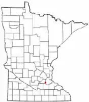 Location of the city of Elko New Market within Scott County, Minnesota | |
| Coordinates: 44°46′04″N 93°16′39″W | |
| Country | United States |
| State | Minnesota |
| County | Scott |
| Founded | 1856 (NM) |
| Established | 1858 (NM) |
| Merged | 2006 |
| Government | |
| • Type | Mayor-council government - Executive form |
| Area | |
| • City | 3.48 sq mi (9.02 km2) |
| • Land | 3.48 sq mi (9.02 km2) |
| • Water | 0.00 sq mi (0.00 km2) |
| Elevation | 971 ft (296 m) |
| Population | |
| • City | 4,110 |
| • Estimate (2019)[3] | 4,774 |
| • Density | 1,370.66/sq mi (529.14/km2) |
| • Metro | 3,279,833 |
| Time zone | UTC-6 (CST) |
| • Summer (DST) | UTC-5 (CDT) |
| Area code(s) | 952 |
| FIPS code | 27-18662 |
| GNIS feature ID | [4] |
| Website | City website |
Served by Interstate 35 and Scott County Road 2, the city contains one public school Eagle View Elementary, and is primarily known for Elko Speedway. The New Market Hotel and Store is on the National Register of Historic Places. The city contains a marker for the Big Woods of south–central Minnesota.[6]
Elko was initially a railway village in 1858. New Market was named for the town near Cambridge, England though it was first named Jackson until its establishment about the same time.[7] Both Elko and New Market were common town names of the era according to the Minnesota Historical Society.
History
On March 21, 2006, both the cities of Elko and New Market passed a referendum to merge. The new city was named Elko New Market with the merger taking effect on January 1, 2007.
Geography
Located midway between the cities of Minneapolis and Faribault along Interstate 35, Elko New Market is in the southern exurban belt of the Minneapolis – Saint Paul area. Burnsville and Lakeville are near Elko New Market.
According to the United States Census Bureau, the city has a total area of 3.36 square miles (8.70 km2), all of it land.[8]
Climate
The climate of Elko New Market is classified as warm-summer humid continental with features of a hot-summer humid continental (Köppen Dfa).
| Climate data for Elko New Market (Lakeville weather station) - 2010-2020 | |||||||||||||
|---|---|---|---|---|---|---|---|---|---|---|---|---|---|
| Month | Jan | Feb | Mar | Apr | May | Jun | Jul | Aug | Sep | Oct | Nov | Dec | Year |
| Average high °F (°C) | 22.6 (−5.2) |
26.4 (−3.1) |
42.4 (5.8) |
55.0 (12.8) |
68.7 (20.4) |
78.3 (25.7) |
82.8 (28.2) |
80.4 (26.9) |
72.1 (22.3) |
57.2 (14.0) |
41.9 (5.5) |
27.1 (−2.7) |
54.5 (12.5) |
| Daily mean °F (°C) | 16.5 (−8.6) |
19.4 (−7.0) |
34.9 (1.6) |
46.2 (7.9) |
59.2 (15.1) |
68.9 (20.5) |
73.2 (22.9) |
70.9 (21.6) |
63.5 (17.5) |
49.6 (9.8) |
36.1 (2.3) |
22.5 (−5.3) |
46.7 (8.2) |
| Average low °F (°C) | 10.4 (−12.0) |
12.2 (−11.0) |
26.8 (−2.9) |
37.4 (3.0) |
49.5 (9.7) |
59.9 (15.5) |
63.9 (17.7) |
61.3 (16.3) |
55.2 (12.9) |
41.9 (5.5) |
29.5 (−1.4) |
18.1 (−7.7) |
38.8 (3.8) |
| Source: weather-online[9] | |||||||||||||
Demographics
| Historical population | |||
|---|---|---|---|
| Census | Pop. | %± | |
| 2000 | 3,972 | — | |
| 2010 | 4,110 | 3.5% | |
| 2019 (est.) | 4,774 | [3] | 16.2% |
| U.S. Decennial Census[10] 2013 Estimate[11] | |||
2010 census
As of the census[2] of 2010, there were 4,110 people, 1,259 households, and 1,064 families residing in the city. The population density was 1,223.2 inhabitants per square mile (472.3/km2). There were 1,328 housing units at an average density of 395.2 per square mile (152.6/km2). The racial makeup of the city was 92.5% White, 1.6% African American, 0.3% Native American, 3.1% Asian, 0.2% from other races, and 2.2% from two or more races. Hispanic or Latino of any race were 2.3% of the population.
There were 1,259 households, of which 60.4% had children under the age of 18 living with them, 73.9% were married couples living together, 6.3% had a female householder with no husband present, 4.3% had a male householder with no wife present, and 15.5% were non-families. 9.5% of all households were made up of individuals, and 0.9% had someone living alone who was 65 years of age or older. The average household size was 3.26 and the average family size was 3.53.
The median age in the city was 30.4 years. 38% of residents were under the age of 18; 4.6% were between the ages of 18 and 24; 39.5% were from 25 to 44; 15.1% were from 45 to 64; and 2.7% were 65 years of age or older. The gender makeup of the city was 50.9% male and 49.1% female.
Education
Sports Venues
References
- "2019 U.S. Gazetteer Files". United States Census Bureau. Retrieved July 26, 2020.
- "U.S. Census website". United States Census Bureau. Retrieved 2012-11-13.
- "Population and Housing Unit Estimates". United States Census Bureau. May 24, 2020. Retrieved May 27, 2020.
- "US Board on Geographic Names". United States Geological Survey. 2007-10-25. Retrieved 2008-01-31.
- "2010 Census Redistricting Data (Public Law 94-171) Summary File". American FactFinder. United States Census Bureau. Retrieved 27 April 2011.
- Sarah P. Rubinstein (2003). Minnesota History Along the Highways: A Guide to Historic Markers and Sites. Minnesota Historical Society Press. ISBN 9780873514569.
- Minnesota Historical Society (1920). Collections of the Minnesota Historical Society. MN Historical Society.
- "US Gazetteer files 2010". United States Census Bureau. Archived from the original on 2012-01-24. Retrieved 2012-11-13.
- . weather-online https://www.weatheronline.co.uk/weather/maps/city?FMM=1&FYY=2010&LMM=1&LYY=2020&WMO=x1358&CONT=namk®ION=0018&LAND=MN&ART=TMX&R=0&NOREGION=1&LEVEL=162&LANG=en&MOD=tab. Retrieved January 5, 2020. Missing or empty
|title=(help) - United States Census Bureau. "Census of Population and Housing". Retrieved February 12, 2014.
- "Population Estimates". United States Census Bureau. Archived from the original on 2014-05-22. Retrieved 2014-07-19.
External links
Municipalities and communities of Scott County, Minnesota, United States | ||
|---|---|---|
| Cities |
| 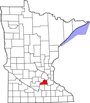 Map of Minnesota highlighting Scott County |
| Townships | ||
| Unincorporated communities | ||
| Ghost towns/Neighborhoods | ||
| Indian reservation | ||
| Footnotes | ‡This populated place also has portions in an adjacent county or counties | |
| ||
| Authority control |
|
|---|