Elma, Washington
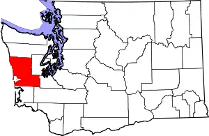
Elma is a city in Grays Harbor County, Washington, United States. The population was 3,107 at the 2010 census.
Elma, Washington | |
|---|---|
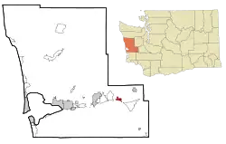
 Location of Elma, Washington | |
| Coordinates: 47°0′20″N 123°24′23″W | |
| Country | United States |
| State | Washington |
| County | Grays Harbor |
| Area | |
| • Total | 2.58 sq mi (6.69 km2) |
| • Land | 2.55 sq mi (6.60 km2) |
| • Water | 0.03 sq mi (0.08 km2) |
| Elevation | 49 ft (15 m) |
| Population | |
| • Total | 3,107 |
| • Estimate (2019)[3] | 3,351 |
| • Density | 1,314.12/sq mi (507.40/km2) |
| Time zone | UTC-8 (Pacific (PST)) |
| • Summer (DST) | UTC-7 (PDT) |
| ZIP code | 98541 |
| Area code(s) | 360 |
| FIPS code | 53-21450 |
| GNIS feature ID | 1512188[4] |
| Website | cityofelma.com |
Geography
Elma is located at 47°0′20″N 123°24′23″W (47.005648, -123.406268).[5]
According to the United States Census Bureau, the city has a total area of 1.92 square miles (4.97 km2), of which, 1.89 square miles (4.90 km2) is land and 0.03 square miles (0.08 km2) is water.[6]
Climate
According to the Köppen Climate Classification system, Elma has a warm-summer Mediterranean climate, abbreviated "Csb" on climate maps. Summers are warm and dry, while winters are cool and very wet. Some form of precipitation occurs on half of all days on average.[7]
| Climate data for Elma | |||||||||||||
|---|---|---|---|---|---|---|---|---|---|---|---|---|---|
| Month | Jan | Feb | Mar | Apr | May | Jun | Jul | Aug | Sep | Oct | Nov | Dec | Year |
| Record high °F (°C) | 64 (18) |
73 (23) |
80 (27) |
89 (32) |
99 (37) |
101 (38) |
105 (41) |
103 (39) |
100 (38) |
91 (33) |
74 (23) |
66 (19) |
105 (41) |
| Average high °F (°C) | 46.4 (8.0) |
51 (11) |
54.9 (12.7) |
60.8 (16.0) |
67.2 (19.6) |
71.6 (22.0) |
76.9 (24.9) |
77.3 (25.2) |
73.4 (23.0) |
63.1 (17.3) |
52.2 (11.2) |
46.9 (8.3) |
61.8 (16.6) |
| Average low °F (°C) | 33.2 (0.7) |
34.3 (1.3) |
35.5 (1.9) |
38.4 (3.6) |
43 (6) |
47.5 (8.6) |
50.5 (10.3) |
50.7 (10.4) |
47 (8) |
41.6 (5.3) |
36.8 (2.7) |
34.3 (1.3) |
41.1 (5.1) |
| Record low °F (°C) | 0 (−18) |
4 (−16) |
15 (−9) |
22 (−6) |
25 (−4) |
31 (−1) |
37 (3) |
33 (1) |
28 (−2) |
15 (−9) |
4 (−16) |
2 (−17) |
0 (−18) |
| Average precipitation inches (mm) | 10.23 (260) |
7.7 (200) |
7.29 (185) |
4.8 (120) |
2.82 (72) |
2.17 (55) |
1.03 (26) |
1.46 (37) |
2.65 (67) |
6.37 (162) |
10.29 (261) |
10.74 (273) |
67.55 (1,716) |
| Average snowfall inches (cm) | 2.6 (6.6) |
1.1 (2.8) |
0.4 (1.0) |
0 (0) |
0 (0) |
0 (0) |
0 (0) |
0 (0) |
0 (0) |
0 (0) |
0.7 (1.8) |
1 (2.5) |
5.8 (15) |
| Average precipitation days (≥ 0.01 inch) | 21 | 18 | 20 | 17 | 13 | 11 | 6 | 7 | 10 | 16 | 21 | 22 | 182 |
| Source: [8] | |||||||||||||
History
First settled in 1853 by D.F. Byles, Elma was later named for Union soldier Elmer Brown.[9] The city of Elma was incorporated on March 22, 1888.[10]
Notable people
- Lloyd Jones was born in Elma. Jones was a businessman and served in the Alaska Senate.[11]
- Professional golfer Bud Ward was born in Elma. He won the U.S. Amateur Golf 1939 and 1941. He had 13 professional wins.[12]
Demographics
| Historical population | |||
|---|---|---|---|
| Census | Pop. | %± | |
| 1890 | 345 | — | |
| 1900 | 894 | 159.1% | |
| 1910 | 1,532 | 71.4% | |
| 1920 | 1,253 | −18.2% | |
| 1930 | 1,545 | 23.3% | |
| 1940 | 1,370 | −11.3% | |
| 1950 | 1,543 | 12.6% | |
| 1960 | 1,811 | 17.4% | |
| 1970 | 2,227 | 23.0% | |
| 1980 | 2,720 | 22.1% | |
| 1990 | 3,011 | 10.7% | |
| 2000 | 3,049 | 1.3% | |
| 2010 | 3,107 | 1.9% | |
| 2019 (est.) | 3,351 | [3] | 7.9% |
| U.S. Decennial Census[13] 2018 Estimate[14] | |||
2010 census
As of the census[2] of 2010, there were 3,107 people, 1,209 households, and 788 families living in the city. The population density was 1,643.9 inhabitants per square mile (634.7/km2). There were 1,307 housing units at an average density of 691.5 per square mile (267.0/km2). The racial makeup of the city was 85.8% White, 1.0% African American, 2.6% Native American, 2.1% Asian, 0.4% Pacific Islander, 3.2% from other races, and 4.9% from two or more races. Hispanic or Latino of any race were 6.6% of the population.
There were 1,209 households, of which 34.7% had children under the age of 18 living with them, 42.8% were married couples living together, 16.2% had a female householder with no husband present, 6.2% had a male householder with no wife present, and 34.8% were non-families. 27.7% of all households were made up of individuals, and 11.7% had someone living alone who was 65 years of age or older. The average household size was 2.53 and the average family size was 3.02.
The median age in the city was 36.1 years. 25.9% of residents were under the age of 18; 9.2% were between the ages of 18 and 24; 25.4% were from 25 to 44; 26.6% were from 45 to 64; and 12.9% were 65 years of age or older. The gender makeup of the city was 49.1% male and 50.9% female.
2000 census
As of the census of 2000, there were 3,049 people, 1,195 households, and 764 families living in the city. The population density was 1,812.6 people per square mile (700.7/km2). There were 1,330 housing units at an average density of 790.7 per square mile (305.7/km2). The racial makeup of the city was 90.98% White, 0.59% African American, 1.31% Native American, 1.28% Asian, 0.26% Pacific Islander, 1.64% from other races, and 3.94% from two or more races. Hispanic or Latino of any race were 3.64% of the population.
There were 1,195 households, out of which 35.5% had children under the age of 18 living with them, 44.9% were married couples living together, 13.6% had a female householder with no husband present, and 36.0% were non-families. 27.5% of all households were made up of individuals, and 12.3% had someone living alone who was 65 years of age or older. The average household size was 2.51 and the average family size was 3.06.
In the city, the population was spread out, with 29.2% under the age of 18, 9.1% from 18 to 24, 28.1% from 25 to 44, 19.3% from 45 to 64, and 14.4% who were 65 years of age or older. The median age was 34 years. For every 100 females, there were 97.2 males. For every 100 females age 18 and over, there were 92.2 males.
The median income for a household in the city was $32,031, and the median income for a family was $36,638. Males had a median income of $38,929 versus $23,125 for females. The per capita income for the city was $13,629. About 13.9% of families and 19.4% of the population were below the poverty line, including 22.5% of those under age 18 and 12.7% of those age 65 or over.
Education
The Elma School District has four schools. Elma Elementary School serves children in an Early Childhood Program, as well as kindergarten through 5th grade. Elma Middle School consists of 6th grade through 8th grade students; Elma High School houses 9th through 12th grade, and the East Grays Harbor High School provides alternative education. The mascot for Elma High School and Middle School is an eagle. Their colors are blue and white. The mascot for East Grays Harbor High School is a Gryphon. Their colors are Black and Turquoise.
Elma High School also participates in the Running Start program, which gives grade 11, and 12 students the opportunity to take college level classes for college credit via Grays Harbor College (Aberdeen, WA), and Washington State University (Pullman, WA).
In terms of early childhood development programs, there are several daycares, a co-op preschool, and a Head Start facility.
References
- "2019 U.S. Gazetteer Files". United States Census Bureau. Retrieved August 7, 2020.
- "U.S. Census website". United States Census Bureau. Retrieved December 19, 2012.
- "Annual Estimates of the Resident Population for Incorporated Places in Washington: April 1, 2010 to July 1, 2019". United States Census Bureau. May 2020. Retrieved May 27, 2020.
- "Elma". Geographic Names Information System. United States Geological Survey.
- "US Gazetteer files: 2010, 2000, and 1990". United States Census Bureau. February 12, 2011. Retrieved April 23, 2011.
- "US Gazetteer files 2010". United States Census Bureau. Archived from the original on January 12, 2012. Retrieved December 19, 2012.
- Climate Summary for Elma, Washington
- "ELMA, WASHINGTON (452531)". Western Regional Climate Center. Retrieved November 15, 2015.
- Majors, Harry M. (1975). Exploring Washington. Van Winkle Publishing Co. p. 68. ISBN 978-0-918664-00-6.
- "City of Elma, WA".
- Alaska Legislature-LLoyd Jones
- Golf Legend. Archived from the original on 2012-03-11. Retrieved 2012-03-08.
- "U.S. Decennial Census". Census.gov. Retrieved June 6, 2013.
- "Population Estimates". United States Census Bureau. Retrieved June 15, 2019.
External links
| Wikimedia Commons has media related to Elma, Washington. |

