Qui-nai-elt Village, Washington
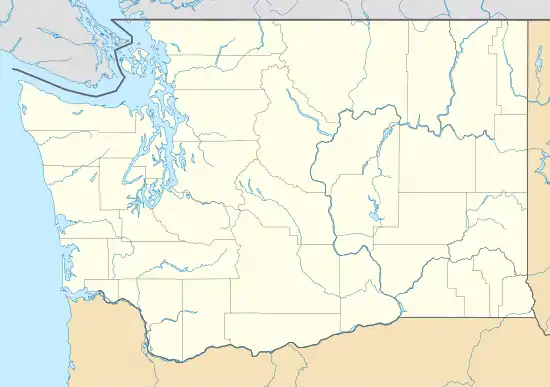
Qui-nai-elt Village is a census-designated place (CDP) in Grays Harbor County, Washington, United States. The population was 54 at the 2010 census.[2]
Qui-nai-elt Village, Washington | |
|---|---|
 Qui-nai-elt Village  Qui-nai-elt Village | |
| Coordinates: 47°15′1″N 124°11′25″W | |
| Country | United States |
| State | Washington |
| County | Grays Harbor |
| Area | |
| • Total | 0.73 sq mi (1.90 km2) |
| • Land | 0.73 sq mi (1.90 km2) |
| • Water | 0.0 sq mi (0.0 km2) |
| Elevation | 260 ft (80 m) |
| Population (2010) | |
| • Total | 54 |
| • Density | 74/sq mi (28.4/km2) |
| Time zone | UTC-8 (Pacific (PST)) |
| • Summer (DST) | UTC-7 (PDT) |
| Area code(s) | 360 |
| FIPS code | 53-57030 |
| GNIS feature ID | 2585027[1] |
The community is in the southwestern part of the Quinault Indian Nation in western Grays Harbor County, about 2 miles (3 km) east of the Pacific Ocean. It is bordered to the south by the community of Moclips. The Moclips Highway runs past the village, leading southwest to Moclips and northeast 19 miles (31 km) to U.S. Route 101 near Neilton.
References
- "Qui-nai-elt Village Census Designated Place". Geographic Names Information System. United States Geological Survey.
- "Geographic Identifiers: 2010 Demographic Profile Data (G001): Qui-nai-elt Village CDP, Washington". American Factfinder. U.S. Census Bureau. Retrieved March 31, 2017.
Municipalities and communities of Grays Harbor County, Washington, United States | ||
|---|---|---|
| Cities | 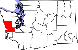 Map of Washington highlighting Grays Harbor County | |
| CDPs | ||
| Other unincorporated communities | ||
| Indian reservations | ||
| Footnotes | ‡This populated place also has portions in an adjacent county or counties | |
| ||
This article is issued from Wikipedia. The text is licensed under Creative Commons - Attribution - Sharealike. Additional terms may apply for the media files.