Elmore, Vermont
Elmore is a town in Lamoille County, Vermont, United States. The town was named for Colonel Samuel Elmore, a landowner.[5][6] The population was 855 at the 2010 census.[2] Elmore contains the villages of East Elmore and Lake Elmore, as well as Elmore State Park, a 700-acre (2.8 km2) recreational area on the 219-acre (0.9 km2) Lake Elmore and on Elmore Mountain to the west.
Elmore, Vermont | |
|---|---|
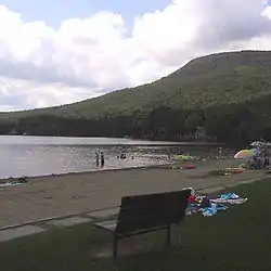 Along Lake Elmore in the town of Elmore | |
 Elmore, Vermont | |
 Elmore, Vermont Location in the United States | |
| Coordinates: 44°30′10″N 72°30′39″W | |
| Country | United States |
| State | Vermont |
| County | Lamoille |
| Communities | East Elmore Lake Elmore |
| Area | |
| • Total | 39.7 sq mi (102.7 km2) |
| • Land | 39.1 sq mi (101.3 km2) |
| • Water | 0.5 sq mi (1.4 km2) |
| Elevation | 1,634 ft (498 m) |
| Population | |
| • Total | 855 |
| • Density | 22/sq mi (8.4/km2) |
| Time zone | UTC-5 (Eastern (EST)) |
| • Summer (DST) | UTC-4 (EDT) |
| ZIP code | 05657 |
| Area code(s) | 802 |
| FIPS code | 50-23725[3] |
| GNIS feature ID | 1462089[4] |
| Website | www |
Geography
Elmore is in southeastern Lamoille County, bordered to the south and east by Washington County. A small portion of the town border on the east is with Caledonia County. According to the United States Census Bureau, the town has a total area of 39.7 square miles (102.7 km2), of which 39.1 square miles (101.3 km2) are land and 0.54 square miles (1.4 km2), or 1.38%, are water.[1] Lake Elmore is in the northwest corner of the town, and drains north via Elmore Pond Brook toward the Lamoille River. Lake Elmore village sits at the northern end of the lake. The Worcester Mountains are on the western side of the town. Elmore Mountain, at the northern end of the range, rises to an elevation of 2,608 feet (795 m) to the west of Lake Elmore.
Vermont Route 12 crosses the town, passing through Lake Elmore village and along the east side of Lake Elmore. The highway leads northwest 5 miles (8 km) to Morrisville and south 20 miles (32 km) to Montpelier, the state capital.
Demographics
| Historical population | |||
|---|---|---|---|
| Census | Pop. | %± | |
| 1790 | 12 | — | |
| 1800 | 45 | 275.0% | |
| 1810 | 157 | 248.9% | |
| 1820 | 157 | 0.0% | |
| 1830 | 442 | 181.5% | |
| 1840 | 476 | 7.7% | |
| 1850 | 504 | 5.9% | |
| 1860 | 602 | 19.4% | |
| 1870 | 637 | 5.8% | |
| 1880 | 682 | 7.1% | |
| 1890 | 593 | −13.0% | |
| 1900 | 550 | −7.3% | |
| 1910 | 553 | 0.5% | |
| 1920 | 468 | −15.4% | |
| 1930 | 382 | −18.4% | |
| 1940 | 300 | −21.5% | |
| 1950 | 312 | 4.0% | |
| 1960 | 237 | −24.0% | |
| 1970 | 292 | 23.2% | |
| 1980 | 421 | 44.2% | |
| 1990 | 573 | 36.1% | |
| 2000 | 849 | 48.2% | |
| 2010 | 855 | 0.7% | |
| 2014 (est.) | 872 | [7] | 2.0% |
| U.S. Decennial Census[8] | |||
As of the 2000 census,[3] there were 849 people, 306 households, and 223 families residing in the town. The population density was 21.7 people per square mile (8.4/km2). There were 458 housing units at an average density of 11.7 per square mile (4.5/km2). The racial makeup of the town was 98.35% White, 0.12% Native American, 0.35% Asian, 0.12% from other races, and 1.06% from two or more races. Hispanic or Latino of any race were 0.47% of the population.
There were 306 households, out of which 42.8% had children under the age of 18 living with them, 61.4% were married couples living together, 6.2% had a female householder with no husband present, and 26.8% were non-families. 18.0% of all households were made up of individuals, and 5.6% had someone living alone who was 65 years of age or older. The average household size was 2.77 and the average family size was 3.20.
In the town, the population was spread out, with 29.8% under the age of 18, 5.5% from 18 to 24, 32.4% from 25 to 44, 23.8% from 45 to 64, and 8.5% who were 65 years of age or older. The median age was 37 years. For every 100 females, there were 97.9 males. For every 100 females age 18 and over, there were 98.0 males.
The median income for a household in the town was $45,357, and the median income for a family was $48,214. Males had a median income of $31,250 versus $27,361 for females. The per capita income for the town was $20,069. About 6.4% of families and 6.3% of the population were below the poverty line, including 6.0% of those under age 18 and 2.8% of those age 65 or over.
Notable people
References
- "2019 U.S. Gazetteer Files". United States Census Bureau. Retrieved January 29, 2021.
- "Total Population: 2010 Census DEC Summary File 1 (P1), Elmore town, Lamoille County, Vermont". data.census.gov. U.S. Census Bureau. Retrieved January 29, 2021.
- "U.S. Census website". United States Census Bureau. Retrieved 2008-01-31.
- "US Board on Geographic Names". United States Geological Survey. 2007-10-25. Retrieved 2008-01-31.
- "Profile for Elmore, Vermont". ePodunk. Retrieved 2010-05-10.
- Gannett, Henry (1905). The Origin of Certain Place Names in the United States. Govt. Print. Off. pp. 118.
- "Annual Estimates of the Resident Population for Incorporated Places: April 1, 2010 to July 1, 2014". Archived from the original on May 23, 2015. Retrieved June 4, 2015.
- "U.S. Decennial Census". United States Census Bureau. Retrieved May 16, 2015.
External links

Municipalities and communities of Lamoille County, Vermont, United States | ||
|---|---|---|
| Towns | 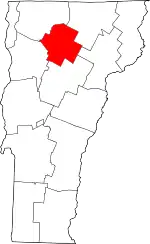 Map of Vermont highlighting Lamoille County | |
| Villages | ||
| CDP | ||
| Unincorporated communities | ||
| ||
