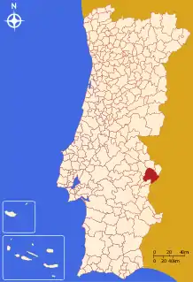
Elvas
Elvas (Portuguese pronunciation: [ˈɛlvɐʃ] (![]() listen)) is a Portuguese municipality, former episcopal city and frontier fortress of easternmost central Portugal, located in the district of Portalegre in Alentejo. It is situated about 200 kilometres (120 mi) east of Lisbon, and about 8 kilometres (5.0 mi) west of the Spanish fortress of Badajoz, by the Madrid-Badajoz-Lisbon railway. The municipality population as of 2011 was 23,078,[1] in an area of 631.29 square kilometres (243.74 sq mi).[2] The city itself had a population of 16,640 as of 2011.[3]
listen)) is a Portuguese municipality, former episcopal city and frontier fortress of easternmost central Portugal, located in the district of Portalegre in Alentejo. It is situated about 200 kilometres (120 mi) east of Lisbon, and about 8 kilometres (5.0 mi) west of the Spanish fortress of Badajoz, by the Madrid-Badajoz-Lisbon railway. The municipality population as of 2011 was 23,078,[1] in an area of 631.29 square kilometres (243.74 sq mi).[2] The city itself had a population of 16,640 as of 2011.[3]
Elvas | |
|---|---|
.jpg.webp) .jpg.webp) .jpg.webp) .jpg.webp) .jpg.webp) .jpg.webp) .jpg.webp) | |
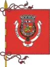 Flag  Coat of arms | |
 | |
| Coordinates: 38°52′N 7°09′W | |
| Country | |
| Region | Alentejo |
| Intermunic. comm. | Alto Alentejo |
| District | Portalegre |
| Parishes | 7 |
| Government | |
| • President | Dr. Nuno Miguel Fernandes Mocinha (PS) |
| Area | |
| • Total | 631.29 km2 (243.74 sq mi) |
| Population (2011) | |
| • Total | 23,078 |
| • Density | 37/km2 (95/sq mi) |
| Time zone | UTC±00:00 (WET) |
| • Summer (DST) | UTC+01:00 (WEST) |
| Local holiday | January 14 |
| Website | http://www.cm-elvas.pt |
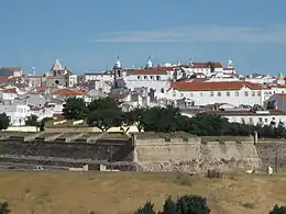
Elvas is among the finest examples of intensive usage of the trace italienne (star fort) in military architecture, and has been a World Heritage Site since 30 June 2012. The inscribed site name is Garrison Border Town of Elvas and its Fortifications.
History
Elvas lies on a hill 8 kilometres (5.0 mi) northwest of the Guadiana river. The Amoreira Aqueduct 6 kilometres (3.7 mi) long supplies the city with pure water; it was begun early in the 15th century and completed in 1622. For some distance it includes four tiers of superimposed arches, with a total height of 40 metres (130 ft).[4]
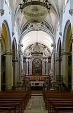
It was wrested from the Moors by Afonso I of Portugal in 1166 but was temporarily recaptured before its final occupation by the Portuguese in 1226. In 1570 it became an episcopal see, the Roman Catholic Diocese of Elvas, until 1818. The late Gothic Our Lady of the Assumption Cathedral, which has many traces of Moorish influence in its architecture, dates from the reign of Manuel I of Portugal (1495–1521).[4]
It was defended by seven bastions and the two forts of Santa Luzia and the Nossa Senhora da Graça Fort.[4] From 1642 it was the chief frontier fortress south of the Tagus, which withstood sieges by the Spanish in 1659, 1711 and 1801.[5] Elvas was the site of the Battle of the Lines of Elvas in 1659, during which the garrison and citizens of the city assisted in the rout of a Spanish Army. The Napoleonic French under Marshal Junot took it in March 1808 during the Peninsular War, but evacuated it in August after the conclusion of the Convention of Sintra.[5] The fortress of Campo Maior 15 kilometres (9.3 mi) to the northeast is known for its Napoleonic era siege by the French and relief by the British under Marshal Beresford in 1811, an exploit commemorated in a ballad by Sir Walter Scott.[4]
The Garrison Border Town of Elvas and its Fortifications were added to the list of UNESCO World Heritage Sites in 2012.[6]
Climate
| Climate data for Elvas, 1971-2000 normals and extremes | |||||||||||||
|---|---|---|---|---|---|---|---|---|---|---|---|---|---|
| Month | Jan | Feb | Mar | Apr | May | Jun | Jul | Aug | Sep | Oct | Nov | Dec | Year |
| Record high °C (°F) | 21.0 (69.8) |
23.0 (73.4) |
30.8 (87.4) |
32.0 (89.6) |
35.0 (95.0) |
42.5 (108.5) |
44.0 (111.2) |
42.0 (107.6) |
41.5 (106.7) |
33.0 (91.4) |
29.2 (84.6) |
22.0 (71.6) |
44.0 (111.2) |
| Average high °C (°F) | 13.4 (56.1) |
15.3 (59.5) |
18.3 (64.9) |
20.1 (68.2) |
23.8 (74.8) |
29.3 (84.7) |
33.6 (92.5) |
33.4 (92.1) |
29.7 (85.5) |
23.2 (73.8) |
17.6 (63.7) |
14.2 (57.6) |
22.7 (72.8) |
| Daily mean °C (°F) | 8.6 (47.5) |
10.2 (50.4) |
12.3 (54.1) |
14.1 (57.4) |
17.3 (63.1) |
21.7 (71.1) |
25.1 (77.2) |
24.8 (76.6) |
22.2 (72.0) |
17.4 (63.3) |
12.5 (54.5) |
9.7 (49.5) |
16.3 (61.4) |
| Average low °C (°F) | 3.8 (38.8) |
5.0 (41.0) |
6.3 (43.3) |
8.0 (46.4) |
10.8 (51.4) |
14.1 (57.4) |
16.6 (61.9) |
16.3 (61.3) |
14.7 (58.5) |
11.5 (52.7) |
7.5 (45.5) |
5.3 (41.5) |
10.0 (50.0) |
| Record low °C (°F) | −7.0 (19.4) |
−5.0 (23.0) |
−2.0 (28.4) |
−1.5 (29.3) |
1.5 (34.7) |
6.0 (42.8) |
10.0 (50.0) |
8.0 (46.4) |
4.0 (39.2) |
−1.0 (30.2) |
−4.5 (23.9) |
−5.5 (22.1) |
−7.0 (19.4) |
| Average rainfall mm (inches) | 63.1 (2.48) |
54.6 (2.15) |
39.6 (1.56) |
51.2 (2.02) |
44.0 (1.73) |
23.6 (0.93) |
4.8 (0.19) |
2.6 (0.10) |
25.6 (1.01) |
58.6 (2.31) |
75.1 (2.96) |
92.6 (3.65) |
535.4 (21.09) |
| Average precipitation days (≥ 0.1 mm) | 10.9 | 9.2 | 8.0 | 9.3 | 8.1 | 4.1 | 1.3 | 1.3 | 4.0 | 8.9 | 9.0 | 11.2 | 85.3 |
| Mean monthly sunshine hours | 154.3 | 161.8 | 212.1 | 224.6 | 275.4 | 316.2 | 366.6 | 339.2 | 252.2 | 198.6 | 164.8 | 129.4 | 2,795.2 |
| Source: Instituto de Meteorologia[7] | |||||||||||||
| Climate data for Vila Fernando, 1971-2000 normals and extremes, elevation: 360 m (1,180 ft) | |||||||||||||
|---|---|---|---|---|---|---|---|---|---|---|---|---|---|
| Month | Jan | Feb | Mar | Apr | May | Jun | Jul | Aug | Sep | Oct | Nov | Dec | Year |
| Record high °C (°F) | 20.0 (68.0) |
22.6 (72.7) |
27.5 (81.5) |
31.0 (87.8) |
34.5 (94.1) |
42.0 (107.6) |
42.5 (108.5) |
40.6 (105.1) |
41.2 (106.2) |
33.6 (92.5) |
26.5 (79.7) |
22.5 (72.5) |
42.5 (108.5) |
| Average high °C (°F) | 12.2 (54.0) |
13.8 (56.8) |
16.7 (62.1) |
18.3 (64.9) |
22.3 (72.1) |
27.8 (82.0) |
32.0 (89.6) |
31.8 (89.2) |
28.1 (82.6) |
21.7 (71.1) |
16.3 (61.3) |
13.1 (55.6) |
21.2 (70.1) |
| Daily mean °C (°F) | 8.4 (47.1) |
9.7 (49.5) |
11.7 (53.1) |
13.0 (55.4) |
16.2 (61.2) |
20.6 (69.1) |
23.9 (75.0) |
23.6 (74.5) |
21.4 (70.5) |
16.6 (61.9) |
12.2 (54.0) |
9.6 (49.3) |
15.6 (60.0) |
| Average low °C (°F) | 4.7 (40.5) |
5.6 (42.1) |
6.7 (44.1) |
7.7 (45.9) |
10.1 (50.2) |
13.3 (55.9) |
15.7 (60.3) |
15.5 (59.9) |
14.6 (58.3) |
11.5 (52.7) |
8.1 (46.6) |
6.0 (42.8) |
10.0 (49.9) |
| Record low °C (°F) | −5.0 (23.0) |
−5.0 (23.0) |
−1.0 (30.2) |
−1.0 (30.2) |
2.0 (35.6) |
6.0 (42.8) |
9.0 (48.2) |
8.0 (46.4) |
4.0 (39.2) |
1.5 (34.7) |
−0.5 (31.1) |
−3.0 (26.6) |
−5.0 (23.0) |
| Average rainfall mm (inches) | 64.3 (2.53) |
54.6 (2.15) |
41.7 (1.64) |
54.0 (2.13) |
39.2 (1.54) |
23.2 (0.91) |
7.6 (0.30) |
4.5 (0.18) |
23.8 (0.94) |
58.6 (2.31) |
72.9 (2.87) |
88.2 (3.47) |
532.6 (20.97) |
| Average precipitation days (≥ 0.1 mm) | 11.0 | 9.2 | 7.6 | 9.1 | 7.1 | 4.0 | 1.5 | 1.0 | 3.9 | 8.2 | 9.3 | 10.1 | 82 |
| Source: Instituto de Meteorologia[8] | |||||||||||||
Civil Parishes
Administratively, the municipality is divided in seven civil parishes (freguesias):[9]
- Assunção, Ajuda, Salvador e Santo Ildefonso
- Barbacena e Vila Fernando
- Caia, São Pedro e Alcáçova
- Santa Eulália
- São Brás e São Lourenço
- São Vicente e Ventosa
- Terrugem e Vila Boim
Sister cities
 Badajoz, Extremadura, Spain
- Olivenza, Extremadura, Spain
 Campo Maior, Alentejo, Portugal
Gallery
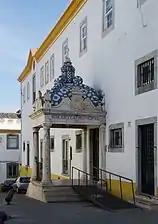 Entrance of the Municipal Library of Elvas
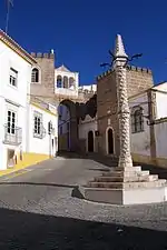 A pillory in the city of Elvas
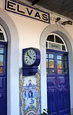 Elvas Station
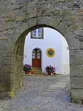 Typical features
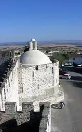
 City walls
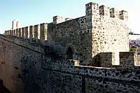
.jpg.webp) Elvas, Portugal
Elvas, Portugal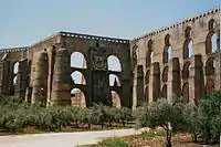
 Inside of a local Catholic church
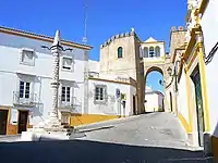 Square of Santa Clara
.jpg.webp) Elvas, Alentejo
Elvas, Alentejo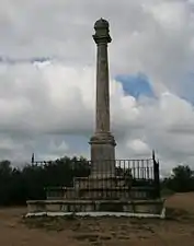 Monument commemorating the 1659 Battle of the Lines of Elvas
References
- Instituto Nacional de Estatística
- "Áreas das freguesias, concelhos, distritos e país". Archived from the original on 2018-11-05. Retrieved 2018-11-05.
- UMA POPULAÇÃO QUE SE URBANIZA, Uma avaliação recente – Cidades, 2004 Archived October 6, 2014, at the Wayback Machine Nuno Pires Soares, Instituto Geográfico Português (Geographic Institute of Portugal)
- Chisholm 1911, p. 300.
- Chisholm 1911, p. 301.
- "Garrison Border Town of Elvas and its Fortifications".
- "Monthly Averages for Elvas (1971–2000)" (PDF). IPMA.
- "Monthly Averages for Vila Fernando (1971–2000)" (PDF). IPMA.
- Diário da República. "Law nr. 11-A/2013, page 552 44" (PDF) (in Portuguese). Retrieved 22 July 2014.
 This article incorporates text from a publication now in the public domain: Chisholm, Hugh, ed. (1911). "Elvas". Encyclopædia Britannica. 9 (11th ed.). Cambridge University Press. pp. 300–301.
| Wikimedia Commons has media related to Elvas. |
| Norte |
| Flag of Portugal |
|---|---|---|
| Centro | ||
| Lisboa |
| |
| Alentejo |
| |
| Azores |
| |
| Madeira | ||
| Authority control |
|---|
