Essexville, Michigan
Essexville is a city in Bay County in the U.S. state of Michigan. The population at 3,478 at the 2010 census.[7] Located along the Saginaw River, Essexville is part of the Saginaw, Midland, and Bay City metropolitan area.
Essexville, Michigan | |
|---|---|
| City of Essexville | |
| Motto(s): "Gateway to the Saginaw Bay"[1] | |
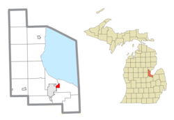 Location within Bay County | |
 Essexville Location within the state of Michigan | |
| Coordinates: 43°36′41″N 83°50′37″W | |
| Country | United States |
| State | Michigan |
| County | Bay |
| Platted | 1867 |
| Incorporated | 1883 (village) 1934 (city) |
| Government | |
| • Type | Council–manager |
| • Mayor | Scott Wittbrodt |
| Area | |
| • Total | 1.40 sq mi (3.63 km2) |
| • Land | 1.29 sq mi (3.35 km2) |
| • Water | 0.11 sq mi (0.28 km2) |
| Elevation | 584 ft (178 m) |
| Population | |
| • Total | 3,478 |
| • Estimate (2019)[4] | 3,278 |
| • Density | 2,531.27/sq mi (977.38/km2) |
| Time zone | UTC-5 (Eastern (EST)) |
| • Summer (DST) | UTC-4 (EDT) |
| ZIP code(s) | 48732 |
| Area code(s) | 989 |
| FIPS code | 26-26420[5] |
| GNIS feature ID | 0625647[6] |
| Website | Official website |
History
Essexville is named after Ransom P. Essex, a local settler.[8][9] It was first platted in 1867.[10] The Essexville Post Office opened on Feb 27, 1871. The Post Office was closed from January 20 to February 24 in 1879.[11] It was incorporated as a village in 1883 within Hampton Township[12] and as a city in 1934.[10]
Geography
According to the United States Census Bureau, the city has a total area of 1.41 square miles (3.65 km2), of which 1.30 square miles (3.37 km2) is land and 0.11 square miles (0.28 km2) is water.[13] It is also directly on the Saginaw River.
Demographics
| Historical population | |||
|---|---|---|---|
| Census | Pop. | %± | |
| 1890 | 1,545 | — | |
| 1900 | 1,639 | 6.1% | |
| 1910 | 1,477 | −9.9% | |
| 1920 | 1,538 | 4.1% | |
| 1930 | 1,864 | 21.2% | |
| 1940 | 2,390 | 28.2% | |
| 1950 | 3,167 | 32.5% | |
| 1960 | 4,590 | 44.9% | |
| 1970 | 4,990 | 8.7% | |
| 1980 | 4,378 | −12.3% | |
| 1990 | 4,088 | −6.6% | |
| 2000 | 3,766 | −7.9% | |
| 2010 | 3,478 | −7.6% | |
| 2019 (est.) | 3,278 | [4] | −5.8% |
| U.S. Decennial Census[14] | |||
2010 census
As of the census[3] of 2010, there were 3,478 people, 1,437 households, and 1,016 families residing in the city. The population density was 2,675.4 inhabitants per square mile (1,033.0/km2). There were 1,527 housing units at an average density of 1,174.6 per square mile (453.5/km2). The racial makeup of the city was 95.5% White, 0.9% African American, 0.6% Native American, 0.8% Asian, 0.8% from other races, and 1.4% from two or more races. Hispanic or Latino of any race were 3.0% of the population.
There were 1,437 households, of which 31.0% had children under the age of 18 living with them, 54.1% were married couples living together, 11.1% had a female householder with no husband present, 5.4% had a male householder with no wife present, and 29.3% were non-families. 25.5% of all households were made up of individuals, and 11.6% had someone living alone who was 65 years of age or older. The average household size was 2.42 and the average family size was 2.87.
The median age in the city was 42.3 years. 22.8% of residents were under the age of 18; 7.1% were between the ages of 18 and 24; 23.8% were from 25 to 44; 29.8% were from 45 to 64; and 16.6% were 65 years of age or older. The gender makeup of the city was 47.6% male and 52.4% female.
2000 census
As of the census[5] of 2000, there were 3,766 people, 1,487 households, and 1,088 families residing in the city. The population density was 3,114.3 per square mile (1,201.7/km2). There were 1,530 housing units at an average density of 1,265.2 per square mile (488.2/km2). The racial makeup of the city was 96.34% White, 0.53% African American, 0.80% Native American, 0.58% Asian, 0.61% from other races, and 1.14% from two or more races. Hispanic or Latino of any race were 2.07% of the population.
There were 1,487 households, out of which 34.2% had children under the age of 18 living with them, 60.1% were married couples living together, 10.2% had a female householder with no husband present, and 26.8% were non-families. 23.8% of all households were made up of individuals, and 13.8% had someone living alone who was 65 years of age or older. The average household size was 2.53 and the average family size was 2.98.
In the city, the population was spread out, with 25.4% under the age of 18, 6.8% from 18 to 24, 25.1% from 25 to 44, 26.3% from 45 to 64, and 16.4% who were 65 years of age or older. The median age was 40 years. For every 100 females, there were 90.4 males. For every 100 females age 18 and over, there were 85.4 males.
The median income for a household in the city was $43,750, and the median income for a family was $55,610. Males had a median income of $46,037 versus $30,417 for females. The per capita income for the city was $25,060. About 2.7% of families and 4.4% of the population were below the poverty line, including 2.7% of those under age 18 and 5.8% of those age 65 or over.
Education
Public education in Essexville is provided by the Essexville-Hampton School District.[15]
Cultural attractions
Heritage House is a modest two-story residence that is preserved as a "fine example of a mid-west country home," open to the public.[16]
Hampton Square Mall, the first shopping mall in the Bay City metro area, was located in Essexville. The mall closed in 2010.
References
- "City of Essexville, Michigan". City of Essexville, Michigan. Retrieved August 24, 2012.
- "2019 U.S. Gazetteer Files". United States Census Bureau. Retrieved July 25, 2020.
- "U.S. Census website". United States Census Bureau. Retrieved 2012-11-25.
- "Population and Housing Unit Estimates". United States Census Bureau. May 24, 2020. Retrieved May 27, 2020.
- "U.S. Census website". United States Census Bureau. Retrieved 2008-01-31.
- U.S. Geological Survey Geographic Names Information System: Essexville, Michigan
- |04000US26|16000US2626420&_street=&_county=Essexville&_cityTown=Essexville&_state=04000US26&_zip=&_lang=en&_sse=on&ActiveGeoDiv=&_useEV=&pctxt=fph&pgsl=160&_submenuId=population_0&ds_name=DEC_2000_SAFF&_ci_nbr=null&qr_name=null®=null%3Anull&_keyword=&_industry= Population Finder, U.S. Census Bureau
- Gannett, Henry (1905). The Origin of Certain Place Names in the United States. Govt. Print. Off. pp. 121.
- "Profile for Essexville, Michigan, MI". ePodunk. Retrieved August 24, 2012.
- Walter Romig, Michigan Place Names, p. 187
- U.S. Geological Survey Geographic Names Information System: Essexville Post Office, Michigan
Citation: directoriesUSA. Michigan Business Directory, 2007/2008. 2007/2008. 12-Dec-2007. - 1910 United States Federal Census: Michigan, Bay County, Hampton Township, Enumeration District 0059 - Essexville Village, Sheet 12, accessed via ancestry.com paid subscription site December 2019.
- "US Gazetteer files 2010". United States Census Bureau. Archived from the original on 2012-01-25. Retrieved 2012-11-25.
- "Census of Population and Housing". Census.gov. Retrieved June 4, 2015.
- "Essexville-Hampton School District". Essexville-Hampton School District. Retrieved August 24, 2012.
- http://bay-journal.com/bay/hamp-essex/his-local.html
External links
Municipalities and communities of Bay County, Michigan, United States | ||
|---|---|---|
| Cities | 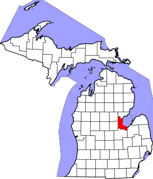 Map of Michigan | |
| Charter townships | ||
| Civil townships | ||
| Unincorporated communities |
| |
| Defunct | ||
| Footnotes | ‡This populated place also has portions in an adjacent county or counties | |
| ||
Central/Mid-Michigan including the Tri-Cities and Thumb | |||||||
|---|---|---|---|---|---|---|---|
| Central cities | |||||||
| Counties |
| ||||||
| Geography | |||||||
| Transportation | |||||||
| Economy |
| ||||||