Estelline, South Dakota
Estelline is a city in Hamlin County, South Dakota, United States. It is part of the Watertown, South Dakota Micropolitan Statistical Area. The population was 768 at the 2010 census. The current mascot for Estelline High School is the Redhawks.
Estelline, South Dakota | |
|---|---|
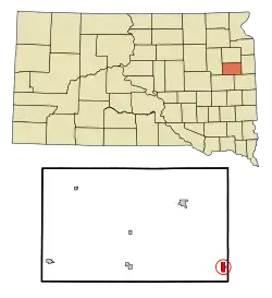 Location in Hamlin County and the state of South Dakota | |
| Coordinates: 44°34′34″N 96°54′2″W | |
| Country | United States |
| State | South Dakota |
| County | Hamlin |
| Incorporated | 1920[1] |
| Area | |
| • Total | 0.94 sq mi (2.45 km2) |
| • Land | 0.94 sq mi (2.45 km2) |
| • Water | 0.00 sq mi (0.00 km2) |
| Elevation | 1,654 ft (504 m) |
| Population | |
| • Total | 768 |
| • Estimate (2019)[4] | 746 |
| • Density | 789.42/sq mi (304.64/km2) |
| Time zone | UTC-6 (Central (CST)) |
| • Summer (DST) | UTC-5 (CDT) |
| ZIP code | 57234 |
| Area code(s) | 605 |
| FIPS code | 46-19980[5] |
| GNIS feature ID | 1254960[6] |
History
A post office was first established at Estelline in 1879.[7] Estelline was platted in 1882.[8][9] The city was named for a local farmer's daughter.[8]
Geography
Estelline is located at 44°34′34″N 96°54′02″W.[10]
According to the United States Census Bureau, the city has a total area of 0.95 square miles (2.46 km2), all of it land.[11]
Estelline has been assigned the ZIP code 57234 and the FIPS place code 19980.
Demographics
| Historical population | |||
|---|---|---|---|
| Census | Pop. | %± | |
| 1890 | 210 | — | |
| 1900 | 357 | 70.0% | |
| 1910 | 509 | 42.6% | |
| 1920 | 658 | 29.3% | |
| 1930 | 488 | −25.8% | |
| 1940 | 627 | 28.5% | |
| 1950 | 760 | 21.2% | |
| 1960 | 722 | −5.0% | |
| 1970 | 624 | −13.6% | |
| 1980 | 719 | 15.2% | |
| 1990 | 658 | −8.5% | |
| 2000 | 675 | 2.6% | |
| 2010 | 768 | 13.8% | |
| 2019 (est.) | 746 | [4] | −2.9% |
| U.S. Decennial Census[12] | |||
2010 census
At the 2010 census there were 768 people in 297 households, including 189 families, in the city. The population density was 808.4 inhabitants per square mile (312.1/km2). There were 321 housing units at an average density of 337.9 per square mile (130.5/km2). The racial makup of the city was 93.1% White, 0.7% Native American, 5.2% from other races, and 1.0% from two or more races. Hispanic or Latino of any race were 6.3%.[3]
Of the 297 households 30.0% had children under the age of 18 living with them, 47.5% were married couples living together, 9.1% had a female householder with no husband present, 7.1% had a male householder with no wife present, and 36.4% were non-families. 31.3% of households were one person and 15.8% were one person aged 65 or older. The average household size was 2.40 and the average family size was 2.98.
The median age was 40.9 years. 25.8% of residents were under the age of 18; 6.6% were between the ages of 18 and 24; 21.7% were from 25 to 44; 19% were from 45 to 64; and 26.8% were 65 or older. The gender makeup of the city was 47.3% male and 52.7% female.
2000 census
At the 2000 census there were 675 people in 290 households, including 173 families, in the city. The population density was 703.8 people per square mile (271.5/km2). There were 311 housing units at an average density of 324.3 per square mile (125.1/km2). The racial makup of the city was 98.67% White, 0.74% Native American, 0.15% Asian, and 0.44% from two or more races. Hispanic or Latino of any race were 1.48%.[5] 32.1% were of German, 22.0% Norwegian, 8.7% Irish, 6.8% American and 5.3% Dutch ancestry according to Census 2000.
Of the 290 households 24.1% had children under the age of 18 living with them, 53.8% were married couples living together, 3.8% had a female householder with no husband present, and 40.3% were non-families. 37.2% of households were one person and 21.4% were one person aged 65 or older. The average household size was 2.13 and the average family size was 2.82.
The age distribution was 21.2% under the age of 18, 3.9% from 18 to 24, 22.1% from 25 to 44, 18.5% from 45 to 64, and 34.4% 65 or older. The median age was 48 years. For every 100 females, there were 91.8 males. For every 100 females age 18 and over, there were 84.7 males.
The median household income was $27,679 and the median family income was $36,250. Males had a median income of $28,393 versus $22,222 for females. The per capita income for the city was $14,967. About 4.4% of families and 12.7% of the population were below the poverty line, including 9.7% of those under age 18 and 22.2% of those age 65 or over.
References
- "SD Towns" (PDF). South Dakota State Historical Society. Archived from the original (PDF) on 2010-02-10. Retrieved 2010-02-11.
- "2019 U.S. Gazetteer Files". United States Census Bureau. Retrieved July 30, 2020.
- "U.S. Census website". United States Census Bureau. Retrieved 2012-06-21.
- "Population and Housing Unit Estimates". United States Census Bureau. May 24, 2020. Retrieved May 27, 2020.
- "U.S. Census website". United States Census Bureau. Retrieved 2008-01-31.
- "US Board on Geographic Names". United States Geological Survey. 2007-10-25. Retrieved 2008-01-31.
- "Hamlin County". Jim Forte Postal History. Archived from the original on 2 April 2015. Retrieved 17 March 2015.
- Chicago and North Western Railway Company (1908). A History of the Origin of the Place Names Connected with the Chicago & North Western and Chicago, St. Paul, Minneapolis & Omaha Railways. p. 69.
- Federal Writers' Project (1940). South Dakota place-names, v.1-3. University of South Dakota. p. 37.
- "US Gazetteer files: 2010, 2000, and 1990". United States Census Bureau. 2011-02-12. Retrieved 2011-04-23.
- "US Gazetteer files 2010". United States Census Bureau. Archived from the original on 2012-01-25. Retrieved 2012-06-21.
- United States Census Bureau. "Census of Population and Housing". Retrieved June 12, 2016.
Municipalities and communities of Hamlin County, South Dakota, United States | ||
|---|---|---|
| Cities | 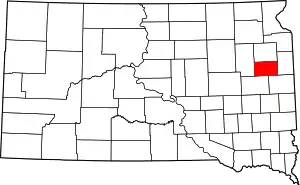 | |
| Towns | ||
| CDP | ||
| Unincorporated communities | ||
| Footnotes | ‡This populated place also has portions in an adjacent county or counties | |
| ||