Etowah, Oklahoma
Etowah is a town in Cleveland County, Oklahoma, United States. The population was 92 at the 2010 census.
Etowah, Oklahoma | |
|---|---|
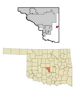 Location of Etowah, Oklahoma. | |
| Coordinates: 35°8′5″N 97°10′7″W | |
| Country | United States |
| State | Oklahoma |
| County | Cleveland |
| Area | |
| • Total | 2.06 sq mi (5.32 km2) |
| • Land | 2.05 sq mi (5.31 km2) |
| • Water | 0.00 sq mi (0.01 km2) |
| Elevation | 1,096 ft (334 m) |
| Population (2010) | |
| • Total | 92 |
| • Estimate (2019)[2] | 99 |
| • Density | 48.27/sq mi (18.63/km2) |
| Time zone | UTC-6 (Central (CST)) |
| • Summer (DST) | UTC-5 (CDT) |
| FIPS code | 40-24460[3] |
| GNIS feature ID | 1102936[4] |
Geography
Etowah is located at 35°8′5″N 97°10′7″W (35.134592, -97.168620).[5]
According to the United States Census Bureau, the town has a total area of 2.0 square miles (5.2 km2), all land.
Demographics
| Historical population | |||
|---|---|---|---|
| Census | Pop. | %± | |
| 1990 | 33 | — | |
| 2000 | 122 | 269.7% | |
| 2010 | 92 | −24.6% | |
| 2019 (est.) | 99 | [2] | 7.6% |
| U.S. Decennial Census[6] | |||
At the 2010 census, there were 92 people, 42 households, and 34 families in the town. The population density was 59.4 people per square mile (23.0/km2). There were 50 housing units at an average density of 21.4 per square mile (8.3/km2). The racial makeup of the town was 93.44% White, 0.82% Native American, and 5.74% from two or more races. Hispanic or Latino of any race were 3.28% of the population.
Of the 42 households 45.2% had children under the age of 18 living with them, 78.6% were married couples living together, and 19.0% were non-families. 19.0% of households were one person and 4.8% were one person aged 65 or older. The average household size was 2.90 and the average family size was 3.32.
The age distribution was 32.0% under the age of 18, 11.5% from 18 to 24, 32.8% from 25 to 44, 18.0% from 45 to 64, and 5.7% 65 or older. The median age was 31 years. For every 100 females, there were 121.8 males. For every 100 females age 18 and over, there were 102.4 males.
The median household income was $34,375 and the median family income was $34,375. Males had a median income of $26,786 versus $25,833 for females. The per capita income for the town was $10,190. None of the population and none of the families were below the poverty line.
References
- "2019 U.S. Gazetteer Files". United States Census Bureau. Retrieved July 28, 2020.
- "Population and Housing Unit Estimates". United States Census Bureau. May 24, 2020. Retrieved May 27, 2020.
- "U.S. Census website". United States Census Bureau. Retrieved 2008-01-31.
- "US Board on Geographic Names". United States Geological Survey. 2007-10-25. Retrieved 2008-01-31.
- "US Gazetteer files: 2010, 2000, and 1990". United States Census Bureau. 2011-02-12. Retrieved 2011-04-23.
- "Census of Population and Housing". Census.gov. Retrieved June 4, 2015.
External links
Municipalities and communities of Cleveland County, Oklahoma, United States | ||
|---|---|---|
| Cities | 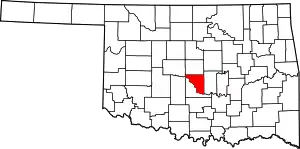 Cleveland County map | |
| Towns | ||
| Neighborhood | ||
| Footnotes | ‡This populated place also has portions in an adjacent county or counties | |
| ||
