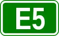
European route E5
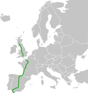
The European route E5 is part of the United Nations international E-road network. It is the westernmost north–south "reference road", running from Greenock in Scotland, south through Great Britain and France to Algeciras, Spain.[1] The route is 1,900 miles (3,100 km) long.
| |
|---|---|
 | |
| Major junctions | |
| North end | Greenock, United Kingdom |
| South end | Algeciras, Spain |
| Location | |
| Countries | |
| Highway system | |
| International E-road network
| |
The E5 follows the route Greenock – Glasgow – Gretna – Carlisle – Penrith – Preston – Warrington – Birmingham – Oxford – Newbury – Southampton ... Le Havre – Paris – Orléans – Tours – Poitiers – Bordeaux – San Sebastián – Burgos – Madrid – Córdoba – Seville – Cádiz – Algeciras.[2]
United Kingdom

Although the United Kingdom Government participates fully in activities concerning the E-routes,[3] E-routes are not signposted within the United Kingdom. Hence the first 724 km of the route is not signed.
The E5 has a gap at the English Channel between Southampton and Le Havre, France. There is no direct ferry link, but a ferry from nearby Portsmouth, along the M27, connects to Le Havre.
France
The E5 arrives from the non-existing ferry from Southampton in Le Havre. It passes the capital Paris, before continuing southwest passed Orléans, Tours and Bordeaux. It ends at the border town of Hendaye with Spain. It covers a distance of 985 km (612 mi)[4].
Route
 United Kingdom
 A8: Greenock –
- M8: – Glasgow (Interchange with (
 E16)
E16) 
.svg.png.webp) M74 / A74(M): Glasgow – Anglo-Scottish border (Start of multiplex with
M74 / A74(M): Glasgow – Anglo-Scottish border (Start of multiplex with  E18 at
  )
) M6: Anglo-Scottish border – Cannock (End of multiplex with E18 at
  Carlisle, interchange with
 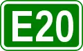 E20 and multiplex with
 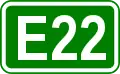 E22 at Warrington)
- M6: Cannock –
 OR
OR  : Birmingham Northern Relief Road (Whole length) (Interchange with
 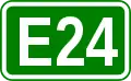 E24)
E24) - M42: Birmingham
 M40: Birmingham – Oxford
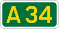 A34: Oxford – Winchester (Interchange with
 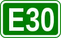 E30 at
  Newbury)
 M3: Winchester – Southampton
- Gap (English Channel)
 France
 N 282: Le Havre
 A 131: Le Havre (
 E 44) – Tancarville
 N 182: Tancarville
- A 131: Tancarville – Bourneville (
 E 46)
E 46)  A 13: Bourneville (Start of Concurrency with E 46) – Rouen (End of Concurrency with E 46) – Paris
- Boulevard Périphérique: Paris (
 E 15
E 15  E 19
E 19  E 50, Towards
  E 54)
E 54)  A 6a: Paris ( E 15) – Massy ( E 15 E 50)
 A 10: Massy ( E 15 E 50) – Ablis ( E 50) – Orléans (
 E 9, Start of Concurrency with
  E 5) – Tours (
 E 502
E 502  E 604, End of Concurrency with E 5) – Poitiers (
 E 62) – Niort (
 E 601) – Saintes (
 E 602
E 602  E 603) – Bordeaux
 N 230: Bordeaux (Start of Concurrency with
  E 70)
E 70) A 630: Bordeaux (
 E 72)
E 72) A 63: Bordeaux – Bayonne (Start of Concurrency with
  E 80) – Hendaye
 Spain
Spain

 AP-1 / AP-8: Irún – Donostia/S. Sebastián – Eibar (End of Concurrency with
  E-70) –
- AP-1: Eibar ( E-70) – Miranda de Ebro (
 E-804) – Burgos
  A-1: Burgos (End of Concurrency with
  E-80) – Madrid
 M-30: Madrid (
 E-90
E-90 E-901)
 A-4: Madrid ( E-90) – Manzanares (
 E-903) – Bailén (
 E-902) – Córdoba – Sevilla (
 E-1, Towards
  E-803)
References
- European Agreement on Main International Traffic Arteries, 25 October 2016
- European Agreement on Main International Traffic Arteries, 25 October 2016
- For example Economic and Social Council Document ECE/TRANS/WP.6/AC.2/18 - 17 December 2008; Agenda item 6 Participation in the 2005 E-route census
- "E05". www.elbruz.org. Retrieved 2 September 2020.
External links
| Wikimedia Commons has media related to E5. |