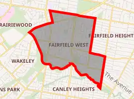
Fairfield West, New South Wales
Fairfield West is a suburb of Sydney, in the state of New South Wales, Australia. Fairfield West is located 27 kilometres west of the Sydney central business district in the local government area of the City of Fairfield. Fairfield West is part of the Greater Western Sydney region.
| Fairfield West Sydney, New South Wales | |||||||||||||||
|---|---|---|---|---|---|---|---|---|---|---|---|---|---|---|---|
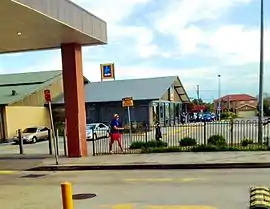 An Aldi chain in Fairfield West plaza | |||||||||||||||
| |||||||||||||||
| Population | 11,575 (2016 census)[1] | ||||||||||||||
| • Density | 3,620/km2 (9,370/sq mi) | ||||||||||||||
| Established | 1870s | ||||||||||||||
| Postcode(s) | 2165 | ||||||||||||||
| Area | 3.2 km2 (1.2 sq mi) | ||||||||||||||
| Location | 27 km (17 mi) west of Sydney CBD | ||||||||||||||
| LGA(s) | City of Fairfield | ||||||||||||||
| State electorate(s) | Fairfield, Prospect | ||||||||||||||
| Federal Division(s) | Fowler, McMahon | ||||||||||||||
| |||||||||||||||
Fairfield West shares the postcode of 2165 with the separate suburbs of Fairfield, Fairfield Heights and Fairfield East.
History
When British settlers first arrived in Sydney, the area that is now known as Fairfield West was inhabited by the Cabrogal tribe. A railway station was built at neighbouring Fairfield in 1856 leading to substantial population growth around the station which eventually to Fairfield West being subdivided in the 1870s. At the time it was mostly small farms but a Progress Association was established leading to a post office, school and a sportsground being built in the community. Timber cutting became a significant local industry and the sawmills brought other businesses into the new town, which was well established by the end of the 1800s. Fairfield West Public School was built there in 1925.[2]
Recreational areas
The Endeavour Sports Reserve, located near Orphan School Creek, is a large floodlit urban park and a sports ground that features shared soccer, cricket, league and hockey fields, and four tennis courts. The vegetation along the creek side has been identified by the NSW National Parks and Wildlife Service as a Cumberland Plain Endangered Ecological Community. The narrow woodland strip, which border the creek, feature a walking/cycling path, and are dominated by Eucalyptus moluccana and Eucalyptus tereticornis trees. Although not in the suburb, Brenan Park is adjacent to the northeastern vicinity of Fairfield West.[3]
Population
At the 2016 census, there were 11,575 residents in Fairfield West.
The most common ancestries were Vietnamese (16.3%), Australian (8.4%), English (8.3%), Chinese (7.6%) and Assyrian (7.4%).
41.7% of people were born in Australia. The next most common countries of birth were Iraq (13.6%), Vietnam (12.8%), Cambodia (3.4%), New Zealand (1.5%) and Syria (1.4%).
In Fairfield West 27.0%% of people spoke only English at home. Other languages spoken at home included Vietnamese (19.7%), Arabic (9.3%), Assyrian Neo-Aramaic (8.8%), Chaldean Neo-Aramaic (4.8%) and Spanish (4.3%).
The top responses for religious affiliation were Catholic (34.2%), Buddhism (16.2%), No Religion (12.0%), Unstated (7.3%) and Islam (5.8%). The majority of dwellings (87.9%) were separate houses, with the remainder of dwellings being semi-detached or townhouses.[1]
Notable residents
- Vic Hey (1912-1995), member of the Australian Rugby League Hall of Fame.
- Maria Tran, actress & filmmaker who grew up as a resident and went to Fairfield West Public School from year 4–6.
References
- Australian Bureau of Statistics (27 June 2017). "Fairfield West (State Suburb)". 2016 Census QuickStats. Retrieved 27 June 2016.

- "Fairfield West". Fairfield City Council. Archived from the original on 17 August 2008. Retrieved 2008-07-02.
- King M & Associates (1997) Recreation Needs Assessment Study prepared for Fairfield City Council