Wakeley, New South Wales
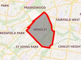
Wakeley is a suburb of Sydney, in the state of New South Wales, Australia 34 kilometres west of the Sydney central business district in the local government area of the City of Fairfield. Wakeley is part of the Greater Western Sydney region.
| Wakeley Sydney, New South Wales | |||||||||||||||
|---|---|---|---|---|---|---|---|---|---|---|---|---|---|---|---|
| |||||||||||||||
| Population | 4,746 (2016 census)[1] | ||||||||||||||
| Established | Early 1980s | ||||||||||||||
| Postcode(s) | 2176 | ||||||||||||||
| Location | 34 km (21 mi) west of Sydney CBD | ||||||||||||||
| LGA(s) | City of Fairfield | ||||||||||||||
| State electorate(s) | Fairfield | ||||||||||||||
| Federal Division(s) | Fowler | ||||||||||||||
| |||||||||||||||
The City of Fairfield Council Chambers are located in Wakeley.
History
Wakeley is named after Daniel Wakeley, an early settler in the area. It was mainly used for farming until being redeveloped as a residential suburb in 1980.[2]
Schools
- King Park Public School
- Mary MacKillop College, which is run by the Sisters of St Joseph.
Churches
A Salvation Army and charity centre are also there.
References
- Australian Bureau of Statistics (27 June 2017). "Wakeley (State Suburb)". 2016 Census QuickStats. Retrieved 12 April 2018.

- The Book of Sydney Suburbs, Frances Pollon, Angus & Robertson Publishers, 1990, p.146 ISBN 0-207-14495-8
This article is issued from Wikipedia. The text is licensed under Creative Commons - Attribution - Sharealike. Additional terms may apply for the media files.