Falakata
Falakata is a census town in the Falakata CD block in the Alipurduar subdivision[1] of the Alipurduar district in the state of West Bengal, India.
Falakata | |
|---|---|
Census Town | |
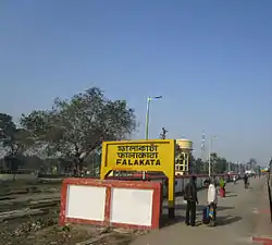 Falakata Station nameplate | |
 Falakata Location in West Bengal, India  Falakata Falakata (India) | |
| Coordinates: 26.53°N 89.2°E | |
| Country | |
| State | West Bengal |
| District | Alipurduar |
| Government | |
| • Type | Municipality |
| • Body | Falakata Municipality |
| Elevation | 88 m (289 ft) |
| Population (2011) | |
| • Total | 19,716 |
| Languages | |
| • Official | Bengali, English |
| Time zone | UTC+5:30 (IST) |
| Vehicle registration | WB |
| Lok Sabha constituency | Alipurduars (SC) |
| Vidhan Sabha constituency | Falakata (SC) |
| Website | alipurduar |
Geography
| Places and tea estates in the western portion of Alipurdar subdivision (including Madarihat-Birpara, Falakata and Alipuduar I CD blocks) in Alipurduar district CT: census town, R: rural/ urban centre, N: neighbourhood, NP: national park/ wildlife sanctuary, TE: tea estate Abbreviations used in names – TG for Tea Garden (town/village), TE for Tea Estate Owing to space constraints in the small map, the actual locations in a larger map may vary slightly |
Location
Falakata is located at 26.53°N 89.2°E It has an average elevation of 88 metres (288 feet). Mujnai is the main river. Falakata is surrounded by rich forests, corn fields and the nearby Kunjanagar Eco-Park.
Area overview
Alipurduar district is covered by two maps. It is an extensive area in the eastern end of the Dooars in West Bengal. It is undulating country, largely forested, with numerous rivers flowing down from the outer ranges of the Himalayas in Bhutan. It is a predominantly rural area with 79.38% of the population living in the rural areas. The district has 1 municipal town and 20 census towns and that means that 20.62% of the population lives in urban areas. The scheduled castes and scheduled tribes, taken together, form more than half the population in all the six community development blocks in the district. There is a high concentration of tribal people (scheduled tribes) in the three northern blocks of the district.[2][3][4]
Note: The map alongside presents some of the notable locations in the subdivision. All places marked in the map are linked in the larger full screen map.
Civic administration
Police station
Falakata police has jurisdiction over Falakata CD block.[5]
CD block HQ
Headquarters of Falakata CD block is at Falakata.[6]
Infrastructure
According to the District Census Handbook 2011, Jalpaiguri, Falakata covered an area of 4.92 km2. Among the civic amenities, it had 10 km roads, with open drains, the protected water supply involved overhead tanks, uncovered wells. It had 4,389 domestic electric connections, 26 road lighting points. Among the medical facilities it had 2 hospitals, 4 family welfare centres, 1 family welfare centre, 1 maternity and child welfare centre, 1 maternity home, 25 medicine shops. Among the educational facilities it had 14 primary schools, 4 middle schools, 4 secondary schools, 4 senior secondary schools. It had 2 non-formal education centre, 1 orphanage home. Among the social, recreational and cultural facilities, it had 1 stadium, 1 cinema theatre, 1 auditorium/ community hall, 1 public library, 1 reading room. Three important commodities it produced were: atta, mustard seed, butter. It had branches of 1 nationalised bank, 1 private commercial bank, 2 cooperative banks.[7]
Demographics
As per 2011 Census of India,[8] Falakata had a population of 19716 of which 10,022 are males while 9,694 are females. Males constitute 51% of the population and females 49%. Falakata has an average literacy rate of 86.01%, higher than the national average of 59.5%: male literacy is 89.48%, and female literacy is 82.42%. In Falakata, 12% of the population is under 6 years of age.
Education
Falakata College is an arts college. Falakata High School is the oldest school of Falakata. Raymond Memorial Higher Secondary School is an English medium, Christian minority school, with almost 2,200 students, run by the Seventh-day Adventist Church since 1949. It is a co-educational day-boarding school with classes from nursery to 12th grade, offering science, commerce and arts streams at the +2 levels. The school is recognized by The Council for the Indian School Certificate Examinations, New Delhi (ICSE/ISC). Falakata has 2 moe co-ed English medium schools, one being Techno India and the other being Morning Star. There are many government primary schools provides free education for poor children. On another hand, private primary schools are growing day by day.
Tourism
Falakata has many tourist places s nearby such as Darjeeling, Mahananda Wildlife Sanctuary, Gangtok one can easily reach there by trains as well as the personal vehicle.
Transportation- falakata does not have any city bus services in town but there are numerous intercity buses available for nearby towns .
Healthcare
Falakata Rural Hospital, with 30 beds at Falakata, is the major government medical facility in the Falakata CD block.[9]
Falakata Superspeciality Hospital, with 100 beds, is functional.[10][11]
References
- District-wise list of statutory towns Archived 27 September 2007 at the Wayback Machine
- "District Statistical Handbook 2014 Jalpaiguri". Tables 2.2, 2.4b. Department of Planning and Statistics, Government of West Bengal. Retrieved 29 June 2020.
- "CD block Wise Primary Census Abstract Data(PCA)". 2011 census: West Bengal – District-wise CD blocks. Registrar General and Census Commissioner, India. Retrieved 29 June 2020.
- "District Census Handbook, Jalpaiguri, Series 20, Part XIIA" (PDF). Census of India 2011, page 13 Physiography. Directorate of Census Operations, West Bengal. Retrieved 18 June 2020.
- "District Statistical Handbook 2014 Jalpaiguri". Tables 2.1, 2.2. Department of Statistics and Programme Implementation, Government of West Bengal. Retrieved 7 July 2020.
- "District Census Handbook, Jalpaiguri, Series 20, Part XIIA" (PDF). Census of India 2011, Fifth page, map of Jalpaiguri district. Directorate of Census Operations, West Bengal. Retrieved 7 July 2020.
- "District Census Handbook Jalpaiguri, Census of India 2011, Series 20, Part XII A" (PDF). Section II Town Directory, Pages 451-453: Statement I: Status and Growth History, Pages 454-455: Statement II: Physical Aspects and Location of Towns, Pages 456-457: Statement III: Civic and other Amenities, Pages 458-459: Statement IV: Medical Facilities 2009, Pages 460—463: Statement V: Educational, Recreational and Cultural Facilities, Pages 464: Statement VI:Industry and Banking. Directorate of Census Operations V, West Bengal. Retrieved 26 June 2020.
- "Census of India 2011: Data from the 2011 Census, including cities, villages and towns (Provisional)". Census Commission of India. Archived from the original on 16 June 2004. Retrieved 1 November 2008.
- "Health & Family Welfare Department" (PDF). Health Statistics – Rural Hospitals. Government of West Bengal. Retrieved 1 July 2020.
- "Falakata Super Speciality Hospital to begin indoor services". The Statesman, 22 Februaray 2018. Retrieved 1 July 2020.
- "CCU inaugurated at Falakata Super Speciality Hospital". Siliguri Times, 18 March 2020. Retrieved 1 July 2020.
Cities, towns and locations in Alipurduar district | |||
|---|---|---|---|
| Cities, municipal and census towns | |||
| Locations other than cities and towns | |||
| Specitic Tea Estates | |||
| Related Topics |
| ||