Foggaret Ezzaouia
Foggaret Ezzoua (Arabic: فقارة الزوى, lit. Foggara of the Zoua) which means (the source of water of the zoua (الزوى) who are the origin people of the region) is a municipality in In Salah District, In Salah Province, Algeria. According to the 2008 census it has a population of 6,649,[1] up from 4,763 in 1998,[2] with an annual growth rate of 3.5%.[1] Its postal code is 11220 and its municipal code is 1110.
Foggaret Ezzoua
فقارة الزوى | |
|---|---|
Commune and town | |
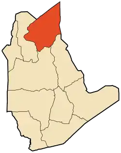 Location of Foggaret Ezzoua commune within In Salah Province | |
 Foggaret Ezzoua Location of Foggaret Ezzoua within Algeria | |
| Coordinates: 27°21′48″N 2°50′53″E | |
| Country | |
| Province | In Salah Province |
| District | In Salah District |
| Area | |
| • Total | 61,313 km2 (23,673 sq mi) |
| Elevation | 305 m (1,001 ft) |
| Population (2008)[1] | |
| • Total | 6,649 |
| • Density | 0.11/km2 (0.28/sq mi) |
| Time zone | UTC+1 (CET) |
| ONS code | 1110 |
| Postal code | 11220 |
Geography
Foggaret Ezzoua lies at an elevation of 305 metres (1,001 ft) on a dry plain in the Sahara. The town is located just to the east of an oasis; separated by a line of sand dunes.
Climate
Foggaret Ezzoua has a hot desert climate (Köppen climate classification BWh), with extremely hot summers and mild winters, and very little precipitation throughout the year.
| Climate data for Foggaret Ezzoua | |||||||||||||
|---|---|---|---|---|---|---|---|---|---|---|---|---|---|
| Month | Jan | Feb | Mar | Apr | May | Jun | Jul | Aug | Sep | Oct | Nov | Dec | Year |
| Average high °C (°F) | 20.4 (68.7) |
23.6 (74.5) |
27.9 (82.2) |
32.9 (91.2) |
36.7 (98.1) |
42.8 (109.0) |
44.6 (112.3) |
43.5 (110.3) |
40.2 (104.4) |
34.1 (93.4) |
26.5 (79.7) |
21.5 (70.7) |
32.9 (91.2) |
| Daily mean °C (°F) | 13.1 (55.6) |
15.8 (60.4) |
19.6 (67.3) |
24.7 (76.5) |
28.6 (83.5) |
34.6 (94.3) |
36.2 (97.2) |
35.5 (95.9) |
32.5 (90.5) |
26.3 (79.3) |
18.9 (66.0) |
14.2 (57.6) |
25.0 (77.0) |
| Average low °C (°F) | 5.8 (42.4) |
8.0 (46.4) |
11.4 (52.5) |
16.5 (61.7) |
20.5 (68.9) |
26.4 (79.5) |
27.9 (82.2) |
27.5 (81.5) |
24.8 (76.6) |
18.6 (65.5) |
11.4 (52.5) |
6.9 (44.4) |
17.1 (62.8) |
| Average precipitation mm (inches) | 3 (0.1) |
2 (0.1) |
2 (0.1) |
1 (0.0) |
1 (0.0) |
0 (0) |
0 (0) |
1 (0.0) |
1 (0.0) |
1 (0.0) |
3 (0.1) |
4 (0.2) |
19 (0.6) |
| Source: climate-data.org[3] | |||||||||||||
Transportation
Foggaret Ezzoua is connected to the N1 highway just north of In Salah by a local road, passing the villages of Igostène and Hassi Lahdjar on the way. Another track leads south to the villages of Silafène and Hinoune.
Education
4.5% of the population has a tertiary education, and another 16.5% has completed secondary education.[4] The overall literacy rate is 82.2%, and is 91.1% among males and 72.4% among females; all three figures are the second highest in the province after the commune of In Ghar.[5]
Localities
The commune is composed of five localities:[6]
- Fouggaret Ezzoua
- Silafène
- Hinoune
- Foggaret el Arab
- Laarab
References
- "Population: Wilaya de Tamanrasset" (PDF) (in French). Office National des Statistiques Algérie. Retrieved 30 May 2013.
- "Algeria Communes". Statoids. Retrieved 8 March 2013.
- "Climate data for: Foggaret Ezzaouia". climate-data.org. Retrieved 31 May 2013.
- "Structure relative de la population résidente des ménages ordinaires et collectifs âgée de 6 ans et plus selon le niveau d'instruction et la commune de résidence" (PDF) (in French). Office National des Statistiques Algérie. Retrieved 30 May 2013.
- "Taux d'analphabétisme et taux d'alphabétisation de la population âgée de 15 ans et plus, selon le sexe et la commune de résidence " (PDF) (in French). Office National des Statistiques Algérie. Retrieved 30 May 2013.
- "Décret n° 84-365, fixant la composition, la consistance et les limites territoriale des communes. Wilaya de Tamanghasset" (PDF) (in French). Journal officiel de la République Algérienne. 19 December 1984. p. 1496. Archived from the original (PDF) on 2 March 2013 or before. Retrieved 2 March 2013. Check date values in:
|archivedate=(help)
Places adjacent to Foggaret Ezzaouia | |
|---|---|
.svg.png.webp)
