Fonte Boa, Amazonas
Fonte Boa (literally, "good water spring") is a municipality located in the Brazilian state of Amazonas. Its population was 17,005 (2020)[1] and its area is 12,111 km².[2]
Fonte Boa | |
|---|---|
 Flag  Seal | |
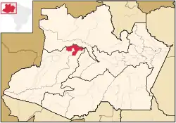 Location of the municipality inside Amazonas | |
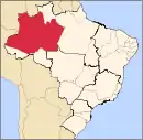
 Fonte Boa Location in Brazil | |
| Coordinates: 2°30′50″S 66°5′30″W | |
| Country | |
| Region | North |
| State | |
| Population (2020) | |
| • Total | 17,005 |
| Time zone | UTC−4 (BRT) |
| • Summer (DST) | UTC−4 (DST no longer used) |
The city is served by Fonte Boa Airport.
The municipality contains 45% of the 146,950 hectares (363,100 acres) Auatí-Paraná Extractive Reserve, created in 2001.[3]
Climate
| Climate data for Fonte Boa, Amazonas (1981–2010, extremes 1925–present) | |||||||||||||
|---|---|---|---|---|---|---|---|---|---|---|---|---|---|
| Month | Jan | Feb | Mar | Apr | May | Jun | Jul | Aug | Sep | Oct | Nov | Dec | Year |
| Record high °C (°F) | 37.0 (98.6) |
36.5 (97.7) |
37.5 (99.5) |
36.0 (96.8) |
35.7 (96.3) |
34.7 (94.5) |
36.3 (97.3) |
37.3 (99.1) |
37.0 (98.6) |
38.0 (100.4) |
37.6 (99.7) |
36.5 (97.7) |
38.0 (100.4) |
| Average high °C (°F) | 31.7 (89.1) |
31.8 (89.2) |
31.7 (89.1) |
31.4 (88.5) |
31.1 (88.0) |
30.9 (87.6) |
31.3 (88.3) |
32.3 (90.1) |
32.6 (90.7) |
32.8 (91.0) |
32.4 (90.3) |
32.0 (89.6) |
31.8 (89.2) |
| Daily mean °C (°F) | 26.7 (80.1) |
26.8 (80.2) |
26.6 (79.9) |
26.5 (79.7) |
26.3 (79.3) |
26.0 (78.8) |
26.2 (79.2) |
26.5 (79.7) |
26.8 (80.2) |
27.1 (80.8) |
26.9 (80.4) |
26.8 (80.2) |
26.6 (79.9) |
| Average low °C (°F) | 22.8 (73.0) |
23.3 (73.9) |
22.8 (73.0) |
22.8 (73.0) |
22.6 (72.7) |
22.3 (72.1) |
22.1 (71.8) |
22.4 (72.3) |
22.5 (72.5) |
22.9 (73.2) |
22.9 (73.2) |
22.9 (73.2) |
22.7 (72.9) |
| Record low °C (°F) | 19.0 (66.2) |
18.0 (64.4) |
19.0 (66.2) |
13.0 (55.4) |
18.4 (65.1) |
16.2 (61.2) |
14.5 (58.1) |
15.0 (59.0) |
12.0 (53.6) |
19.4 (66.9) |
17.9 (64.2) |
14.4 (57.9) |
12.0 (53.6) |
| Average precipitation mm (inches) | 237.9 (9.37) |
207.9 (8.19) |
257.3 (10.13) |
278.0 (10.94) |
271.2 (10.68) |
215.4 (8.48) |
179.4 (7.06) |
134.7 (5.30) |
146.1 (5.75) |
188.0 (7.40) |
176.6 (6.95) |
216.6 (8.53) |
2,509.1 (98.78) |
| Average precipitation days (≥ 1.0 mm) | 17 | 15 | 17 | 18 | 19 | 17 | 14 | 12 | 12 | 13 | 13 | 16 | 183 |
| Average relative humidity (%) | 89.1 | 89.3 | 90.3 | 90.2 | 90.1 | 90.2 | 89.0 | 88.5 | 87.6 | 87.4 | 88.0 | 88.3 | 89.0 |
| Mean monthly sunshine hours | 129.0 | 116.5 | 114.0 | 107.1 | 118.6 | 125.0 | 149.0 | 170.8 | 165.4 | 159.9 | 143.1 | 125.3 | 1,623.7 |
| Source 1: Instituto Nacional de Meteorologia[4] | |||||||||||||
| Source 2: Meteo Climat (record highs and lows)[5] | |||||||||||||
References
- IBGE 2020
- IBGE - "Archived copy". Archived from the original on June 11, 2008. Retrieved June 11, 2008.CS1 maint: archived copy as title (link)
- RESEX Auatí-Paraná (in Portuguese), ISA: Instituto Socioambiental, retrieved 2016-10-21
- "Normais Climatológicas Do Brasil 1981–2010" (in Portuguese). Instituto Nacional de Meteorologia. Retrieved 26 October 2018.
- "Station Fonte Boa" (in French). Meteo Climat. Retrieved 26 October 2018.
Capital: Manaus | ||||||||||||||
| Mesoregion Centro Amazonense |
|  | ||||||||||||
| Mesoregion Norte Amazonense |
| |||||||||||||
| Mesoregion Sudoeste Amazonense |
| |||||||||||||
| Mesoregion Sul Amazonense |
| |||||||||||||
This article is issued from Wikipedia. The text is licensed under Creative Commons - Attribution - Sharealike. Additional terms may apply for the media files.