Fossil Ridge Wilderness
The Fossil Ridge Wilderness is a U.S. Wilderness Area located approximately 16 miles (26 km) northeast of Gunnison, Colorado in the Gunnison National Forest. The 13,992-acre (56.62 km2) wilderness includes Fossil Ridge, a high, exposed ridge of Paleozoic carbonates that contain epeiric sea fossils. Elevations in the wilderness range from 8,880 feet (2,710 m) at Summerville Creek to 13,254 feet (4,040 m) at the summit of Henry Mountain. Elk, deer, mountain goats, and bighorn sheep can be found in the wilderness.[3][4][5][6]
| Fossil Ridge Wilderness | |
|---|---|
IUCN category Ib (wilderness area) | |
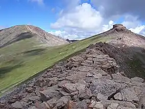 Henry Mountain and Square Top Mountain in the Fossil Ridge Wilderness. | |
 | |
| Location | Gunnison County , Colorado, USA |
| Nearest city | Gunnison, CO |
| Coordinates | 38°41′00″N 106°38′00″W[1] |
| Area | 13,992 acres (56.62 km2) |
| Established | 1993 |
| Governing body | U.S. Forest Service |
References
- "Fossil Ridge Wilderness". Geographic Names Information System. United States Geological Survey. Retrieved August 10, 2012.
- "Fossil Ridge Wilderness". Geographic Names Information System. United States Geological Survey. Retrieved August 10, 2012.
- "Fossil Ridge Wilderness". Wilderness.net. Retrieved August 10, 2012.
- "Fossil Ridge Wilderness". Colorado Wilderness. Retrieved August 10, 2012.
- Prather, Thomas (1999). Geology of the Gunnison Country (Second ed.). Gunnison, Colorado: B & B Printers.
- "Geologic and aeromagnetic maps of the Fossil Ridge area and vicinity, Gunnison County, Colorado". United States Geological Survey. Retrieved November 1, 2014.
This article is issued from Wikipedia. The text is licensed under Creative Commons - Attribution - Sharealike. Additional terms may apply for the media files.