Gunnison Gorge National Conservation Area
The Gunnison Gorge National Conservation Area is a 62,844-acre (254.32 km2) National Conservation Area located in west-central Colorado near Montrose. It is managed by the Bureau of Land Management (BLM) as part of the National Landscape Conservation System. 57,725 acres (233.60 km2) were designated in the Black Canyon of the Gunnison National Park and Gunnison Gorge National Conservation Area Act of 1999 (Public Law 106-76). The Black Canyon of the Gunnison Boundary Revision Act of 2003 (PL 108-78) expanded the NCA to its current size.
| Gunnison Gorge National Conservation Area | |
|---|---|
IUCN category V (protected landscape/seascape) | |
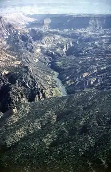 Aerial View of Ute Park, GGNCA | |
 Map of the United States 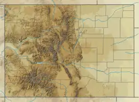 Gunnison Gorge National Conservation Area (Colorado) | |
| Location | Delta County / Montrose County,[1] Colorado, USA |
| Nearest city | Montrose, Colorado |
| Coordinates | 38.622°N 107.889°W[2] |
| Area | 62,844 acres (254.32 km2) |
| Established | 1999 |
| Governing body | Bureau of Land Management |
| www | |
References
- Gunnison Gorge National Conservation Area Archived 2012-02-01 at the Wayback Machine Bureau of Land Management
- "Gunnison Gorge National Conservation Area (Blm)". protectedplanet.net. Archived from the original on 2011-11-26. Retrieved 2011-12-29.
- "Gunnison Gorge National Conservation Area (Blm)". protectedplanet.net. Archived from the original on 2011-11-26. Retrieved 2011-12-29.
- "Gunnison Gorge National Conservation Area and Wilderness". Bureau of Land Management. Archived from the original on 2010-02-20. Retrieved 2009-10-09.
![]() This article incorporates public domain material from websites or documents of the Bureau of Land Management.
This article incorporates public domain material from websites or documents of the Bureau of Land Management.
External links
- Gunnison Gorge National Conservation Area - BLM page
 Media related to Gunnison Gorge National Conservation Area at Wikimedia Commons
This article is issued from Wikipedia. The text is licensed under Creative Commons - Attribution - Sharealike. Additional terms may apply for the media files.