Foster, Oklahoma
Foster is a town in Garvin County, Oklahoma, United States. It was incorporated in 2002[4] and had a population of 161 at the 2010 census.[5]
Foster, Oklahoma | |
|---|---|
 Foster  Foster | |
| Coordinates: 34°36′59″N 97°29′21″W | |
| Country | United States |
| State | Oklahoma |
| County | Garvin |
| Area | |
| • Total | 16.03 sq mi (41.53 km2) |
| • Land | 15.95 sq mi (41.31 km2) |
| • Water | 0.08 sq mi (0.21 km2) |
| Elevation | 974 ft (297 m) |
| Population (2010) | |
| • Total | 161 |
| • Estimate (2019)[2] | 161 |
| • Density | 10.09/sq mi (3.90/km2) |
| Time zone | UTC-6 (Central (CST)) |
| • Summer (DST) | UTC-5 (CDT) |
| ZIP code | 73039 (historically), 73434 (today) |
| Area code(s) | 580 |
| FIPS code | 40-27500 |
| GNIS feature ID | 1092974,[3] 2412646[3] |
Foster is served by State Highway 29A, a spur of State Highway 29. A post office was first established at Foster on August 12, 1891.[6]
Cemetery
There is a cemetery located at 34°36′14″N 97°29′38″W.[3]
Geography
Foster is located in southwestern Garvin County at 34°36′59″N 97°29′21″W (34.6164698, -97.4891933).[3] State Highway 29 follows the northern border of the town, leading east 5 miles (8 km) to Elmore City and west 18 miles (29 km) to Bray. State Highway 76 passes through the western part of the town, leading north 19 miles (31 km) to Lindsay and south 12 miles (19 km) to Ratliff City. Wynnewood is 21 miles (34 km) east of Foster via State Highway 29, and Pauls Valley, the Garvin County seat, is 22 miles (35 km) to the northeast via Highway 29 and Airline Road.
According to the U.S. Census Bureau, the town of Foster has a total area of 16.0 square miles (41.5 km2), of which 15.9 square miles (41.3 km2) are land and 0.1 square miles (0.2 km2), or 0.52%, is water.[5]
Demographics
| Historical population | |||
|---|---|---|---|
| Census | Pop. | %± | |
| 2010 | 161 | — | |
| 2019 (est.) | 161 | [2] | 0.0% |
| U.S. Decennial Census[7] | |||
References
- "2019 U.S. Gazetteer Files". United States Census Bureau. Retrieved July 28, 2020.
- "Population and Housing Unit Estimates". United States Census Bureau. May 24, 2020. Retrieved May 27, 2020.
- "Geographic Names Information System". United States Geological Survey. Retrieved 2008-01-31.
- "Boundary Changes". Geographic Change Notes: Oklahoma. Population Division, United States Census Bureau. 2006-05-19. Archived from the original on 2010-08-06. Retrieved 2008-07-13.
- "Geographic Identifiers: 2010 Demographic Profile Data (G001): Foster town, Oklahoma". American Factfinder. U.S. Census Bureau. Retrieved January 23, 2017.
- OKGenWeb/USGenWeb Project - Garvin County, Oklahoma - Foster Postmasters Archived 2006-06-29 at the Wayback Machine
- "Census of Population and Housing". Census.gov. Retrieved June 4, 2015.
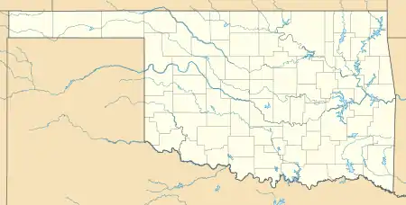
Municipalities and communities of Garvin County, Oklahoma, United States | ||
|---|---|---|
| Cities | 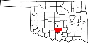 Garvin County map | |
| Towns | ||
| Unincorporated communities | ||
| Ghost town | ||
| Indian reservation | ||
| Footnotes | ‡This populated place also has portions in an adjacent county or counties | |
| ||