Maysville, Oklahoma
Maysville is a town in Garvin and McClain counties, Oklahoma, United States. The population was 1,232 at the 2010 census,[5] down from 1,313 in 2000.
Maysville, Oklahoma | |
|---|---|
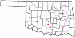 Location of Maysville, Oklahoma | |
| Coordinates: 34°49′3″N 97°24′37″W | |
| Country | United States |
| State | Oklahoma |
| Counties | Garvin, McClain |
| Area | |
| • Total | 1.93 sq mi (5.01 km2) |
| • Land | 1.56 sq mi (4.04 km2) |
| • Water | 0.37 sq mi (0.97 km2) |
| Elevation | 938 ft (286 m) |
| Population (2010) | |
| • Total | 1,232 |
| • Estimate (2019)[2] | 1,203 |
| • Density | 771.65/sq mi (297.86/km2) |
| Time zone | UTC-6 (Central (CST)) |
| • Summer (DST) | UTC-5 (CDT) |
| ZIP code | 73057 |
| Area code(s) | 405 |
| FIPS code | 40-47150[3] |
| GNIS feature ID | 1095194[4] |
History
A post office was established at this location on March 19, 1878 and operated until May 29, 1878. It was reestablished as Beef Creek, Indian Territory on June 17, 1878. The post office took its name from nearby Beef Creek, a tributary of the Washita River.
On September 19, 1902 the name of Beef Creek was changed to Mayesville, Indian Territory. The new name was in honor of David Mayes and John Mayes, local ranchers.[6]
At the time of its founding, Beef Creek, later Mayesville, was located in Pickens County, Chickasaw Nation.[7]
Geography
Maysville is located in northern Garvin County at 34°49′3″N 97°24′37″W (34.817489, -97.410162),[8] on the south side of the valley of the Washita River. The town has an exclave to the north in McClain County, surrounding Wiley Post Memorial Reservoir.
Oklahoma State Highway 19 passes through the center of town as 6th Street, leading southeast 12 miles (19 km) to Pauls Valley, the Garvin County seat, and west 11 miles (18 km) to Lindsay. State Highway 74 (Ripley Street) crosses Highway 19 on the east side of downtown, leading north 14 miles (23 km) to Purcell and south 13 miles (21 km) to Elmore City.
According to the United States Census Bureau, Maysville has a total area of 2.0 square miles (5.1 km2), of which 1.6 square miles (4.1 km2) is land and 0.4 square miles (1.0 km2), or 19.05%, is water.[5]
Demographics
| Historical population | |||
|---|---|---|---|
| Census | Pop. | %± | |
| 1910 | 476 | — | |
| 1920 | 627 | 31.7% | |
| 1930 | 875 | 39.6% | |
| 1940 | 880 | 0.6% | |
| 1950 | 1,294 | 47.0% | |
| 1960 | 1,530 | 18.2% | |
| 1970 | 1,380 | −9.8% | |
| 1980 | 1,396 | 1.2% | |
| 1990 | 1,203 | −13.8% | |
| 2000 | 1,313 | 9.1% | |
| 2010 | 1,232 | −6.2% | |
| 2019 (est.) | 1,203 | [2] | −2.4% |
| U.S. Decennial Census[9] | |||
As of the census[3] of 2000, there were 1,313 people, 507 households, and 317 families residing in the town. The population density was 2,329.9 people per square mile (905.3/km2). There were 581 housing units at an average density of 1,031.0 per square mile (400.6/km2). The racial makeup of the town was 85.00% White, 0.38% African American, 9.60% Native American, 0.15% Pacific Islander, 0.76% from other races, and 4.11% from two or more races. Hispanic or Latino of any race were 1.68% of the population.
There were 507 households, out of which 32.7% had children under the age of 18 living with them, 53.1% were married couples living together, 13.8% had a female householder with no husband present, and 29.4% were non-families. 26.8% of all households were made up of individuals, and 13.0% had someone living alone who was 65 years of age or older. The average household size was 2.53 and the average family size was 3.05.
In the town, the population was spread out, with 28.5% under the age of 18, 8.1% from 18 to 24, 24.2% from 25 to 44, 20.6% from 45 to 64, and 18.7% who were 65 years of age or older. The median age was 37 years. For every 100 females, there were 86.8 males. For every 100 females age 18 and over, there were 82.0 males.
The median income for a household in the town was $25,921, and the median income for a family was $31,369. Males had a median income of $28,194 versus $18,438 for females. The per capita income for the town was $12,449. About 16.9% of families and 21.6% of the population were below the poverty line, including 24.0% of those under age 18 and 16.1% of those age 65 or over.
In fiction
In the fifth season of The West Wing, an Oklahoma town named Maysville was the site of a devastating tornado.[10]
References
- "2019 U.S. Gazetteer Files". United States Census Bureau. Retrieved July 28, 2020.
- "Population and Housing Unit Estimates". United States Census Bureau. May 24, 2020. Retrieved May 27, 2020.
- "U.S. Census website". United States Census Bureau. Retrieved 2008-01-31.
- "US Board on Geographic Names". United States Geological Survey. 2007-10-25. Retrieved 2008-01-31.
- "Geographic Identifiers: 2010 Demographic Profile Data (G001): Maysville town, Oklahoma". American Factfinder. U.S. Census Bureau. Retrieved January 24, 2017.
- George H. Shirk. Oklahoma Place Names (Norman: University of Oklahoma Press, 1965), pp. 19 & 138.
- Charles Goins, Historical Atlas of Oklahoma (Norman: University of Oklahoma Press, 2006), plate 105.
- "US Gazetteer files: 2010, 2000, and 1990". United States Census Bureau. 2011-02-12. Retrieved 2011-04-23.
- "Census of Population and Housing". Census.gov. Retrieved June 4, 2015.
- "Search or Browse The West Wing Transcripts -- View or Search transcripts and summaries". www.westwingtranscripts.com. Retrieved 2016-10-07.
Municipalities and communities of Garvin County, Oklahoma, United States | ||
|---|---|---|
| Cities | 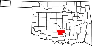 Garvin County map | |
| Towns | ||
| Unincorporated communities | ||
| Ghost town | ||
| Indian reservation | ||
| Footnotes | ‡This populated place also has portions in an adjacent county or counties | |
| ||