Katie, Oklahoma
Katie is a town in Garvin County, Oklahoma, United States. The town is 69 miles (111 km) south of Oklahoma City. It was incorporated in 2004[4] and had a population of 348 at the 2010 census.[5] On May 9, 2016, an EF4 tornado touched down in the southern part of Katie, and tracked to the east, causing one death and several injuries.
Katie, Oklahoma | |
|---|---|
 Katie  Katie | |
| Coordinates: 34°34′46″N 97°21′8″W | |
| Country | United States |
| State | Oklahoma |
| County | Garvin |
| Area | |
| • Total | 20.49 sq mi (53.08 km2) |
| • Land | 20.39 sq mi (52.80 km2) |
| • Water | 0.11 sq mi (0.28 km2) |
| Elevation | 975 ft (297 m) |
| Population (2010) | |
| • Total | 348 |
| • Estimate (2019)[2] | 354 |
| • Density | 17.36/sq mi (6.70/km2) |
| Time zone | UTC-6 (Central (CST)) |
| • Summer (DST) | UTC-5 (CDT) |
| Area code(s) | 580 |
| FIPS code | 40-38700 |
| GNIS feature ID | 1094292[3] |
Geography
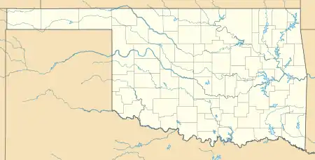
Katie is located in southern Garvin County, 5 miles (8 km) southeast of Elmore City and 15 miles (24 km) southwest of Wynnewood. It is 17 miles (27 km) southwest of Pauls Valley, the county seat. According to the U.S. Census Bureau, the town has a total area of 20.3 square miles (52.7 km2), of which 20.2 sq mi (52.4 km2) are land and 0.1 sq mi (0.3 km2), or 0.52%, is water.[5]
Demographics
| Historical population | |||
|---|---|---|---|
| Census | Pop. | %± | |
| 2010 | 348 | — | |
| 2019 (est.) | 354 | [2] | 1.7% |
| U.S. Decennial Census[6] | |||
References
- "2019 U.S. Gazetteer Files". United States Census Bureau. Retrieved July 28, 2020.
- "Population and Housing Unit Estimates". United States Census Bureau. May 24, 2020. Retrieved May 27, 2020.
- U.S. Geological Survey Geographic Names Information System: Katie, Oklahoma
- "Boundary Changes". Geographic Change Notes: Oklahoma. Population Division, United States Census Bureau. 2006-05-19. Archived from the original on 2006-02-06. Retrieved 2008-07-13.
- "Geographic Identifiers: 2010 Demographic Profile Data (G001): Katie town, Oklahoma". American Factfinder. U.S. Census Bureau. Retrieved January 24, 2017.
- "Census of Population and Housing". Census.gov. Retrieved June 4, 2015.
Municipalities and communities of Garvin County, Oklahoma, United States | ||
|---|---|---|
| Cities | 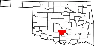 Garvin County map | |
| Towns | ||
| Unincorporated communities | ||
| Ghost town | ||
| Indian reservation | ||
| Footnotes | ‡This populated place also has portions in an adjacent county or counties | |
| ||
This article is issued from Wikipedia. The text is licensed under Creative Commons - Attribution - Sharealike. Additional terms may apply for the media files.