Frankstown Township, Blair County, Pennsylvania
Frankstown Township is a township in Blair County, Pennsylvania, United States. It is part of the Altoona Metropolitan Statistical Area. The population was 7,381 at the 2010 census.[4]
Frankstown Township, Pennsylvania | |
|---|---|
 Canoe Lake at Canoe Creek State Park | |
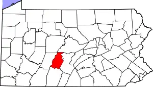
 Map of Blair County, Pennsylvania highlighting Frankstown Township | |
 Map of Blair County, Pennsylvania | |
| Country | United States |
| State | Pennsylvania |
| County | Blair |
| Settled | 1758 |
| Incorporated | 1787 |
| Government | |
| • Type | Board of Supervisors |
| • Chairman of the Board | James Grove |
| • Vice chairman | George Henry |
| • Supervisor | Kenny Wertz |
| Area | |
| • Total | 49.26 sq mi (127.57 km2) |
| • Land | 48.83 sq mi (126.46 km2) |
| • Water | 0.43 sq mi (1.11 km2) |
| Population (2010) | |
| • Total | 7,381 |
| • Estimate (2016)[2] | 7,403 |
| • Density | 151.62/sq mi (58.54/km2) |
| Time zone | UTC-5 (Eastern (EST)) |
| • Summer (DST) | UTC-4 (EDT) |
| Area code(s) | 814 |
| FIPS code | 42-013-27600 |
| Website | Township website |
| Designated | April 01, 1947[3] |
The township was named after Stephen Franks, a pioneer citizen.[5]
Geography
Frankstown Township occupies the center of Blair County. It is bordered by the borough of Hollidaysburg and Allegheny Township to the west, Logan Township and Tyrone Township to the northwest, Catharine Township to the northeast, Woodbury Township to the east, Huston Township to the southeast, and Taylor Township and Blair Township to the southwest.
The township is located in the heart of the Ridge and Valley Province of the Appalachian Mountains, and a large portion of the township's borders follow ridgecrests: Brush Mountain on the northwest side, and the continuous ridge of Loop Mountain and Lock Mountain on the southwest and southeast. The Frankstown Branch of the Juniata River flows from west to east through the center of the township. U.S. Route 22 passes through the township in the same general direction as the river.
According to the United States Census Bureau, the township has a total area of 49.3 square miles (127.6 km2), of which 48.8 square miles (126.5 km2) is land and 0.42 square miles (1.1 km2), or 0.87%, is water.[4]
Demographics
| Historical population | |||
|---|---|---|---|
| Census | Pop. | %± | |
| 2010 | 7,381 | — | |
| 2016 (est.) | 7,403 | [2] | 0.3% |
| U.S. Decennial Census[6] | |||
As of the census[7] of 2000, there were 7,694 people, 2,887 households, and 2,225 families residing in the township. The population density was 158.1 people per square mile (61.0/km2). There were 3,036 housing units at an average density of 62.4/sq mi (24.1/km2). The racial makeup of the township was 97.05% White, 0.42% African American, 0.04% Native American, 1.83% Asian, 0.08% from other races, and 0.58% from two or more races. Hispanic or Latino of any race were 0.56% of the population.
There were 2,887 households, out of which 33.5% had children under the age of 18 living with them, 67.9% were married couples living together, 6.5% had a female householder with no husband present, and 22.9% were non-families. 19.8% of all households were made up of individuals, and 9.5% had someone living alone who was 65 years of age or older. The average household size was 2.61 and the average family size was 3.01.
In the township the population was spread out, with 24.0% under the age of 18, 6.0% from 18 to 24, 25.6% from 25 to 44, 28.0% from 45 to 64, and 16.5% who were 65 years of age or older. The median age was 42 years. For every 100 females, there were 96.6 males. For every 100 females age 18 and over, there were 91.3 males.
The median income for a household in the township was $49,677, and the median income for a family was $54,348. Males had a median income of $40,450 versus $27,389 for females. The per capita income for the township was $24,329. About 6.8% of families and 6.5% of the population were below the poverty line, including 9.2% of those under age 18 and 6.5% of those age 65 or over.
Recreation
Canoe Creek State Park is located in the northeast part of the township.[8]
Pennsylvania State Game Lands Number 147 is located east of Canoe Creek State Park on Dunning Mountain and a small portion of Pennsylvania State Game Lands Number 166 is located in the eastern part of the township east of Canoe Creek Park.[9][10]
2012 Geeseytown shooting
On December 21, 2012, at Geeseytown, a gunman, identified as 44-year-old Jeffrey Lee Michael, killed two men and a woman. The woman was shot inside of the Juniata Valley Gospel Church on the Juniata Valley Road, one man was shot outside his residence, and the other man was fatally shot after crashing his vehicle into Michael's pickup truck. In a gunfight with the police, three policemen were injured, and Michael was shot and killed.[11]
Notable person
Harold L. Ickes, U.S. Secretary of the Interior, was born in Frankstown Township in 1874.
References
- "2016 U.S. Gazetteer Files". United States Census Bureau. Retrieved Aug 13, 2017.
- "Population and Housing Unit Estimates". Retrieved June 9, 2017.
- "PHMC Historical Markers Search" (Searchable database). Pennsylvania Historical and Museum Commission. Commonwealth of Pennsylvania. Retrieved 2014-01-25.
- "Geographic Identifiers: 2010 Demographic Profile Data (G001): Frankstown township, Blair County, Pennsylvania". U.S. Census Bureau, American Factfinder. Archived from the original on February 12, 2020. Retrieved March 11, 2014.
- Espenshade, Abraham Howry (1925). Pennsylvania Place Names. Evangelical Press. p. 309. ISBN 978-0-8063-0416-8.
- "Census of Population and Housing". Census.gov. Retrieved June 4, 2016.
- "U.S. Census website". United States Census Bureau. Retrieved 2008-01-31.
- 2007 General Highway Map Blair County Pennsylvania (PDF) (Map). 1:65,000. Pennsylvania Department of Transportation, Bureau of Planning and Research, Geographic Information Division. Retrieved 2008-04-02. Note: shows Canoe Creek State Park
- Pennsylvania State Game Lands Number 147, retrieved 14 November 2018
- Pennsylvania State Game Lands Number 166, retrieved 14 November 2018
- "4 Dead, 3 Troopers Hurt in Shootings". Altoona Mirror. 21 December 2012. Retrieved 21 December 2012.
External links
Municipalities and communities of Blair County, Pennsylvania, United States | ||
|---|---|---|
| City | | |
| Boroughs | ||
| Townships | ||
| CDPs | ||
| Unincorporated communities | ||
| Footnotes | ‡This populated place also has portions in an adjacent county or counties | |
| ||